
State Planning Procedure State Development Programme defines Regions

- Slides: 18
State Planning Procedure State Development Programme defines Regions within state boundaries and across state boundaries if that is required for integrated planning Central places and their ranking for further development Development axes of more than just regional importance Areas of special importance for development, including: Economically weak areas Areas of urban agglomeration State Development Programme outlines broad develoment measures to lead the development towards the defined development goals
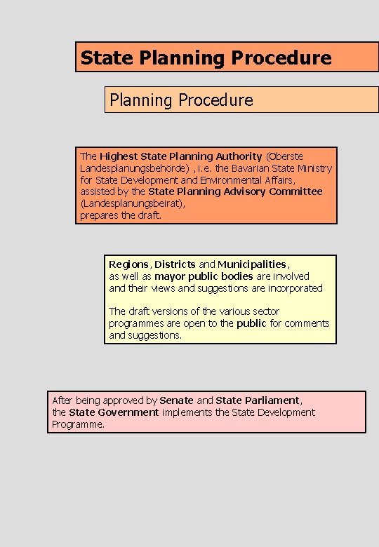
State Planning Procedure The Highest State Planning Authority (Oberste Landesplanungsbehörde) , i. e. the Bavarian State Ministry for State Development and Environmental Affairs, assisted by the State Planning Advisory Committee (Landesplanungsbeirat), prepares the draft. Regions, Districts and Municipalities, as well as mayor public bodies are involved and their views and suggestions are incorporated The draft versions of the various sector programmes are open to the public for comments and suggestions. After being approved by Senate and State Parliament, the State Government implements the State Development Programme.
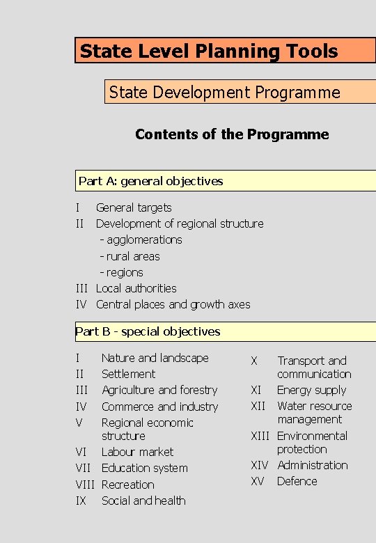
State Level Planning Tools State Development Programme Contents of the Programme Part A: general objectives I II General targets Development of regional structure - agglomerations - rural areas - regions III Local authorities IV Central places and growth axes Part B - special objectives I II IV V Nature and landscape Settlement Agriculture and forestry Commerce and industry Regional economic structure VI Labour market VII Education system VIII Recreation IX Social and health X Transport and communication XI Energy supply XII Water resource management XIII Environmental protection XIV Administration XV Defence
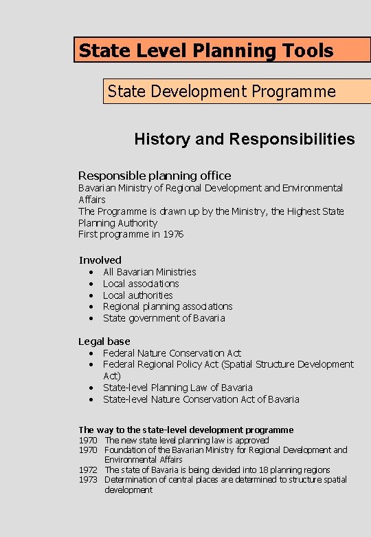
State Level Planning Tools State Development Programme History and Responsibilities Responsible planning office Bavarian Ministry of Regional Development and Environmental Affairs The Programme is drawn up by the Ministry, the Highest State Planning Authority First programme in 1976 Involved • All Bavarian Ministries • Local associations • Local authorities • Regional planning associations • State government of Bavaria Legal base • Federal Nature Conservation Act • Federal Regional Policy Act (Spatial Structure Development Act) • State-level Planning Law of Bavaria • State-level Nature Conservation Act of Bavaria The way to the state-level development programme 1970 The new state level planning law is approved 1970 Foundation of the Bavarian Ministry for Regional Development and Environmental Affairs 1972 The state of Bavaria is being devided into 18 planning regions 1973 Determination of central places are determined to structure spatial development
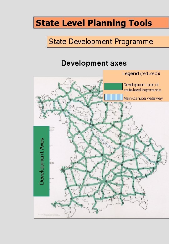
State Level Planning Tools State Development Programme Development axes Legend (reduced): Development axes of state-level importance Development Axes Main-Danube waterway
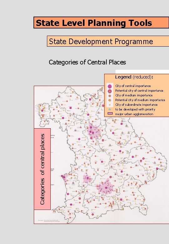
State Level Planning Tools State Development Programme Categories of Central Places Legend (reduced): City of central importance Potential city of central importance Categories of central places City of medium importance Potential city of medium importance City of subordinate importance to be developed with priority major urban agglomeration
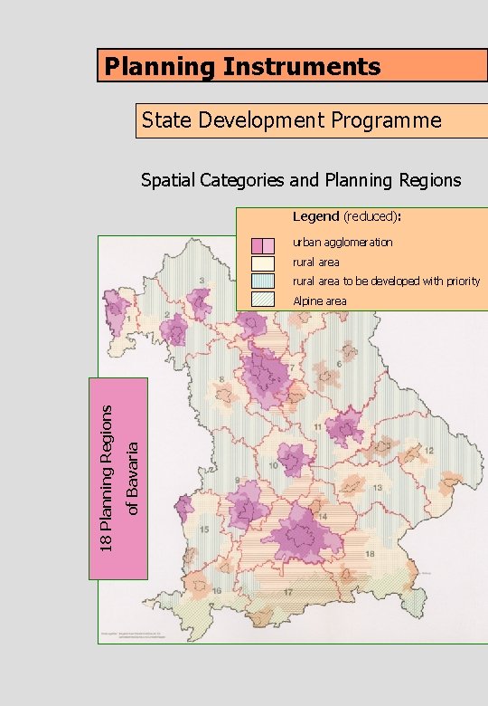
Planning Instruments State Development Programme Spatial Categories and Planning Regions Legend (reduced): urban agglomeration rural area to be developed with priority of Bavaria 18 Planning Regions Alpine area
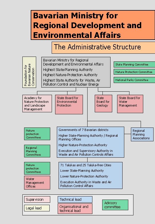
Bavarian Ministry for Regional Development and Environmental Affairs Foundaition for Bavarian Nature Conservation The Administrative Structure Bavarian Ministry for Regional Development and Environmental Affairs State Planning Committee Highest State-Planning Authority Nature Protection Committee Highest Nature-Protection Authority National Parks Committee Highest State Authority for Waste, Air Pollution Control and Nuclear Energy Academy for Nature Protection and Landscape Management Nature protection Committees Regional Planning Committees Nature protection Committees Water Management Offices State Board for Environmental Protection State Board for Geology State Board for Water Management Governments of 7 Bavarian districts Higher State-Planning Authority / Regional Planning Offices Higher Nature-Protection Authority Execution and Supervisory Authority in Waste and Air Pollution Controls Affairs 71 Talukas and 25 Taluka-free Cities Lower State-Planning Authority Lower Nature-Protection Authority Execution Authority in Waste and Air Pollution Control Affairs Supervision Technical lead Legal lead Organisational and technical lead Advisory committee Regional Planning Associations
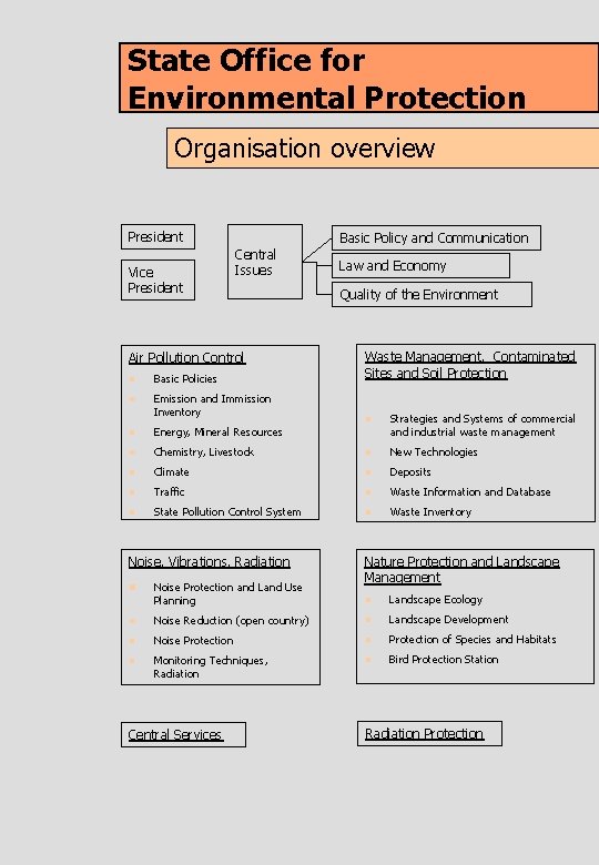
State Office for Environmental Protection Organisation overview President Vice President Basic Policy and Communication Central Issues Air Pollution Control n Basic Policies n Emission and Immission Inventory n Energy, Mineral Resources n Law and Economy Quality of the Environment Waste Management, Contaminated Sites and Soil Protection n Strategies and Systems of commercial and industrial waste management Chemistry, Livestock n New Technologies n Climate n Deposits n Traffic n Waste Information and Database n State Pollution Control System n Waste Inventory Noise, Vibrations, Radiation n Noise Protection and Land Use Planning Nature Protection and Landscape Management n Landscape Ecology n Noise Reduction (open country) n Landscape Development n Noise Protection n Protection of Species and Habitats n Monitoring Techniques, Radiation n Bird Protection Station Central Services Radiation Protection
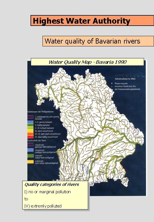
Highest Water Authority Water quality of Bavarian rivers Water Quality Map - Bavaria 1990 Quality categories of rivers I) no or marginal pollution to IV) extremly polluted
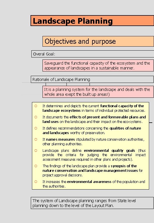
Landscape Planning Objectives and purpose Overal Goal: Saveguard the functional capacity of the ecosystem and the appearance of landscapes in a sustainable manner. Rationale of Landscape Planning It is a planning system for the landscape and deals with the whole area exept the built up areas!) ¢ It determines and depicts the current functional capacity of the landscape ecosystems in terms of individual protected resources. ¢ It documents the effects of present and foreseeable plans and land uses on the landscape and their impact on the eco-systems. ¢ It defines recommendations concerning the qualities of nature and landscapes worthy of preservation. ¢ It names measures stipulated by nature conservation authorities, other planning authorities. ¢ Landscape plans define environmental quality goals (thus provide the criteria for judging the environmental impact assessment measures required in other plans and projects). ¢ The findings of the landscape plan provide a synopsis of the nature conservation and landscape management issues for project approval decisions. ¢ It increases the environmental awareness of the population and the authorities. The system of Landscape planning ranges from State level planning down to the level of the Layout Plan.
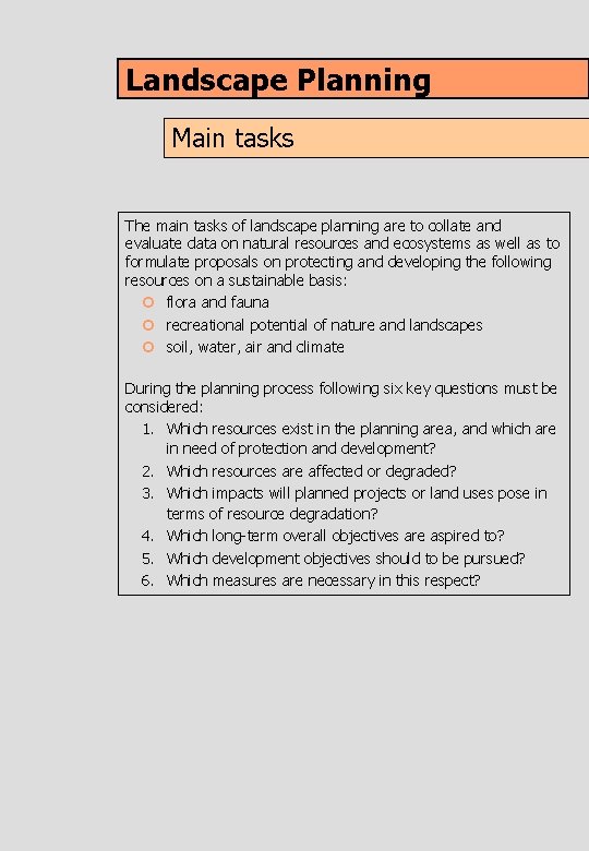
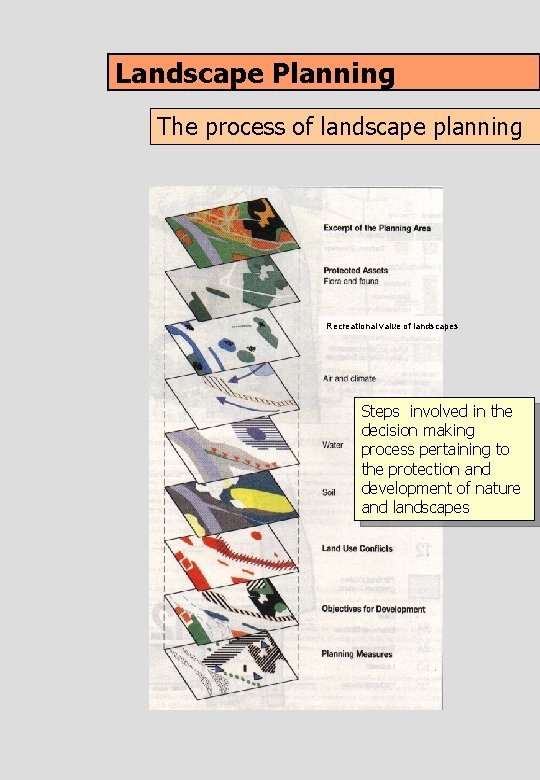
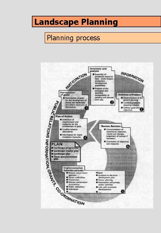
Landscape Planning Main tasks The main tasks of landscape planning are to collate and evaluate data on natural resources and ecosystems as well as to formulate proposals on protecting and developing the following resources on a sustainable basis: ¢ flora and fauna ¢ recreational potential of nature and landscapes ¢ soil, water, air and climate During the planning process following six key questions must be considered: 1. Which resources exist in the planning area, and which are in need of protection and development? 2. Which resources are affected or degraded? 3. Which impacts will planned projects or land uses pose in terms of resource degradation? 4. Which long-term overall objectives are aspired to? 5. Which development objectives should to be pursued? 6. Which measures are necessary in this respect?
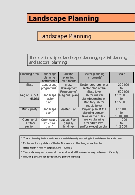
Landscape Planning The relationship of landscape planning, spatial planning and sectoral planning Planning area Landscape Outline Sector planning instruments 4 instruments State Landscape Sector programme or State 1 programme Development sector plan at the Programme 1 State level Region Gov’t Landscape Regional plan Sector master district master plan(depending on plan 1 statutory sector regulations) Municipality Landscape Master Plan Project plan at the plan 2 planning consent level or the public works planning Communal Open space Layout Plan procedure level Territory structure (legally and/or execution plan 3 section binding) Scale 1 : 200 000 to 1 : 500 000 1 : 25 000 to 1 : 50 000 1 : 5 000 to 1: 10 000 1 : 1000 to 1: 2 500 1 These planning instruments are named differently according to the different federal states 2 Excluding the city states of Berlin, Bremen and Hamburg as well as the states North Rhine-Westphalia and Thuringia 3 These planning instruments do not exist in all of the states or may be termed differently 4 Including EIA and landscape management planning
Landscape Planning The process of landscape planning Recreational value of landscapes Steps involved in the decision making process pertaining to the protection and development of nature and landscapes
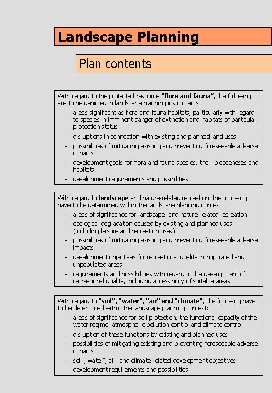
Landscape Planning Plan contents With regard to the protected resource "flora and fauna”, the following are to be depicted in landscape planning instruments: - areas significant as flora and fauna habitats, particularly with regard to species in imminent danger of extinction and habitats of particular protection status - disruptions in connection with existing and planned land uses - possibilities of mitigating existing and preventing foreseeable adverse impacts - development goals for flora and fauna species, their biocoenoses and habitats - development requirements and possibilities With regard to landscape and nature-related recreation, the following have to be determined within the landscape planning context: - areas of significance for landscape- and nature-related recreation - ecological degradation caused by existing and planned uses (including leisure and recreation uses) - possibilities of mitigating existing and preventing foreseeable adverse impacts - development objectives for recreational quality in populated and unpopulated areas - requirements and possibilities with regard to the development of recreational quality, including accessibility of suitable areas With regard to "soil", "water", "air" and "climate", the following have to be determined within the landscape planning context: - areas of significance for soil protection, the functional capacity of the water regime, atmospheric pollution control and climate control - disruption of these functions by existing and planned uses - possibilities of mitigating existing and preventing foreseeable adverse impacts - soil-, water", air- and climate-related development objectives - development requirements and possibilities
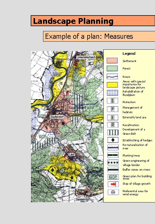
Landscape Planning Example of a plan: Measures Legend Settlement Forest Rivers Areas with special importance for landscape picture Rehabilitation of floodplain Protection Management of habitats Extensiify land use Recultivation Development of a Green Belt Establisching of hedges Re-naturalisation of river Planting trees Green engineering of village border Buffer zones on rivers Green plan for building areas Stop of village growth Preferential area for wind energy
Landscape Planning process
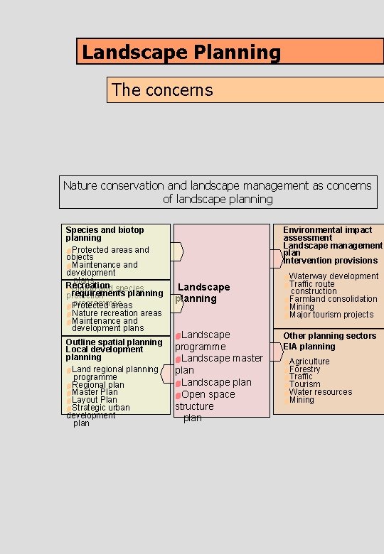
Landscape Planning The concerns Nature conservation and landscape management as concerns of landscape planning Species and biotop planning 4 Protected areas and objects 4 Maintenance and development plans Recreation 4 Biotop and species requirements planning protection programmes 4 Protected areas 4 Nature recreation areas 4 Maintenance and development plans Outline spatial planning Local development planning 4 Land regional planning programme 4 Regional plan 4 Master Plan 4 Layout Plan 4 Strategic urban development plan Environmental impact assessment Landscape management plan Intervention provisions Landscape planning 4 Landscape programme 4 Landscape master plan 4 Landscape plan 4 Open space structure plan 4 Waterway development 4 Traffic route construction 4 Farmland consolidation 4 Mining 4 Major tourism projects Other planning sectors EIA planning 4 Agriculture 4 Forestry 4 Traffic 4 Tourism 4 Water resources 4 Mining