State Climate Office Weekly Drought Update Adnan Akyuz
- Slides: 23

State Climate Office Weekly Drought Update Adnan Akyuz, Ph. D. NDSU, AES State Climatologist Last Update: 7/23/2020

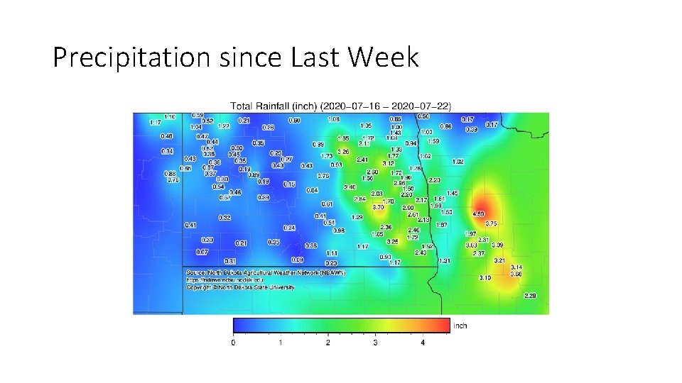
Precipitation since Last Week

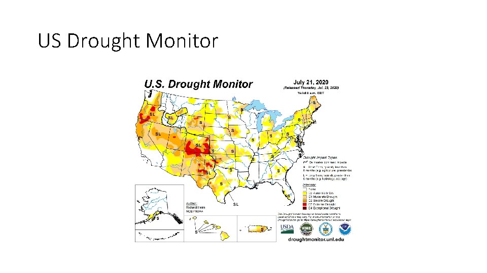
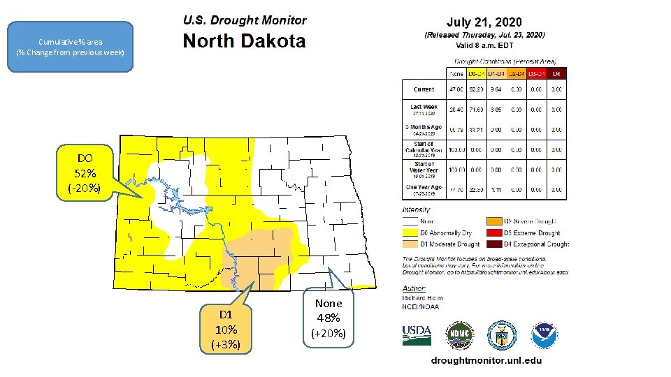
US Drought Monitor

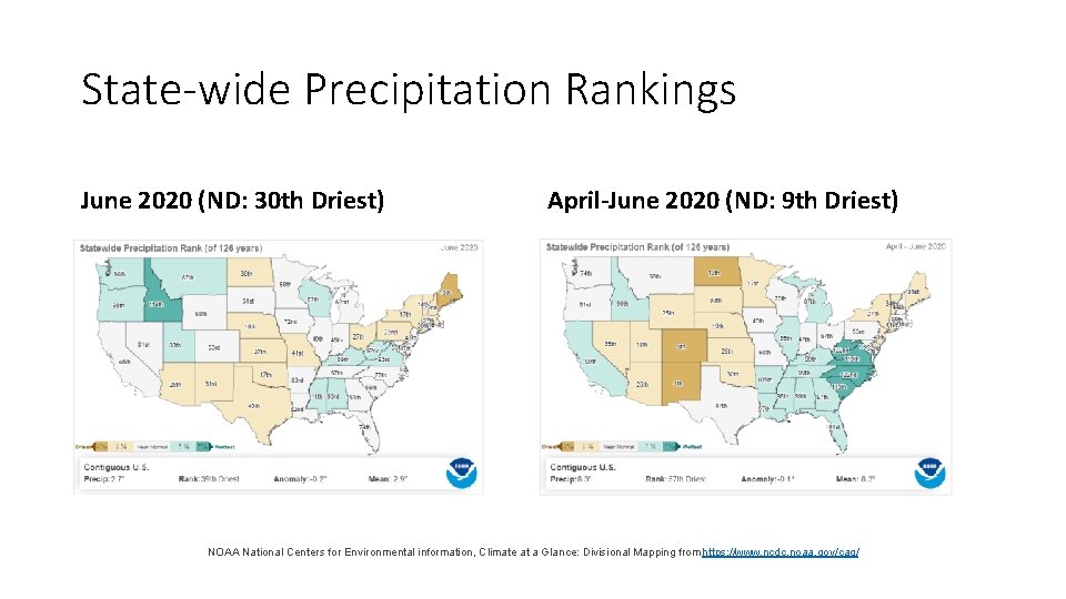
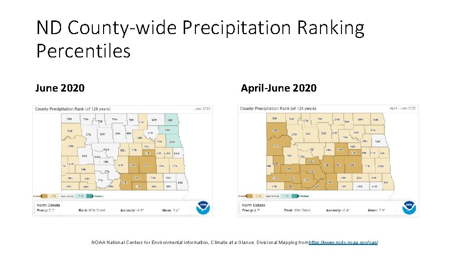
State-wide Precipitation Rankings June 2020 (ND: 30 th Driest) April-June 2020 (ND: 9 th Driest) NOAA National Centers for Environmental information, Climate at a Glance: Divisional Mapping from https: //www. ncdc. noaa. gov/cag/

ND County-wide Precipitation Ranking Percentiles June 2020 April-June 2020 NOAA National Centers for Environmental information, Climate at a Glance: Divisional Mapping from https: //www. ncdc. noaa. gov/cag/

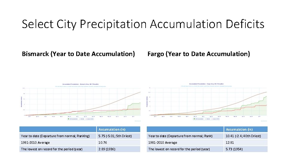
Select City Precipitation Accumulation Deficits Bismarck (Year to Date Accumulation) Fargo (Year to Date Accumulation) Accumulation (in) Year to date (Departure from normal; Ranking) 5. 75 (-5. 01; 5 th Driest) Year to date (Departure from normal; Rank) 10. 41 (-2. 4; 40 th Driest) 1981 -2010 Average 10. 76 1981 -2010 Average 12. 81 The lowest on record for the period (year) 2. 89 (1936) The lowest on record for the period (year) 5. 73 (1954)

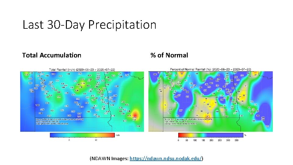
Last 30 -Day Precipitation Total Accumulation % of Normal (NDAWN Images: https: //ndawn. ndsu. nodak. edu/)

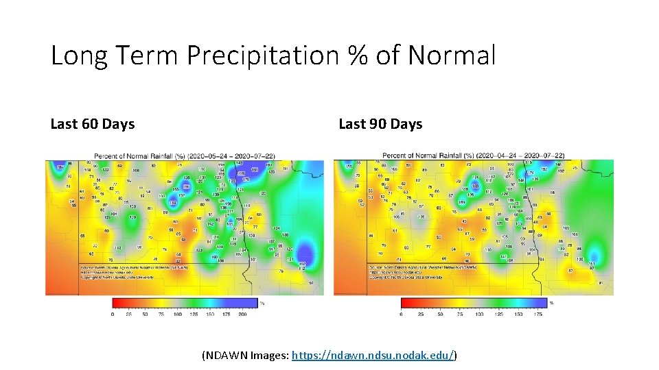
Long Term Precipitation % of Normal Last 60 Days Last 90 Days (NDAWN Images: https: //ndawn. ndsu. nodak. edu/)

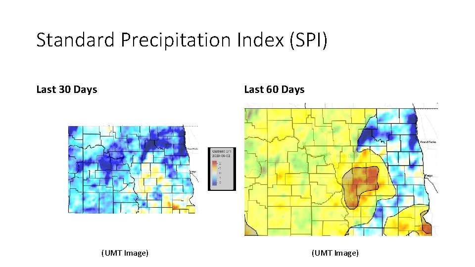
Standard Precipitation Index (SPI) Last 30 Days Last 60 Days (UMT Image)

Cumulative % area (% Change from previous week) DO 52% (-20%) D 1 10% (+3%) None 48% (+20%)

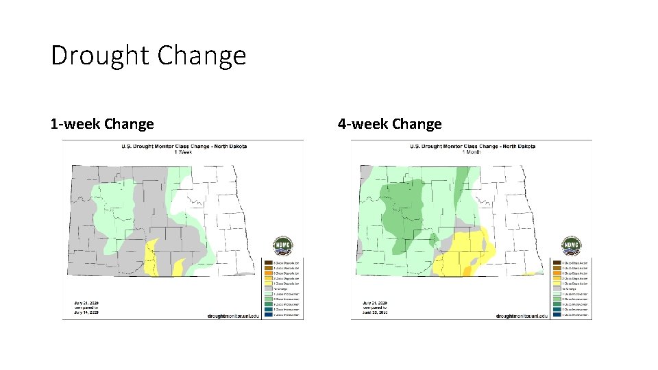
Drought Change 1 -week Change 4 -week Change

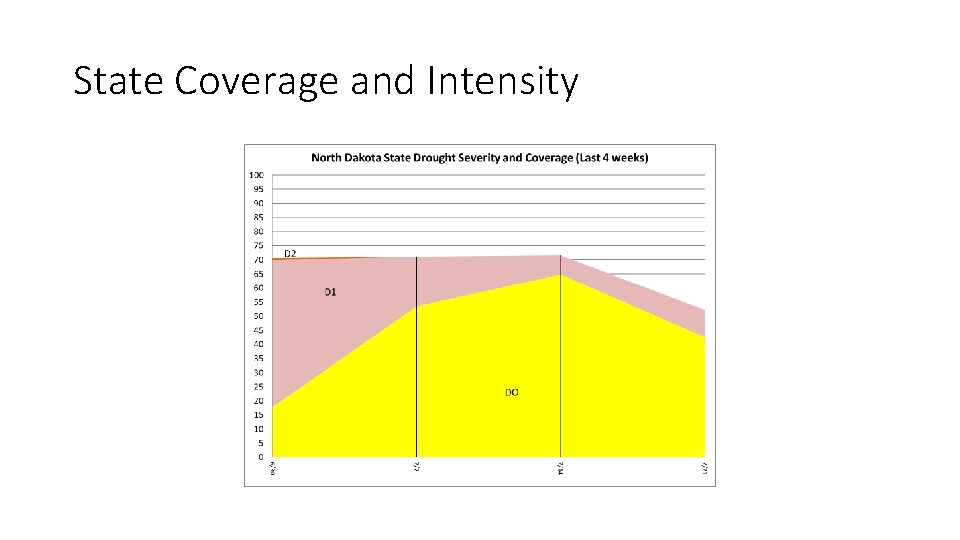
State Coverage and Intensity

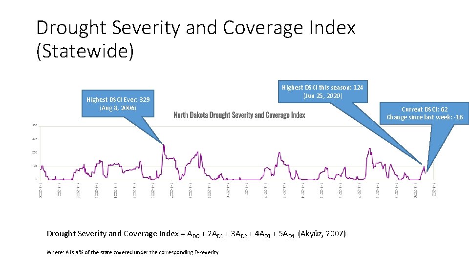
Drought Severity and Coverage Index (Statewide) Highest DSCI Ever: 329 (Aug 8, 2006) Highest DSCI this season: 124 (Jun 25, 2020) Drought Severity and Coverage Index = ADO + 2 AD 1 + 3 AD 2 + 4 AD 3 + 5 AD 4 (Akyüz, 2007) Where: A is a % of the state covered under the corresponding D-severity Current DSCI: 62 Change since last week: -16

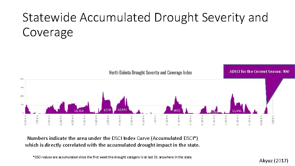
Statewide Accumulated Drought Severity and Coverage ADSCI for the Current Season: 900 19, 319 9, 530 10, 642 9653 2116 11, 991 1714 Numbers indicate the area under the DSCI Index Curve (Accumulated DSCI*) which is directly correlated with the accumulated drought impact in the state. *DSCI values are accumulated since the first week the drought category is at last D 1 anywhere in the state. Akyuz (2017)

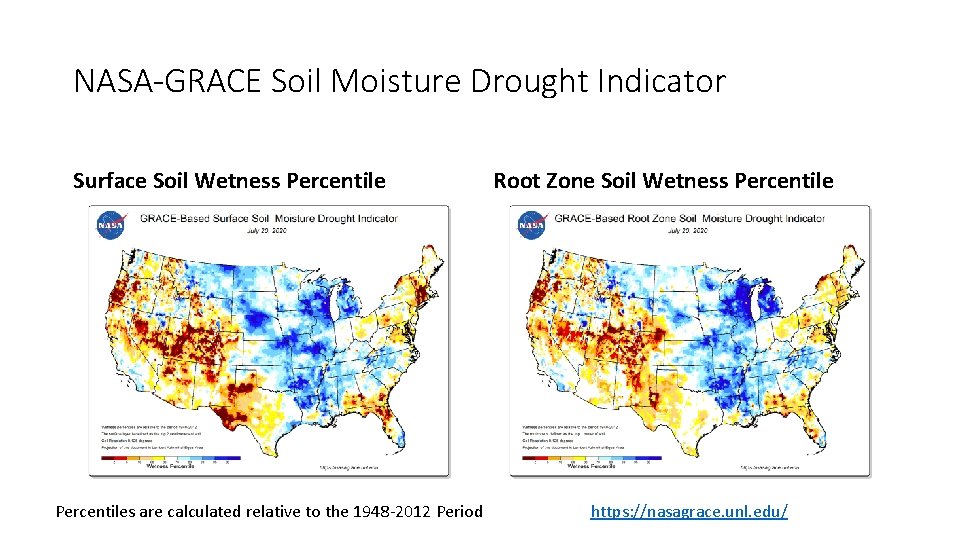
NASA-GRACE Soil Moisture Drought Indicator Surface Soil Wetness Percentiles are calculated relative to the 1948 -2012 Period Root Zone Soil Wetness Percentile https: //nasagrace. unl. edu/

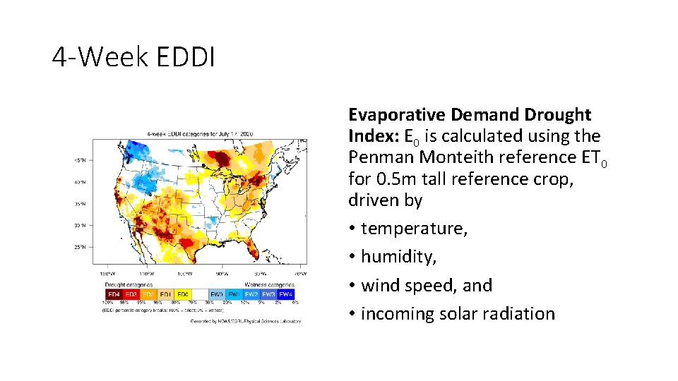
4 -Week EDDI Evaporative Demand Drought Index: E 0 is calculated using the Penman Monteith reference ET 0 for 0. 5 m tall reference crop, driven by • temperature, • humidity, • wind speed, and • incoming solar radiation

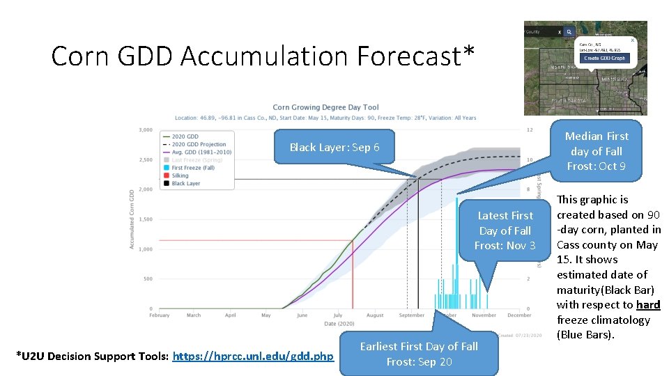
Corn GDD Accumulation Forecast* Median First day of Fall Frost: Oct 9 Black Layer: Sep 6 Latest First Day of Fall Frost: Nov 3 *U 2 U Decision Support Tools: https: //hprcc. unl. edu/gdd. php Earliest First Day of Fall Frost: Sep 20 This graphic is created based on 90 -day corn, planted in Cass county on May 15. It shows estimated date of maturity(Black Bar) with respect to hard freeze climatology (Blue Bars).

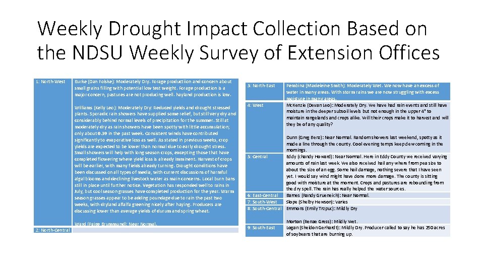
Weekly Drought Impact Collection Based on the NDSU Weekly Survey of Extension Offices 1: North-West Burke (Dan Folske): Moderately Dry. Forage productiion and concern about small grains filling with potential low test weight. Forage production is a major concern, pastures are not producing well. hayland production is low. Williams (Kelly Leo): Moderately Dry: Reduced yields and drought stressed plants. Sporadic rain showers have supplied some relief, but still very dry and considerably behind normal levels of precipitation for the summer. Still at moderately dry as rain showers have been spotty with little accumulation; only about 0. 39 in the past week. Consistent winds have contributed significantly to evaporative loss as well. As stated in previous weeks, crop yields are expected to be lower than normal due to early drought stress. Small showers will help with long season crops, excepting those that have completed flowering where yield loss is already imminent. Harvest of crops will be earlier, with many fields already turning. Drought conditions have been discussed on all types of media, with current discussions of harmful algal blooms and declining livestock water as main concerns. Local burn bans still in place until further notice. Vegetation has responded well to rains in July, but cool season grasses have completed production for the year. Warm season grasses appear to be adding poundage due to rain the past two weeks, with dryland alfalfa greening nicely after haying. Producers are discussing lower than average yields of durum and spring wheat. Ward (Paige Brummund): Near Normal. 2: North-Central 3: North-East 4: West Pembina (Madeleine Smith): Moderately Wet. We now have an excess of water in many areas. With storm rains we are now struggling with excess moisture in many areas. Mc. Kenzie (Devan Leo): Moderately Dry. We have had rain events and still have moisture in the deeper subsoil levels but not enough in the upper 4" to maintain rangelands and crops alike. Will their crops make it to harvest and will they be of any quality? Dunn (Greg Benz): Near Normal. Random showers last weekend, spotty as it made a line through the county. Cool evening temps keep dew coming in the mornings. 5: Central Eddy (chandy Howard): Near Normal. Here in Eddy County we received varying amounts of rain last week. We also received hail any where from pea size to about the size of an egg. Some hail damage, nothing severe that I have seen yet. I would say wind might have done more damage. The county is sitting good with moisture at the moment. Crops and pastures are rebounding from the dry spell. The rain has really helped the water sources. 6: East-Central Barnes (Randy Grueneich): Near Normal. 7: South-West Slope (Shelby Hewson): Varies 8: South-Central Emmons (Emily Trzpuc): Mildly Dry 9: South-East Morton (Renae Gress): Mildly Wet. Logan (Sheldon Gerhardt): Mildly Dry. Producer called to say he has 250 acres of soybeans that are burning up.

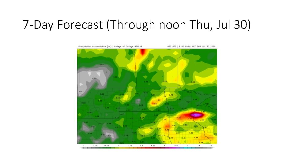
7 -Day Forecast (Through noon Thu, Jul 30)

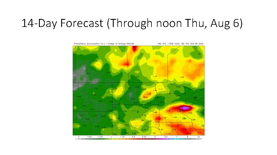
14 -Day Forecast (Through noon Thu, Aug 6)

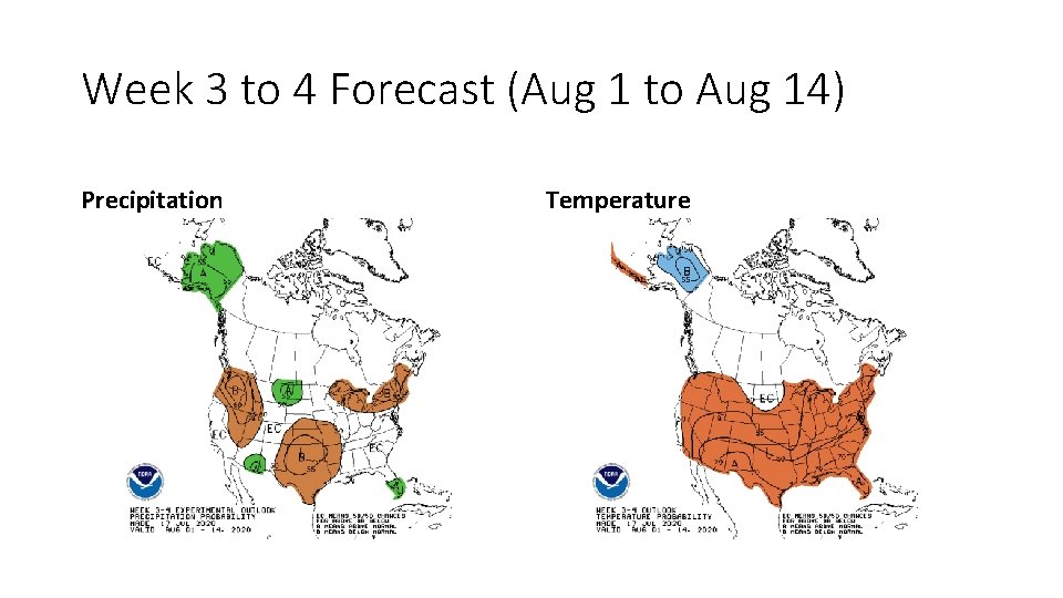
Week 3 to 4 Forecast (Aug 1 to Aug 14) Precipitation Temperature

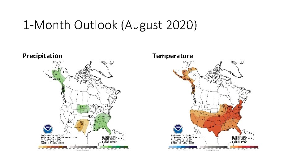
1 -Month Outlook (August 2020) Precipitation Temperature

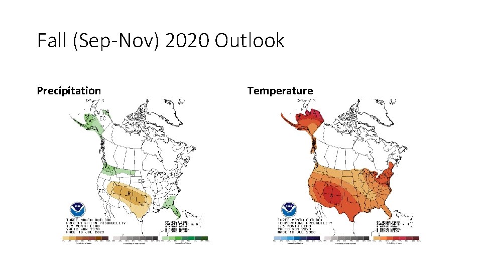
Fall (Sep-Nov) 2020 Outlook Precipitation Temperature