STANDARDS SS 6 G 1 Locate selected features


")


- Slides: 52
STANDARDS: SS 6 G 1 Locate selected features of Latin America. a. Locate on a world and regional political-physical map: Amazon River, Amazon Rainforest, Caribbean Sea, Gulf of Mexico, Atlantic Ocean, Pacific Ocean, Panama Canal, Andes Mountains, Sierra Madre Mountains, and Atacama Desert. b. Locate on a world and regional politicalphysical map the countries of Brazil, Chile, Colombia, Cuba, Mexico, and Panama. © Brain Wrinkles
Geography of Latin America
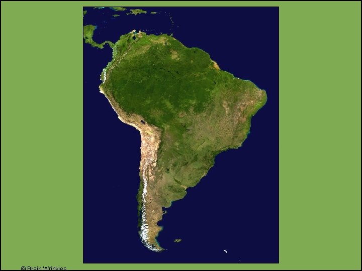
Geography • Latin America is located in the Western Hemisphere. • It is a large land area that includes most of the countries in the three regions of South America, Central America, and the Caribbean Islands. • Latin America is bordered by the Pacific Ocean to the west and the Atlantic Ocean to the east.
© Brain Wrinkles
Culture • Latin America is not a continent, but rather a cultural region. • Latin American countries share a similar culture and history. • The cultural element that unites the countries is language (Spanish and Portuguese). • The region is called Latin America because these languages developed from the Latin language.
Regions Latin America is divided into three regions: 1. Mexico and Central America 2. The Caribbean Islands 3. South America
Mexico & Central America
Mexico & Central America • 2, 500 miles (about as wide as the US) • Mountains dominate the region. • They are part of a huge system that extends from Canada, through the US, and all the way to the tip of South America. • There is a central plateau in Mexico. • It lies between the Sierra Madre mountains and makes up more than half of the country’s area.
© Brain Wrinkles
Mexico & Central America • Central America is an isthmus. • An isthmus is a narrow strip of land that has water on both sides and joins 2 larger bodies of water. • There are many volcanoes in Central America, as a result, their soil is arable (fertile) and many people farm lands
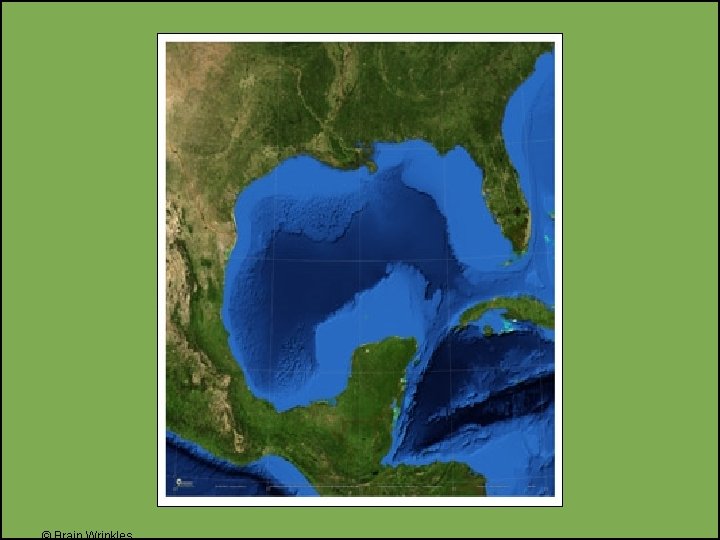
Gulf of Mexico • The Gulf of Mexico is a body of water that lies between Mexico and Florida. • It is an “arm” of the Atlantic Ocean. • The Gulf of Mexico is bordered by the United States to the north, Mexico to the south, and Cuba to the east. • The Mississippi River and Rio Grande are two major rivers that flow into the Gulf of
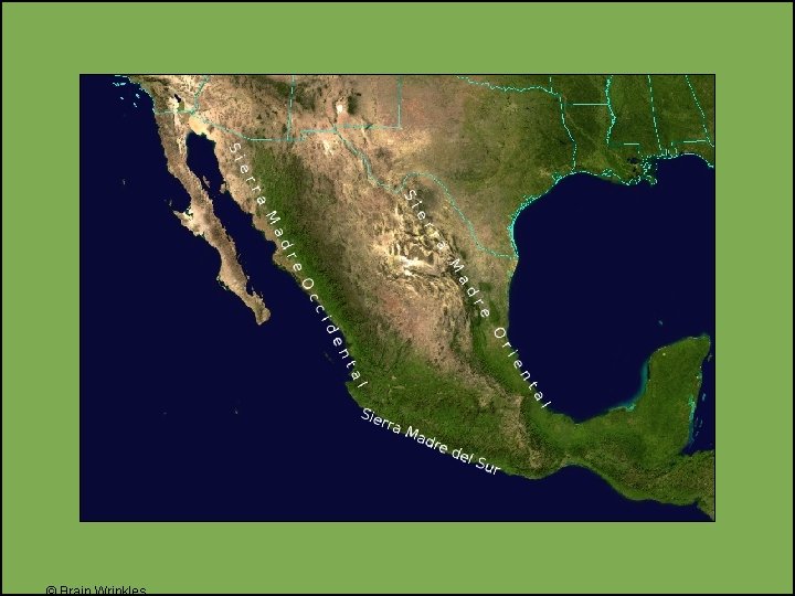
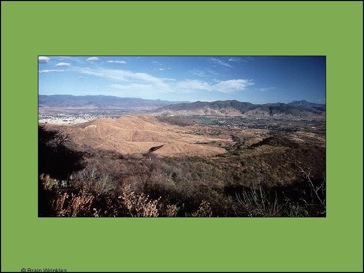
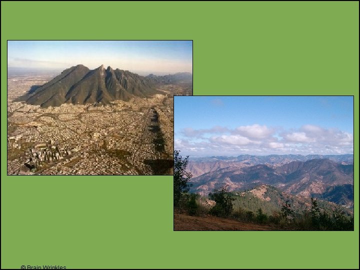
Sierra Madre Mountains • The Sierra Madre Mountains are the main mountain system in Mexico. • The range contains 3 major chains: the Sierra Madre Occidental in the west, the Sierra Madre Oriental in the east, and the Sierra Madre del Sur, which extends along the southern coast. • The Sierra Madre range contains some of the highest mountains and volcanoes in Latin America.
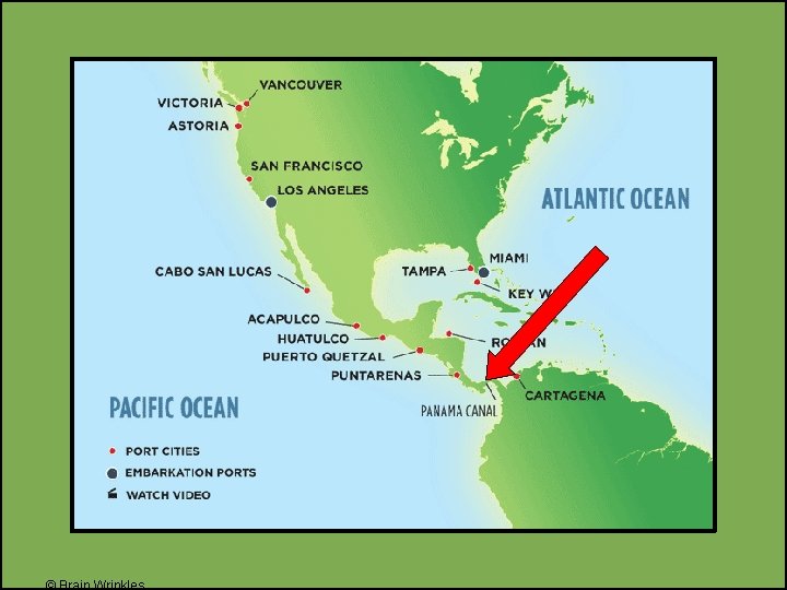
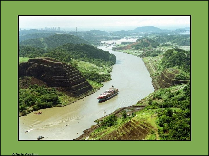
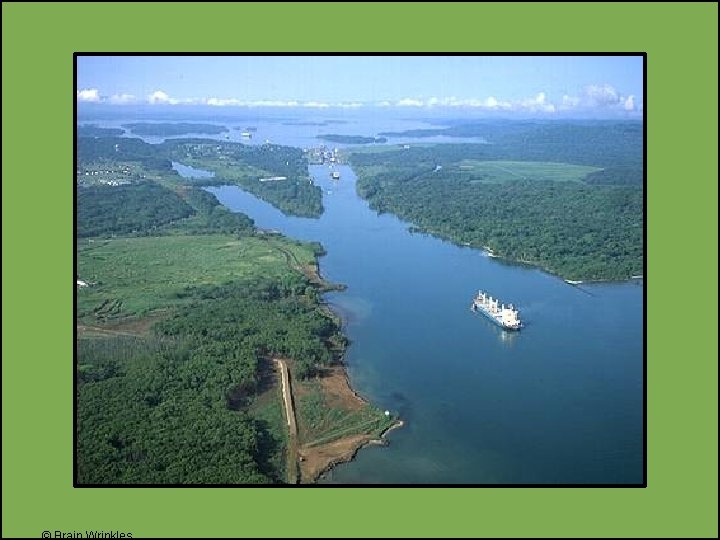
Panama Canal • The Panama Canal is a man-made feature across the isthmus of Panama in Central America. • It is a major “shortcut” that allows ships to travel between the Pacific and Atlantic oceans. • The Panama Canal is nearly 50 miles long.
Panama Canal • It handles a large volume of world shipping and enables ships to avoid traveling around South America, reducing their voyages by thousands of miles and many days. • It consists of artificially created lakes, channels, and a series of locks, or waterfilled chambers, that raise and lower ships through the mountainous terrain of central Panama.
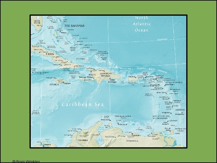
Caribbean Islands
Caribbean Islands • The smaller islands are made of coral (skeletons of tiny sea animals, a rock-like substance). • The larger islands are actually tops of underwater mountains. • Examples: Cuba, Jamaica
Caribbean Sea • The Caribbean Sea is another arm of the Atlantic ocean. • It is located between Cuba and South America and surrounds the Caribbean islands.
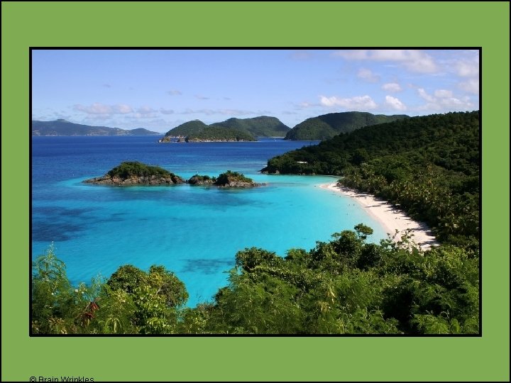
Caribbean Sea • The Caribbean Sea is a major trade route for Latin American countries. • It is also a popular tourist area that is noted for its mild tropical climate and beautiful beaches.
South America
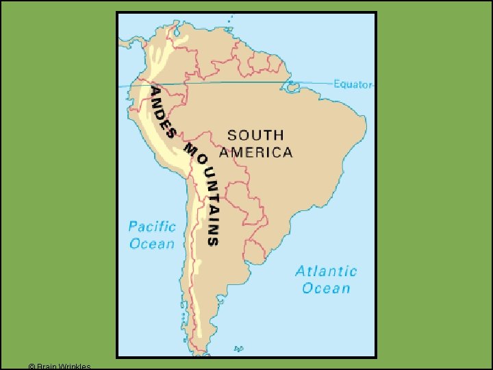
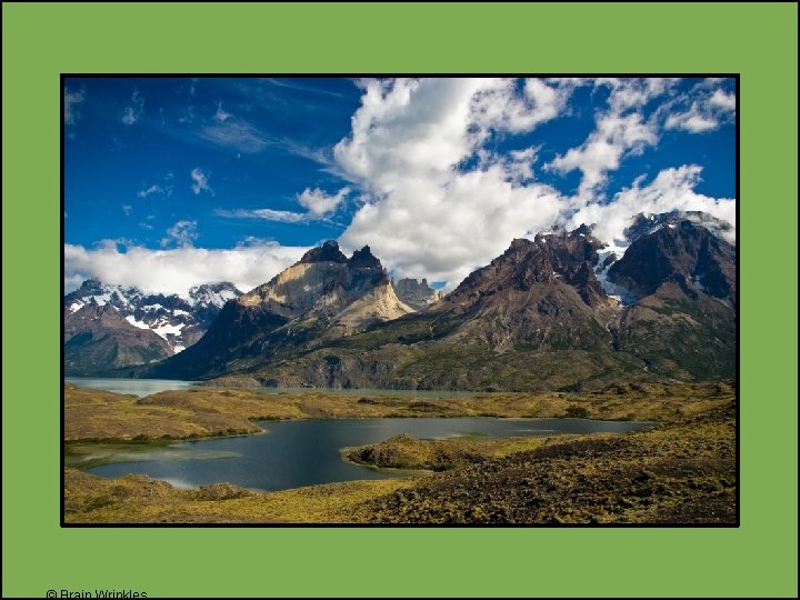
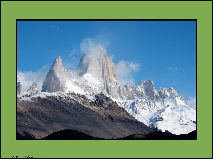
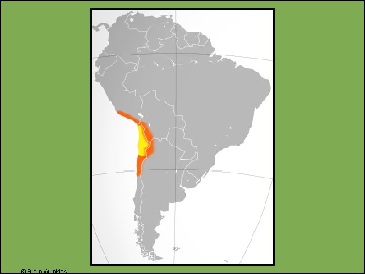
Andes Mountains • The Andes Mountains run 4, 500 miles along the west coast of South America. • The Andes are the longest continuous mountain range in the world. • They rise at some points to 20, 000 feet— the same height as twenty 100 story buildings stacked on top of each other!
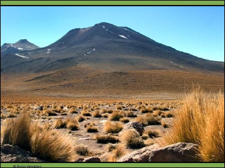
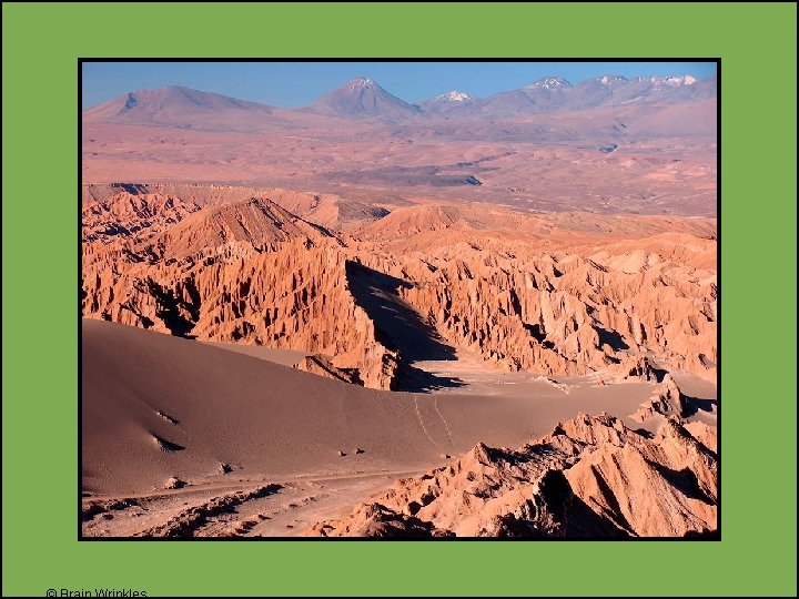
Atacama Desert • The Atacama Desert is located in Chile at a high elevation in the Andes Mountains. • The desert’s average temperature is pretty chilly. • Also, it’s one of the driest places on earth with very little recorded rainfall annually. • Parts of the Atacama Desert have never
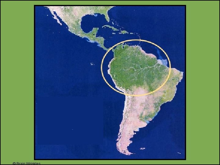
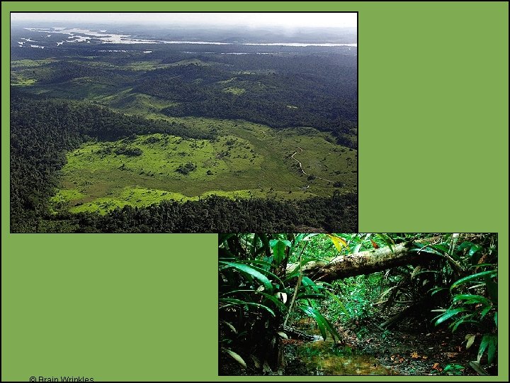
Amazon Rainforest • The Amazon Rainforest spreads across much of northern South America and covers 1/3 rd of the continent. • It is the largest tropical rainforest in the world. • The Amazon Rainforest is home to over 40, 000 plants, 1, 000 different species of birds, and 2. 5 million different kinds of insects.
Amazon Rainforest • The Amazon Rainforest’s plants produce more than 20% of the world’s oxygen supply. • It is often called the “lungs of the Earth”.
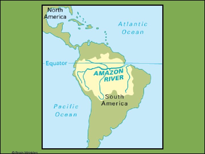
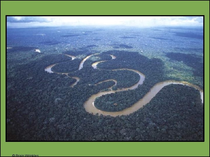
Amazon River • The Amazon River is the 2 nd longest river in the world (the 1 st is the Nile River). • It carries the greatest volume of water of any river in the world. • The Amazon River stretches 4, 000 miles (primarily across Brazil) to the Atlantic Ocean.
Amazon River • The Amazon River contains 20% of all fresh water in the world! • It serves as a natural highway where it’s hard to build roads. • The Amazon also provides food and hydroelectric power.
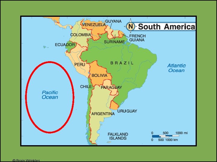
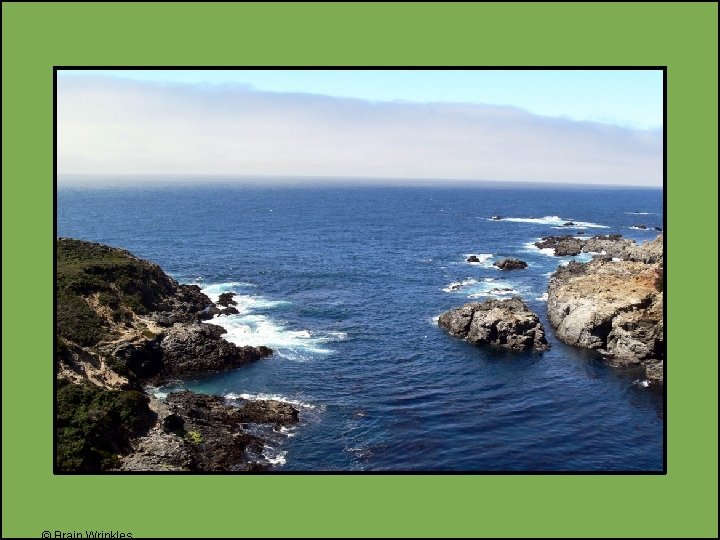
Pacific Ocean • The Pacific Ocean is the world’s largest ocean. • It touches the western coast of South America.
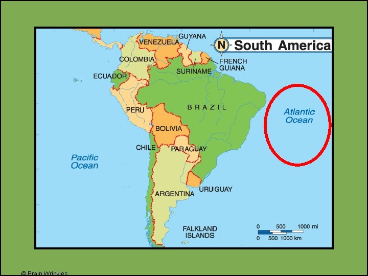
Atlantic Ocean • The Atlantic Ocean is the world’s second -largest ocean. • It is located east of South America.
Latin America’s Physical Features Directions: Complete the chart below with information that you learn during the presentation. If time allows, color your illustrations. What: Where: What: Caribbean Sea Sierra Madre Mountains Where: Illustration: Gulf of Mexico Illustration: Where: Illustration: Panama Canal Illustration: What: Where: What: Atacama Desert Where: Illustration: Andes Mountains Illustration: © Brain Wrinkles
Latin America’s Physical Features What: Where: What: Atlantic Ocean Amazon River Directions: Complete the chart below with information that you learn during the presentation. If time allows, color your illustrations. Where: Illustration: Amazon Rainforest Illustration: Where: Illustration: Pacific Ocean Illustration: © Brain Wrinkles