
Speaker Philip Hodson New Cheveley Road Newmarket CB
Speaker Philip Hodson New Cheveley Road Newmarket CB 8 8 BS.
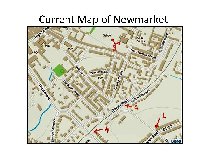
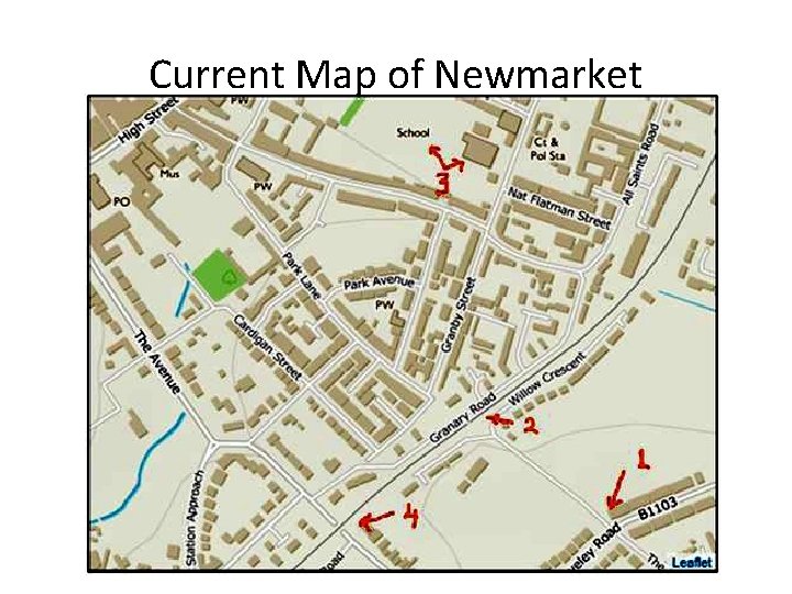
Current Map of Newmarket
Who owns a Public Right of Way? http: //www. pittecroft. org. uk/ownershipofpaths. htm • The National Farmers' Union, the Country Landowners' Association, and the Countryside Commission, in an early edition of their booklet “Managing Public Access” said: • “In simple terms, the surface of a highway, whether a public right of way or a road, is owned by the Highway Authority rather than the owner of the land over which it passes. ”
Who owns a Public Right of Way? http: //www. pittecroft. org. uk/ownershipofpaths. htm • A public way, once created, continues forever unless legally stopped up: 'once a highway, always a highway'. • What does the public– you and me –own? Just the right to use the path but nothing more tangible.
Durham County Council says: - https: //www. durham. gov. uk/article/3325/Public-Rights-of-Way-Frequently-Asked-Questions • If the path is not currently recorded (as a public right of way) it may be possible to claim it as such. This would require the claimants to obtain sufficient evidence to prove that public rights have indeed been established. Public rights can be acquired through 20 years public use with the following conditions: • the route was used without interruption in other words, always useable, no locked gates or prohibitive signs. • users did not seek permission of the landowner. • that there is no evidence that the landowner did not intend public use of the route.
Weatherby Crossing S 22 • Railway companies never locked this crossing. • There are no memories of people having to ask railway companies’ permission before using the crossing. • There is no historical evidence that the railway companies did not intend public use of the route. Indeed, railway companies were helpful to assist crossing.
Medway Council http: //www. medway. gov. uk/roadsandpavements/publicrightsofwayquestions. aspx • The law assumes that if the public uses a path without interference for some period of time (set by statute at 20 years) then the owner had intended to dedicate it as a right of way. A public path that has been unused for 20 years does not cease to be public. • The legal maxim is "once a highway, always a highway".
Who owns this Public Right of Way? • The land at the crossing is owned by Network Rail, • But, the right to cross is owned by the community of Newmarket, • The acts of using this crossing is not Network Rail’s property or facility to extinguish.
Closing a Public Right of Way https: //www. blackburn. gov. uk/Pages/Closing-or-diverting-a-public-right-of-way. aspx • Unnecessary highway • A public right of way may be closed if it can be deemed to be unnecessary and if there is a nearer or more commodious route available to the public. Such closures are processed under section 116 of the Highways Act 1980. • In the interest of the landowner or public • Under section 118 of the Highways Act 1980, landowners may apply to divert a public right of way on their land if they can demonstrate that it is beneficial to move the path and that the alternative route will not be less convenient or less enjoyable to the public.
Newmarket Community attitude • Network Rail has not found a nearer or more commodious route available to the public. • The public are quite happy with the present state of the railway crossing, they consider it sufficiently safe. • The public mostly wish it to stay as a level crossing, but most say they can accept a bridge in lieu.
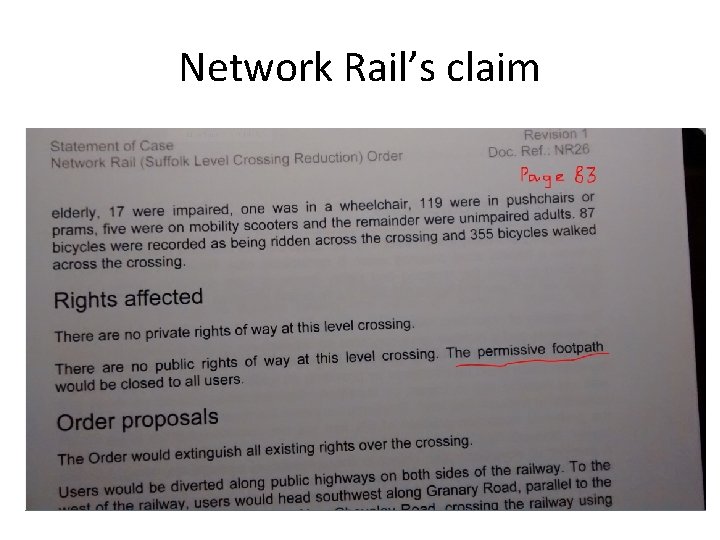
Network Rail’s claim
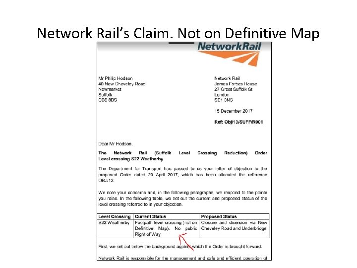
Network Rail’s Claim. Not on Definitive Map
Weatherby Crossing - Permissive Path? • Network Rail claims the Weatherby Crossing to be a Permissive Path. • My understanding is that it is a Private Landowner who gives permission to use his paths, thereby making them “permissive”. • Network Rail is not a private landowner but a Public entity in which the utilities, buildings and grounds it manages are publically owned.
Weatherby Crossing - Permissive Path? • Therefore, I propose that the crossing must be treated as in public ownership, a public way, • and that rights to use this way have been earned by the Newmarket community through many years of walking the crossing without hindrance, in my view, meaning that there is established, Public Right of Way.
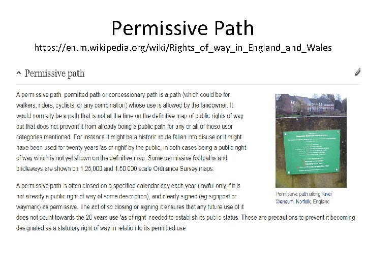
Permissive Path https: //en. m. wikipedia. org/wiki/Rights_of_way_in_England_Wales
Permissive Path https: //en. m. wikipedia. org/wiki/Rights_of_way_in_England_Wales • A permissive path is often closed on a specified calendar day each year, • and clearly signed (eg signpost or waymark) as permissive. • The act of so closing or signing it ensures that any future use of it does not count towards the 20 years use 'as of right' needed to establish its public status. • Network Rail, nor its predecessors, have ever closed or sign-posted this crossing as “permissive”.
Weatherby Crossing – Public Right of Way? • Network Rail has claimed that there is no Public Right of Way because it is not declared on a definitive Map. (see slide of letter from Network Rail above)
Definitive Map http: //naturenet. net/row/definitivemaps. html#definitive%20 map • A definitive map is a map prepared by a surveying authority which is a legal record of the public's rights of way in one of four categories (footpath, bridleway, road used as a public path or byway open to all traffic). • If a way is shown on the map, then that is legal, or conclusive, evidence that the public had those rights along the way at the relevant date of the map.
Definitive Map http: //naturenet. net/row/definitivemaps. html#definitive%20 map • But the reverse is not true. • So the showing of a way as a footpath does not prove that there are not, for example, additional unrecorded rights for horseriders to use the way. • Nor is the fact that a way is not shown at all on the definitive map, proof that the public has no rights over it.
Closing or diverting a public right of way https: //www. blackburn. gov. uk/Pages/Closing-or-diverting-a-public-right-of-way. aspx • Unnecessary highway • A public right of way may be closed if it can be deemed to be unnecessary and if there is a nearer or more commodious route available to the public. • In the interest of the landowner or public • Under section 118 of the Highways Act 1980, landowners may apply to divert a public right of way on their land if they can demonstrate that it is beneficial to move the path and that the alternative route will not be less convenient or less enjoyable to the public. • There is nothing about closing a public right of way on grounds of safety and accepting a less convenient alternative route in lieu.
The following slides show evidence of the foot crossing more than twenty years ago.
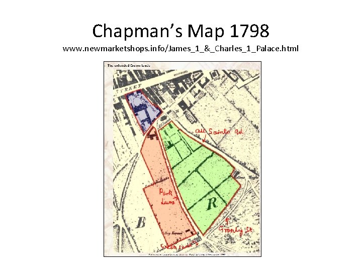
Chapman’s Map 1798 www. newmarketshops. info/James_1_&_Charles_1_Palace. html
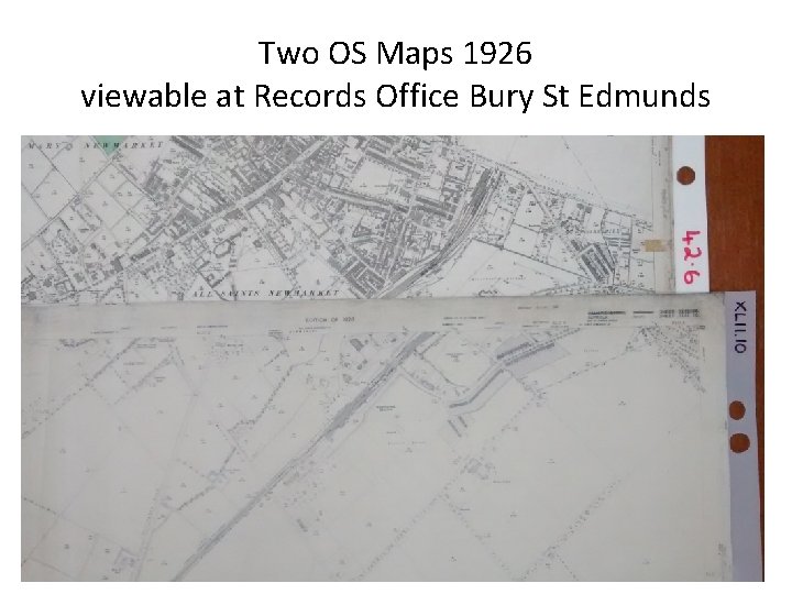
Two OS Maps 1926 viewable at Records Office Bury St Edmunds
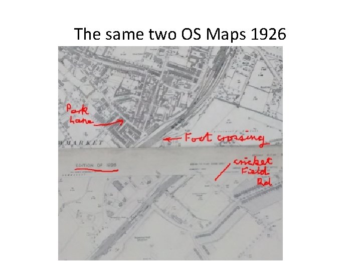
The same two OS Maps 1926
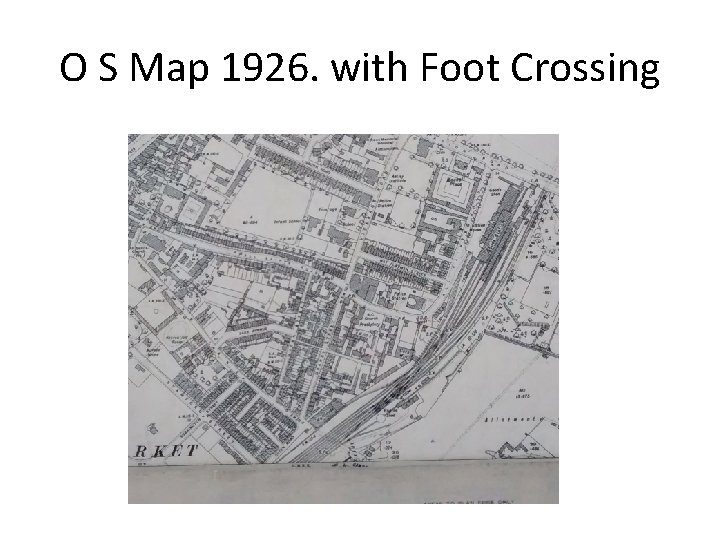
O S Map 1926. with Foot Crossing
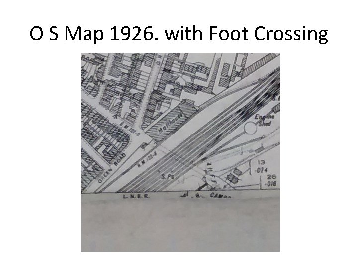
O S Map 1926. with Foot Crossing
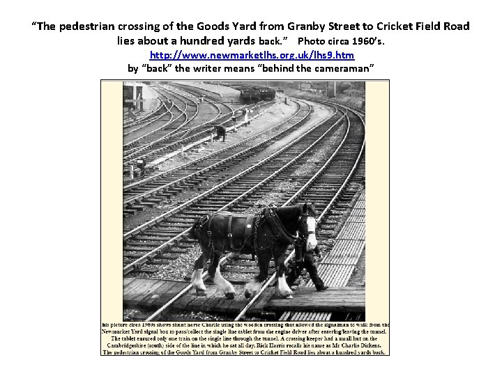
“The pedestrian crossing of the Goods Yard from Granby Street to Cricket Field Road lies about a hundred yards back. ” Photo circa 1960’s. http: //www. newmarketlhs. org. uk/lhs 9. htm by “back” the writer means “behind the cameraman”
Closure of the Weatherby Crossing • Closure and walking by alternative routes Will be • Less Commodious • Less convenient • Less Enjoyable
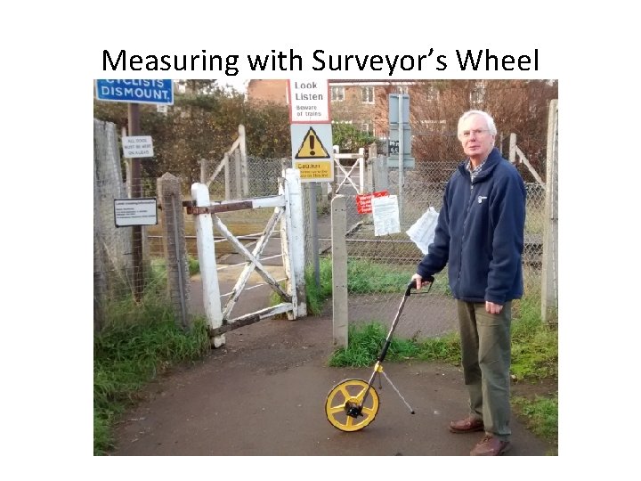
Measuring with Surveyor’s Wheel
Current Map of Newmarket
Four school journeys a day • From junction New Cheveley Road/Cricket Field Road to All Saints School: - 866 metres, taking 10 minutes. • Add 10 minutes to reach NCR/CFR junction • Total 20 minutes. • Multiply, 20 min x 4 = 80 minutes a day. • Times are about doubled by walking via The Bridge or Old Station Road. ≈ 160 minutes a day, 2 hours, 40 minutes. • 2 hrs 40 minutes x 5 school days = 13. 33 hours of walking a week!
Network Rail – Public Servant • Network Rail, is our public servant whom we task with keeping our railway lines in good order, our rail verges and fences clean and tidy, and not least, to provide us with commodious, convenient and enjoyable crossings where we need them.
Network Rail – Public Servant • The Weatherby Crossing is a public entity, in public ownership. • Network Rail is a Public Entity, not a private landlord entitled to grant Permissive Way. • The combination of this path being in public ownership and regular, long-term usage of this path by the public, does make it a public right of way.
Network Rail – Public Servant • Providing improved commodious facility is a requirement for closing a public right of way. • Network Rail is not able to provide more commodious facilities for crossing the lines by simple closure.
Safety • Excessive expectancies for safety are not cause for closure of a public right of way nor this pedestrian rail crossing. • Electricity, an unseeable force which spreads through water and metal, which jumps gaps with the capacity to kill, would never be allowed in today’s “zero tolerance of risk” mentality. • Common sense needs to be applied. The majority of Newmarket citizens say they think this crossing is sufficiently safe as it is. • Most of the Newmarket community may accept a bridge in lieu, but many would prefer a level crossing. • Network Rail needs to get into the Newmarket Community to establish this.
• Network Rail, is our public servant whom we task with keeping our railway lines in good order, our rail verges and fences clean and tidy, and not least, to provide us with commodious, convenient and enjoyable crossings where we need them. • But in this, it seems Network Rail is “going off the rails”.
Disruption and increased travel inconvenience • The closure of level crossings across Cambridgeshire, Suffolk and elsewhere threatens to really disrupt ease of travel and to impose heavy extra travel costs upon many of us. • It is vital that citizens now start to set out their “compensatory positions”.

• END
- Slides: 38