Southwest Asias Geography Physical Features of the Middle


- Slides: 44
Southwest Asia’s Geography Physical Features of the Middle East
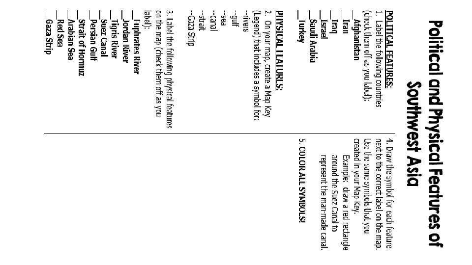
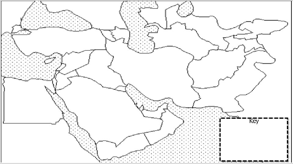
Standards SS 7 G 5 The student will locate selected features in Southwestern Asia (Middle East). a. Locate on a world and regional political-physical map: Euphrates River, Jordan River, Tigris River, Suez Canal, Persian Gulf, Strait of Hormuz, Arabian Sea, Red Sea, and Gaza Strip. b. Locate on a world and regional political-physical map the nations of Afghanistan, Iraq, Israel, Saudi Arabia, and Turkey.
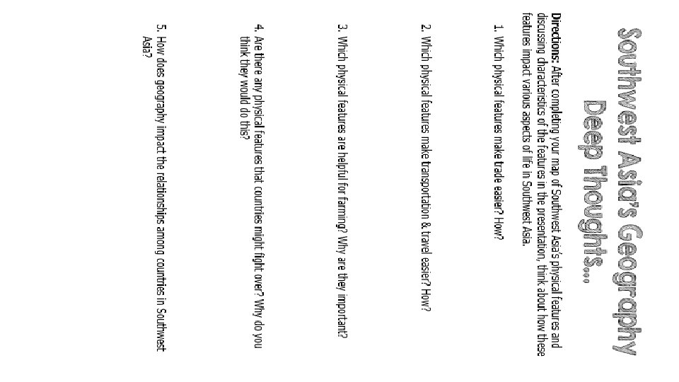
Teachers Print off the following page for each student. They should complete the chart while discussing the presentation.
Southwest Asia’s Geography Physical Features of the Middle East
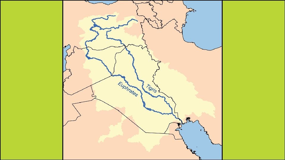
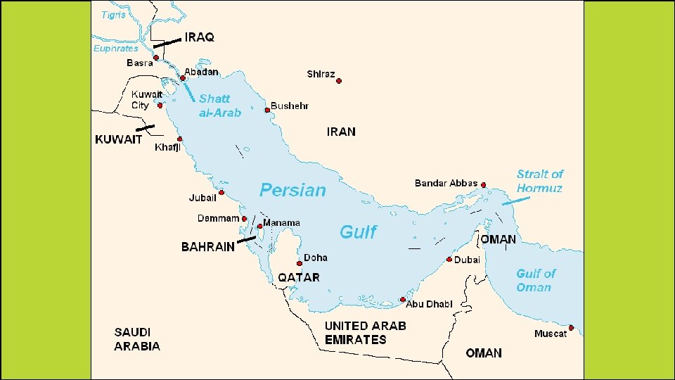
Euphrates & Tigris Rivers • • Both rivers begin in Turkey and flow south through Iraq. In southern Iraq, the Euphrates River joins with the Tigris River to form one waterway called the Shaat al-Arab. • It then flows along the border between Kuwait and Iran and empties into the Persian Gulf. • The rivers provide water for both drinking and farming. • The countries that share these rivers have had problems over how the water should be shared.
Euphrates River
Tigris River
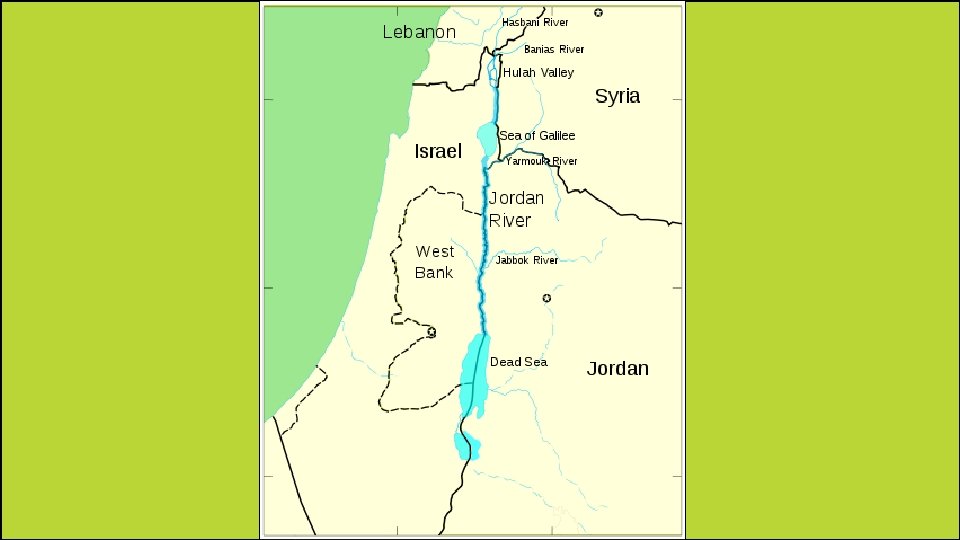
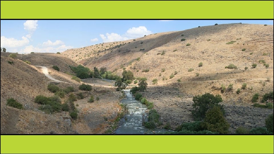
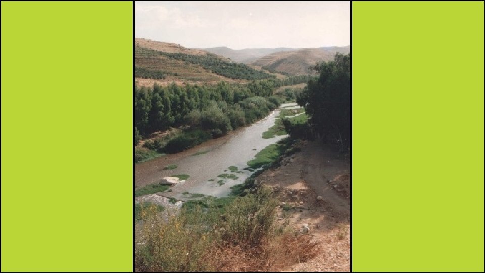
Jordan River • The Jordan River begins at the southern end of the Sea of Galilee & flows south until it reaches the Dead Sea. • This river is a main source of water for Israel, Jordan, parts of Syria, & many of those living in the West Bank & the Gaza Strip. • The Jordan River is also important because it is the political boundary between Israel, the West Bank, & Jordan.
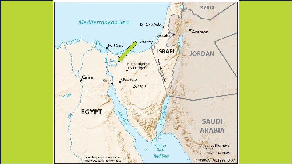
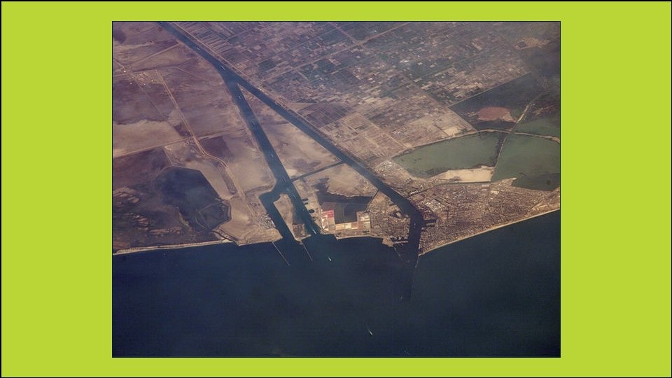
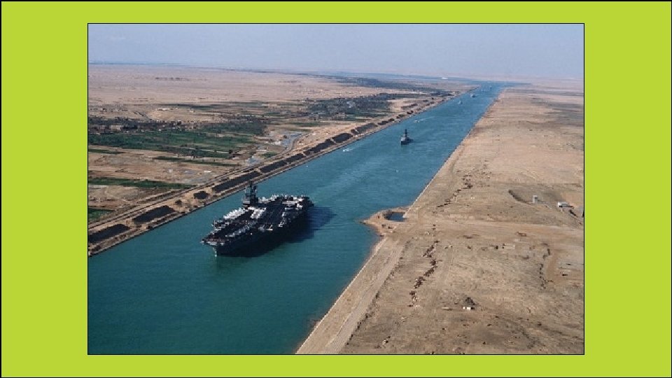
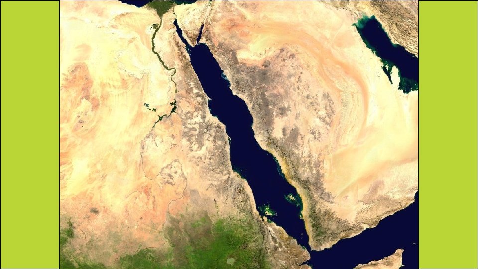
Suez Canal • This is a 120 -mile man-made waterway that is used to transport goods to and from all three continents. • The French started building it, but it was completed by the British in 1869. • It connects the Red Sea with the Mediterranean Sea. • At the northern end of the Red Sea, ships can enter the canal and can get to the Mediterranean Sea without having to sail all around the continent of Africa.
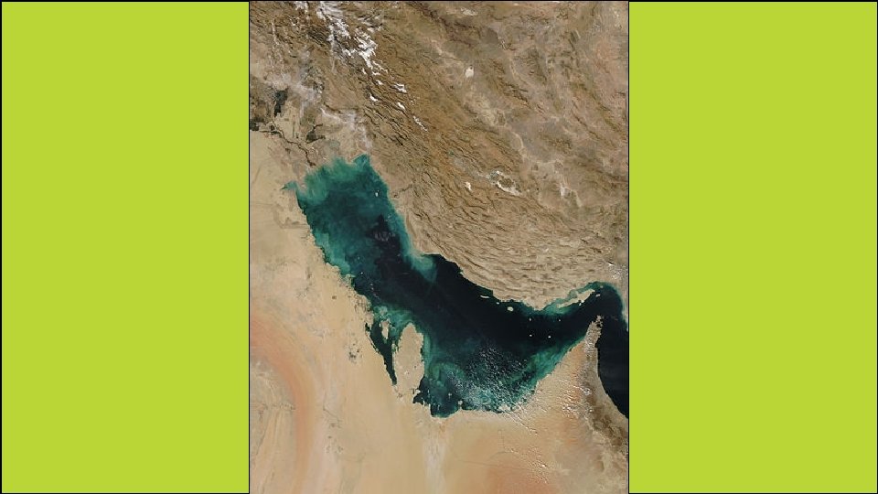
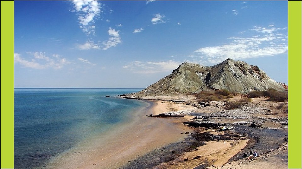
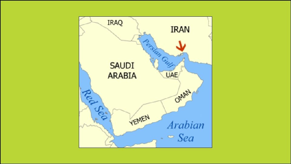
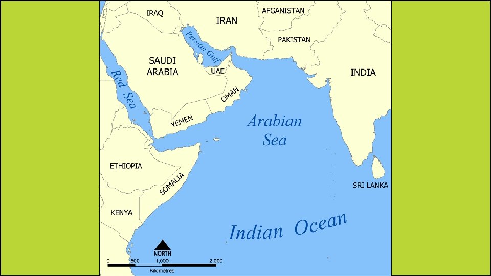
Persian Gulf • This is located between the country of Iran and the Arabian Peninsula. • It is one of the main ways oil is shipped from the rich fields of Kuwait, Saudi Arabia, Iran, and other countries that line its shores. • All of the countries that produce oil in that region depend on the Persian Gulf as a shipping route.
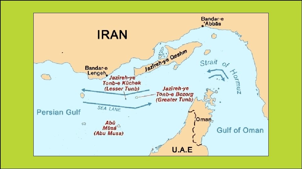
Strait of Hormuz • It is located at one end of the Persian Gulf. • It connects the Persian Gulf to the Arabian Sea. • It is very important because any ships coming out of or into the Persian Gulf must navigate through this very narrow waterway.
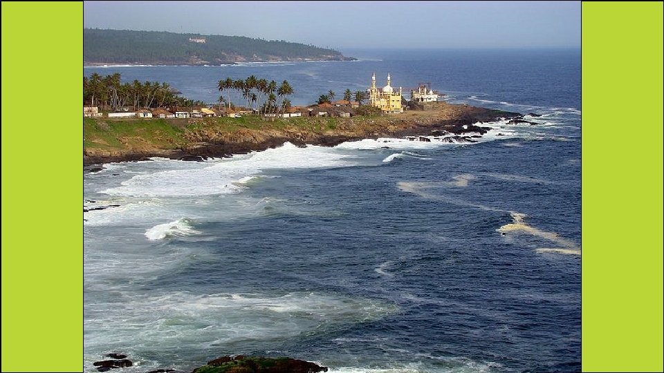
Arabian Sea • This is located north of the Indian Ocean. • It forms part of a key shipping route between Europe and India through the Suez Canal.
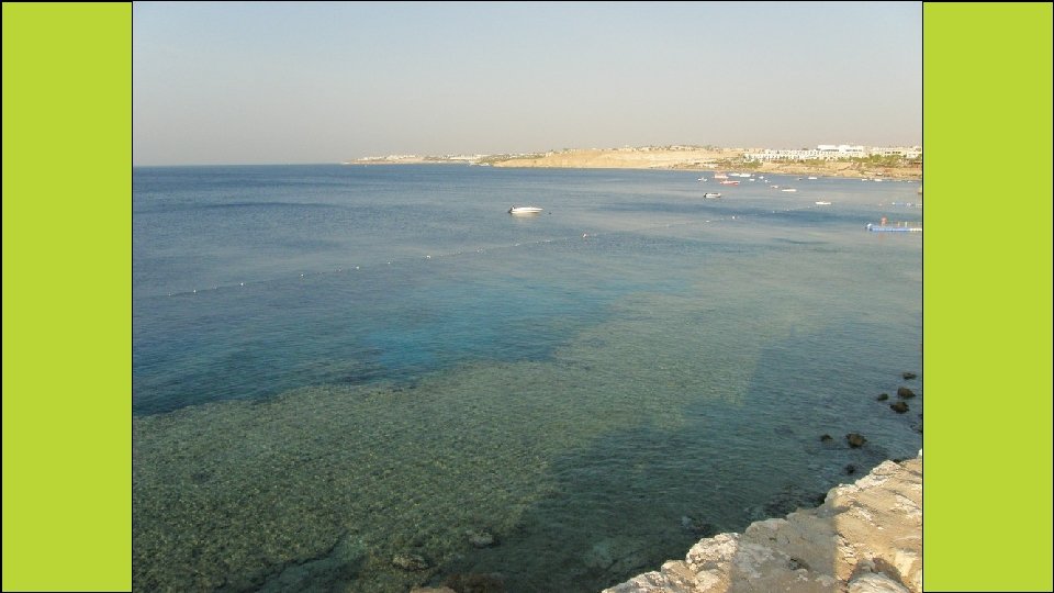
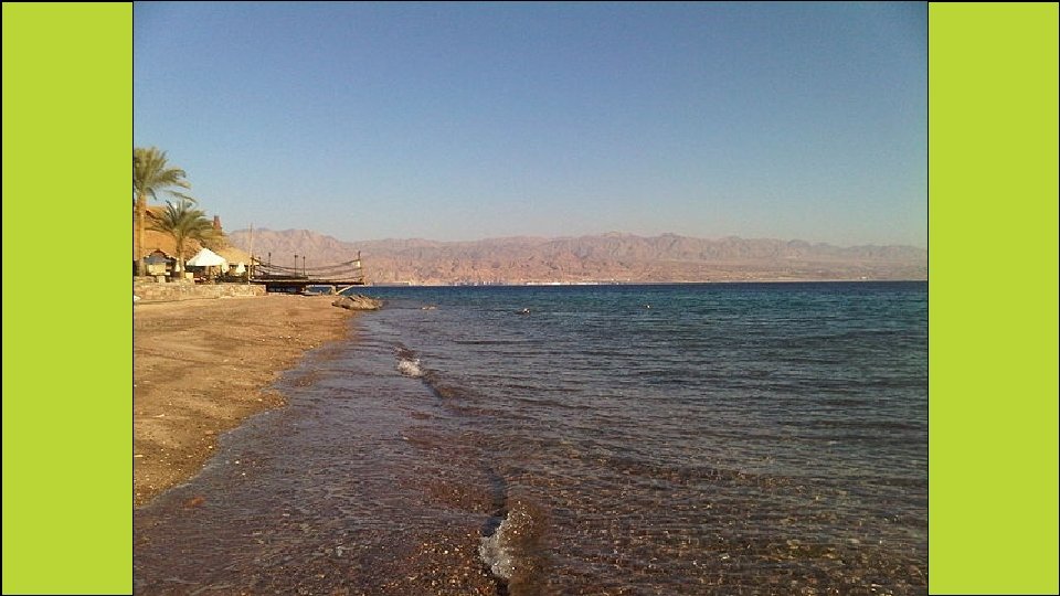
Red Sea • This is an inlet of the Indian Ocean that lies between Africa and Asia. • Because of its location between Europe, Persian Gulf, and East Asia, heavy shipping traffic takes place here. • During the Roman Empire, it was an important route for trade between Rome and China. • During the Middle Ages, it was a key part of the Spice Trade.
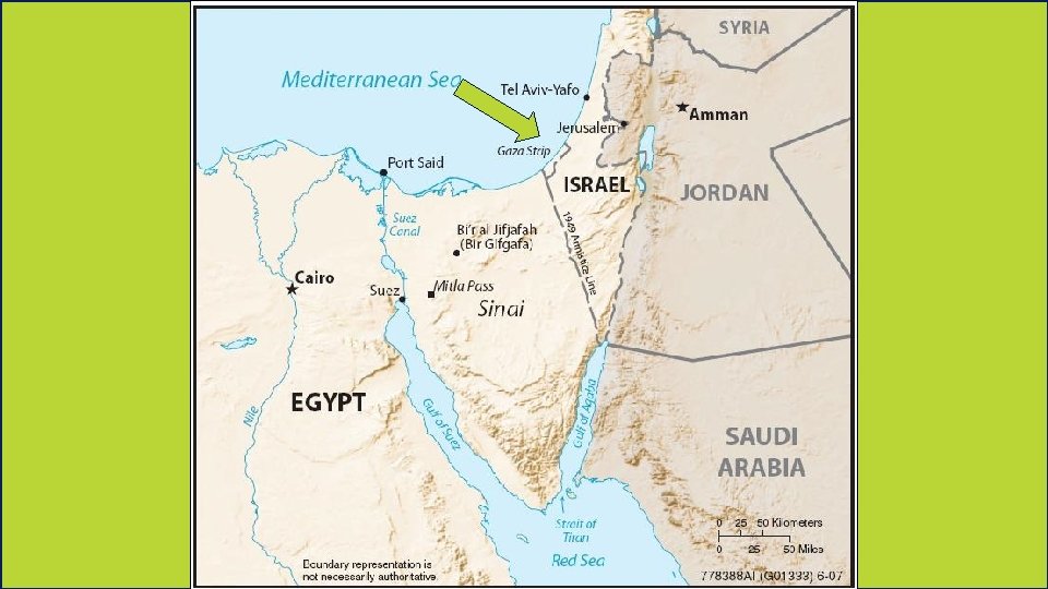
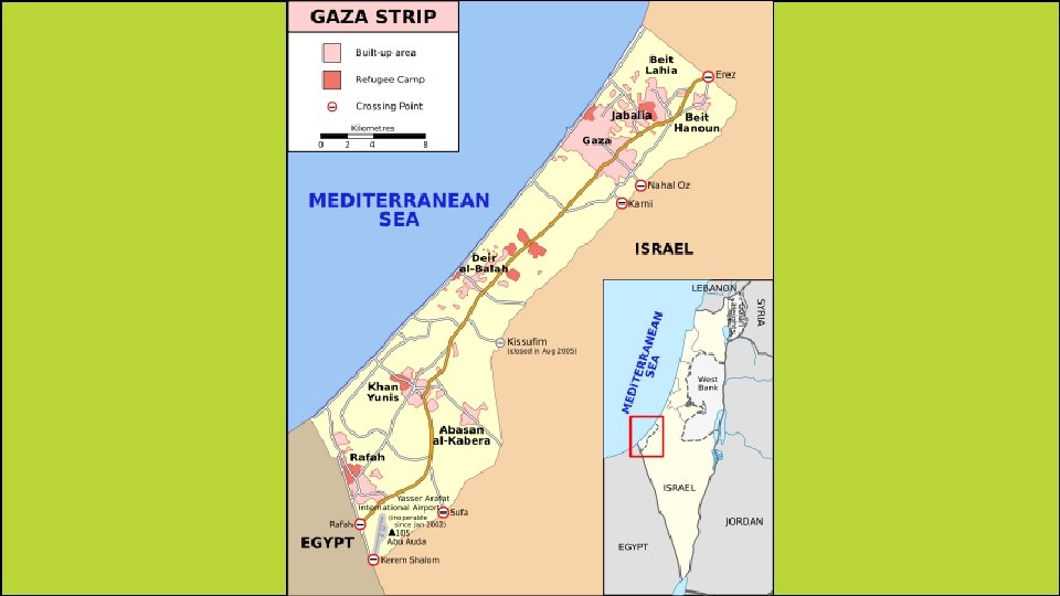
Gaza Strip • It is located along the southeastern shore of the Mediterranean Sea. • The Gaza Strip is a rectangular territory that is about 25 miles long and 4 to 5 miles wide. • It’s one of the world’s most densely populated areas. • The Gaza Strip is often politically unstable and there have been many outbreaks of violence over the last 60 years.
Gaza Skyline, 2007
Teachers Thank you for downloading this file. I hope you enjoy using it with your students, and I can’t wait to read your feedback in my TPT store! • For more social studies materials, please visit my store: http: //www. teacherspayteachers. com/Store/Brain-Wrinkles • I teach Language Arts and Social Studies in Georgia, so my products are aligned with Common Core (LA) and Georgia Performance Standards (SS). © Copyright 2013. Brain Wrinkles. All rights reserved. Permission is granted to copy pages specifically designed for student or teacher use by the original purchaser or licensee. The reproduction of any other part of this product is strictly prohibited. Copying any part of this product and placing it on the Internet in any form (even a personal/classroom website) is strictly forbidden. Doing so makes it possible for an Internet search to make the document available on the Internet, free of charge, and is a violation of the Digital Millennium Copyright Act (DMCA).
Credits: All photos were found via Creative Commons and labeled for reuse. • Fonts: • Backgrounds & Graphics: