South Carolina Groundwater Management Issues Challenges and Successes


 wells being impacted")


 898")
- Slides: 34
South Carolina Groundwater Management Issues, Challenges, and Successes Director Rob Devlin
Contents 1. 2. 3. 4. 5. Hydrogeologic Framework & Climate History of Groundwater Management Changing Water Issues Challenges of Water Management Program Successes
Hydrogeologic Framework & Climate
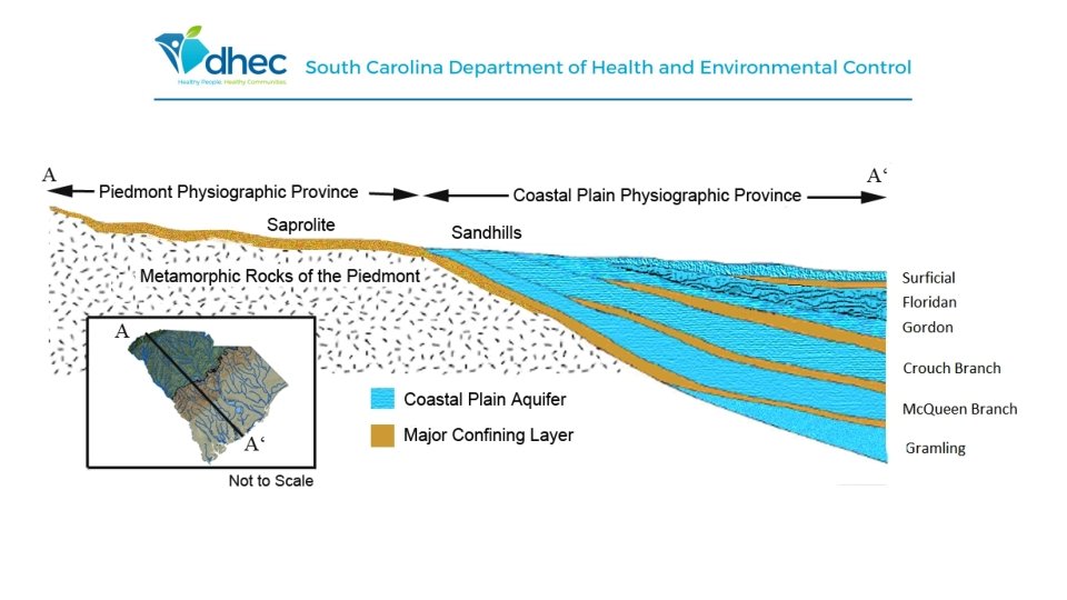
Hydrogeologic Framework of SC • 4 primary aquifers utilized throughout the Coastal Plain: • • Floridan Aquifer Gordon Aquifer Crouch Branch Aquifer Mc. Queen Branch Aquifer
Atlantic Coastal Plain Aquifer System • Extends from eastern Georgia, through North and South Carolina and into southern Virginia • Covers 22, 500 mi 2 in South Carolina • Permeable composition and high precipitation= large quantities of highquality groundwater • Groundwater availability is generally good • Average loss per year from the system: 45, 000 acre-feet per year
Climate • South Carolina is classified as a humid, subtropical environment • Summer temperatures average 90 degrees • Winter temperatures average 55 degrees • Precipitation averages between 40 and 60 inches per year
History of Groundwater Management
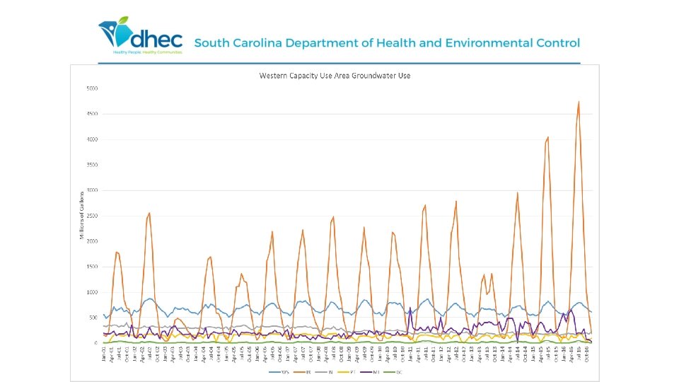
Water Quantity Programs Capacity Use Program • Since the 1970 s • Issue permits in designated areas of the Coastal Plain using >3 million gallons per month Surface Water Withdrawal Permitting • Since June 2012 • Issue permits statewide if using >3 million gallons per month Water Use Reporting • All registered and permitted groundwater and surface water withdrawers report their annual water use to the department • Data is compiled and water use reports are produced • Water use reports are available on our website for public use
Groundwater Use and Reporting Act Title 49 Chapter 5 South Carolina Code of Laws The groundwater resources of the State be put to beneficial use to the fullest extent to which they are capable, subject to reasonable regulation in order to conserve and protect these resources, prevent waste, and to provide and maintain conditions which are conducive to the development and use of water resources.
Groundwater Use and Reporting Act • Requires those withdrawing >3 million gallons per month to register and report water use annually • Capacity Use Areas are established where excessive groundwater withdrawals present potentially adverse effects • Groundwater Management Plans are established in each Capacity Use Area to guide groundwater management
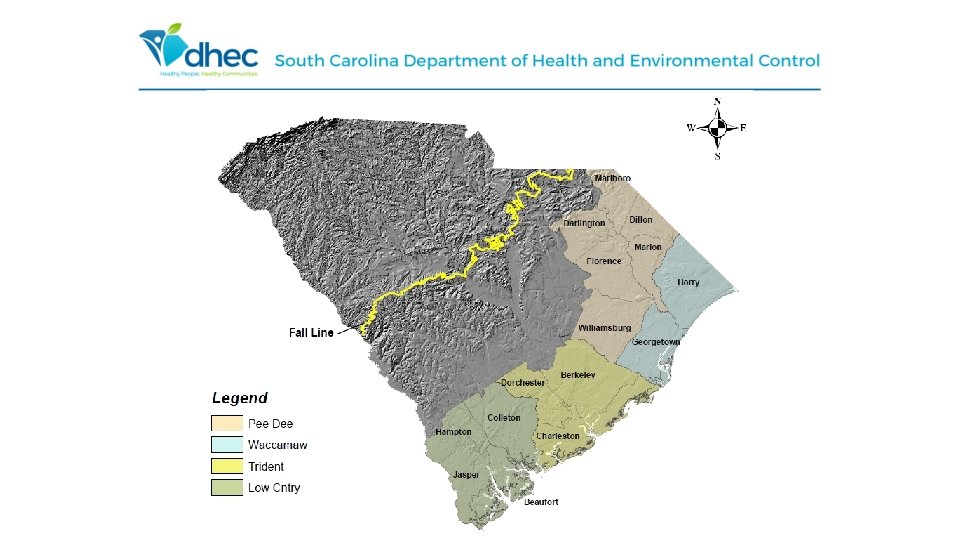
Capacity Use Area Declaration Timeline • Waccamaw - June 22, 1979 includes Georgetown, Horry Counties • Lowcountry - July 24, 1981 includes Beaufort, Colleton and Jasper Counties; Hampton County was added on June 10, 2008 • Trident – August 8, 2002 includes Berkeley, Charleston, and Dorchester Counties • Pee Dee – February 12, 2004 includes Darlington, Dillon, Florence, Marion, Marlboro, and Williamsburg Counties
Groundwater Permitting • Goal is to maximize the use of the resource while preventing harm to aquifer or other users • Reasonable use (e. g. how much water for a particular crop) • Permits are issued on a 5 year cycle • Groundwater Evaluations are released the year prior to repermitting for stakeholder involvement
Changing Water Issues
Population Since the 2010 Census, South Carolina has grown by 8. 6%, with approximately 400, 000 more people. In 2017 the population exceeded 5 million, with an estimated population of 5, 024, 369. Population is expected to grow to 6 million by 2030.
Increasing Agricultural Production • Over 24, 000 agricultural operations in SC, covering 5, 000 acres of land • There has been a 79% increase in agricultural production since 2002 • Majority of agricultural operations are in the inner coastal plain, near aquifer catchment areas
Beginning in the late 1990 s South Carolina has experienced repetitive dry period and Drought that have increased pressure ion the state water resource
Droughts • South Carolina is usually hot, humid and wet for much of spring, summer and winter • Since 1998, winters have become more “Western” style, in that they are drier effecting recharge • There have been 2 major droughts in the past 20 years, 1998 -2002, and 2008 -2012 • Droughts, along with population increase, have decreased the static water-level in wells across the state
Challenges of Water Management
Public Perception • Residents are generally scared in regards to water supply, largely from media frenzy • Public typically finds use of groundwater acceptable only for public water supply • The conjunctive use of Groundwater and Surface Water is highly controversial
Balancing Conjunctive Use & Public Perception • In some areas of the state, use of groundwater may be better than surface water, and vice-versa • Difficult to educate the public on conjunctive use • Views are generally all or nothing • Hydrology is a challenging subject to teach to general public
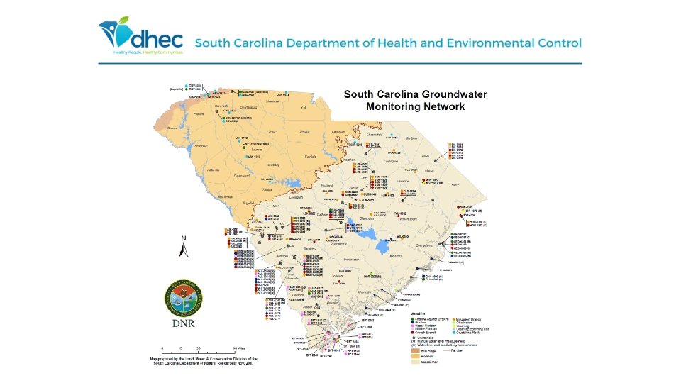
Resources for Water-Monitoring • Most water-level monitoring is done by SCDNR • Require more staff to perform regular wateruse checks & to enforce water limits • Driving force of future Department water management goals
More Proactive, Less Reactive • In the past, the Department mostly responded to crises once they arose • Goal: manage water resources more aggressively • Challenge: public • On one hand the public doesn’t think enough is being done • On another, the public finds too much interference when action is taken • How to balance? • Have to operate by regulation
Program Successes
Benefits of Capacity Use Areas • Investigate complaints of shallow (home) wells being impacted • Can locate new wells in areas that will support their water needs • provides more certainty for economic development • Includes best management practices, conservation, efficiency, in permit • Proactive measures to have sustainable resources, minimize risk of dramatic reductions to solve problems later
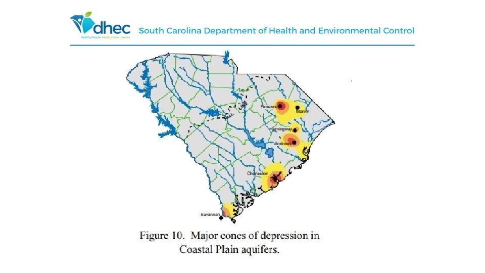
Trident Capacity Use Area Successes: • Comparing SC DNR’s 2001 potentiometric map to the 2014 potentiometric map, areas like Kiawah Island, Charleston County, and Moncks Corner, Berkeley County, water levels have rebounded by more than 50 feet. • Zones of concern in the tri-county area have shrunk to localized pockets, instead of region-wide deficits.
Waccamaw Capacity Use Area Successes: • Comparing SC DNR’s 2001 potentiometric map to the 2014 potentiometric map, Myrtle Beach, Horry County, has seen a waterlevel increase of over 50 feet, and throughout Georgetown County there has been a 75 feet increase in water levels. • There is now only one small pocket of area at or below mean average sea level in the entire capacity use region.
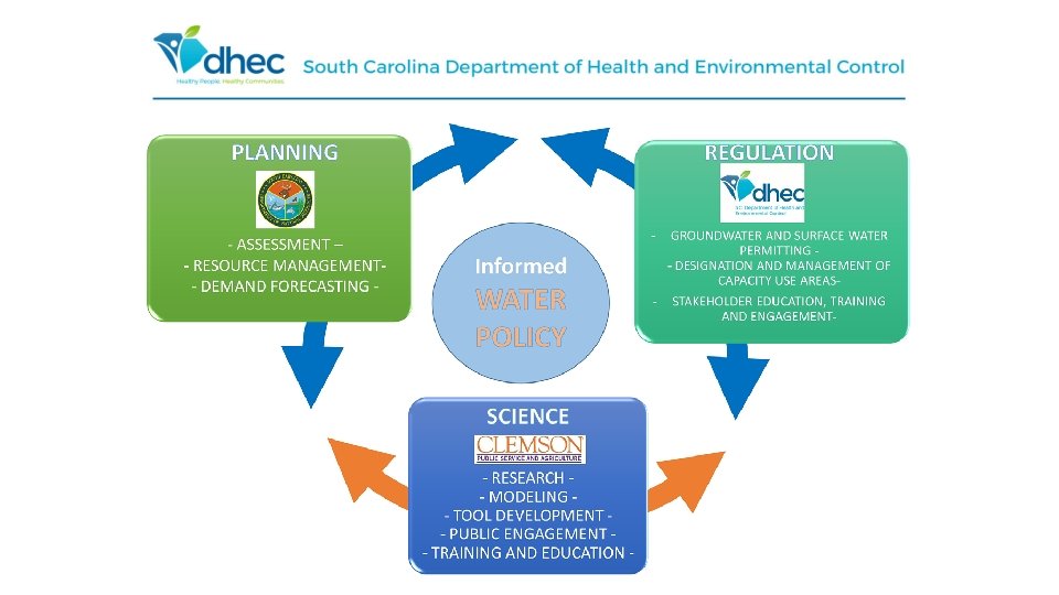
Collaboration • Work closely with both SCDNR and USGS on groundwater and surface water issues • • Modeling Permitting Monitoring Water Demand Forecasting
Robert Devlin, Director Water Monitoring, Assessment and Protection Divison devlinrj@dhec. sc. gov (803) 898 - 3798