South Carolina Geography What is the coastal zone


 �Northwest tip of SC")


- Slides: 20
South Carolina Geography
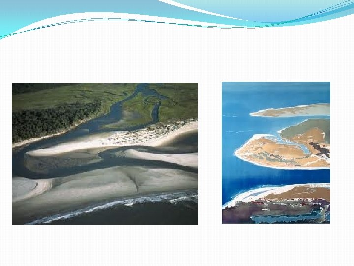
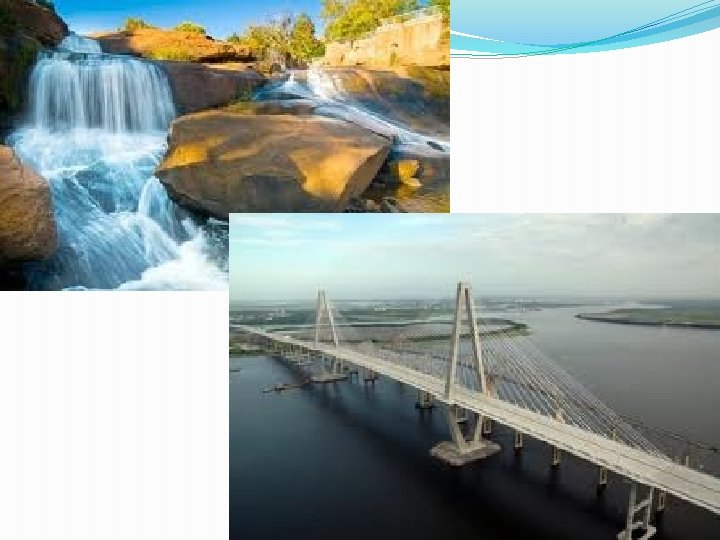
What is the coastal zone? � 185 miles long and 10 miles wide � Atlantic Coast � Myrtle Beach, Georgetown, Charleston, and Beaufort � 3 sections 1. Grand Strand NC border to Winyah Bay sandy 2. Santee Delta Winyah Bay to Bull's Bay largest delta 3. Barrier Islands Bull's Bay to Savannah River Protect coast
What is the Outer Coastal Plain? � 30 -50 miles wide �lower pine belt �Swamps �Savannahs �tidal rivers
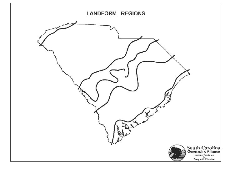
Assignment: Identify each section of the coastal zone on the map. Use a color for each section and create a key. Identify each of the large cities in the coastal zone.
What is the Inner Coastal Plain? � 130 - 250 ft. above sea level �Upper pine belt �Forests w/ tall trees �National Parks �Carolina Bays (oval depressions look like swamp cause unknown)
What are the Sandhills? �fall zone (transition from flat to hills and divides the state into the Lowcountry and the Backcountry aka Up Country) �Columbia to Camden �Barren �poor farming � Sandlappers- ate sand for minerals
Assignments: People from South Carolina are still called Sandlappers. How did they get that nickname? Should South Carolinians be proud of this name? Write a paragraph defending your side. (5 sentences) List 10 words that you would use to describe people from South Carolina.
What is the Piedmont? � 1/3 of state �Greenville-Spartanburg area �fast flowing rivers �textile factories
What is the Blue Ridge? � 500 square miles (smallest) �Northwest tip of SC � Sassafras Mountain �Whitewater Falls
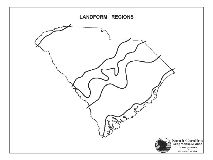
Can you identify the geographic region?
Assignments 1. Complete labeling the map. Add all of the geographic regions. 2. If you could choose, in which geographical region of South Carolina would you live? (5 sentence paragraph with at least 3 details)
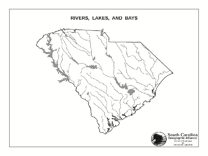
What are SC’s 3 river systems? �Pee Dee River System 1. north coast 2. no lakes �Santee River System 1. middle of coast 2. largest system �Savannah River System 1. On Georgia border 2. several rivers and lakes
Assignment: Identify each river system on the map. Use a color for each system and create a key.
Study Guide SC Geography Name, label, and identify the main characteristics of the 6 landform regions of SC. 1. 2. 3. 4. 5. 6. 7. Define fall zone. 8. The fall zone divides the state into the __________ and the __________. Name label and identify the main characteristics of the 3 river systems of SC. 9. 10. 11.