South Asia Satellite View of South Asia The


![The Himalayas § “him” [snow] § “aalaya” [home] § Mt. Everest is 29, 035 The Himalayas § “him” [snow] § “aalaya” [home] § Mt. Everest is 29, 035](https://slidetodoc.com/presentation_image_h/302c6d835f34666fad94fd2802f11ec6/image-17.jpg)




- Slides: 113


South Asia

Satellite View of South Asia

The Size of South Asia


South Asia: Physica l Map

Bodies of Water I us d n R. Brahmaputr a R. Gang e s R. Bay of Bengal Arabian Sea Indian Ocean

The Ganges River System 1, 560 miles long

“Mata Ganga” (Mother Ganges)

The Brahmaputra River System 1, 800 miles long

Floods on the Brahmaputra: 2003

Flooding on the Brahmaputra

The Indus River System 1, 975 miles long

Valleys / Plains Indo-G angeti c Plain

Hindu Kush

The Khyber Pass
![The Himalayas him snow aalaya home Mt Everest is 29 035 The Himalayas § “him” [snow] § “aalaya” [home] § Mt. Everest is 29, 035](https://slidetodoc.com/presentation_image_h/302c6d835f34666fad94fd2802f11ec6/image-17.jpg)
The Himalayas § “him” [snow] § “aalaya” [home] § Mt. Everest is 29, 035 feet. It is the highest mt. peak in the world.

The Himalayas

Deserts / Plateaus Tibetan Plateau r Tha t er Des Deccan Plateau

The Deccan Plateau § 31, 800 square miles in size. § Elevation range: 2, 000 – 8, 000 feet high. § From the Sanskrit word, “dakshina” [“the south”].

The Tibetan Plateau § The “Roof of the World. ” § average elevation is 16, 400 feet.

The Thar Desert § The Great Indian Desert § 200 - 1500 feet in elevation. § up to 127ºF in July.

Completed Map H ind Kh y Pa ber I ss I u. Ksarakoran h Mts. Tibetan Kashmir Plateau. Mt. Ev Hi R erest m Punjab s a B r a h maputra R. lay du Indo-Gang n as etic I ▲ P l a G i n r a a n ges Th t R. r e s De lls i H hya Vind ts a Bay of h Deccan G Bengal n Plateau er st Arabian Sea a E s hat rn G ste We Indian Ocean


Climate Regions of South Asia

Winter Monsoons: Nov. -April

Summer Monsoons: May-Oct.

Global Areas of Malaria


Major Farming Systems of South Asia

Economic Activities & Resources

Silk Cultivation


Population Density

Population Density

Literacy Rate in India

Satellite View of China

China vs. the U. S. in Size China United States SOURCE: Topic 5: “The Awakening Giant” by Dr. Jean-Paul Rodrigue, Dept. of Economics & Geography, Hofstra University.

Comparing China & the U. S. United States China Size Main physical barrier Main River Population Connectivity problems 3. 7 million square miles Himalayas 3. 6 million square miles Rockies Yangtze / East - West East Coast Mississippi / North – South East Coast North - South East - West

Countries & Regions Russia Mongolia N. Korea S> Korea Tibet Indian Subcontinent Taiwan Southeast Asia Philippines

Cities Harbin BEIJING Lhasa Nanjing Shanghai Xi’an Taipei Guangzhou Macao Hong Kong

Completed Political Map Harbin Mongolia BEIJING N. Korea S> Korea Tibet Nanjing Shanghai Xi’an Lhasa Indian Subcontinent Guangzhou Macao Southeast Asia Taipei Taiwan Hong Kong Philippines


China’s Topography

Bodies of Water Am ur Riv er Sea of Japan e River H g n a u H Yellow Sea River Yangtze Xi Ri ver Pacific Ocean South China Sea

The Polluted Yellow River!

Mountains & Peaks Altai Mts. Tian Shan Kunlun Shan Himalayan Mts. Greater Khingan

The Great Wall of China

Deserts & Plateaus Gobi Desert Taklamakan Desert Tibetan Plateau

Valleys / Plains / Basins Manchurian Plain North China Plain Tarim Basin Sichuan Basin

North China Plain

Agricultural Regions in China Great Wall Shabdong Gr Peninsula an d C CHUNG ana l KUO

Completed Topographic Map Am ur Greater River Khingan Manchurian Plain Altai Mts. Tian Shan Tarim Basin Taklamakan Desert Kunlun Shan Tibetan Plateau Himalayan Mts. North China Gobi Desert Plain ll a W t a Gre Sea of Japan Shabdong Gr Peninsula e River and H Yellow g n a u H CHUNG Ca Sea na KUO l Sichuan er iv R e z t g Yan Basin Xi Ri ver Pacific Ocean South China Sea


China’s Climate Zones

Monsoon Precipitation Patterns

Winter Monsoons

Summer Monsoons

Precipitation in China


Agricultural Regions in China

Arable Land

“Brown” China vs. “Green” China nt a n i Pasture and Oasis he at om D W Rice t nan i m Do Double-crop rice SOURCE: Topic 5: “The Awakening Giant” by Dr. Jean-Paul Rodrigue, Dept. of Economics & Geography, Hofstra University.

South China


Major Chinese Industries

Fuels, Power, Minerals, & Metals in China


China as % of World Population

Top 10 Populated Nations 2001 2050

Population Density


Nippon -- “Land of the Rising Sun”

Japan and the United States

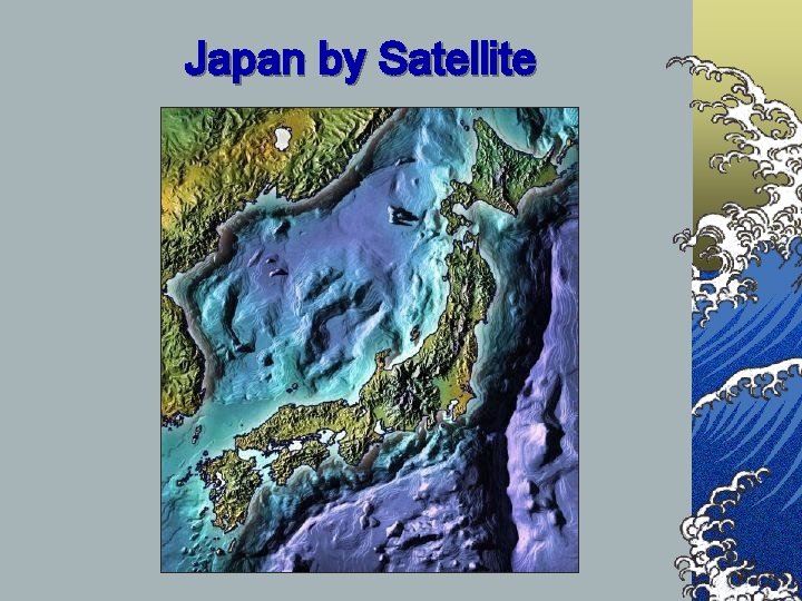
Japan’s Topography

Bodies of Water Ishikari R. Sea of Japan s ean r o K Shinano R. Tone R. it a r St Pacific Ocean Inland Sea

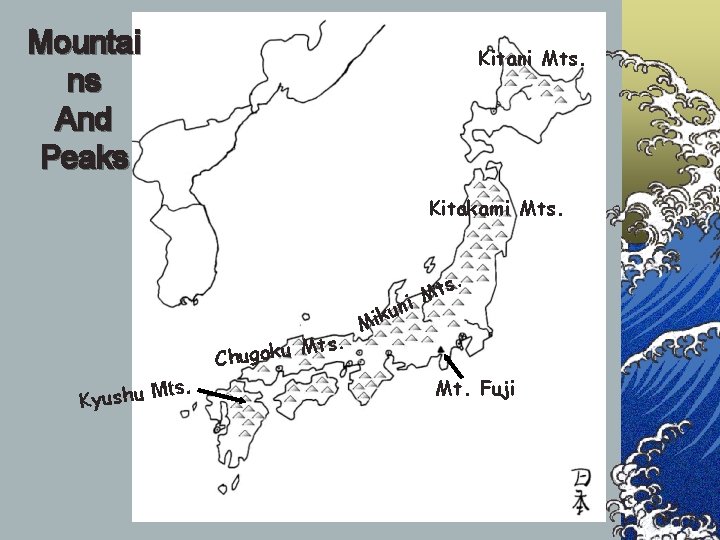
Mountai ns And Peaks Kitani Mts. Kitakami Mts. s. ts. M u k o g u Ch ts. M u h s u y K t M ni u k Mi Mt. Fuji

Plains Ishikari Plain Kanto Plain Nobi Plain Osaka Plain

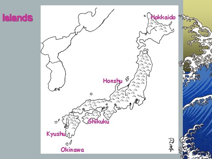
Islands Hokkaido Honshu Shikuku Kyushu Okinawa

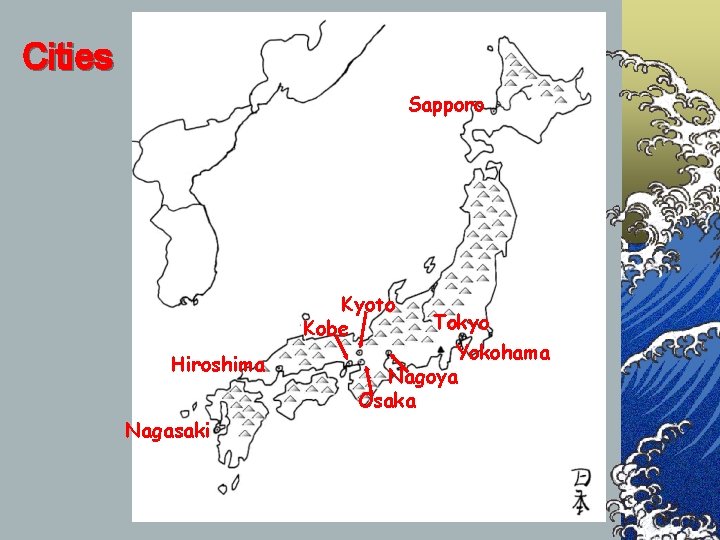
Cities Sapporo Kyoto Kobe Hiroshima Nagasaki Tokyo Yokohama Nagoya Osaka

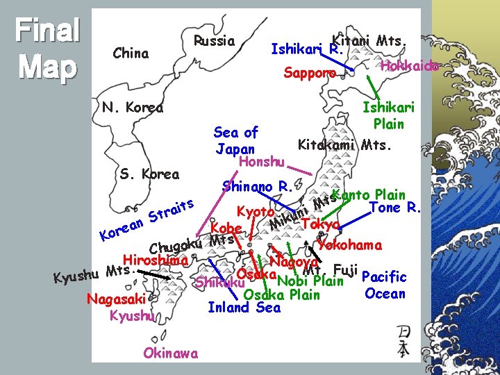
Final Map Russia China Kitani Mts. Ishikari R. Hokkaido Sapporo N. Korea Ishikari Plain Sea of Kitakami Mts. Japan Honshu S. Korea s it a r St Shinano R. Plain. s. Kanto t M Tone R. Kyoto uni ik Tokyo n M a Kobe e Kor ts. M u k Yokohama o g u Ch Hiroshima Nagoya. Mt. Fuji s t M Osaka u h s u y K Nobi Plain Pacific Shikuku Ocean Osaka Plain Nagasaki Inland Sea Kyushu Okinawa

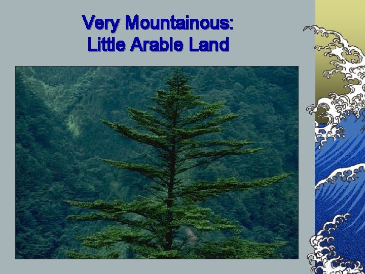
Very Mountainous: Little Arable Land

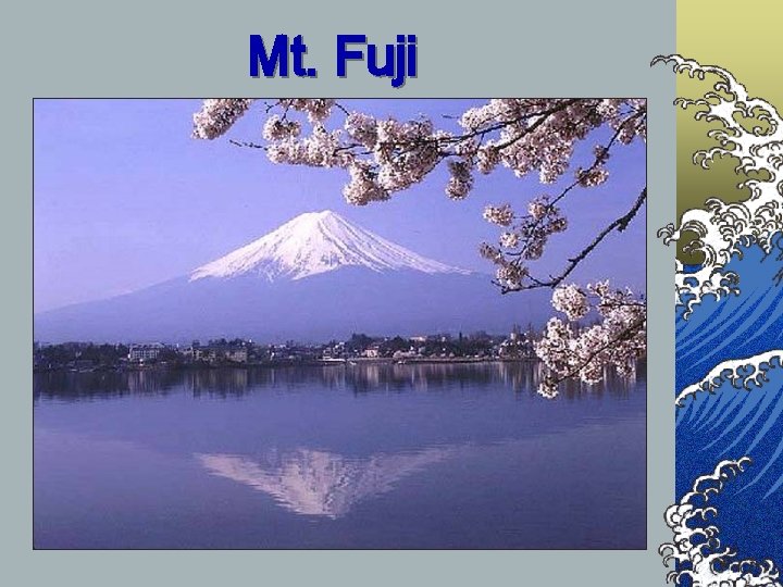
Mt. Fuji

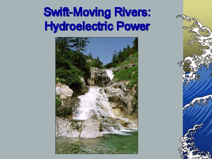
Swift-Moving Rivers: Hydroelectric Power

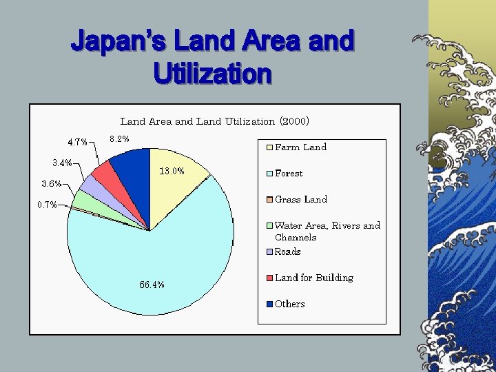
Japan’s Land Area and Utilization

Japan by Satellite

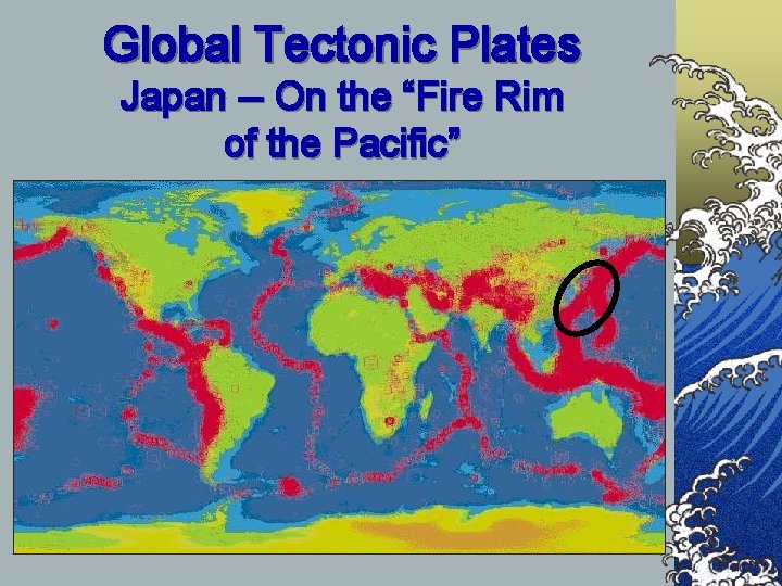
Global Tectonic Plates Japan -- On the “Fire Rim of the Pacific”

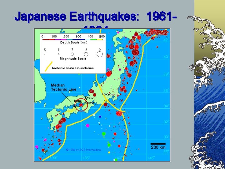
Japanese Earthquakes: 19611994

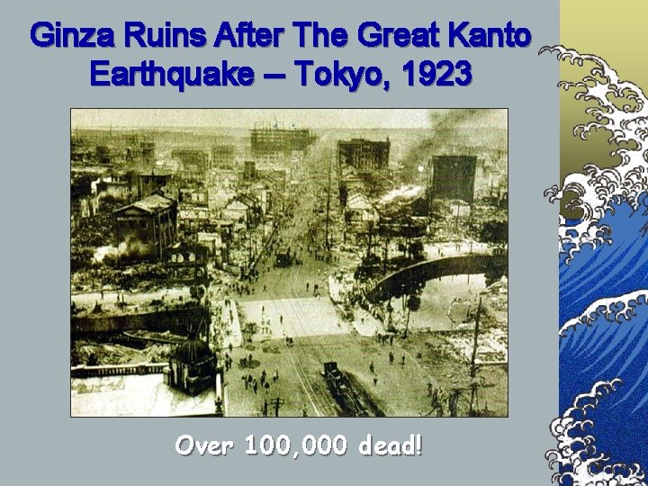
Ginza Ruins After The Great Kanto Earthquake -- Tokyo, 1923 Over 100, 000 dead!

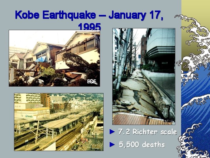
Kobe Earthquake -- January 17, 1995 ► 7. 2 Richter scale ► 5, 500 deaths

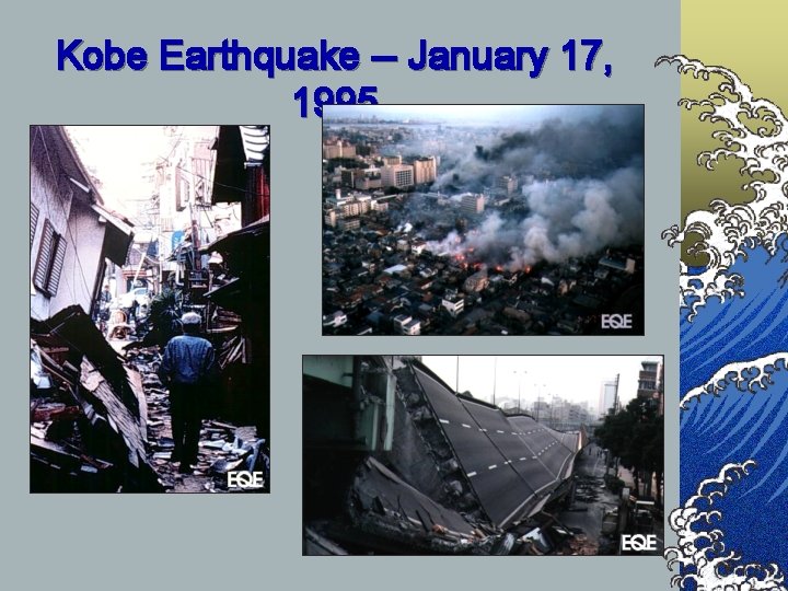
Kobe Earthquake -- January 17, 1995

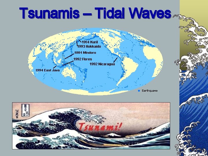
Tsunamis – Tidal Waves


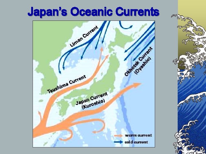
Japan’s Oceanic Currents

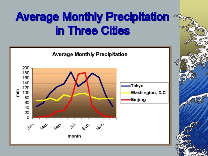
Average Monthly Precipitation in Three Cities

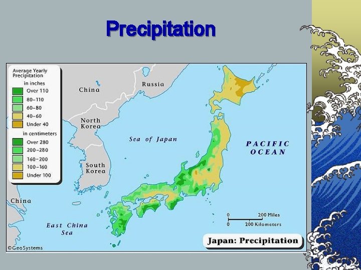
Precipitation

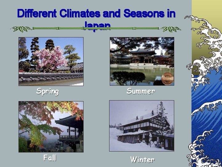
Different Climates and Seasons in Japan Spring Summer Fall Winter


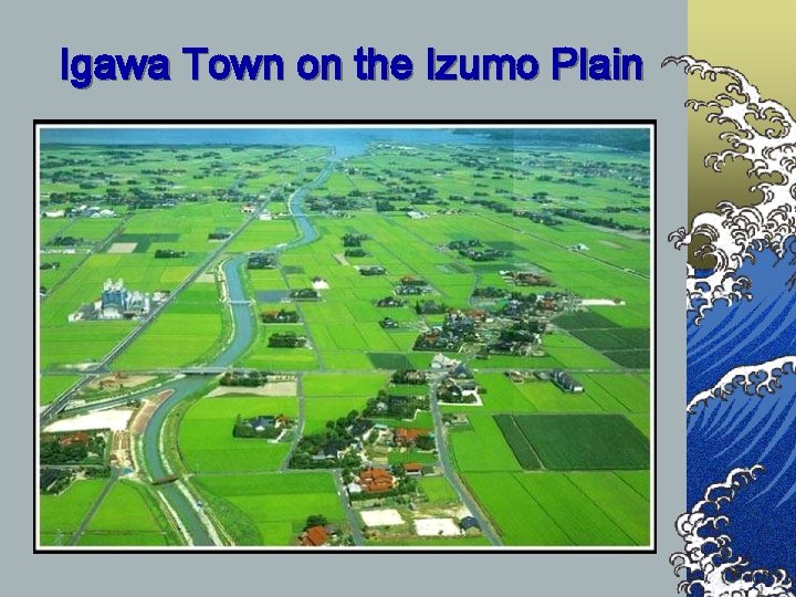
Igawa Town on the Izumo Plain

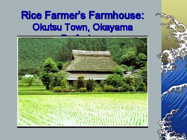
Rice Farmer’s Farmhouse: Okutsu Town, Okayama Prefecture

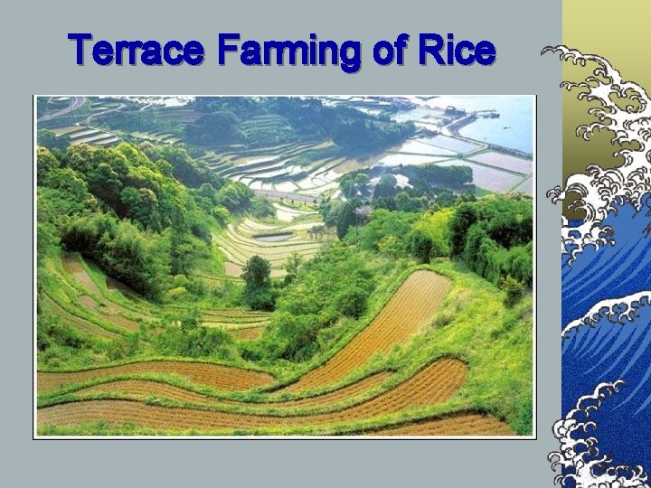
Terrace Farming of Rice

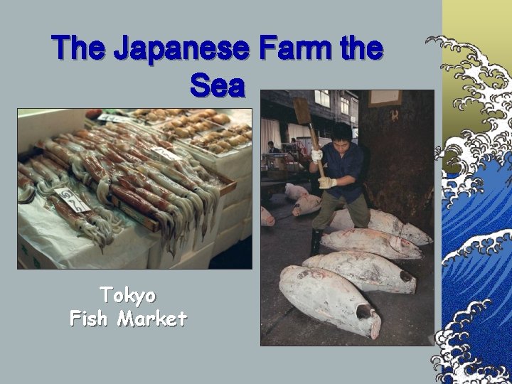
The Japanese Farm the Sea Tokyo Fish Market


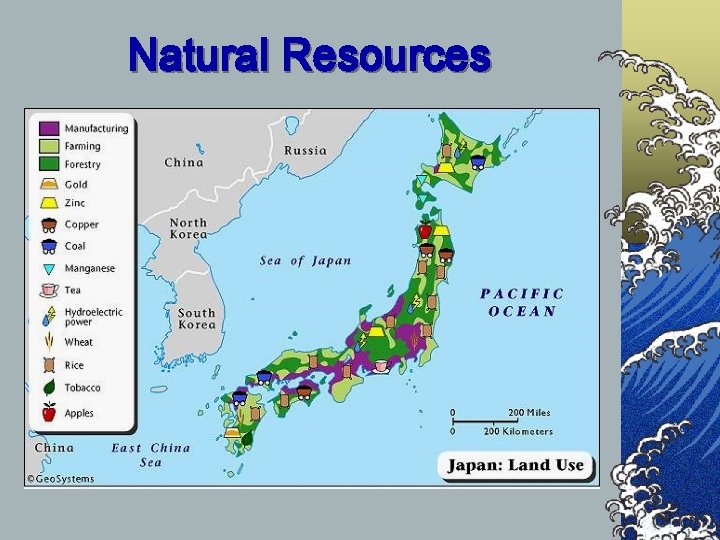
Natural Resources

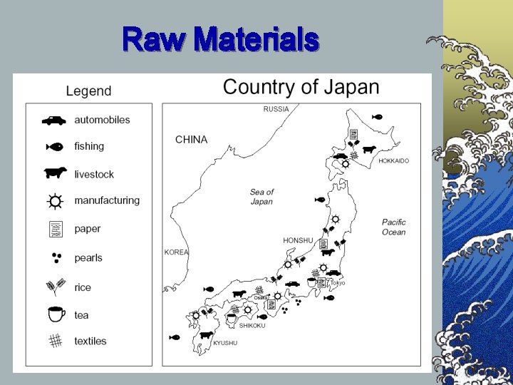
Raw Materials

©However, Japan does not have an abundance of resources and is reliant upon trade/foreign countries for most of their needs.


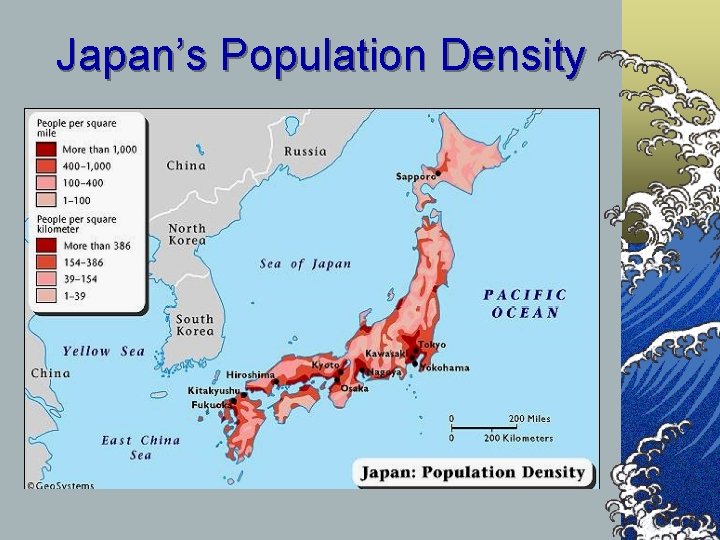
Japan’s Population Density

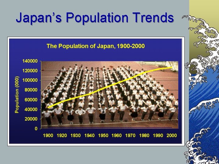
Japan’s Population Trends

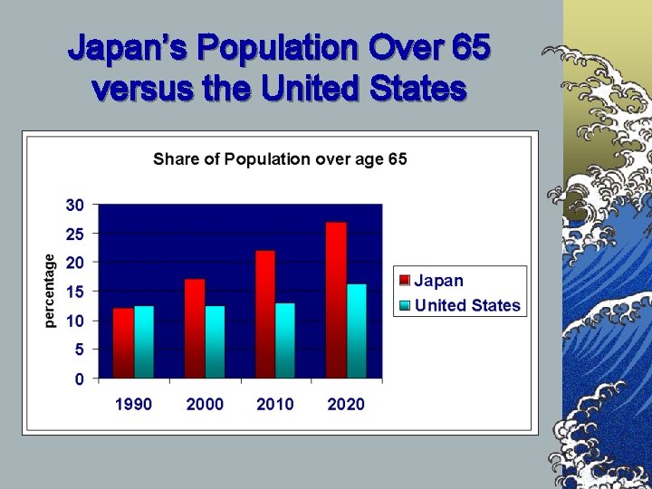
Japan’s Population Over 65 versus the United States

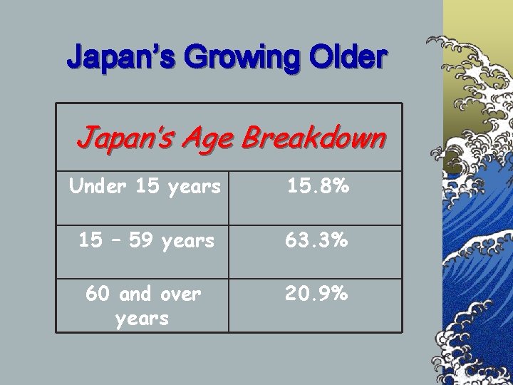
Japan’s Growing Older Japan’s Age Breakdown Under 15 years 15. 8% 15 – 59 years 63. 3% 60 and over years 20. 9%

SAYONARA