South Asia Physical Geography South Asia Satellite View


![The Himalayas § “him” [snow] § “aalaya” [home] § Mt. Everest is 29, 035](https://slidetodoc.com/presentation_image_h2/af21e3984f0a43020b8e90d44516de25/image-6.jpg "The Himalayas § “him” [snow] § “aalaya” [home] § Mt. Everest is 29, 035")


 -Alluvial soil: fertile, river soil -Water:")


- Slides: 37
South Asia Physical Geography
South Asia
Satellite View of South Asia
The Size of South Asia
Mountains & Plateaus Himalaya Mountains -Natural barrier to rest of Asia -Still growing-colliding w/ Asia -Nepal & Bhutan
The Himalayas § “him” [snow] § “aalaya” [home] § Mt. Everest is 29, 035 feet. It is the highest mt. peak in the world.
Mountains & Plateaus cont. Hindu Kush Mountains -Barrier b/w Pakistan & Afghanistan -Fight over passes
Hindu Kush
The Khyber Pass
Mountains & Plateaus cont. Deccan Plateau -Most of southern India -Surrounded by Western & Eastern Ghats -Arid: Mts. Block moisture
The Deccan Plateau § 31, 800 square miles in size. § Elevation range: 2, 000 – 8, 000 feet high. § From the Sanskrit word, “dakshina” [“the south”].
Rivers & Plains Three Great Rivers -Indus, Ganges, Brahmaputra -Begin in Himalayas
The Ganges River System 1, 560 miles long
The Brahmaputra River System 1, 800 miles long
Flooding on the Brahmaputra
The Indus River System 1, 975 miles long
Rivers & Plains cont. Indo-Gangetic Plain -North India -Formed by Indus, Ganges & Brahmaputra (3 Great Rivers) -Most heavily populated area (3/5 of population)
The Thar Desert § The Great Indian Desert § 200 - 1500 feet in elevation. § up to 113ºF in July.
South Asia: Physical Map
Resources u Water & Soil -Provides food (Farming/fishing) -Alluvial soil: fertile, river soil -Water: CROPS & transportation
Resources u Forests -Rain forests -Highland forests -Deforestation: PROBLEM Leads to: soil erosion flooding/landslides habitat loss
Resources u Minerals -Coal, petroleum, natural gas -Iron ore
Climate 1. Highland – coldest 2. Humid subtropical – lush land 3. Semiarid 4. Desert 5. Tropical wet 6. Tropical wet & dry
Climate u Monsoons -Seasonal winds -Good: Rain -Bad: Unpredictable, flooding
Winter Monsoons: Nov. April
Summer Monsoons: May. Oct.
Climate u Cyclones -Violent storms -Dangerous
Major Farming Systems of South Asia
Economic Activities & Resources
Silk Cultivation
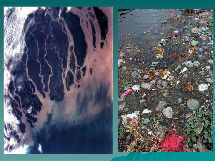
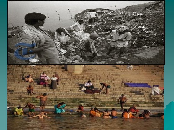
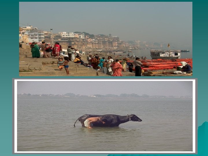
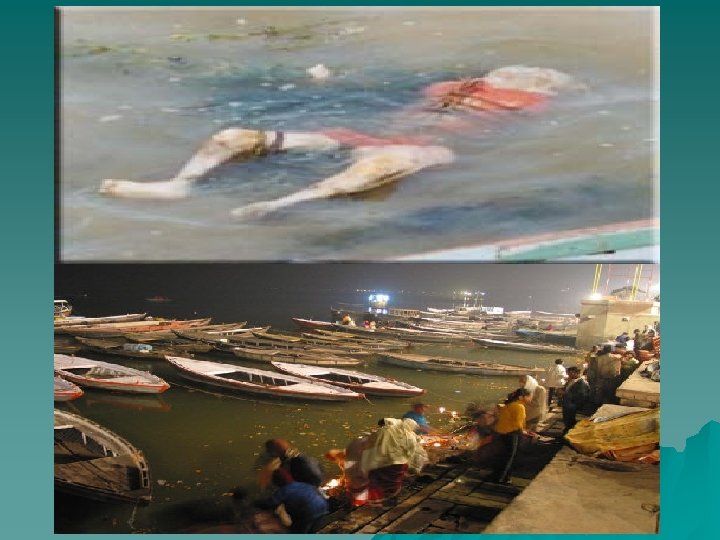
HEI: Ganges River Most well known in region u Important -Drinking, farming, transportation u Hinduism -Most popular religion in India -Sacred River -Healing power u
HEI: Ganges River u Pollution -Most polluted in world -sewage, industrial waste, corpses -Diseases: cholera, hepatitis, typhoid -Enormous problem!!!!
Overview