Soundings and Adiabatic Diagrams for Severe Weather Prediction
Soundings and Adiabatic Diagrams for Severe Weather Prediction and Analysis Continued
Shear vs. CAPE • Need a balance between Shear and CAPE for supercell development • Without shear: single, ordinary, airmass thunderstorm which lasts 20 minutes • If shear is too strong (gust front moves too fast) : multicellular t-storms or low topped severe thunderstorms
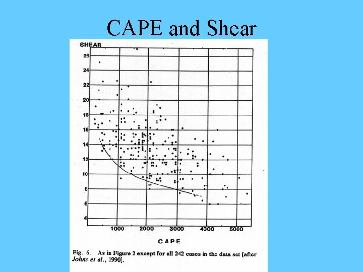
CAPE and Shear
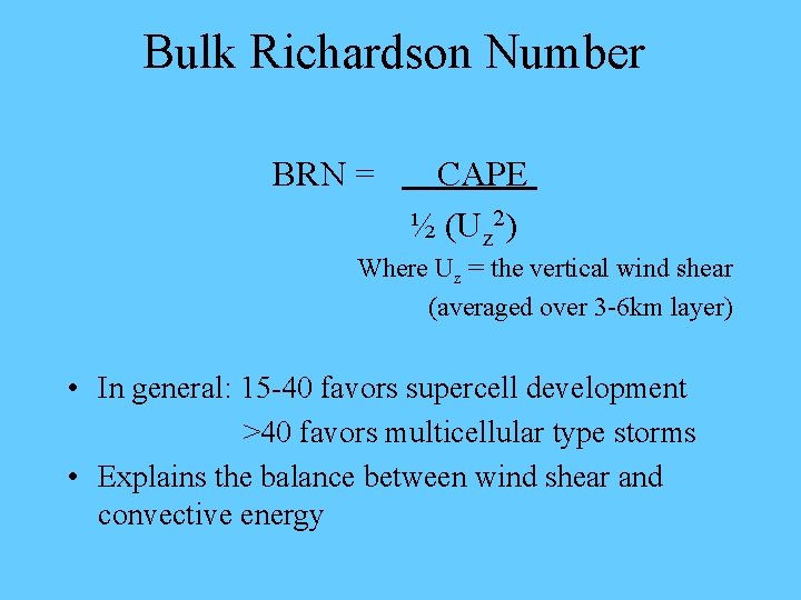
Bulk Richardson Number BRN = CAPE ½ (Uz 2) Where Uz = the vertical wind shear (averaged over 3 -6 km layer) • In general: 15 -40 favors supercell development >40 favors multicellular type storms • Explains the balance between wind shear and convective energy
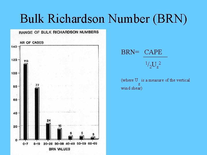
Bulk Richardson Number (BRN) BRN= CAPE 1/ 2 Uz 2 (where U is a measure of the vertical z wind shear)
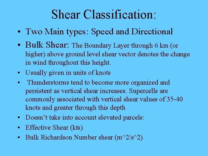
Shear Classification: • Two Main types: Speed and Directional • Bulk Shear: The Boundary Layer through 6 km (or • • • higher) above ground level shear vector denotes the change in wind throughout this height. Usually given in units of knots Thunderstorms tend to become more organized and persistent as vertical shear increases. Supercells are commonly associated with vertical shear values of 35 -40 knots and greater through this depth Doesn’t take into account elevated parcels: Effective Shear (kts) Bulk Richardson Number shear (m^2/s^2)
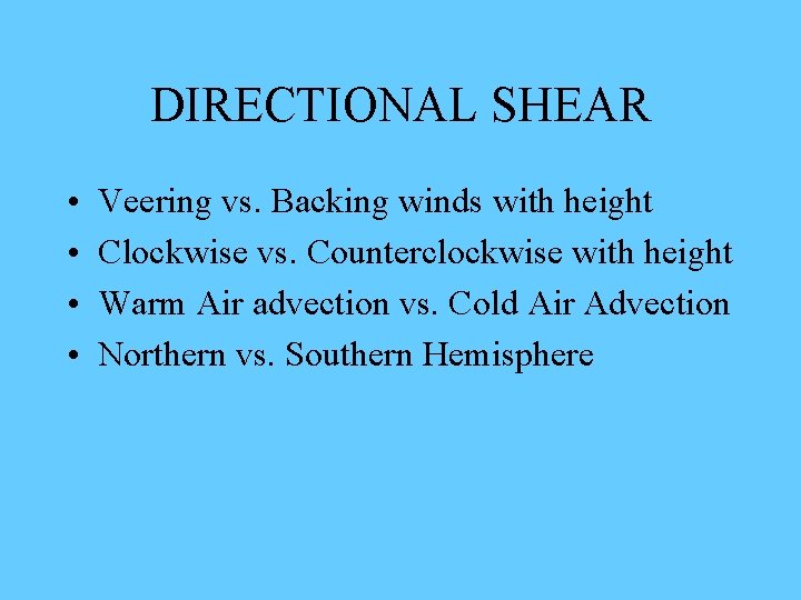
DIRECTIONAL SHEAR • • Veering vs. Backing winds with height Clockwise vs. Counterclockwise with height Warm Air advection vs. Cold Air Advection Northern vs. Southern Hemisphere
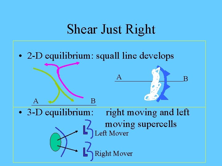
Shear Just Right • 2 -D equilibrium: squall line develops A A B B • 3 -D equilibrium: right moving and left moving supercells Left Mover Right Mover
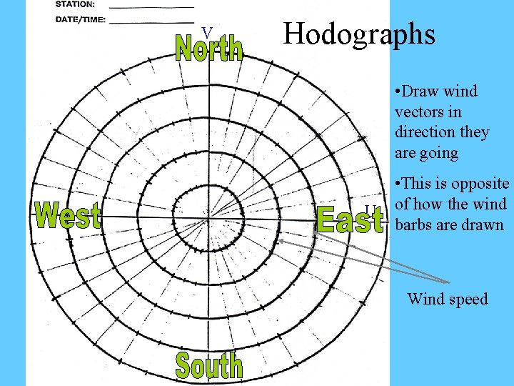
V Hodographs • Draw wind vectors in direction they are going U • This is opposite of how the wind barbs are drawn Wind speed
How a Hodograph is Created! • Lets open our Sounding COMET Module…
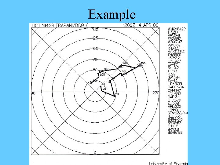
Example
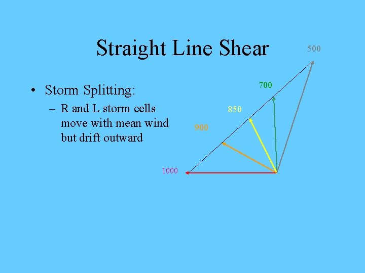
Straight Line Shear 700 • Storm Splitting: – R and L storm cells move with mean wind but drift outward 1000 850 900 500
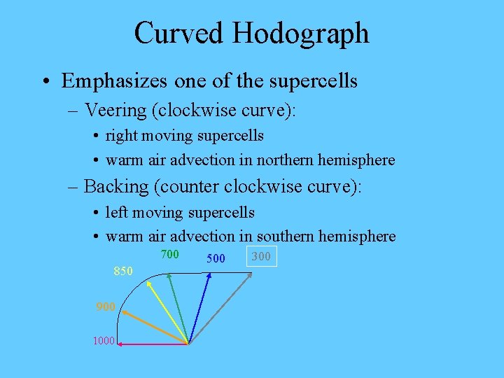
Curved Hodograph • Emphasizes one of the supercells – Veering (clockwise curve): • right moving supercells • warm air advection in northern hemisphere – Backing (counter clockwise curve): • left moving supercells • warm air advection in southern hemisphere 700 850 900 1000 500 300
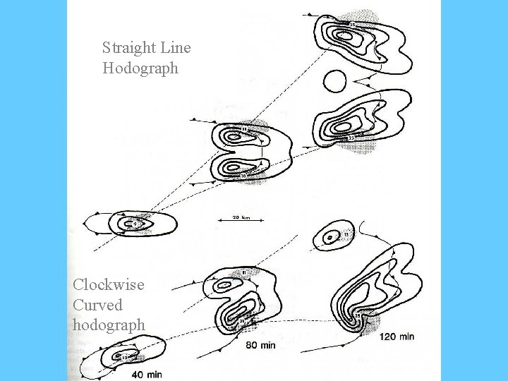
Straight Line Hodograph Clockwise Curved hodograph
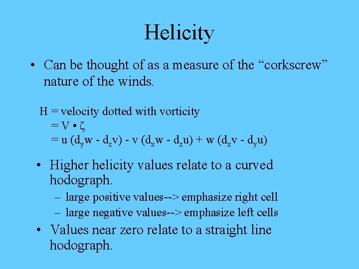
Helicity • Can be thought of as a measure of the “corkscrew” nature of the winds. H = velocity dotted with vorticity =V • ζ = u (dyw - dzv) - v (dxw - dzu) + w (dxv - dyu) • Higher helicity values relate to a curved hodograph. – large positive values--> emphasize right cell – large negative values--> emphasize left cells • Values near zero relate to a straight line hodograph.
Lets Review Main Points • Shear in two parts: Direction and Speed • Hodographs: characterize shear and help us to visualize the vertical shear profile • Helicity = V • ζ • Positive values favor right cells • Negative values favor left cells • 2 -d equilibrium calls for developing squall line • 3 -d equilibrium calls for storm splitting to occur. • Now lets take a look at some radar loops to see these processes in action!!!!
The “Granddaddy” of them all!!! Not the Rose Bowl • • Super Tornado Outbreak of March 11 th- 12 th , 2006 Early season event, Strongly dynamically driven 105 confirmed tornadoes, 13 fatalities Longest lived singular supercell in recorded weather history! Supercell tracked 800 miles across Oklahoma, Kansas, Missouri, Illinois, Indiana, and Michigan. Supercell lasted 17. 5 hours Accounted for nearly a 1/3 of the tornadoes on March 12 th! In a few weeks we will cover the physical and dynamical processes involved in creating and maintaining a supercell through its complete life-cycle.
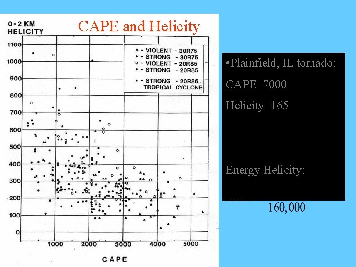
CAPE and Helicity • Plainfield, IL tornado: CAPE=7000 Helicity=165 Energy Helicity:

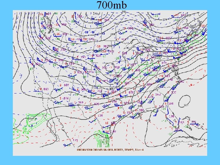
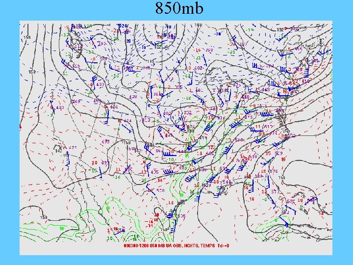
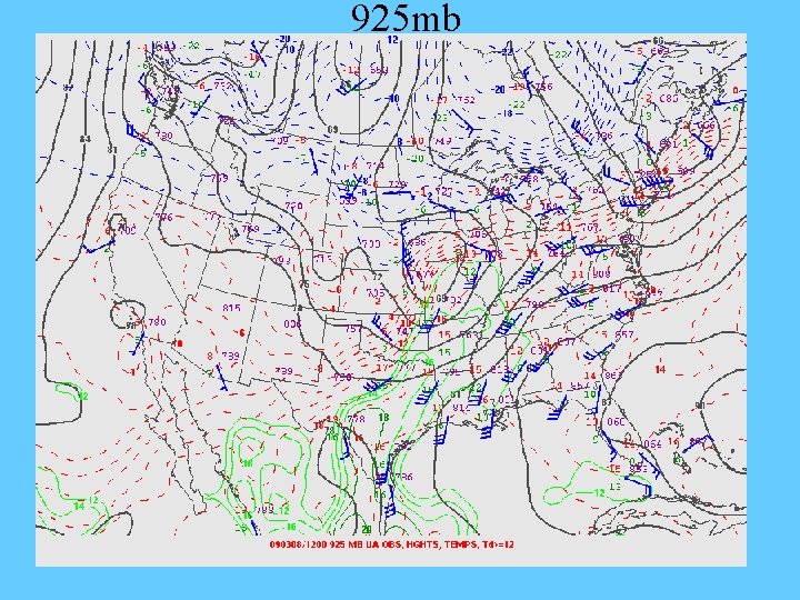
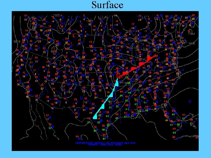
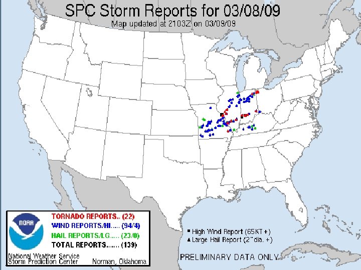
In Class Case Study Tornado Outbreak Missouri, Illinois, Indiana 3/08/09
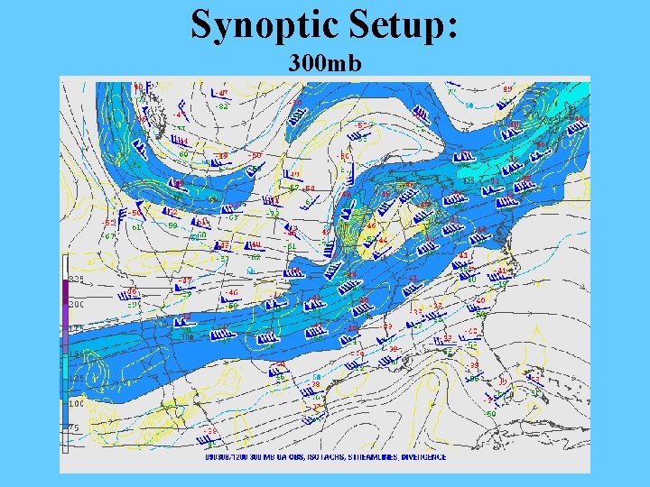
Synoptic Setup: 300 mb
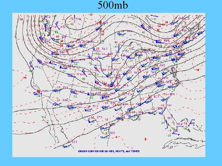
500 mb
700 mb
850 mb
925 mb
Surface
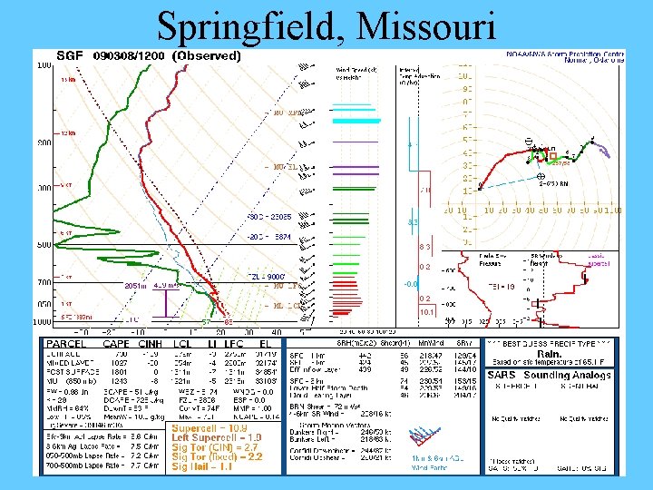
Springfield, Missouri
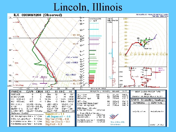
Lincoln, Illinois
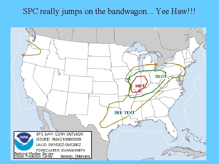
SPC really jumps on the bandwagon…Yee Haw!!!
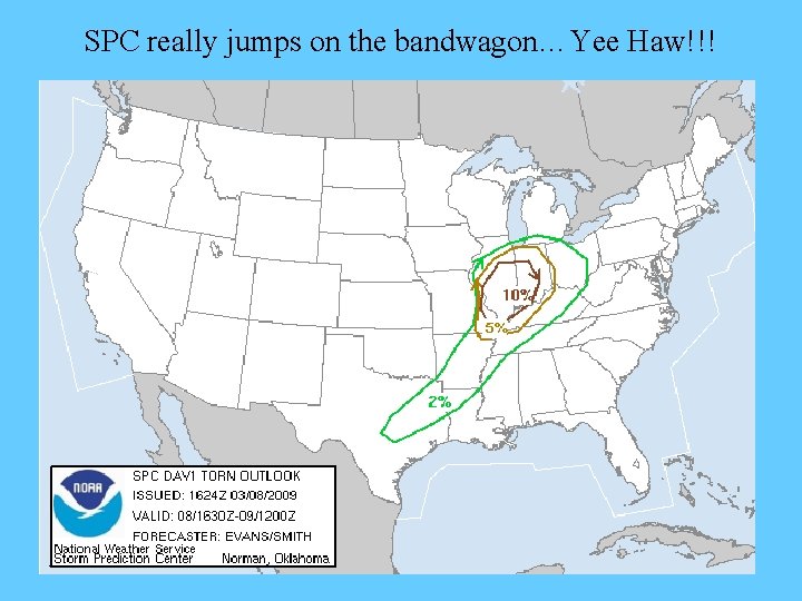
SPC really jumps on the bandwagon…Yee Haw!!!
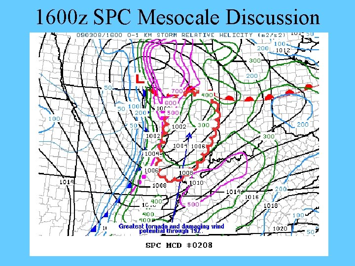
1600 z SPC Mesocale Discussion
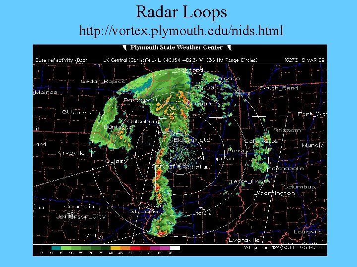
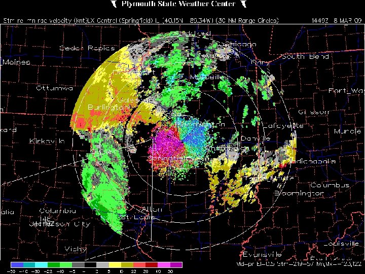
Radar Loops http: //vortex. plymouth. edu/nids. html
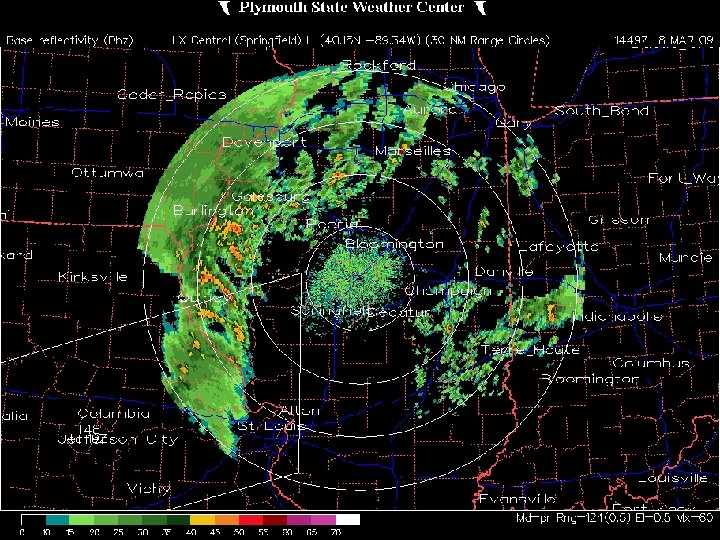
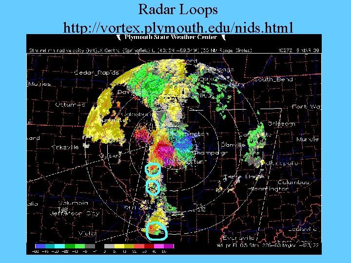
Radar Loops http: //vortex. plymouth. edu/nids. html
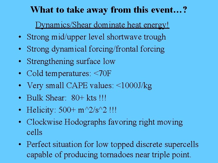
What to take away from this event…? • • • Dynamics/Shear dominate heat energy! Strong mid/upper level shortwave trough Strong dynamical forcing/frontal forcing Strengthening surface low Cold temperatures: <70 F Very small CAPE values: <1000 J/kg Bulk Shear: 80+ kts !!! Helicity: 500+ m^2/s^2 !!! Clockwise Hodographs favoring right moving cells Perfect situation for low topped discrete supercells capable of producing tornadoes near triple point.
Stability Indices
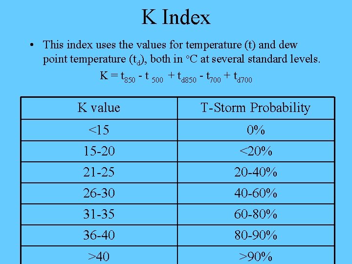
K Index • This index uses the values for temperature (t) and dew point temperature (td), both in o. C at several standard levels. K = t 850 - t 500 + td 850 - t 700 + td 700 K value T-Storm Probability <15 0% 15 -20 <20% 21 -25 20 -40% 26 -30 40 -60% 31 -35 60 -80% 36 -40 80 -90% >40 >90%
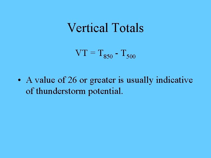
Vertical Totals VT = T 850 - T 500 • A value of 26 or greater is usually indicative of thunderstorm potential.
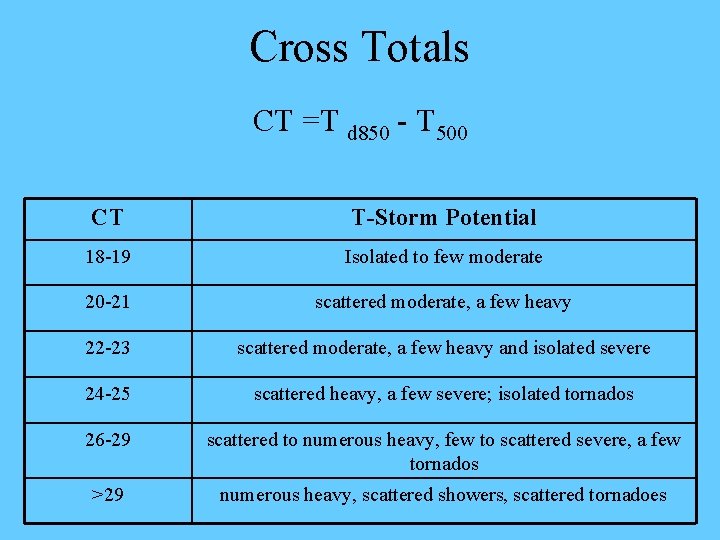
Cross Totals CT =T d 850 - T 500 CT T-Storm Potential 18 -19 Isolated to few moderate 20 -21 scattered moderate, a few heavy 22 -23 scattered moderate, a few heavy and isolated severe 24 -25 scattered heavy, a few severe; isolated tornados 26 -29 scattered to numerous heavy, few to scattered severe, a few tornados >29 numerous heavy, scattered showers, scattered tornadoes
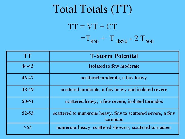
Totals (TT) TT = VT + CT =T 850 + T d 850 - 2 T 500 TT T-Storm Potential 44 -45 Isolated to few moderate 46 -47 scattered moderate, a few heavy 48 -49 scattered moderate, a few heavy and isolated severe 50 -51 scattered heavy, a few severe; isolated tornados 52 -55 scattered to numerous heavy, few to scattered severe, a few tornados >55 numerous heavy, scattered showers, scattered tornadoes
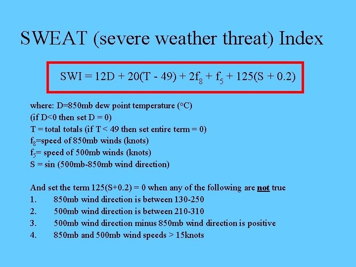
SWEAT (severe weather threat) Index SWI = 12 D + 20(T - 49) + 2 f 8 + f 5 + 125(S + 0. 2) where: D=850 mb dew point temperature (o. C) (if D<0 then set D = 0) T = totals (if T < 49 then set entire term = 0) f 8=speed of 850 mb winds (knots) f 5= speed of 500 mb winds (knots) S = sin (500 mb-850 mb wind direction) And set the term 125(S+0. 2) = 0 when any of the following are not true 1. 850 mb wind direction is between 130 -250 2. 500 mb wind direction is between 210 -310 3. 500 mb wind direction minus 850 mb wind direction is positive 4. 850 mb and 500 mb wind speeds > 15 knots
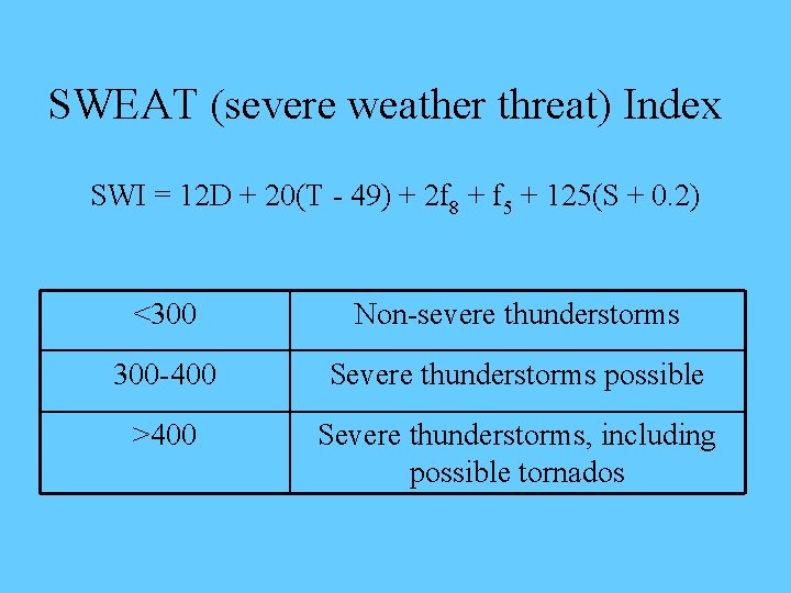
SWEAT (severe weather threat) Index SWI = 12 D + 20(T - 49) + 2 f 8 + f 5 + 125(S + 0. 2) <300 Non-severe thunderstorms 300 -400 Severe thunderstorms possible >400 Severe thunderstorms, including possible tornados
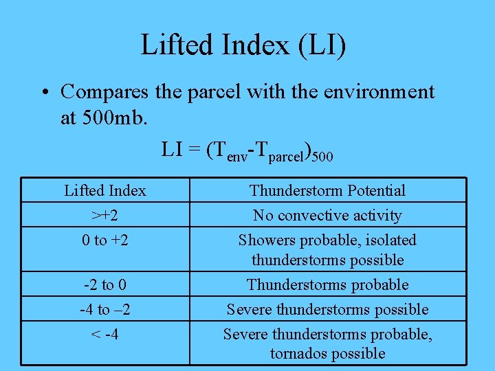
Lifted Index (LI) • Compares the parcel with the environment at 500 mb. LI = (Tenv-Tparcel)500 Lifted Index >+2 0 to +2 Thunderstorm Potential No convective activity Showers probable, isolated thunderstorms possible -2 to 0 -4 to – 2 < -4 Thunderstorms probable Severe thunderstorms possible Severe thunderstorms probable, tornados possible
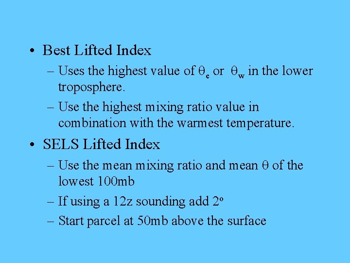
• Best Lifted Index – Uses the highest value of qe or qw in the lower troposphere. – Use the highest mixing ratio value in combination with the warmest temperature. • SELS Lifted Index – Use the mean mixing ratio and mean q of the lowest 100 mb – If using a 12 z sounding add 2 o – Start parcel at 50 mb above the surface
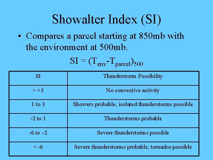
Showalter Index (SI) • Compares a parcel starting at 850 mb with the environment at 500 mb. SI = (Tenv-Tparcel)500 SI Thunderstorm Possibility > +3 No convective activity 1 to 3 Showers probable, isolated thunderstorms possible -2 to 1 Thunderstorms probable -6 to – 2 Severe thunderstorms possible < -6 Severe thunderstorms probable, tornados possible

Supercell Index • Weights various parameters which are indicative of possible supercell development
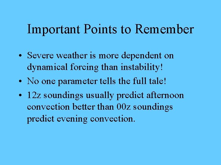
Important Points to Remember • Severe weather is more dependent on dynamical forcing than instability! • No one parameter tells the full tale! • 12 z soundings usually predict afternoon convection better than 00 z soundings predict evening convection.

Links • • • http: //www. geocities. com/weatherguyry/swx 2. html http: //avc. comm. nsdlib. org/cgi-bin/wiki. pl? Severe_Weather_Indices http: //www. theweatherprediction. com/severe/indices/ http: //www. theweatherprediction. com/habyhints/315/ http: //www. spc. noaa. gov/exper/mesoanalysis/ http: //mocha. meteor. wisc. edu/table. 12 z. html
- Slides: 49