Snow Cover Snow cover is one of those
- Slides: 5

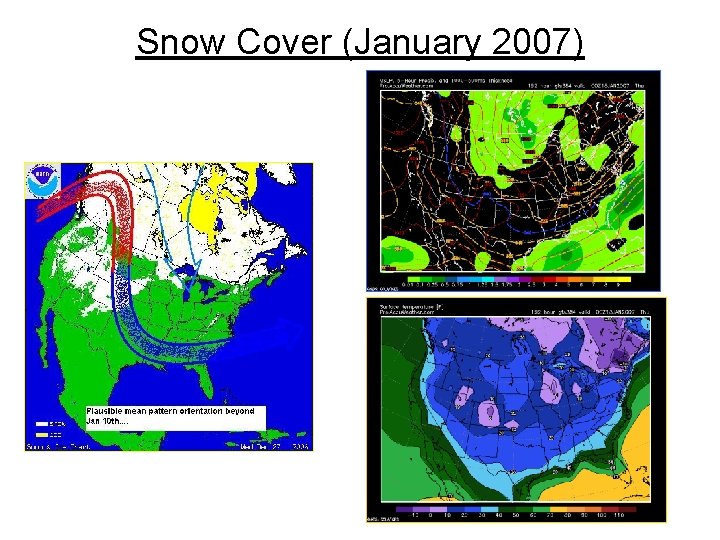
Snow Cover • Snow cover is one of those nebulous qualities that forecasters look at in the months of October & November in Canada. The Premise is that when you have early or heavy snow cover a good portion of Canada there is a tendency to build colder and longer lasting arctic air masses which can then plunge into various portions all of the CONUS during the Winter months.

Snow Cover • There is data which shows a very strong correlation especially east of the Mississippi River to mean temperatures during December January and February and snow cover in Canada. When the snow cover in OCT and NOV is above Normal Temperatures East of the Mississippi river tend to run Below or Much below normal. . and when snow cover in the months of October November is Below normal in Canada temperatures east of the Mississippi river tend to run milder than Normal. That being said simply having early and/or heavy snow cover in the months of October and November over Canada does not necessarily mean that you are going to have a cold and/or Snowy Winter over the central and eastern US. It just increases the chances that such a scenario COULD happen. . . the tendency to produce colder and longer lasting air masses is there.

Snow Cover • However if one were to look at the data from the Autumn of 1977 snow cover was below normal in Canada during the months of October November and yet that turned out to be one of the cold winters on record. On the other hand there was above normal snow cover in the months of October November 1978 in Canada and we had a very cold and stormy winter that followed in the lower 48 states. The only thing can be said with any degree of certainty in my opinion regarding snow cover is that if you have October and November with below normal snow cover the odds are increased that you will have significantly LESS cold air outbreaks plunging into the CONUS. For example the super warm winter of 2001 --02 saw much below normal snow cover in October and November over Canada. The implication here is that when the cold air masses formed and moved south they rapidly modified as they came southward due to lack a snow cover in southern Canada during the heart of the 2001 -02 winter. (DT)

Snow Cover and El Nino • Now typically what happens with Moderate or strong El Niño pattern is that the large Upper Low develops over Alaska near the Bering Sea. . . and from this position the strong jet stream comes around the Upper Low and slams into Western Canada. This ends up destroying the snow cover in Western Canada as well as preventing any sort of cross Polar flow developing from Siberia into North America. This is just one of the ways (but a overlooked way) that a strong or moderate El Niño ends up affecting the overall pattern North America However with a weak El Niño the entire pattern gets displaced. The vortex that in a strong / moderate El Niño is over the Bering Sea often gets displaced to the east in a weak El Niño. . . and is often found in the northeastern Gulf of Alaska near the West Canada Coast. When this pattern occurs Western portions of Canada and the Pacific Northwest see a lot of precipitation. . . but much of it falls as snow since the very deep Vortex is located on the western Canadian Coast and that brings in some very cold air masses. In addition the weak El Niño position ends up increasing snow cover much of Canada even while it provides a mild conditions for much of the CONUS. Thus when the Jet stream decides to split into two branches the cold air is located very close to the US Canada border and the Arctic outbreaks can occur with a lot more frequency.

Snow Cover (January 2007)