
Sky RAN A SelfOrganizing LTE RAN in the


- Slides: 30
Sky. RAN: A Self-Organizing LTE RAN in the Sky Ayon Chakraborty, Eugene Chai, Karthik Sunderesan Amir Khojastepour, Sampath Rangarajan Mobile Communications and Networking Group NEC Labs America ACM Co. NEXT 2018 Heraklion, Greece
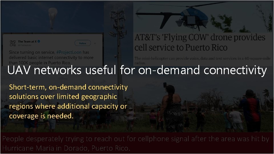
Disconnected by Disaster People desperately trying to reach out for cellphone signal after the area was hit by Hurricane Maria in Dorado, Puerto Rico.
Disconnected by Disaster UAV networks useful for on-demand connectivity Short-term, on-demand connectivity solutions over limited geographic regions where additional capacity or coverage is needed. People desperately trying to reach out for cellphone signal after the area was hit by Hurricane Maria in Dorado, Puerto Rico.
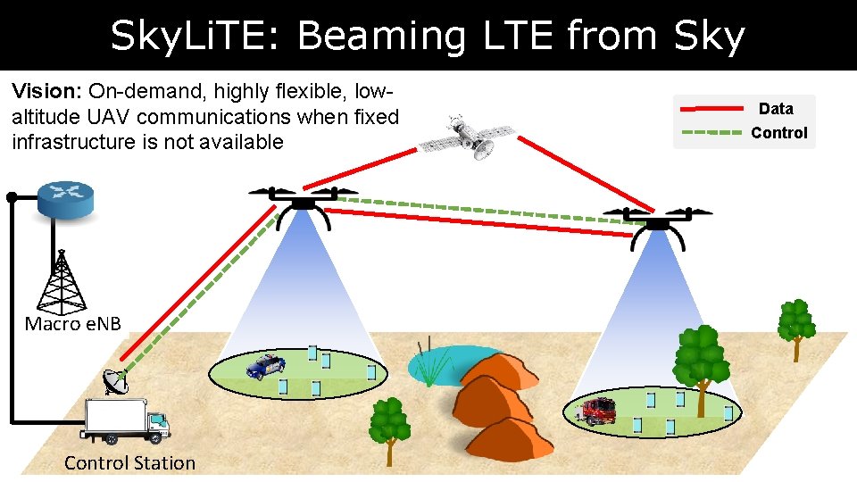
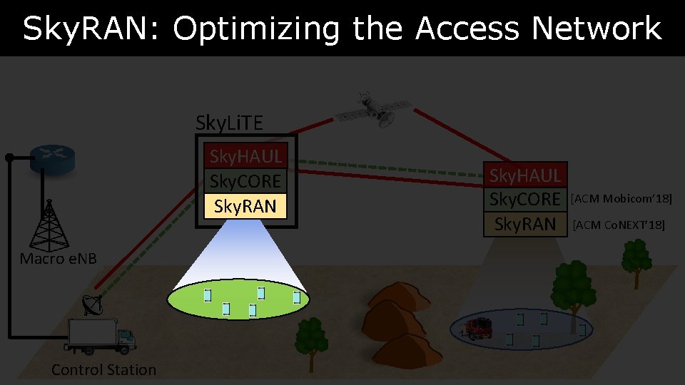
Sky. Li. TE: Beaming LTE from Sky Vision: On-demand, highly flexible, lowaltitude UAV communications when fixed infrastructure is not available Macro e. NB Control Station Data Control
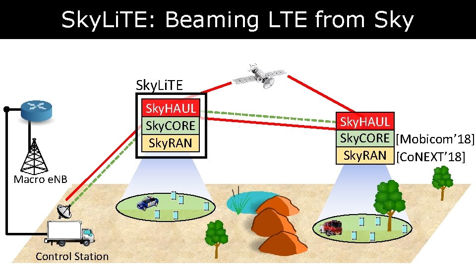
Sky. Li. TE: Beaming LTE from Sky. Li. TE Sky. HAUL Sky. CORE Sky. RAN Macro e. NB Control Station Sky. HAUL Sky. CORE [Mobicom’ 18] Sky. RAN [Co. NEXT’ 18]
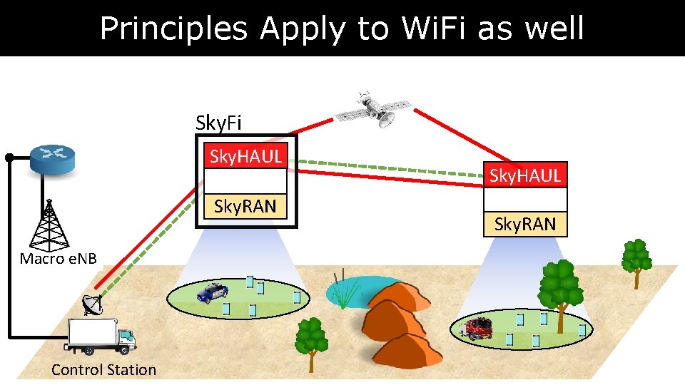
Principles Apply to Wi. Fi as well Sky. Fi Sky. HAUL Sky. RAN Macro e. NB Control Station Sky. HAUL Sky. RAN
Sky. RAN: Optimizing the Access Network Sky. Li. TE Sky. HAUL Sky. CORE Sky. RAN Macro e. NB Control Station Sky. HAUL Sky. CORE Sky. RAN [ACM Mobicom’ 18] [ACM Co. NEXT’ 18]
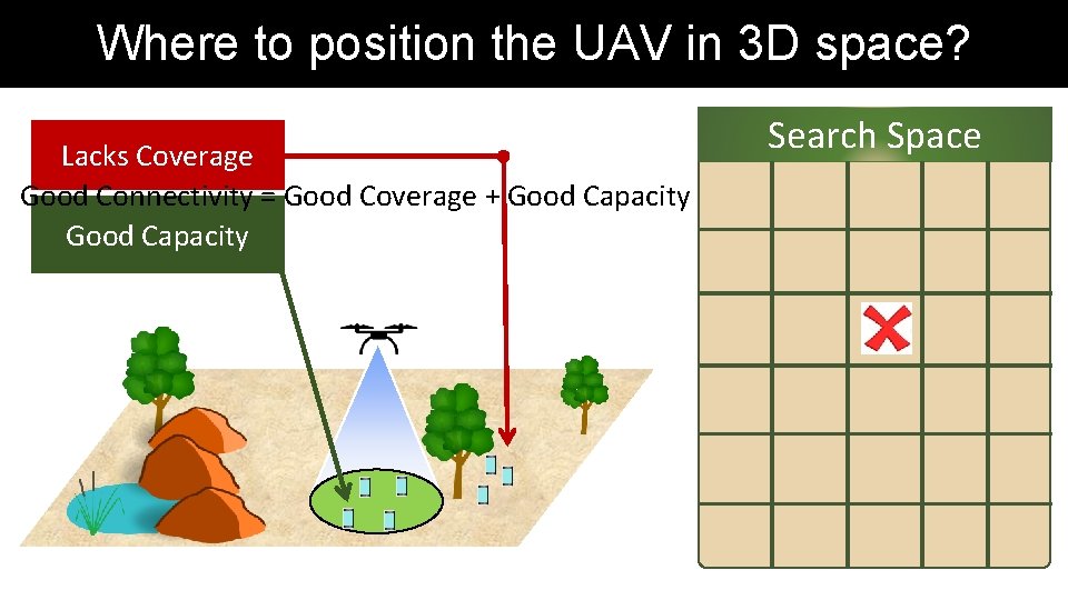
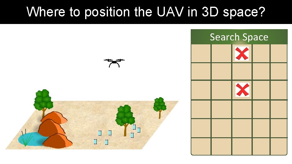
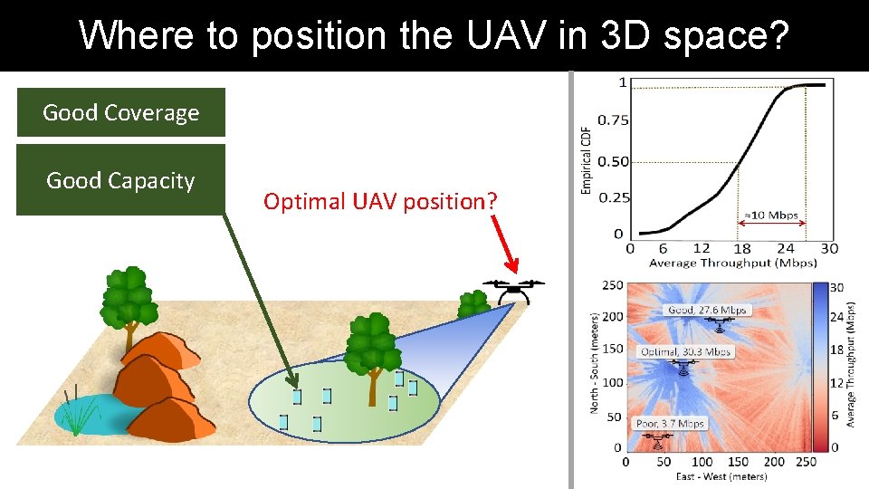
Where to position the UAV in 3 D space? Lacks Coverage Good Connectivity = Good Coverage + Good Capacity Search Space
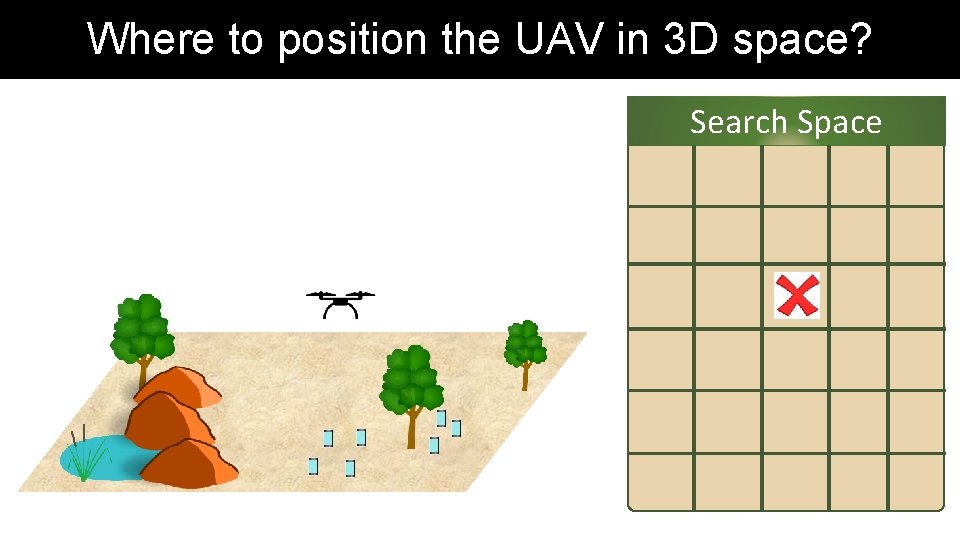
Where to position the UAV in 3 D space? Search Space
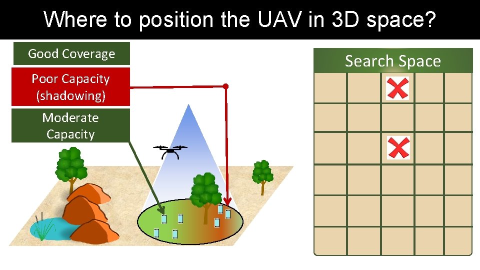
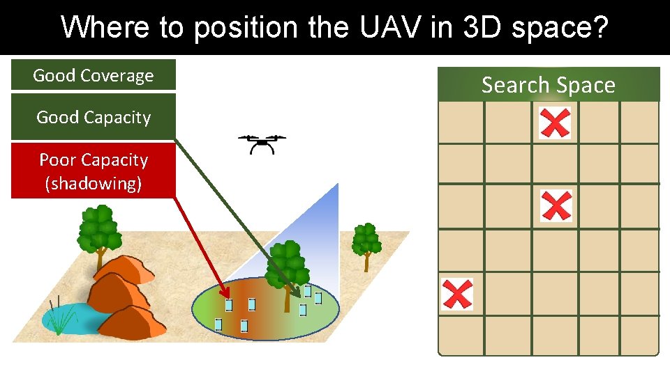
Where to position the UAV in 3 D space? Good Coverage Poor Capacity (shadowing) Moderate Capacity Search Space
Where to position the UAV in 3 D space? Search Space
Where to position the UAV in 3 D space? Good Coverage Good Capacity Poor Capacity (shadowing) Search Space
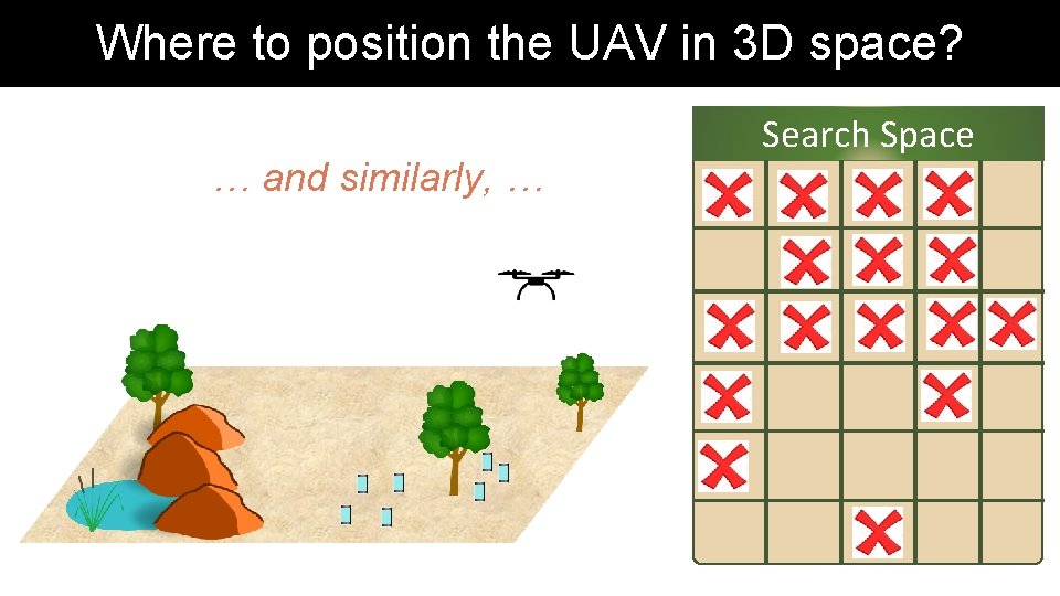
Where to position the UAV in 3 D space? … and similarly, … Search Space
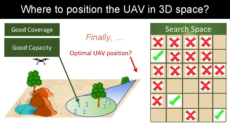
Where to position the UAV in 3 D space? Good Coverage Good Capacity Finally, … Optimal UAV position? Search Space
Where to position the UAV in 3 D space? Good Coverage Good Capacity Optimal UAV position?
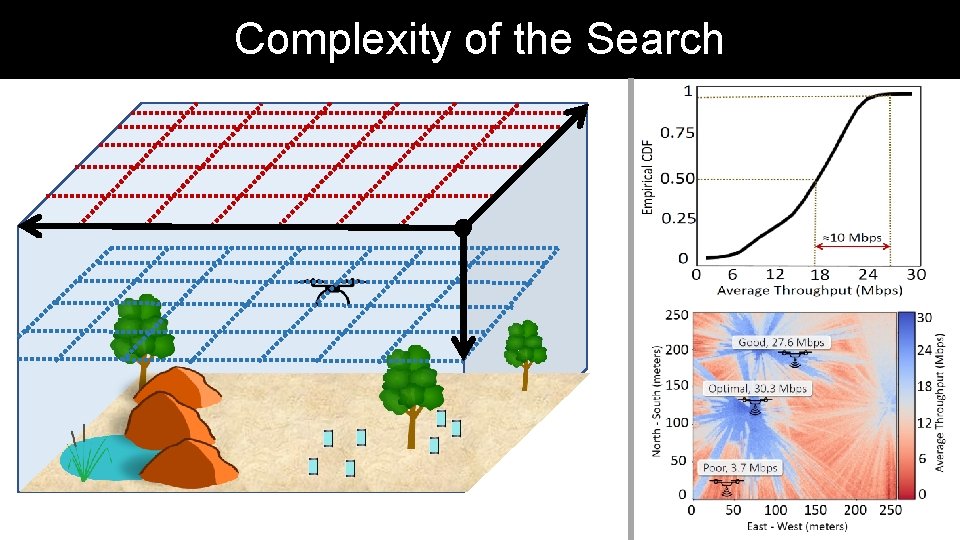
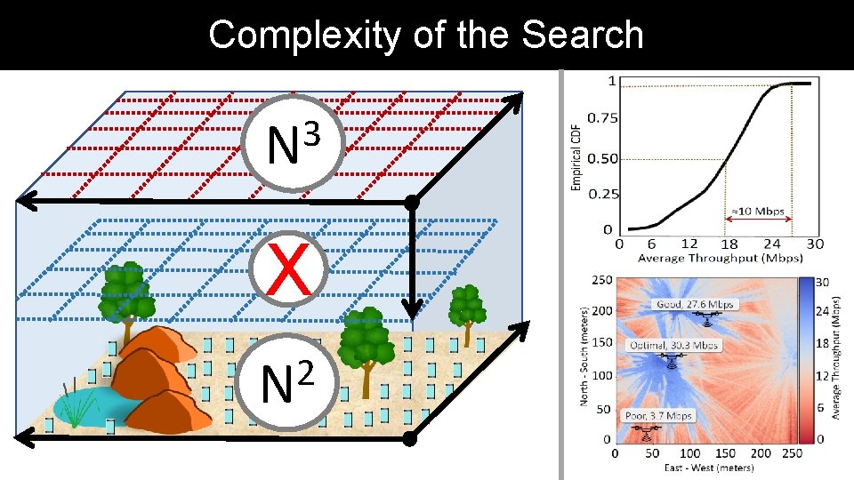
Complexity of the Search
Complexity of the Search 3 N X 2 N
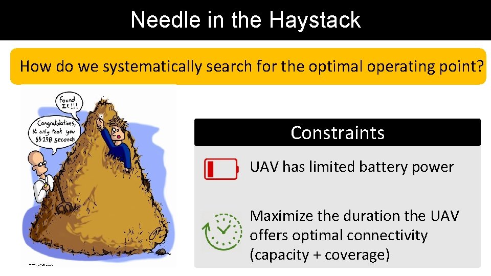
Needle in the Haystack How do we systematically search for the optimal operating point? Constraints UAV has limited battery power Maximize the duration the UAV offers optimal connectivity (capacity + coverage)
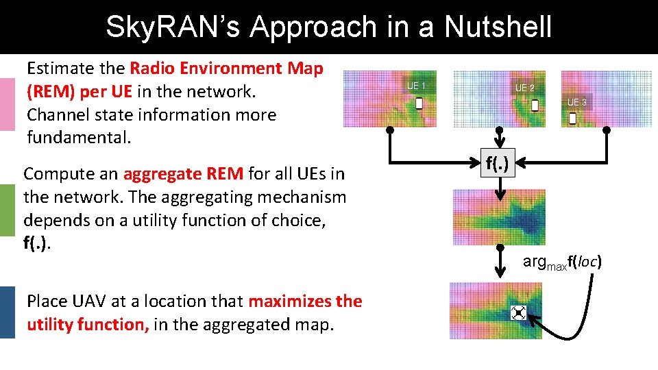
Sky. RAN’s Approach in a Nutshell Estimate the Radio Environment Map (REM) per UE in the network. Channel state information more fundamental. Compute an aggregate REM for all UEs in the network. The aggregating mechanism depends on a utility function of choice, f(. ). Place UAV at a location that maximizes the utility function, in the aggregated map. UE 1 UE 2 UE 3 f(. ) argmaxf(loc)
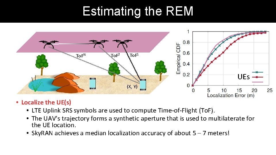
Estimating the REM To. FN To. F 2 To. F 1 UEs (X, Y) • Localize the UE(s) • LTE Uplink SRS symbols are used to compute Time-of-Flight (To. F). • The UAV’s trajectory forms a synthetic aperture that is used to multilaterate for the UE location. • Sky. RAN achieves a median localization accuracy of about 5 – 7 meters!
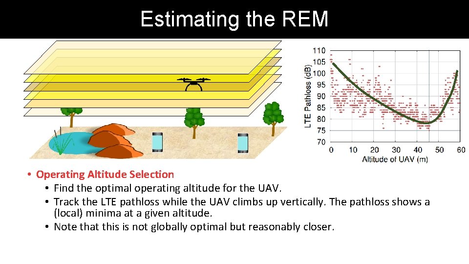
Estimating the REM • Operating Altitude Selection • Find the optimal operating altitude for the UAV. • Track the LTE pathloss while the UAV climbs up vertically. The pathloss shows a (local) minima at a given altitude. • Note that this is not globally optimal but reasonably closer.
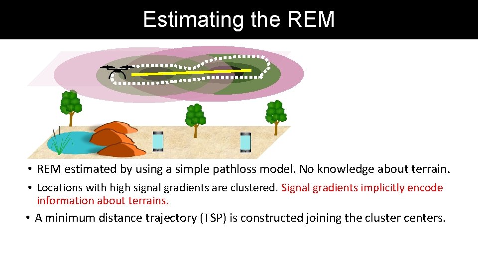
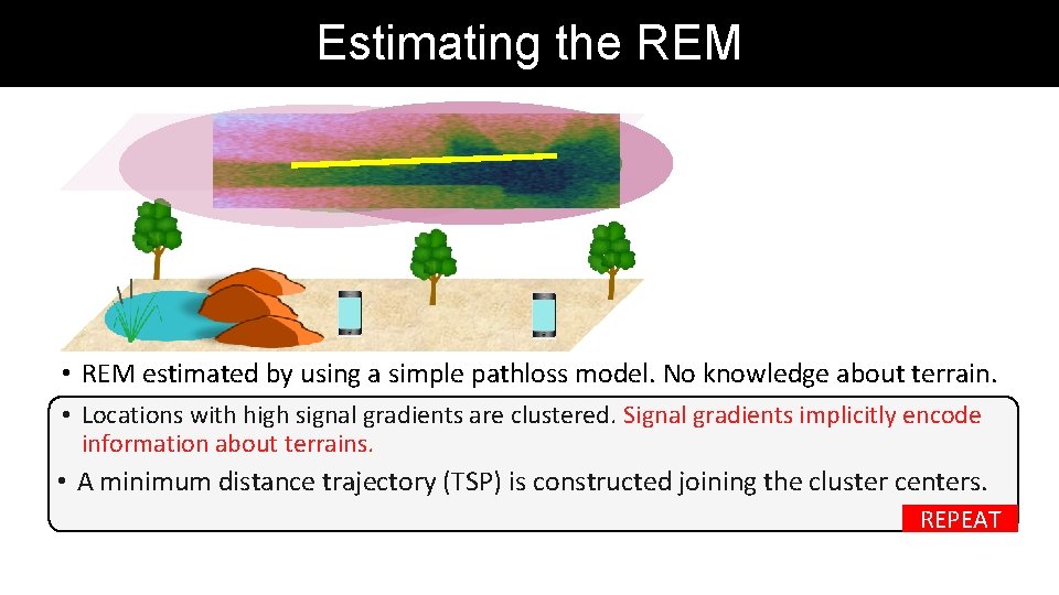
Estimating the REM • REM estimated by using a simple pathloss model. No knowledge about terrain. • Locations with high signal gradients are clustered. Signal gradients implicitly encode information about terrains. • A minimum distance trajectory (TSP) is constructed joining the cluster centers.
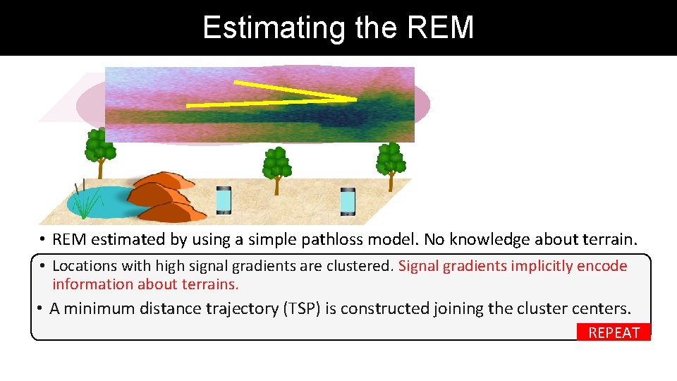
Estimating the REM • REM estimated by using a simple pathloss model. No knowledge about terrain. • Locations with high signal gradients are clustered. Signal gradients implicitly encode information about terrains. • A minimum distance trajectory (TSP) is constructed joining the cluster centers. REPEAT
Estimating the REM • REM estimated by using a simple pathloss model. No knowledge about terrain. • Locations with high signal gradients are clustered. Signal gradients implicitly encode information about terrains. • A minimum distance trajectory (TSP) is constructed joining the cluster centers. REPEAT
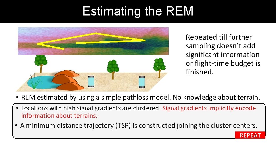
Estimating the REM Repeated till further sampling doesn’t add significant information or flight-time budget is finished. • REM estimated by using a simple pathloss model. No knowledge about terrain. • Locations with high signal gradients are clustered. Signal gradients implicitly encode information about terrains. • A minimum distance trajectory (TSP) is constructed joining the cluster centers. REPEAT
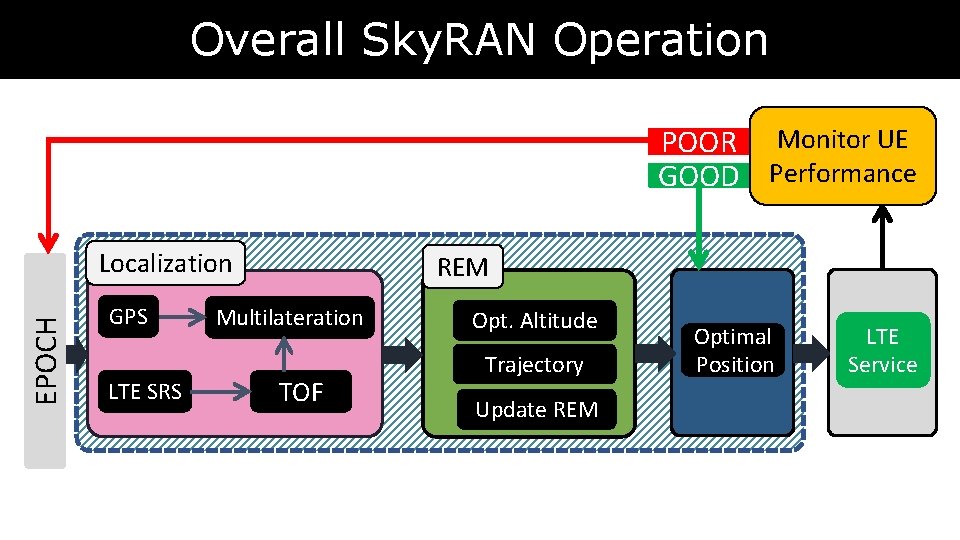
Overall Sky. RAN Operation POOR Monitor UE GOOD Performance EPOCH Localization GPS LTE SRS REM Multilateration TOF Opt. Altitude Trajectory Update REM Optimal Position LTE Service
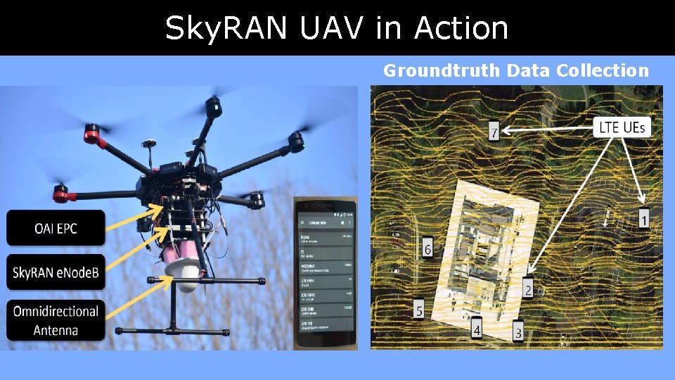
Sky. RAN UAV in Action Groundtruth Data Collection
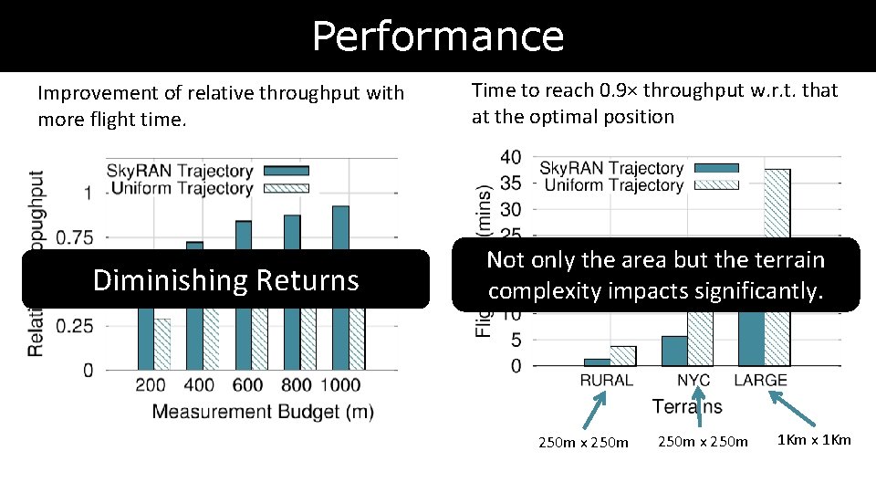
Performance Improvement of relative throughput with more flight time. Time to reach 0. 9× throughput w. r. t. that at the optimal position Diminishing Returns Not only the area but the terrain complexity impacts significantly. 250 m x 250 m 1 Km x 1 Km
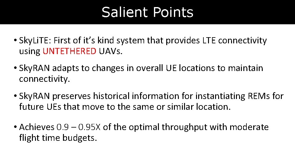
Salient Points • Sky. Li. TE: First of it’s kind system that provides LTE connectivity using UNTETHERED UAVs. • Sky. RAN adapts to changes in overall UE locations to maintain connectivity. • Sky. RAN preserves historical information for instantiating REMs for future UEs that move to the same or similar location. • Achieves 0. 9 – 0. 95 X of the optimal throughput with moderate flight time budgets.
Thank You Ayon Chakraborty ayon@nec-labs. com ACM Co. NEXT 2018 Heraklion, Greece