SIMULATION OF ANCHORAGE HIGHWAY TO HIGHWAY Alaska DOT


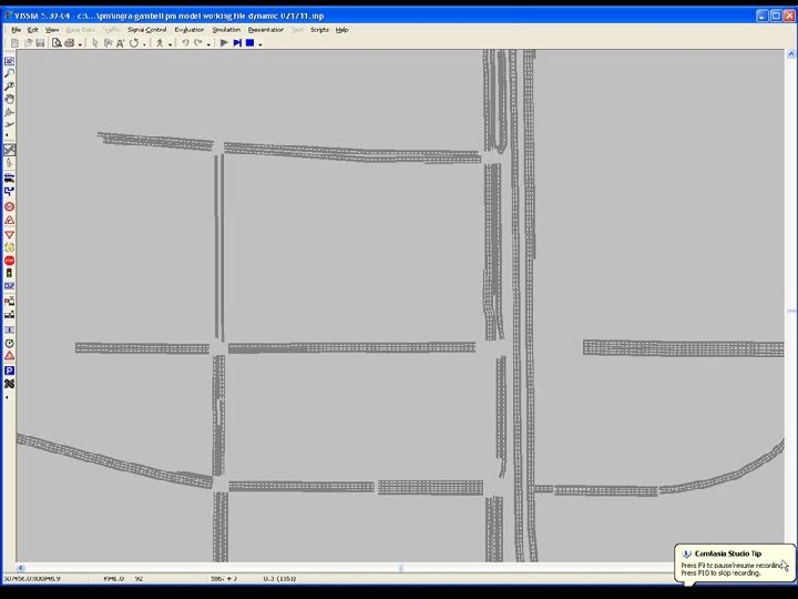
 OD Volumes from Trans. CAD Draw/Layout")

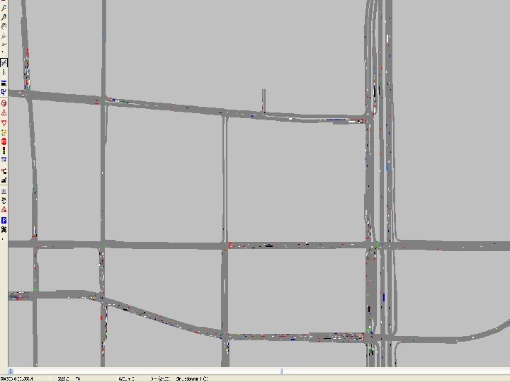
 � Existing")


- Slides: 24
SIMULATION OF ANCHORAGE: HIGHWAY TO HIGHWAY Alaska DOT Quarterly Design Meeting Anchorage, AK April 12 th, 2011 Steve Speth, P. E. , PTOE Professional Associate HDR Engineering
Why Simulation? � Older methods that estimate LOS based on equations don’t cover all scenarios or even model some situations correctly.
Original Synchro Network – 19 intersections
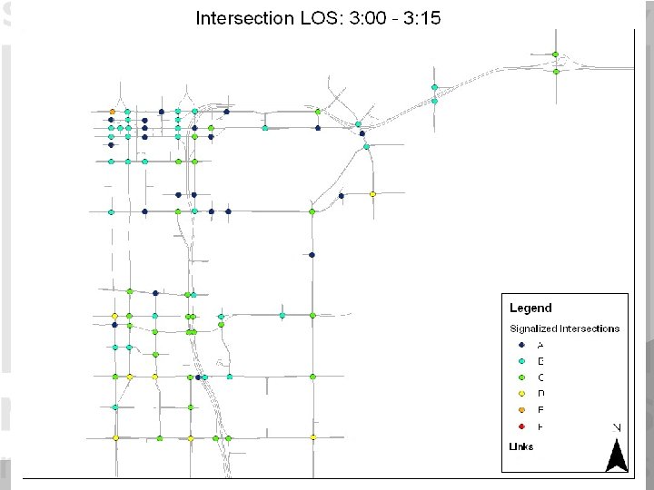
Sample Synchro Output
Why Simulation? � Older methods that estimate LOS based on equations don’t cover all scenarios or even model some situations correctly. � Simulation allows us to look at the individual intersections and interchanges as part of a whole system. All impacts can be analyzed.
Existing Conditions – Study Corridor � VISSIM – Existing conditions calibration � Counts – from various sources � Balanced flow map – 3 hours PM, 2 hours AM � Model output closely matched existing volumes � Queue, congestion matching � Original model was only of study corridor and adjacent intersections
Original Existing VISSIM Network 95 intersections, 6 freeway interchanges
Why Simulation? � Older methods that estimate LOS based on equations don’t cover all scenarios or even model some situations correctly. � Simulation allows us to look at the individual intersections as part of a system. All impacts can be analyzed. � Allows us to build a tool that can be updated and continually used on this project and future projects
Expanded Existing Conditions � VISSIM – Existing conditions calibration �EXPANDED network!
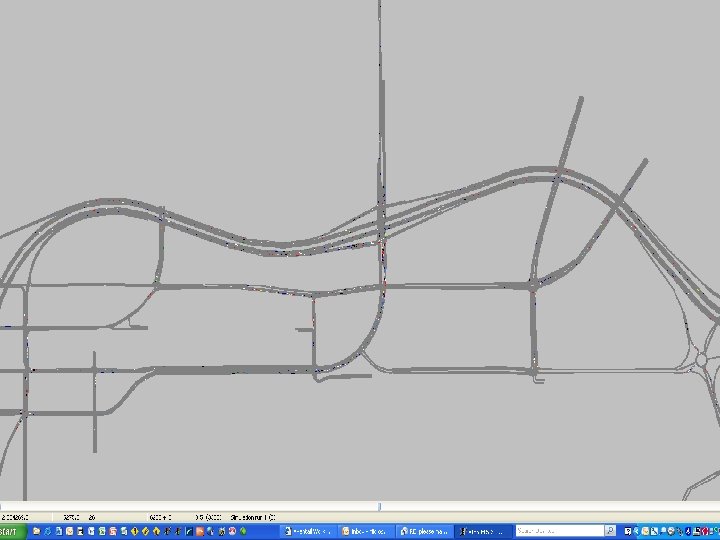
Expanded Existing VISSIM Network 122 intersections, 6 interchanges
Expanded Existing Conditions o VISSIM – Existing conditions calibration o o EXPANDED network! Missing some data, need to have OD Used TRANSCAD (regional model) volumes How do you get from Travel Demand model to detailed turning movements? (future models as well) o Originally did sub-area demand model to T-flow fuzzy o Time consuming, unhappy with “fuzzy” results o Dynamic Assignment in VISSIM o Takes several simulation runs to reach convergence o Meso-scopic model? o Similar issues, still a time consuming process
Future Conditions Modeling Process Calibrated Behavior (from Existing) OD Volumes from Trans. CAD Draw/Layout Concept Dynamic Assignment Fatal Flaw Testing Static Routing Optimize Design Optimize Signal Timing Output Processing
Why VISSIM? � Capability � Ability to model the entire area and direct impacts of the project to surrounding street system � Dynamic Assignment � Multiple hours, realistic queue building � Comparison of concepts � Flexibility � Ability to model various geometric / control conditions � “DUMB” model – you have to tell it everything � Output capabilities are endless
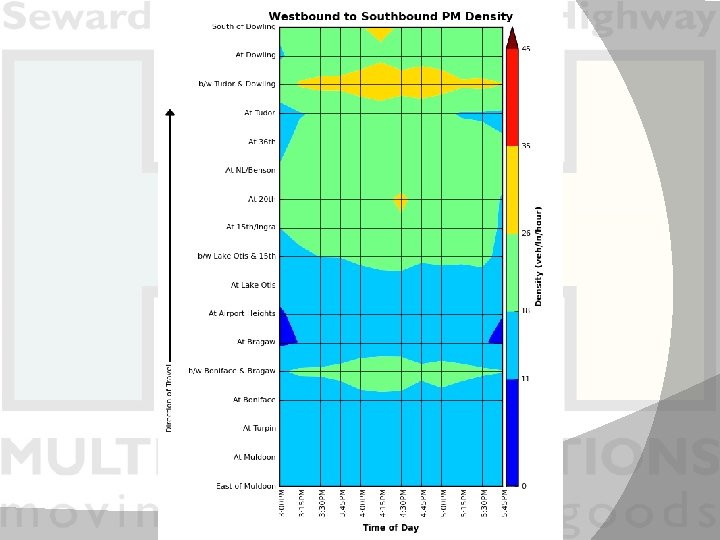
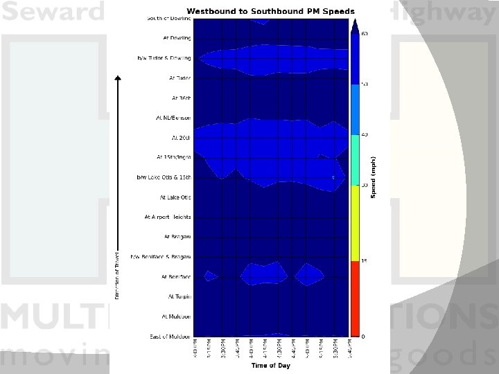
Highway 2 Highway Models � Various models (am & pm peak periods) � Existing � No build (fails, not all traffic served) � Orca (partially completed – on hold) � 15 th (various scenarios, nearly complete – using to test interchange locations & types, weave tie downs, etc) � Ingra/Gambell (various scenarios, nearly complete – using to test interchange locations and types, weave tie downs, etc)
Future Conditions Modeling Fatal Flaw testing � “What If” � � Alternative evaluation � Design Optimization � Alternative Comparison � Various outputs � Visualization � 2 D, 3 D, Enhanced graphics
Next Steps – VISSIM Modeling Finish Optimizing 15 th and Ingra/Gambell Concepts � Produce Outputs to compare “optimized” concepts � � Travel Times � Network Wide Stats � Intersection / Link Stats � “Sensitivity” testing? � What if volumes are 10, 20, 30% higher? � Where are the “pinch points”? � Which concept has the longest life? � Interim year projects? � What projects should be built first? � Most efficient order to build projects? � Construction phasing?
SIMULATION OF ANCHORAGE: HIGHWAY TO HIGHWAY THANK YOU!!! QUESTIONS? ? Steve Speth, P. E. , PTOE Professional Associate HDR Engineering 541 -575 -0434 steve. speth@hdrinc. com
DDI Locations Open to Traffic Springfield, MO – I-44/MO 13 • • • American Fork, UT – I-15/Pioneer Crossing Springfield, MO – National Blvd. /MO 60 Alcoa, TN – US 129 Bypass/Middlesettlements Rd. St. Louis, MO – I-270/Dorsett Road