Shale Island Exploration of Shale Island Shale Island


- Slides: 14

Shale Island Exploration of Shale Island

Shale Island • “Shale Island”, while not an island at all but a small outcrop of “shale” in a region referred to as “Del Monte shale beds” which covers an area of approximately 4 square miles (Iampietro et at, 2005), is located in southern Monterey Bay, central California, approximately 84 miles south of the city of San Francisco and approximately 39 miles west of the San Andreas fault. • “Shale Island” protrudes from the muddy bay bottom and lies 0. 55 miles directly east of the Coast Guard Pier, and approximately 0. 5 miles north of Del Monte Beach. Shale Island is a low-relief outcrop that attains a height of approximately 4 -6 feet and is over 400 feet long and approximately 120 feet wide at its widest exposure at the eastern-most part of the outcrop.

Shale Island • Shale Island lies at a depth of approximately 60 feet; however, the depth at Del Monte shale beds ranges from 30 to 230 feet (Kvitek et al, 2003). • Shale Island the numerous outcrops that comprise the Del Monte shale beds are sensitive ecological areas and habitat for perch, lingcod, over 20 species of rockfish, many benthic invertebrates including the plumose anemone, many species of sponges, cup corals, anemones, and sea stars (Iampietro et al, 2005; Kvitek et al, 2003).

Location of Shale Island Source: Google Earth

Bathymetric contours & legend Source: Alberto Nava

Bathymetry of Del Monte shale beds and Shale Island Bathymetry source: Seafloor Mapping Lab, CSUMB

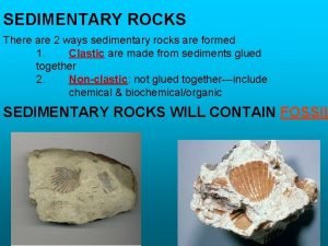
Shale Island its origin • Shale is a fine-grained, sedimentary rock that is derived from the erosion of previously broken down rocks by processes of weathering and erosion. Shale is usually composed of silt, clay-sized particles, and often microscopic marine organisms such as radiolaria, diatoms and their siliceous remains. • The prominent feature of Shale Island is a low-relief outcrop resembling a miniature mesa-butte with long, linear ledges surrounded by unconsolidated sediments that comprise the typical “bay mud”. • The beds comprising Shale Island Del Monte shale beds are identified by laminated semi-siliceous mudstone and sandy siltstone (Iampietro et al, 2005), denoted in the geologic literature as “porcelanite”, and have been mapped by geologists as belonging to the Monterey Formation of middle Miocene age (Bramlette, 1946), making it roughly 14 million years old.

• Shale Island measures approximately 0. 0016 square miles, the Del Monte shale beds measure approximately 4 square miles, and the Monterey Formation in turn measures hundreds of square miles and it is exposed in numerous localities along the Coast Ranges as far north as Point Reyes and further south than Los Angeles and it attains a thickness of over 3, 000 feet (Bramlette, 1946). • In the vicinity of Shale Island the laminated beds are mostly flat-lying with a very gentle dip to the northeast, but this changes abruptly in proximity to faults and granitic rocks in other parts of the bay where the strata are complexly folded (Greene, 1970). • The source of much of the silica in the Monterey Formation stems primarily from diatoms (Bramlette, 1946), unicellular plants with an outer skeleton of hydrated silica.

• According to Bramlette (1946), the semi-siliceous and siliceous rocks that comprise parts of the Monterey Formation as well as the preservation of rhythmic bedding suggests a depositional environment away from wave action and below any marked current action. • Behl (1999), believes that tectonic subsidence and transgression of the shoreline toward land during the late Oligocene to middle Miocene led to the development of middle bathyal depocenters where the sediments belonging to the Monterey Formation accumulated in an oxygen-deficient environment. • The occurrence of the large diatomaceous deposits is interpreted by Bramlette (1946) as colder currents stemming from higher northern latitudes and deposited along the California coast along embayments and basins.

• Based on studies conducted on the Monterey Formation at outcrops in Point Reyes and Point Año Nuevo, White (1990) reaches a similar conclusion and believes that the deposition of diatom ooze represents an intensification of the California current due to strong polar cooling and deposition during periods of strong upwelling. • This implies that if humans had been around during the middle to late Miocene epoch, we would still need to wear warm undergarments under our drysuits. Colder currents from higher latitudes and increased upwelling appeared to have been prevalent along the California coast similar to the present-day oceanic circulation pattern and a cooling trend is believed to have taken place from 14. 9 to 12. 4 million years ago (White, 1990). We could not have been able to dive “Shale Island” as the sediments that make up the Monterey Formation were in the process of being deposited at depths ranging from less than 1, 600 to 7, 500 feet (Behl, 1999) and most importantly, the entire land mass that now comprises Monterey Bay was likely located over 100 miles to the south of its present location and has since been displaced northward by the oblique strike-slip movement of the San Andreas fault (Greene, 1990).

Geologic Map of Portion of Monterey Bay

Partial Geologic Explanation Source: U. S. Geological Survey Open-File Report 97 -30

References Cited • • • Behl, R. J. , 1999. Since Bramlette (1946): The Miocene Monterey Formation of California revisited. Geological Society of America Special Paper 338: Classic Cordilleran Concepts: A View from California, p. 301 -313. Bramlette, M. N. , 1946. The Monterey Formation of California and the Origin of its Siliceous Rocks. U. S. Geological Survey Professional Paper 212. Clark, J. C. , Dupré, W. R. , and Rosenberg, L. I. , 1977. Geologic Map of the Monterey and Seaside 7. 5 Minute Quadrangles, Monterey County: A Digital Database. U. S. Geological Survey Open-File Report 97 -30. Greene, H. G. 1990. Regional tectonics and structural evolution of the Monterey Bay region, central California, in Garrison, R. E. , Greene, H. G. , Hicks, K. R. , Weber, G. E. , and Wright, T. L. (eds. ), Geology and Tectonics of the Central California Coastal Region, San Francisco to Monterey: Pacific Section, American Association of Petroleum Geologists Volume and Guidebook GB 67, p. 31 -56. Greene, H. G. , 1990. Ascension-Monterey canyon system: history and development in Garrison, R. E. , Greene, H. G. , Hicks, K. R. , Weber, G. E. , and Wright, T. L. (eds. ), Geology and Tectonics of the Central California Coastal Region, San Francisco to Monterey: Pacific Section, American Association of Petroleum Geologists Volume and Guidebook GB 67, p. 229 -249. Greene, H. G. , 1977. Geology of the Monterey Bay Region, U. S. Geological Survey Open-file Report 77 -718.

References Cited • • Greene, H. G. , 1970. Geology of Southern Monterey Bay and its Relationship to the Ground Water Basin and Salt Water Intrusion. U. S. Geological Survey Open-file Report 70 -141. Iampietro, P. J. , Kvitek, R. G. , and Morris, E. , 2005. Recent advances in automated genus-specific marine habitat mapping enabled by highresolution multibeam bathymetry. Marine Technology Society v. 39 no. 3, 8393. Kvitek, R. G. , Iampietro, P. J. , and Summers-Morris, E. , 2003. NOAA Technical Report: Integrated spatial data modeling tools for autoclassification and delineation of species-specific habitat maps from highresolution, digital hydrographic data. NOAA Final Report: NOAA Award No. NA 17 OC 2586. Nava, Alberto; 2006. Personal communication. White, L. S. , 1990. Stratigraphy and Paleoceanographic History of the Monterey Formation in Point Reyes and Point Año Nuevo, California, in Garrison, R. E. , Greene, H. G. , Hicks, K. R. , Weber, G. E. , and Wright, T. L. (eds. ), Geology and Tectonics of the Central California Coastal Region, San Francisco to Monterey: Pacific Section, American Association of Petroleum Geologists Volume and Guidebook GB 67, p. 91 -104. The bathymetry of Shale Island was obtained from data downloaded from the Seafloor Mapping Lab of the California State University Monterey Bay. Satellite images of the Monterey Bay region were obtained using Google Earth.
 Shale island
 Shale island
 What is a rock's favorite cereal
 Limestone sandstone shale
 Shale gas
 Marcellus shale royalty calculator
 Shale rock
 Shale planning
 Shale rock classification
 Utica shale map
 Uses of metamorphic rocks
 Regression and transgression
 Shale outcrop
 How are chemical sedimentary rocks formed
 Shale metamorphic grade

