
Severe Weather Forecasting Demonstration Project Regional Subprojects for

Severe Weather Forecasting Demonstration Project Regional Subprojects for the Bay of Bengal and for Southeast Asia – Training Workshop on Severe Weather Forecasting and Warning Services Macau – China 8 – 19 April 2013 Maldives Meteorological Service
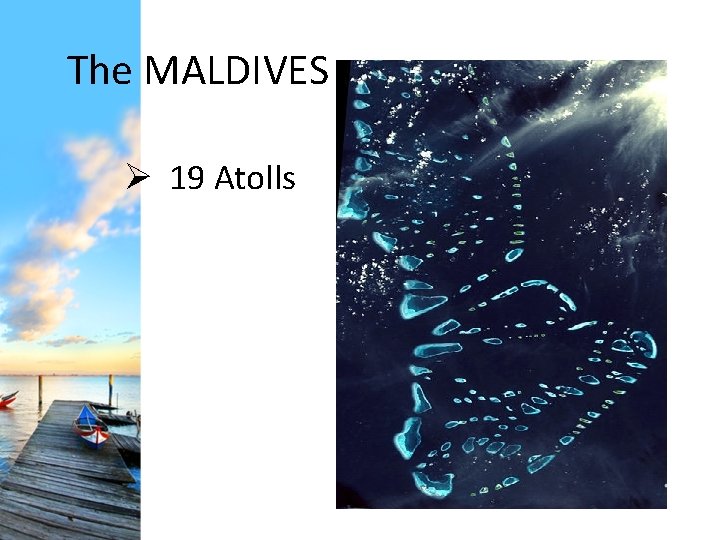
The MALDIVES Ø 19 Atolls
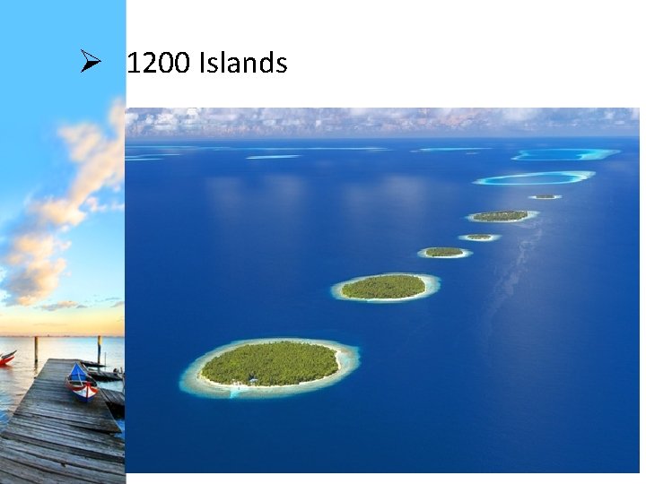
Ø 1200 Islands
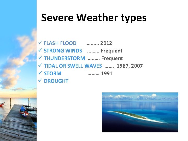
Severe Weather types ü FLASH FLOOD ……… 2012 ü STRONG WINDS ……… Frequent ü THUNDERSTORM ……… Frequent ü TIDAL OR SWELL WAVES ……. 1987, 2007 ü STORM ……… 1991 ü DROUGHT
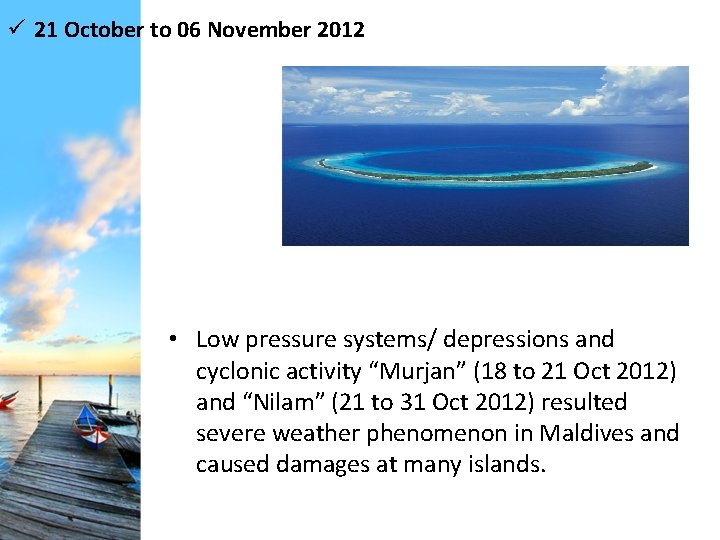
ü 21 October to 06 November 2012 • Low pressure systems/ depressions and cyclonic activity “Murjan” (18 to 21 Oct 2012) and “Nilam” (21 to 31 Oct 2012) resulted severe weather phenomenon in Maldives and caused damages at many islands.
Weather Drivers’ Features Driver Normal 18 th to 24 th October 2012 25 th to 31 st Oct 2012 ITCZ Location around 5. 0°N Located around 10. 0 N because of amplified trough in the equatorial easterly wave moved westwards over Indian region, which also resulted in formation of Cyclonic storm MURJAN over Arabian Sea STWJ’s Core wind speed at 200 hpa is normally above 60 knots Core oscillated between 22. 0 N and 30. 0 N with the wind speed between 84 -104 knots at or near 200 hpa. STWJ exhibited a dual core, one at Lat 22. o. N and other at 30. 0 N on 21 st October 2012. 85 -100 knots is observed during the 25 to 28 October 2012. Also it got shifted southwards 23. 0 N during first week and 29. 0 N during second week because of Anticyclone shifts Sub Tropical Ridge significant high Located over Indian region pressure belt between latitude 12 N and situated around 15 N at 200 hpa. latitudes of 30. 0 N and 30. 0 S Source: Indian Meteorological Department During the 25 Oct 2012, it was located around 15 N and during 26 th & 28 th, it was located between Lat 5 -6 N. It again shifted northwards and located between Lat 1217 N at 200 hpa. This wide variation observed was also in tune with the northward shift in the ITCZ associated with active cyclogenesis during the period.
Impact of weather drivers on synoptic features • Under the influence of weather drivers described above, two lows were seen 20 October 2012 18 UTC and 27 October 2012 18 UTC which caused the heavy rainfall episodes during 21 to 31 October 2012. • Low seen on 20 October 2012 18 UTC near southern Maldives caused heavy rainfall during 22 October 2012 in southern and central part of Maldives. This low intensified and moved west of Maldives and manifested as cyclone ‘MURJAN’ made a land fall at Somalia Coast on 25 October. • Further, another Low developed near northern Maldives during 27 October 2012 18 UTC brought heavy rainfall episodes in Northern part of Maldives.
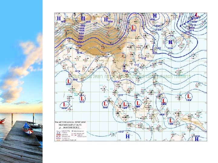
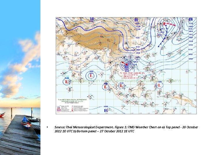
• Source: Thai Meteorological Department. Figure 1: TMD Weather Chart on a) Top panel - 20 October 2012 18 UTC b) Bottom panel – 27 October 2012 18 UTC
IMD Reports…. “Depression formed over southeast and adjoining southwest Bay of Bengal at 06: 00 UTC of 28 October 2012 near latitude 9. 5°N and longitude 86. 0°E moved westwards and intensified into a deep depression in the morning of 29 th October over southwest Bay of Bengal near latitude 9. 0°N and longitude 83. 0°E, and continued to move westwards and intensified into a Cyclonic Storm, ‘NILAM’ in the morning of 30 th October over southwest Bay of Bengal off Sri Lanka coast. The Cyclonic Storm, NILAM then moved northwestwards, crossed north Tamilnadu coast near Mahabalipuram, south of Chennai between 1600 and 1700 hrs IST of 31 st October 2012. After the landfall the cyclonic storm, NILAM moved west-northwestwards and weakened gradually into a deep depression and then into a depression over south Interior Karnataka in the morning of 01 st November 2012”
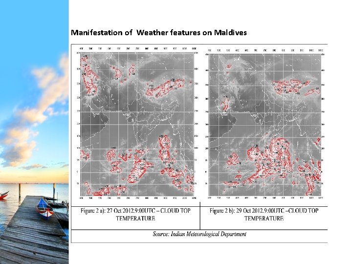
Manifestation of Weather features on Maldives
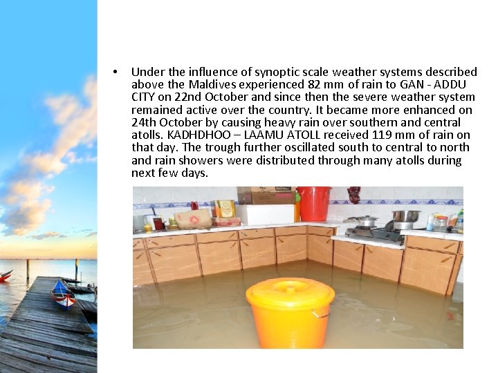
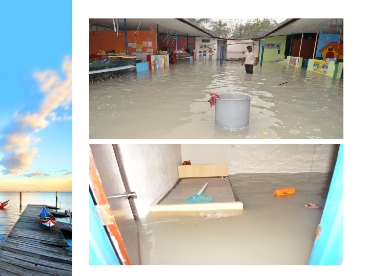
• Under the influence of synoptic scale weather systems described above the Maldives experienced 82 mm of rain to GAN - ADDU CITY on 22 nd October and since then the severe weather system remained active over the country. It became more enhanced on 24 th October by causing heavy rain over southern and central atolls. KADHDHOO – LAAMU ATOLL received 119 mm of rain on that day. The trough further oscillated south to central to north and rain showers were distributed through many atolls during next few days.
• Rainfall at KADHDHOO – LAAMU ATOLL and HANIMAADHOO – HAADHAALU were 62 – 65 mm on 27 th followed by 115 and 145 mm recorded at HANIMAADHOO on 29 October and 30 October, respectively. The October monthly mean rainfall at Hanimaadhoo is 199 mm. Even a much higher intensity/ amount of rainfall is expected in its neighbourhood. • HOARAFUSHI and NOLHIVARANFARU reported most destruction due to floods on the same day. Considering the impact level and recorded rainfall nearby (Hanimaadhoo & Kelaa 128 mm), Maldives Meteorological Service estimate 200 mm of rainfall for Hoarafushi’s flooding. • In the south, KAADEHDHOO – HUVADHU ATOLL recorded 120 mm on 31 October 2012. The October monthly mean rainfall at Kaadehdhoo is 253 mm.
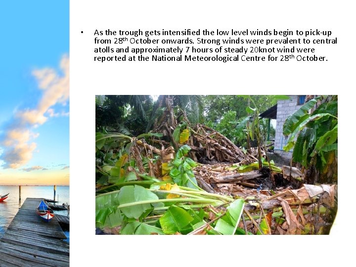
• As the trough gets intensified the low level winds begin to pick-up from 28 th October onwards. Strong winds were prevalent to central atolls and approximately 7 hours of steady 20 knot wind were reported at the National Meteorological Centre for 28 th October.
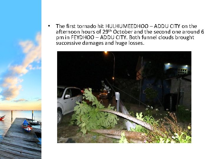
• The first tornado hit HULHUMEEDHOO – ADDU CITY on the afternoon hours of 29 th October and the second one around 6 pm in FEYDHOO – ADDU CITY. Both funnel clouds brought successive damages and huge losses.
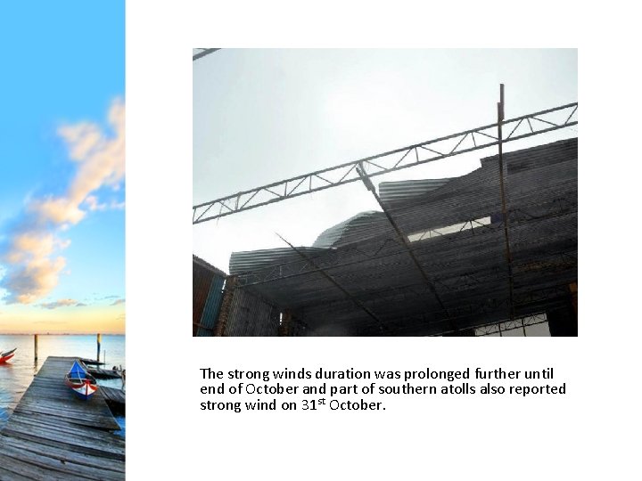
The strong winds duration was prolonged further until end of October and part of southern atolls also reported strong wind on 31 st October.
Forecasting at MMS • Products of various numerical weather prediction (NWP) models and dynamical-statistical models received through internet
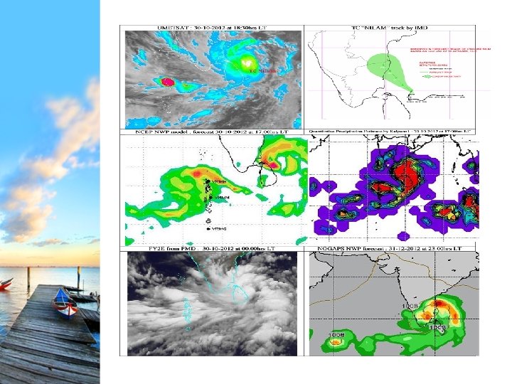
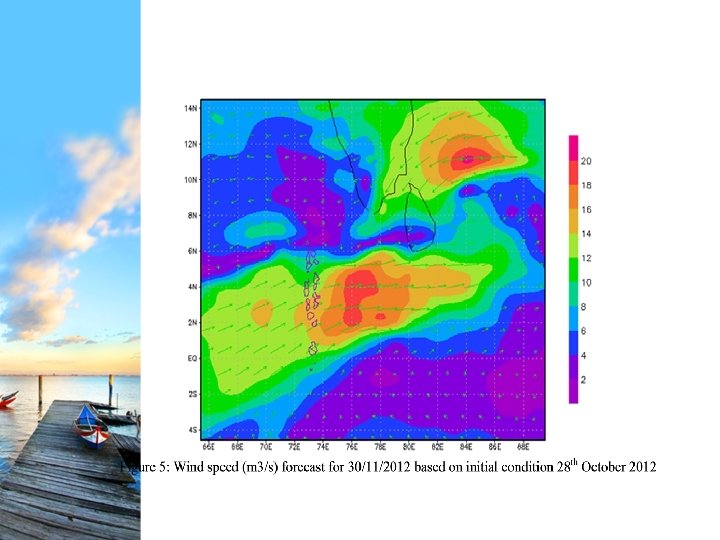
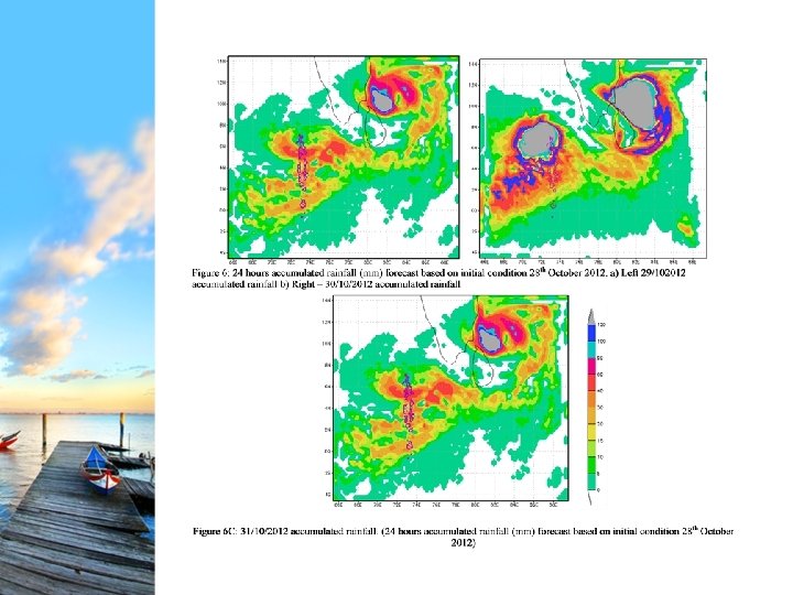
Coordination with RIMES shared its experimental forecast on 29 th October 2012 for NILAM Cyclone about the characteristics of the cyclone, The landfall of Cyclone NILAM on 31 October 2012 was well predicted by RIMES WRF experimental forecast. The six hourly forecast simulations for wind speed and rainfall parameters were shared to MMS.
Damages • The observed impacts during the period reported by Atoll/ Island Councils, National Defense Force (MNDF), Police, NDMC and media were ‘huge and fairly widespread’. • The cost of the damage caused by flooding and tornado are expected to rise to millions.
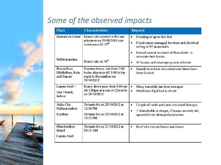
Some of the observed impacts
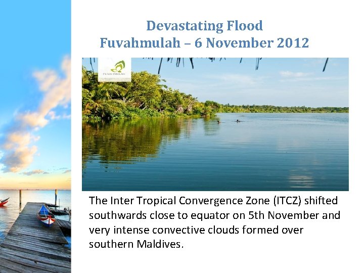
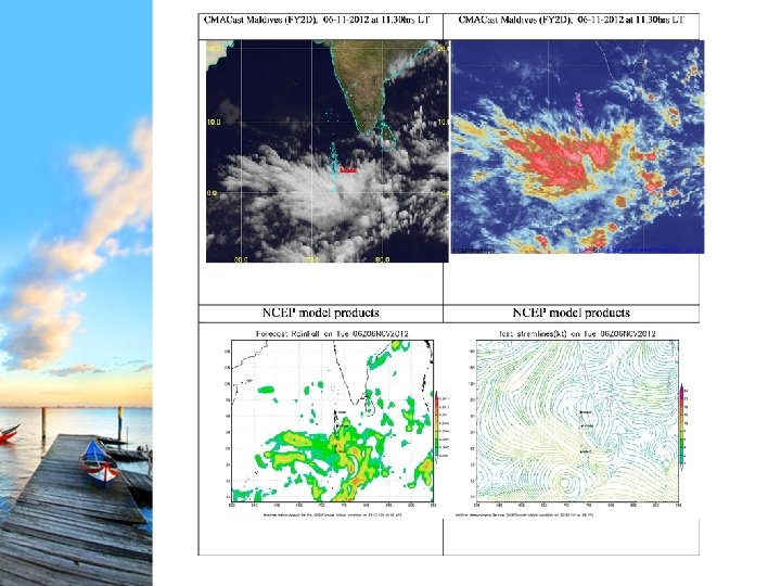
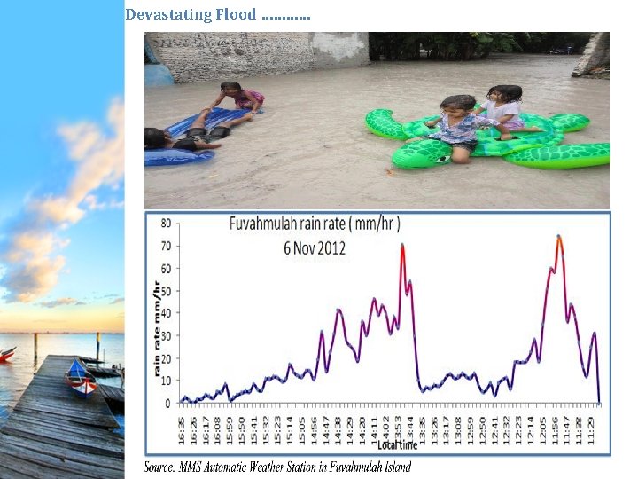
Devastating Flood Fuvahmulah – 6 November 2012 The Inter Tropical Convergence Zone (ITCZ) shifted southwards close to equator on 5 th November and very intense convective clouds formed over southern Maldives.
Devastating Flood …………
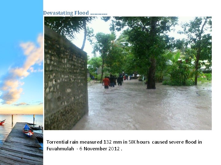
Devastating Flood ………… Torrential rain measured 132 mm in SIX hours caused severe flood in Fuvahmulah - 6 November 2012.
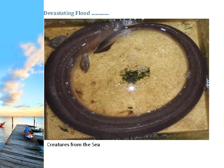
Devastating Flood ………… Creatures from the Sea
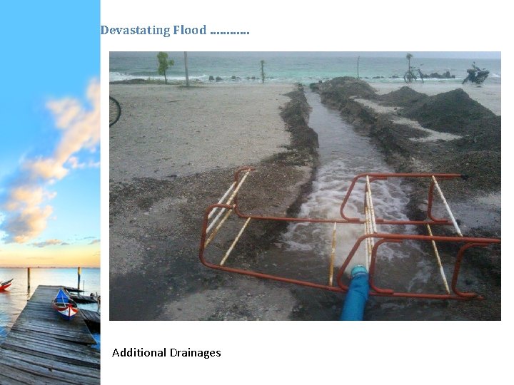
Devastating Flood ………… Additional Drainages
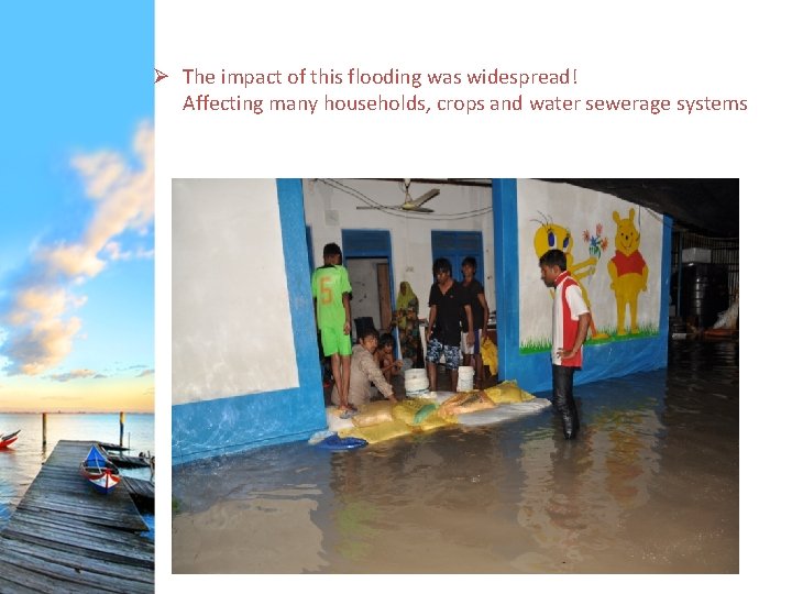
Ø The impact of this flooding was widespread! Affecting many households, crops and water sewerage systems
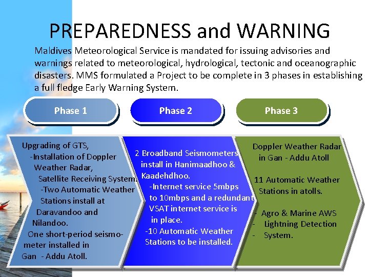
PREPAREDNESS and WARNING Maldives Meteorological Service is mandated for issuing advisories and warnings related to meteorological, hydrological, tectonic and oceanographic disasters. MMS formulated a Project to be complete in 3 phases in establishing a full fledge Early Warning System. Phase 1 Phase 2 Phase 3 Upgrading of GTS, Doppler Weather Radar 2 Broadband Seismometers in Gan - Addu Atoll -Installation of Doppler install in Hanimaadhoo & Weather Radar, Kaadehdhoo. Satellite Receiving System. 11 Automatic Weather -Internet service 5 mbps -Two Automatic Weather Stations in atolls. to 10 mbps and a redundant Stations install at VSAT internet service is Daravandoo and - Agro & Marine AWS in place. Nilandoo. - Lightning Detection -10 Automatic Weather One short-period seismo- - System. Stations to be installed. meter installed in Gan - Addu Atoll.
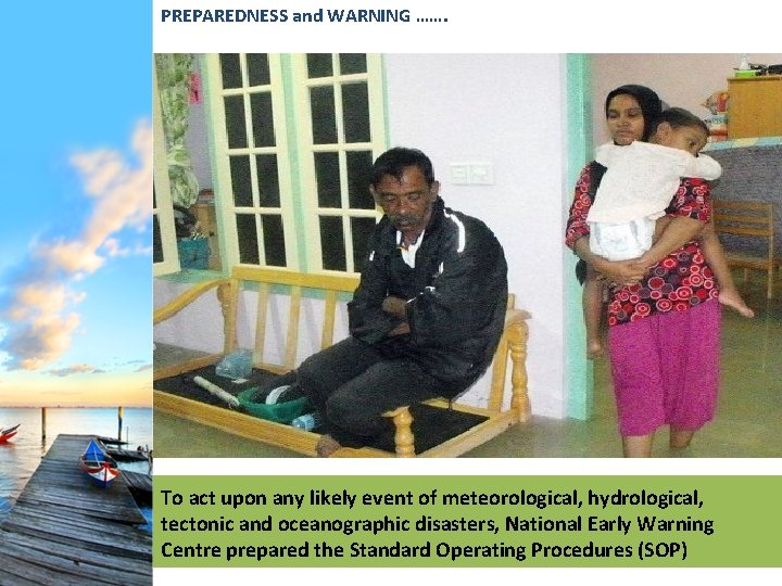
PREPAREDNESS and WARNING ……. To act upon any likely event of meteorological, hydrological, tectonic and oceanographic disasters, National Early Warning Centre prepared the Standard Operating Procedures (SOP)
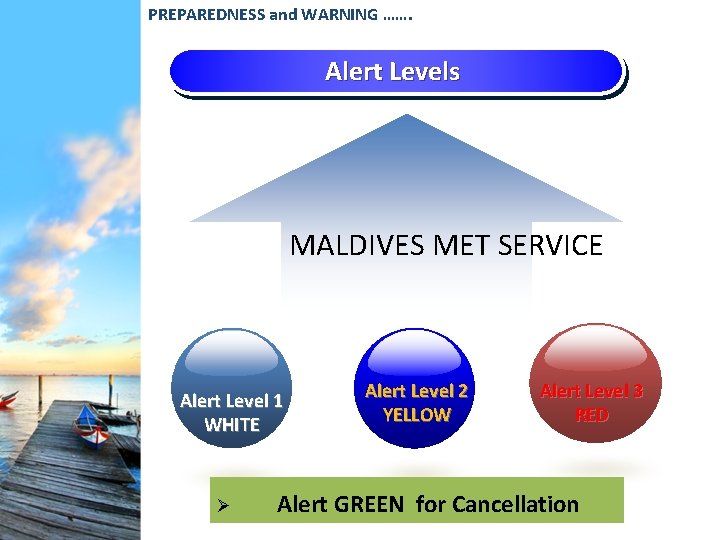
PREPAREDNESS and WARNING ……. Alert Levels MALDIVES MET SERVICE Alert Level 1 WHITE Ø Alert Level 2 YELLOW Alert Level 3 RED Alert GREEN for Cancellation
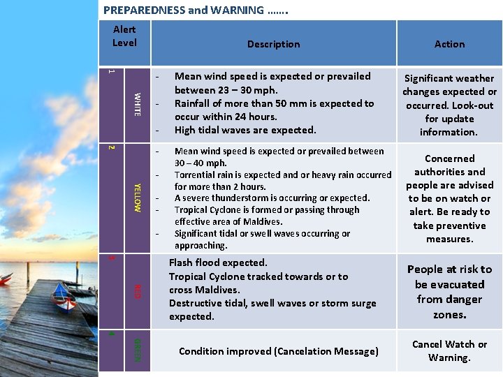
PREPAREDNESS and WARNING ……. Alert Level 1 WHITE - 2 YELLOW - Description Action Mean wind speed is expected or prevailed between 23 – 30 mph. Rainfall of more than 50 mm is expected to occur within 24 hours. High tidal waves are expected. Significant weather changes expected or occurred. Look-out for update information. Mean wind speed is expected or prevailed between 30 – 40 mph. Torrential rain is expected and or heavy rain occurred for more than 2 hours. A severe thunderstorm is occurring or expected. Tropical Cyclone is formed or passing through effective area of Maldives. Significant tidal or swell waves occurring or approaching. 3 RED Flash flood expected. Tropical Cyclone tracked towards or to cross Maldives. Destructive tidal, swell waves or storm surge expected. Concerned authorities and people are advised to be on watch or alert. Be ready to take preventive measures. People at risk to be evacuated from danger zones. 4 GREEN Condition improved (Cancelation Message) Cancel Watch or Warning.
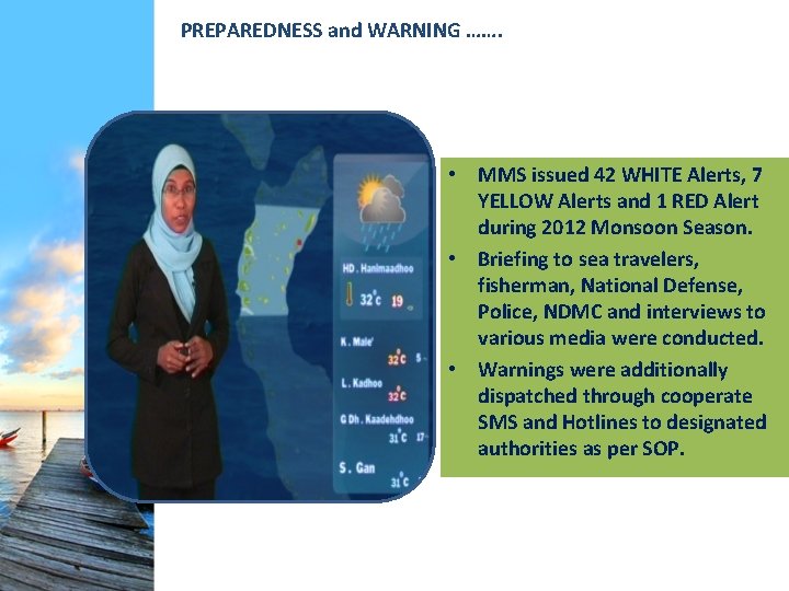
PREPAREDNESS and WARNING ……. • MMS issued 42 WHITE Alerts, 7 YELLOW Alerts and 1 RED Alert during 2012 Monsoon Season. • Briefing to sea travelers, fisherman, National Defense, Police, NDMC and interviews to various media were conducted. • Warnings were additionally dispatched through cooperate SMS and Hotlines to designated authorities as per SOP.
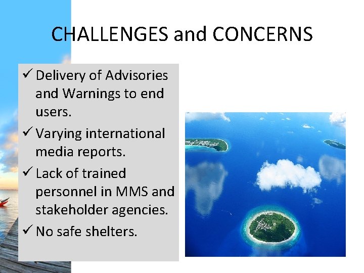
CHALLENGES and CONCERNS ü Delivery of Advisories and Warnings to end users. ü Varying international media reports. ü Lack of trained personnel in MMS and stakeholder agencies. ü No safe shelters.
THANK YOU
- Slides: 38