Seismology of Nepal An Overview Lok Bijaya Adhikari

Seismology of Nepal: An Overview Lok Bijaya Adhikari

Contents • • Introduction Geology and tectonics National Seismological Network Seismicity

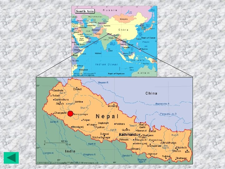
Introduction • Nepal is a mountainous country within Latitude 260 22’ to 300 27’E and Longitude 800 4’ to 880 12’E. 83% of the area is covered by mountain peaks. • Remaining 17% is covered by alluvial plains called ‘Terai plains’. • The total area is 147181 sq. km. • Altitude varies from 50 m to 8848 m. (msl)

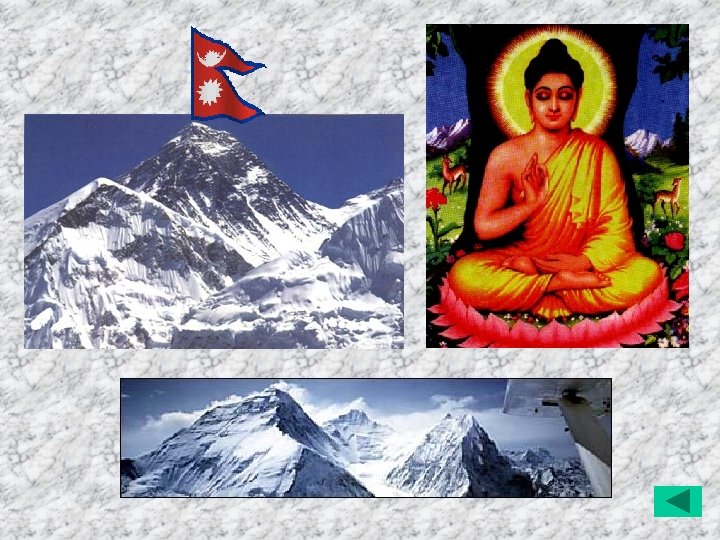
• The population of the country is about 25 million. • Climate varies from subtropical to alpine type. • Rich in biodiversity. Many types of plants, birds and wild animals. • Nepal is country of Mt. Everest and birth place of Buddha.

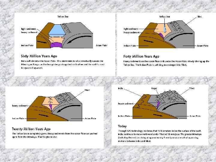
Geology and Tectonics • Nepal lies within 2400 km long active Himalayan mountain belt with 800 km coverage. • Himalaya mountain is the product of continuous collision between Indian and Eurassian plate since early Tertiary. • Himalaya is divided into four main tectonic region - Higher Himalaya - Lesser Himalaya - Sub- Himalaya - Indogangetic alluvial plains.

• Three major longitudinal faults divide Himalaya in 4 major tectonics zones. - Main Central Thrust (MCT). - Main Boundary Thrust(MBT). - Himalayan Frontal Thrust (HFT) • These are formed due to underthrusting of Indian plates during different epochs.

• Gangetic plain- Pleistocene to recent alluvial deposits over 1000 m thick. • Sub-Himalaya – Consists of about 5 km thick Neogene molasse sediments of Siwaliks overthrust by older Lesser Himalayan rocks along MBT. • Lesser Himalaya- Consists of intensely folded metasedimentary rocks between MBT and MCT. • Higher Himalaya- thick sequence of higher Himalayan crystalline and overlying Tethyan sedimentary rocks.

National Seismological Centre • The centre was established in first in 1978 with a vertical component seismometer at the periphery of Kathmandu valley. • By 1999 the total number of vertical component short period seismic stations increased to 21, Plus two strong motion seismograph in the Kathmandu valley. • Among them signals from 9 seismic station are recorded in digital form at autonomous Regional Seismological Center, Birendranagar. • This year one BB STS 2 is installed in RSC and one Long Period seismometer is installed in NSC.

National Seismic Network

Seismic Vault

Seismic Station

Seismic Data Acquisition System in Surkhet

Record of Local Earthquake

Seismicity • West Nepal seems more active than the east. • The major cause of seismicity in the Himalaya is continuous collision between Indian and Eurassian plates. • The seismicity in Nepal Himalaya is concentrated E-W along the narrow belt between MBT and MCT. • The depth of most of the earthquake lies between 10 -20 km.
")
Epicenter Map of Nepal Himalaya (1994 -2005)

• In the last 100 years 4 major earthquakes accommodate the slip of Indian plate towards Tibet , but in the area between 1905 and 1934 earthquake there is no large earthquake since 1255 earthquake(? ? ). So this area of seismic gap is seems to be most vulnerable area for the large future earthquake.
 destroyed 1255 (IX-X) King")
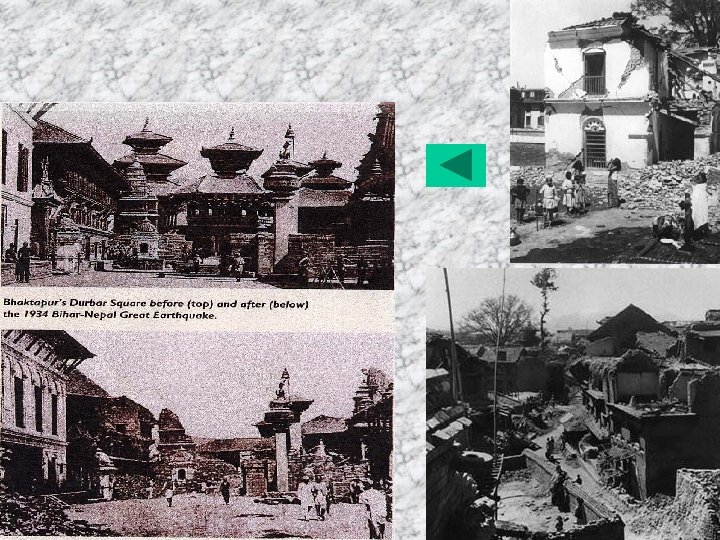
Historical Earthquakes of Nepal Date Magnitude Death Houses (Intensity, MMI) destroyed 1255 (IX-X) King was also killed 1/3 of kingdom of Nepal Perished 1408 Innumerable people killed All big temples were collapsed 1833 7. 8 (VIII-IX) 500 1934 8. 2 (IX-X) 10500 80000 1980 6. 5 (VIII- 178 40000 1988 6. 7 ( VIII-IX) 721 100000

Thank you.

Geology of Nepal Himalaya

• Building damaged in 1988 Udayapur earthquake.

- Slides: 25