Sec 9 5 Applications of Trigonometry to Navigation


- Slides: 38
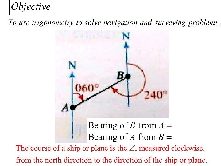
Sec 9. 5 Applications of Trigonometry to Navigation and Surveying
Which direction? • In basic Trig… standard position: Start on the x-axis. Counter clockwise
Which direction? • Navigation… used by ships, planes etc. Start on the y-axis. Clockwise Given using 3 digits
9. 5 Applications of Trigonometry to Navigation and Surveying
9. 5 Applications of Trigonometry to Navigation and Surveying
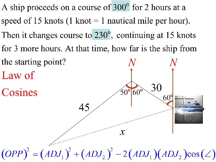
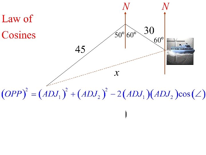
Example 1. A ship proceeds on a course of 300º for 2 hours at a speed of 15 knots (1 knot = 1 nautical mile per hour). Then it changes course to 230º, continuing at 15 knots for 3 more hours. At that time, how far is the ship from its starting point?
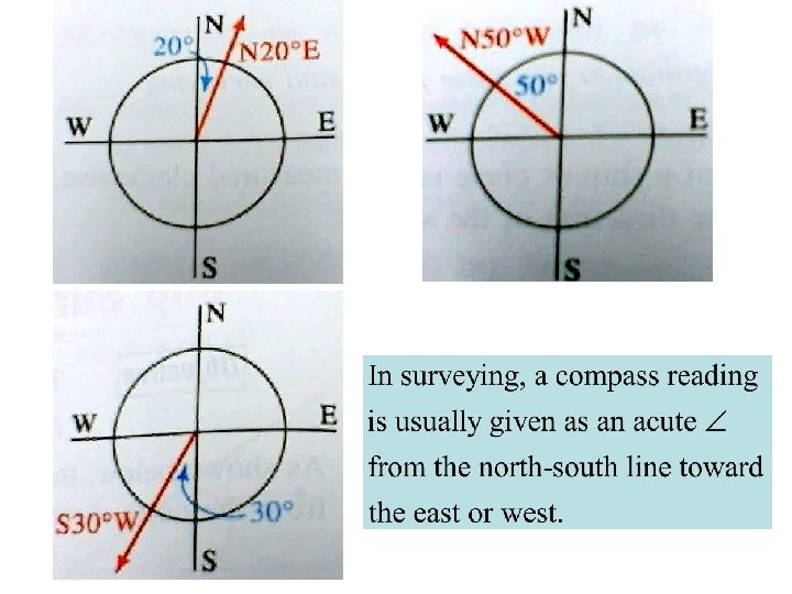
Which direction? • In surveying, a compass reading is usually given as an acute angle from the north-south line toward the east or west line. a) Start on the yaxis. b) Clockwise c) The angle is always acute.
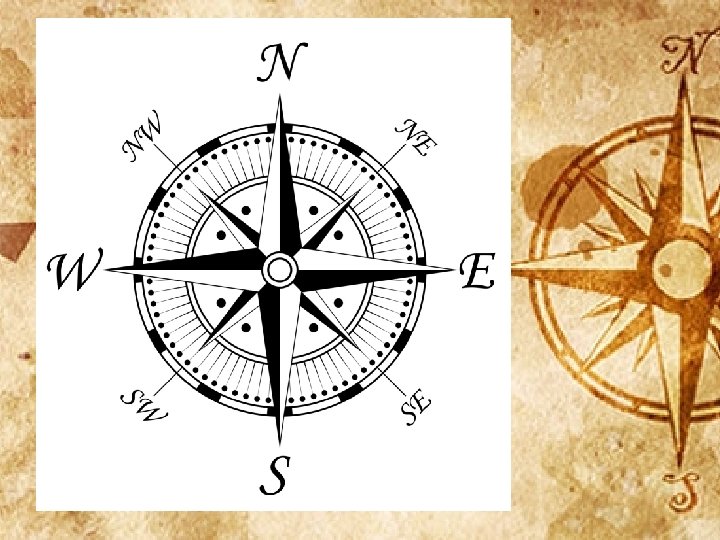
Navigation Surveying
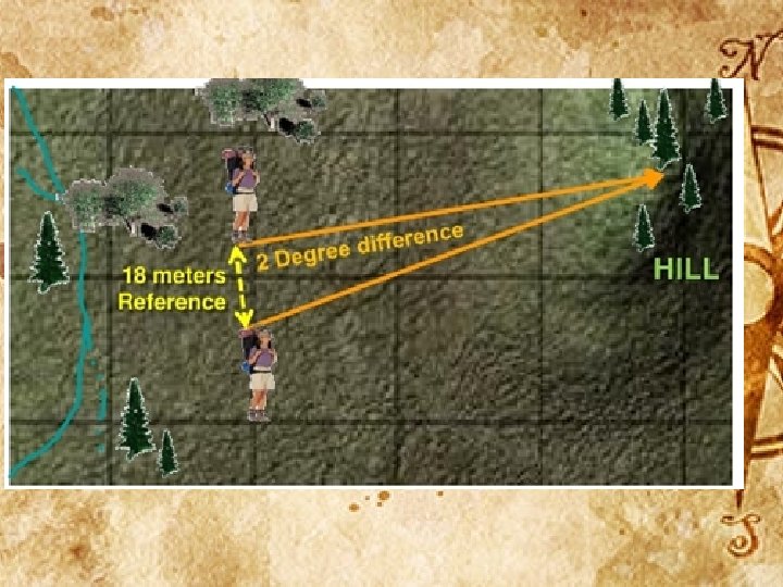
NE Sandy and NE 40 th meet at approx 58 degree angle. Give directions from the Formation Area to the disband Area. a) Using navigation system. b) Using the survey method.
Basic Hints and rules • Make a diagram… give yourself drawing space all around the diagram. • Although drawing to scale might be hard, come as close to a scale as possible. • Write all the given information on your diagram.
Basic Hints and rules • Include a lightly drawn x and y axes at each point. • Find as many angles and sides as you can. • Apply as many geometry rules as you can.
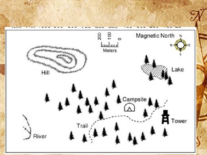
Camping: Give direction from the camp site to each of 4 points of interest: a) The river b) The lake c) To the tower d) The hill
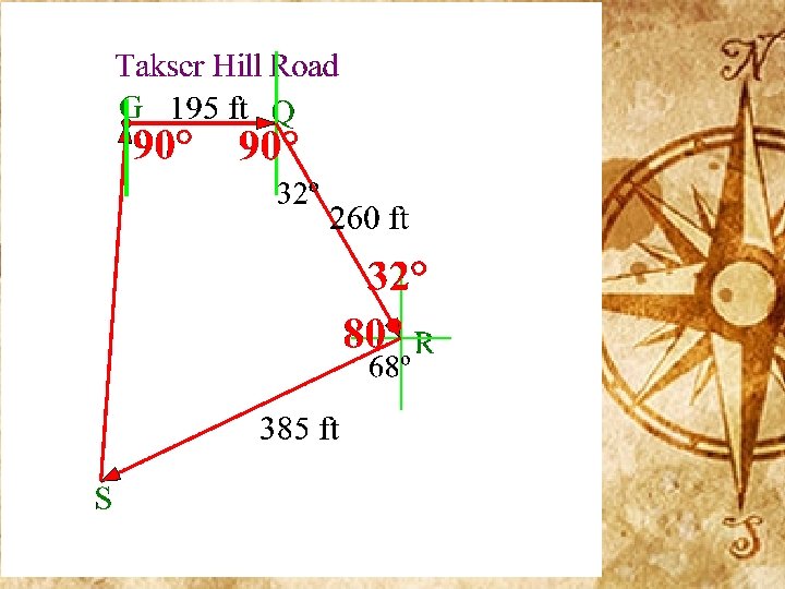
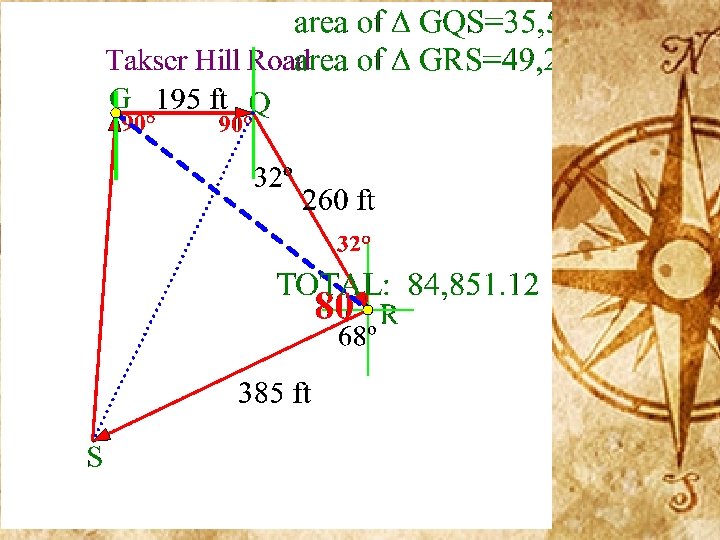
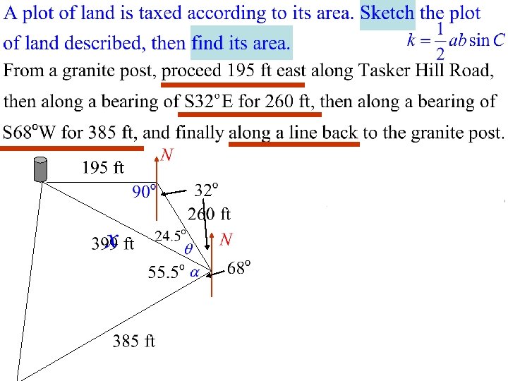
Example 2. Very often a plot of land is taxed according to its area. Sketch the plot of land described. Then find its area. From a granite post, proceed 195 ft east along Tasker Hill Road, then along a bearing of S 32ºE for 260 ft, then along a bearing of S 68ºW for 385 ft, and finally along a line back to the granite post. With these types of problems, a careful diagram is essential. Next slide will demonstrate all the steps. Make sure to have your geometric tools and math wits about you!
• click here for a sample test
Homework: In class Exit Slip: • Sec 9. 5 • Page 353 Problem written #17. exercises • Only full solutions • 7 -13 odds; 15, will be considered. If you were absent, see Navi 16, 17 for make up Exit Slip.
Applications of Trig to Navigation and Surveying The course of a ship or plane is the angle, measured clockwise, from the north direction to the direction of the ship or plane.
As shown, the compass bearing of one location from another is measured in the same way. Note that compass bearings and courses are given with three digits, such as 060º rather than 60º
Example 1. A ship proceeds on a course of 300º for 2 hours at a speed of 15 knots (1 knot = 1 nautical mile per hour). Then it changes course to 230º, continuing at 15 knots for 3 more hours. At that time, how far is the ship from its starting point?
Example 1. A ship proceeds on a course of 300º for 2 hours at a speed of 15 knots (1 knot = 1 nautical mile per hour). Then it changes course to 230º, continuing at 15 knots for 3 more hours. At that time, how far is the ship from its starting point?
Example 2. Very often a plot of land is taxed according to its area. Sketch the plot of land described. Then find its area. From a granite post, proceed 195 ft east along Tasker Hill Road, then along a bearing of S 32ºE for 260 ft, then along a bearing of S 68ºW for 385 ft, and finally along a line back to the granite post.
Example 2. Very often a plot of land is taxed according to its area. Sketch the plot of land described. Then find its area. From a granite post, proceed 195 ft east along Tasker Hill Road, then along a bearing of S 32ºE for 260 ft, then along a bearing of S 68ºW for 385 ft, and finally along a line back to the granite post.