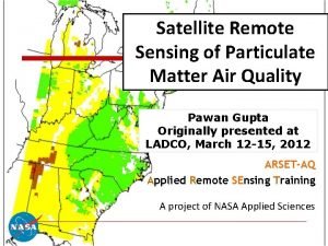
Satellite Remote Sensing of Surface Air Quality Pawan


- Slides: 39

Satellite Remote Sensing of Surface Air Quality Pawan Gupta NASA Goddard Space Flight Center GESTAR/USRA (pawan. gupta@nasa. gov) ARSET Applied Remote SEnsing Training A project of NASA Applied Sciences

Pollution Sources Atmospheric aerosols are highly variable in space and time

Air Pollution Monitoring Ground Measurements Air and Space Observations Models

Air Pollution Monitoring CIMEL MODELS Satellite TEOM LIDAR Sampler Aircraft

How Satellite Works?

Remote Sensing Collecting information about an object without being in direct physical contact with it.

Remote Sensing …

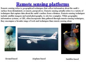
Remote Sensing: Platforms • Platform depends on application • What information do we want? • How much detail? • What type of detail? • How frequent?

What does satellite measures ? Reference: CCRS/CCT

Remote Sensing Cont… Satellite measured spectral radiance A priority information & Radiative Transfer Theory Retrieval Algorithm Geophysical Parameters Applications

Number of Satellites making daily observations of Earth-Atmosphere and Ocean Globally

What you get from satellite ? VIIRS Day Time Night Time

Why Satellites for Air Quality Monitoring ?

Global Status of PM 2. 5 Monitoring Ground Sensor Network Not complete network but representative Population Density

Global Status of PM 2. 5 Monitoring q Spatial distribution of air pollution from existing ground network does not support high population density. q Surface measurements are not cost effective q Many countries do not have PM 2. 5 mass measurements q In the US, 31% of total population have no PM monitoring. Can be use satellites?

Environmental Agencies & Public Looking for… WHO • Public • Decision/Policy Makers • Media • Researchers India 40 µgm-3 – Annual mean 60 µgm-3 – 24 hour mean

Aerosols from satellite Biomass Burning Aerosol Optical Thickness MODIS AQUA Spring Winter Pollution & dust Summer Haze & Pollution Fall Dust Biomass Burning Several satellites provide state-of-art aerosol measurements over global region on daily basis

Aerosol Optical Depth Sun Atmosphere The optical depth expresses the quantity of light removed from a beam by scattering or absorption by aerosols during its path through the atmosphere These optical measurements of light extinction are used to represent aerosols (particulate) amount in the entire column of the atmosphere. Surface • AOD - Aerosol Optical Depth • AOT - Aerosol Optical Thickness

Aerosol Optical Depth to Surface Particulate Matter

What is our interest and what we get from satellite? To of the Atmosphere Aerosol Optical Particle size Depth 10 km 2 Vertical Column Composition Water uptake Vertical Distribution Surface Layer Earth Surface PM 2. 5 mass concentration (µgm-3) -- Dry Mass

AOD vs PM 2. 5 AOD – Column integrated value (top of the atmosphere to surface) - Optical measurement of aerosol loading – unit less. AOD is function of shape, size, type and number concentration of aerosols PM 2. 5 – Mass per unit volume of aerosol particles less than 2. 5 µm in aerodynamic diameter at surface (measurement height) level

AOD – PM Relation Top-of-Atmosphere surface o – particle density o Q – extinction coefficient o re – effective radius o f. PBL – % AOD in PBL o HPBL – mixing height Composition Size distribution Vertical profile

PM 2. 5 Estimation: Popular Methods PM 2. 5 Difficulty Level Two Variable Method Y=m. X + c AOT Multi. Variable Method Artificial Neural Network MSC • • and Empirical Methods, Data Assimilation etc. are under utilized

AOD & PM 2. 5 Relationship Gupta et al. , 2006

AOT-PM 2. 5 Relationship Gupta, 2008

PM 2. 5 Estimation: Popular Methods PM 2. 5 Difficulty Level Two Variable Method Y=m. X + c AOT Multi. Variable Method Artificial Neural Network MSC • • and Empirical Methods, Data Assimilation etc. are under utilized

Advantages of using reanalysis meteorology along with satellite Predictor: AOD + Meteorology TVM Linear Correlation Coefficient between observed and estimated PM 2. 5 Gupta, 2008

PM 2. 5 Estimation: Popular Methods PM 2. 5 Difficulty Level Two Variable Method Y=m. X + c AOT Multi. Variable Method Artificial Neural Network MSC • • and Empirical Methods, Data Assimilation etc. are under utilized

Time Series Examples of Results from ANN Gupta et al. , 2009

TVM Vs MVM vs TVM Artificial Intelligence MVM Gupta et al. , 2009 ANN 30

PM 2. 5 Estimation: Popular Methods PM 2. 5 Difficulty Level Two Variable Method Y=m. X + c AOT Multi. Variable Method Artificial Neural Network MSC • • and Empirical Methods, Data Assimilation etc. are under utilized

Scaling approach o Basic idea: let an atmospheric chemistry model decide the conversion from AOD to PM 2. 5. Satellite AOD is used to calibrate the absolute value of the model-generated conversion ratio. Satellite-derived PM 2. 5 = x satellite AOD Liu et al. , 2006, 32

Annual Mean PM 2. 5 from Satellite Observations van Donkelaar et al. , 2006, 2009

Questions to Ask: Issues üHow accurate are these estimates ? üIs the PM 2. 5 -AOD relationship always linear? üHow does AOD retrieval uncertainty affect estimation of air quality üDoes this relationship change in space and time? üDoes this relationship change with aerosol type? üHow does meteorology drive this relationship? üHow does vertical distribution of aerosols in the atmosphere affect these estimates?

The Use of Satellite Models o Currently for research n Spatial trends of PM 2. 5 at regional to national level n Interannual variability of PM 2. 5 n Model calibration / validation n Exposure assessment for health effect studies o In the near future for research n Spatial trends at urban scale n Improved coverage and accuracy n Fused statistical – deterministic models o For regulation? 35

Trade-offs and Limitations o Spatial resolution – varies from sensor to sensor and parameter to parameter o Temporal resolution – depends on satellite orbits (polar vs geostationary), swath width etc. o Retrieval accuracies – varies with sensors and regions o Calibration o Data Format, Data version o Etc.

Assumption for Quantitative Analysis When most particles are concentrated and well mixed in the boundary layer, satellite AOD contains a strong signal of ground-level particle concentrations. No textbook solution!

Shopping List - Requirements for this job o A good high speed computer system o Internet to access satellite & other data o Some statistical software (SAS, R, Matlab, etc. , IDL, Fortran, Python, etc. ) o Some programming skill o Knowledge of regional air pollution patterns o Ideally, GIS software and working knowledge o Surface & Satellite Data

Suggested Reading
 Energy transfer
 Remote sensing platforms
 Active remote sensing
 Advantages of remote sensing
 Digital number remote sensing
 Limitations of remote sensing
 Idealized remote sensing system
 Graduated symbol map definition ap human geography
 Choropleth map example ap human geography
 Stereoscopic parallax
 Strip camera in remote sensing
 Remote sensing image
 Ifov and fov in remote sensing
 Geometry of vertical aerial photograph
 National authority for remote sensing and space sciences
 Canada centre for remote sensing
 Distortion definition ap human geography
 Remote sensing applications center
 Remote sensing applications center
 Remote sensing physics
 Microwave remote sensing lecture notes
 Remote sensing in precision agriculture
 Aerial photography in remote sensing pdf
 Introduction to microwave remote sensing
 Remote sensing physics
 Tangential scale distortion
 Remote sensing
 Lidar remote sensing for forestry
 Remote-sensing
 Applied remote sensing training program
 Advantages of remote sensing
 Remote sensing
 Digital interpretation in remote sensing
 Pawan sharma bits pilani
 M. pawan kumar
 Quality by design
 Air higroskopis air kapiler dan air gravitasi
 Quality control and quality assurance
 Quality management pmp
 Pmbok quality management
