
Satellite Navigation as seen by NATO CGSIC 5
Satellite Navigation as seen by NATO CGSIC, 5 Dec. 2002, EUROCONTROL, Brussels Prepared by Jean-Philippe SAULAY NATO Head Quarters C 3 Staff (NHQC 3 S) Navigation and Identification Section (Ext 4309) nav. ident@hq. nato. int NATO UNCLASSIFIED 1

OUTLINE n n n Introduction / Outline NATO Structure/Missions Navigation in NATO Navigation Evolution Current Issues • • • n GPS PALS WRC 2003 NAVWAR GALILEO Conclusion NATO UNCLASSIFIED 2
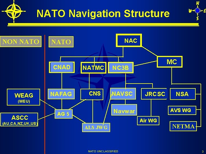
NATO Navigation Structure NON NATO WEAG NAC NATO CNAD NATMC NC 3 B NAFAG CNS NAVSC MC JRCSC NSA (WEU) ASCC (AU, CA, NZ, UK, US) AVS WG Navwar AG 5 Air WG ALS JWG NATO UNCLASSIFIED NETMA 3
NATO Main Mission Alliance fundamental tasks: Security, Peace Preservation and Euro. Atlantic Security Reinforcement 3 main Military Missions: • Article 5 collective defense • Non-article 5 crisis response • Consultation and co-operation NATO UNCLASSIFIED 4
Navigation Activities n n n Support to NAC and Senior Committees (NC 3 B, CNAD…) for Navigation, Approach and Landing Systems, Time and Frequency standards Support to MC and Military Structure Missions • Information exchange (equipment, development, R&D, • • • testing, new technologies…) Plans and policies (transition/implementation plans…) Standardisation (STANAGs development, maintenance, …) Collaborative efforts (international co-operation development and promotion, international test campaigns, …) NATO UNCLASSIFIED 5
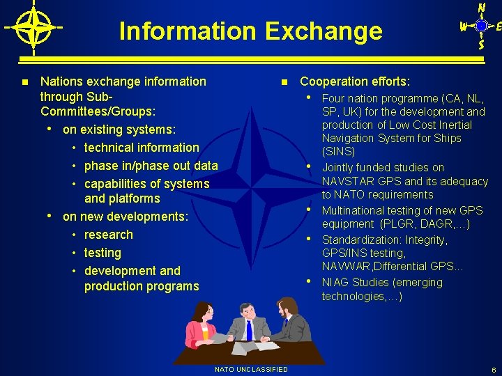
Information Exchange n Nations exchange information through Sub. Committees/Groups: • on existing systems: • technical information • phase in/phase out data • capabilities of systems and platforms • on new developments: • research • testing • development and production programs n NATO UNCLASSIFIED Cooperation efforts: • Four nation programme (CA, NL, • • SP, UK) for the development and production of Low Cost Inertial Navigation System for Ships (SINS) Jointly funded studies on NAVSTAR GPS and its adequacy to NATO requirements Multinational testing of new GPS equipment (PLGR, DAGR, …) Standardization: Integrity, GPS/INS testing, NAVWAR, Differential GPS. . . NIAG Studies (emerging technologies, …) 6

Navigation systems - Doppler Navigator - GPS/NAVSTAR - Differential GPS - Inertial Navigation Systems - Loran-C ( including Eurofix) - MLS (including DME-P) - PAR - ILS NAVIGATION - MIDS/JTIDS - Non Directional Beacons - Position Location Reporting Systems (PLRS) - SYLEDIS - TACAN - Terrain Reference Navigation - VOR/DME - Celestial Navigation Positioning Navigation Timing Approach and Landing Systems NATO UNCLASSIFIED 8

Navigation Policy n NATO navigation policy, strategy and requirements: • • “ANP-1 NATO Master Navigation Document” “NATO Strategic Plan for Air Navigation and Landing Systems” National PALS Implementation Strategies (NPIS) “Policy on Navigation Services for NATO Military Operations” Common Fitting Standards for Air Communication, Navigation, Identification and Landing Systems for Joint NATO/Pf. P Operations ALS NATO Staff Target NATO Staff Requirements and Military Operational Requirements Under development/approval • “NATO Strategic Plan for Joint Navigation and Landing Systems” • “Generic Operational Characteristics of Satellite Positioning, Navigation, Timing Services for NATO Military Operations” • Precision Approach and Landing System Transition Strategy NATO UNCLASSIFIED 9

Navigation Systems Evolution n n Emergence of satellite technology Evolution of of the global navigation environment • Emergence of Satellite Navigation (GNSS, RNSS) • Traditional ground-based systems/back-up systems 3 Existing or underdevelopment Systems • GPS, GLONASS, GALILEO NATO uses US GPS System • Only Available System Meeting NATO Military Requirements • NAVSTAR GPS MOU IV and Addendum • STANAGs • Permanent exchange of information among NATO Nations NATO UNCLASSIFIED 10
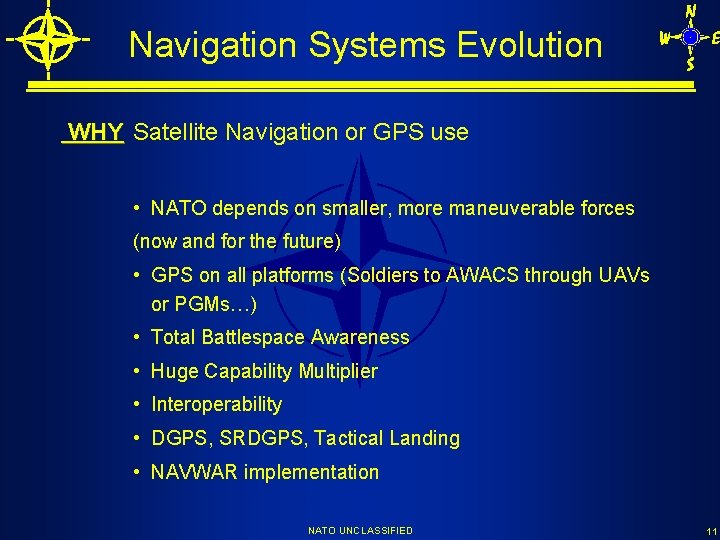
Navigation Systems Evolution WHY Satellite Navigation or GPS use • NATO depends on smaller, more maneuverable forces (now and for the future) • GPS on all platforms (Soldiers to AWACS through UAVs or PGMs…) • Total Battlespace Awareness • Huge Capability Multiplier • Interoperability • DGPS, SRDGPS, Tactical Landing • NAVWAR implementation NATO UNCLASSIFIED 11
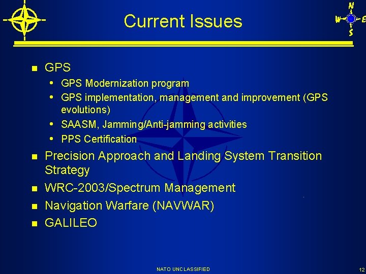
Current Issues n GPS • GPS Modernization program • GPS implementation, management and improvement (GPS evolutions) SAASM, Jamming/Anti-jamming activities PPS Certification n n • • Precision Approach and Landing System Transition Strategy WRC-2003/Spectrum Management Navigation Warfare (NAVWAR) GALILEO NATO UNCLASSIFIED 12
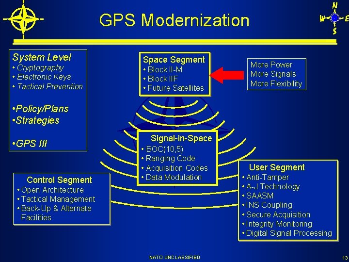
GPS Modernization System Level • Cryptography • Electronic Keys • Tactical Prevention Space Segment • Block II-M • Block IIF • Future Satellites More Power More Signals More Flexibility • Policy/Plans • Strategies • GPS III Control Segment Signal-in-Space • BOC(10, 5) • Ranging Code • Acquisition Codes • Data Modulation • Open Architecture • Tactical Management • Back-Up & Alternate Facilities NATO UNCLASSIFIED User Segment • Anti-Tamper • A-J Technology • SAASM • INS Coupling • Secure Acquisition • Integrity Monitoring • Digital Signal Processing 13
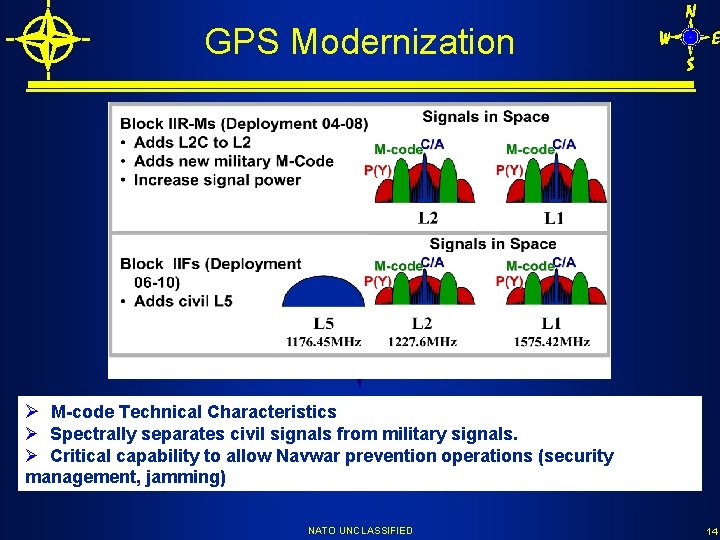
GPS Modernization Ø M-code Technical Characteristics Ø Spectrally separates civil signals from military signals. Ø Critical capability to allow Navwar prevention operations (security management, jamming) NATO UNCLASSIFIED 14
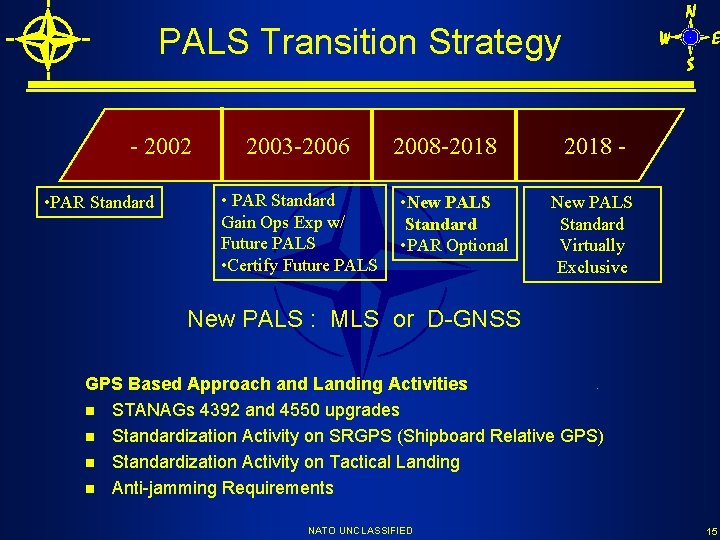
PALS Transition Strategy - 2002 • PAR Standard 2003 -2006 • PAR Standard Gain Ops Exp w/ Future PALS • Certify Future PALS 2008 -2018 • New PALS Standard • PAR Optional 2018 New PALS Standard Virtually Exclusive New PALS : MLS or D-GNSS GPS Based Approach and Landing Activities n STANAGs 4392 and 4550 upgrades n Standardization Activity on SRGPS (Shipboard Relative GPS) n Standardization Activity on Tactical Landing n Anti-jamming Requirements NATO UNCLASSIFIED 15
WRC-2003/Spectrum Management - Development of a NATO Military Position for WRC-03 to be approved by the NAC in March 2003 - Co-operation with the European Conference Preparatory Group (CEPG) and the Inter-American Telecommunication Commission (CITEL) - WRC 2003 Navigation Issues are mainly in 4 Agenda Items: • item 1. 4: 5091 -5150 MHz Band, use of the band by fixed-satellite service, impact on MLS • item 1. 15: 960 -1215 MHz, 1260 -1300 MHz and 5010 -5030 MHz Bands, Resolutions 604, 605 and 606 (MLS, Pf. D limits) • item 1. 17: 2900 -3400 MHz Band, Radiolocation allocation upgrade (impact on Radars) • item 1. 28: 108 -117. 975 MHz Band (DGPS corrections) NATO UNCLASSIFIED 16
NAVWAR (1) NATO NAVWAR definition “NAVWAR is defined as preventing the hostile use of Positioning, Navigation and Timing information while protecting the unimpeded use of the information by NATO forces and preserving peaceful use of this information outside the area of operations” NAVWAR AHWG “NATO must develop and implement a NAVWAR strategy that ensures availability of this information (PNT) to friendly forces and denies access to potential adversaries. ” NAVWAR ANP “Provide an overall NAVWAR framework and concepts in support of NATO military operations…” NATO UNCLASSIFIED 17
NAVWAR (2) n n Preventing Hostile use of PNT in an area of operations Supports critical and time sensitive military operations Denial of PNT services through security management (encryption, user equipment proliferation awareness and control…) Denial of PNT services through selectable spectrum/modulation techniques In the case of GPS Achieving spectrally separation of military services from civil services is a fundamental part of GPS Modernization and facilitates denial of non-military PNT at the scale of the local area of operations. NATO UNCLASSIFIED 18
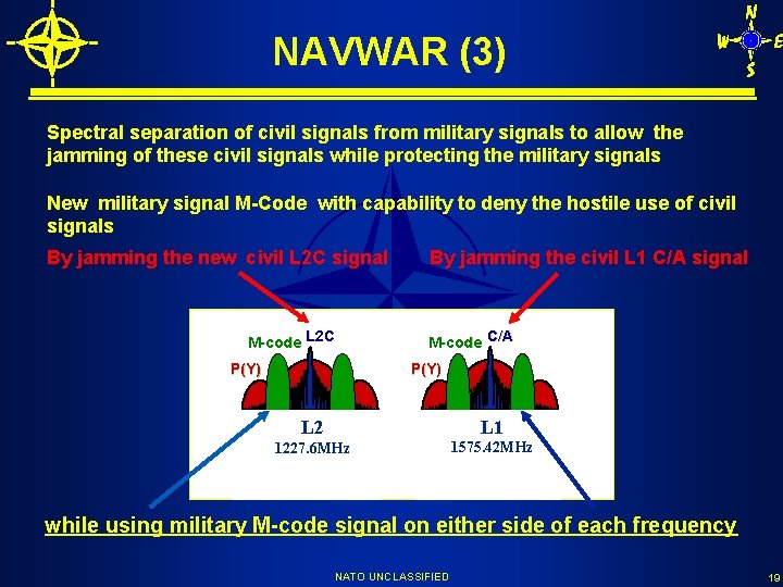
NAVWAR (3) Spectral separation of civil signals from military signals to allow the jamming of these civil signals while protecting the military signals New military signal M-Code with capability to deny the hostile use of civil signals By jamming the new civil L 2 C signal M-code L 2 C P(Y) By jamming the civil L 1 C/A signal M-code C/A P(Y) L 2 L 1 1227. 6 MHz 1575. 42 MHz while using military M-code signal on either side of each frequency NATO UNCLASSIFIED 19
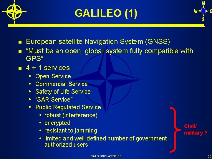
GALILEO (1) n n n European satellite Navigation System (GNSS) “Must be an open, global system fully compatible with GPS” 4 + 1 services • Open Service • Commercial Service • Safety of Life Service • “SAR Service” • Public Regulated Service • • robust (interference) encrypted resistant to jamming limited and well-defined number of governmentauthorized users NATO UNCLASSIFIED Civil/ military ? 20
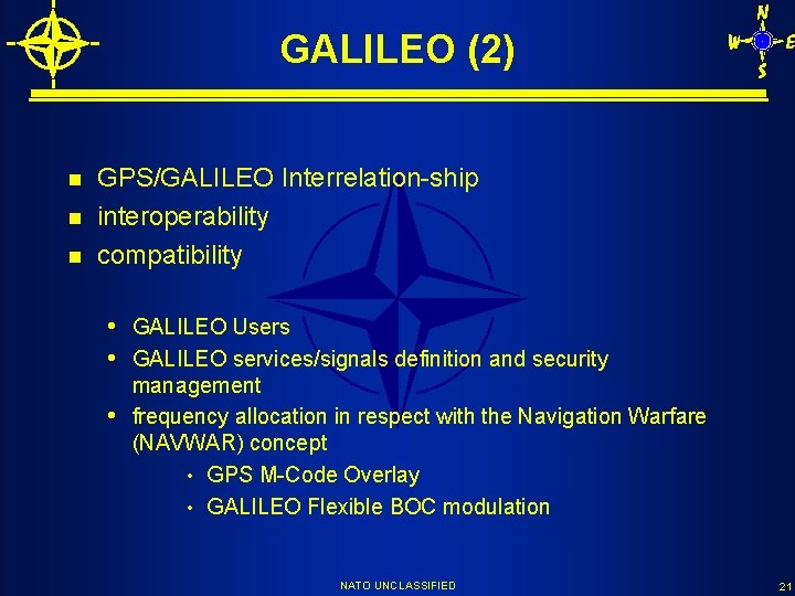
GALILEO (2) n n n GPS/GALILEO Interrelation-ship interoperability compatibility • GALILEO Users • GALILEO services/signals definition and security • management frequency allocation in respect with the Navigation Warfare (NAVWAR) concept • GPS M-Code Overlay • GALILEO Flexible BOC modulation NATO UNCLASSIFIED 21
M-code/PRS overlay M-code: BOC(10, 5) modulation on L 1 & L 2 PRS: BOC(n, m) on L 1 & E 6 partial/full overlay NATO UNCLASSIFIED 22
GALILEO (3) n NATO is not a “first line player” on GPS/GALILEO • no “NATO position” on GALILEO • GPS is US controlled/managed • GALILEO is EU controlled/managed BUT - GPS is a crucial capability for NATO - NATO needs to protect its Military Capabilities - NATO needs to protect its Forces - GALILEO impacts NATO UNCLASSIFIED 23
SUMMARY n n Navigation Information (or PNT) Dominance crucial for Military Operations Satellite Navigation importance/predominance Navigation Warfare to maintain military advantage during operations GALILEO impacts • can be negative • can be positive • highly dependent on US/EU cooperation and EU technical choices NATO UNCLASSIFIED 24
More information ? n On NATO • http: //www. nato. int n On NAFAG and ALS systems • http: //www. nato. int/nafag n On Navigation • nav. ident@hq. nato. int Jean-Philippe SAULAY tel. +32 22 707 4309 fax + 32 2 707 5709 nav. ident@hq. nato. int Georges THIBAUT tel. +32 22 707 4288 fax + 32 2 707 xxxx g. thibaut@hq. nato. int NATO UNCLASSIFIED 25
- Slides: 24