Satellite information on the ocean surface Scatterometer and


.")
 § Day and")
 that are in resonance")


: ü SCAT on ERS-1, ERS-2")


 - wind selection based on")


 U An Incr @ 18 h ML 114 ML")


 slope of leading edge SWH power waveform time ü SWH")
 ERS-1 15 Aug. 1993 ERS-2 1 May 1996")


- Slides: 38
Satellite information on the ocean surface: Scatterometer and Altimeter 15 March 2016 Giovanna De Chiara with contributions from Saleh Abdalla, Magdalena Balmaseda, Hao Zou, Patrick Laloyaux © ECMWF
Outline Scatterometer Winds ü ü The importance of scatterometer wind observations Scatterometer principles Data usage at ECMWF and their impact How we can improve usage and impact Altimeter Wind, Waves, Sea Surface Height ü Altimeter principles ü Use of altimeter data in the wave and ocean models ü Altimeter data impacts
Why is Scatterometer important? The scatterometer measures the ocean surface winds (ocean wind vector). Ocean surface winds: § affect the full range of ocean movement § modulate air-sea exchanges of heat, momentum, gases, and particulates § direct impact on human activities Wind observations below 850 h. Pa FSO values relative quantities (in %) Wide daily coverage of ocean surface winds Ex: 1 day of ASCAT-A data [Horanyi et al. , 2013]
Scatterometer ü A Scatterometer is an active microwave instrument (side-looking radar) § Day and night acquisition Incoming § Not affected by clouds Returned ü The return signal, backscatter (σ0 sigma-nought), is sensitive to: § Surface wind (ocean) § Soil moisture (land) § Ice age (ice) ü Scatterometer was originally designed to measure ocean wind vectors: § Measurements sensitive to the ocean-surface roughness due to capillary gravity waves generated by local wind conditions (surface stress) § Observations from different look angles: wind direction
Scatterometer Bragg scattering occurs from the ocean capillary-gravity waves (cm-range) that are in resonance with the microwaves The amount of backscatter depends on: ü The frequency and polarization of the emitted wave § C-band (5. 3 GHz): λ ~ 5. 6 cm § Ku-band (14. 6 GHz): λ ~ 2. 1 cm Backscatter highly depends on: ü Wind speed ü Relative direction between the surface wind and look angle ü Incidence angle
Dependency of the backscatter on. . . Wind speed
Dependency of the backscatter on. . . Wind direction upwind downwind crosswind Wind direction wrt Beam § § Asymmetry Upwind – Downwind (particularly small) Asymmetry Upwind – Crosswind
Dependency of the backscatter on. . . Wind direction Backscatter response depends on the relative angle between the pulse and capillary wave direction (wind direction) Mid Fore Beam Mid Beam Wind direction wrt Mid Beam Fore Aft Beam C-band SCAT geometry Wind direction wrt Mid Beam Aft Wind direction wrt Mid Beam
How can we relate backscatter to wind speed and direction? ü The relationship is determined empirically § Ideally collocate with surface stress observations § In practice with buoy and 10 m model winds U 10 N: equivalent neutral wind speed : wind direction w. r. t. beam pointing : incidence angle p : radar beam polarization : microwavelength ü Geophysical model functions (GMF) families § C-band: CMOD (currently CMOD 5. N) § Ku-band: NSCAT, QSCAT
How can we relate backscatter to wind speed and direction? For the C-band data, σ0 triplets lies on a double conical surface z_mid σ0 triplets with the same wind speed CMOD 5 0° 180° 0 ° or 180 °? ? ? z_aft r z_fo 270° e [Stoffelen] 90° ü Wind inversion: search for minimum distances between the σ0 triplets and all the solutions on the GMF surface. ü Noise in the observations can change the position wrt the cone: wind direction ambiguities
C- band scatterometers Used on European platforms (1991 onwards): ü SCAT on ERS-1, ERS-2 by ESA ü ASCAT on Metop-A, Metop-B by EUMETSAT § f~5. 3 GHz (λ~5. 7 cm) § VV polarization § Three antennae Pros and cons: ü ü Hardly affected by rain High quality wind direction (especially ASCAT) Two nearly opposite wind solutions Rather narrow swath: § ERS-1/2: 500 km § ASCAT-A/B: 2 x 550 km
Ku-band scatterometers Used on US, Japanese, Indian and Chinese platforms: ü ü NSCAT, Quik. SCAT, Sea. Winds by NASA (and Japan) Oceansat by ISRO Haiyang-2 A by China Rapid. SCAT on the ISS § f~13 GHz (λ ~ 2. 2 cm) § VV and HH polarization: § Two rotating pencil-beams (4 look angles) Pros and cons: ü Up to four wind solutions (rank-1 most often the correct one) ü Broad swath (1, 800 km) OSCAT daily coverage ü Affected by rain ü Problems regarding wind direction: § azimuth diversity not good in centre of swath § outer 200 km only sensed by one beam.
Operational usage of scatterometer winds at ECMWF 95 96 97 98 99 00 01 02 03 04 05 06 07 08 09 10 11 12 13 14 15 16 ERS-1 ERS-2 (Regional Mission Scenario) ERS-2 Quik. SCAT METOP-A ASCAT METOP-B ASCAT Oceansat-2 (OSCAT) (Rapid. SCAT) C-Band Ku Band Under Monitoring
Scatterometer assimilation strategy C-band Ku-Band Resolution 25 km 50 km σ0 bias correction √ - Wind Inversion ECMWF KNMI Wind Speed bias correction √ √ QC – Sea Ice check √ √ Rain flag check - √ Thinning 100 km - Maximum wind speed assimilated 35 m/s 25 m/s Assigned observation error 1. 5 m/s 2 m/s 4 D-Var 2 solutions 1 solution Assimilated as 10 m eq. neutral wind (U&V) √ √
Scatterometer assimilation strategy ü C-band: Ambiguous vector wind (U&V) - wind selection based on background winds ü Purely quadratic cost function ü For SCATT, 10 m equivalent neutral wind (ENW), rather than 10 m wind are used to take into account for stability effects: § for stable atmospheric stratification ENW is smaller than wind § for unstable atmospheric stratification ENW is larger than wind § on average the difference is 0. 2 m/s
ASCAT-A wind data
s the model able to vertically propagate the inf Single observation experiments TC Haiyan – CY 40 R 1 2013110712 [Assimilation Window 9 - 1 ASCAT-A obs @ 1 pm Philippines
Single Observation Experiments (1 ASCAT-A) U An Incr @ 18 h ML 114 ML PL(h. Pa) Model Levels Res ~ 16 km 137 ~ 1013 114 ~ 850 96 ~ 500 79 ~ 250 60 ~ 100 U An Incr @ 18 h 50 100 137 V An Incr @ 18 h 100 S N 137 S N
Impact of scatterometer winds Contribution to the reduction of the 24 h Forecast Error (total dry energy norm) [Cardinali, 2009] Global statistics with respect to the total observing network Dec 2012 / Feb 2013
Impact of scatterometer winds on Tropical Cyclone FC ü For each storm the min SLP have been detected from the ECMWF model fields ü SLP have been compared to observation values (from NHC and JMA) Statistics based only on cases where ASCAT-A, ASCAT-B and OSCAT passes were available Dec 2012/ Feb 2013
Impact of scatterometer winds …on the ocean parameters Temperature difference Scatt – No. Scatt November 2013 Verified against conventional temperature observations Tropical Atlantic Tropical Indian Tropical East Pacific [P. Laloyaux]
How can we improve usage and impact? ü Include dependency from other geophysical quantities such as ocean currents § Stress is related to relative wind § The observation operator should act on relative wind § Accurate ocean current input are needed ü Improve QC mostly for extreme events § Because of thinning and QC the strongest winds can be rejected ü Test on the observation error, thinning and use of high resolution products TC Haiyan 10 m ASCAT-A wind speed 10 m FG wind speed
TC QC issues CTRL Var. QC/Thin=4/Obs. Err=1. 5 m/s Var. QC / Thin=2 TC KILO – 2015090812 HN HN & Thin=2 & Obserr=0. 5
Scatterometer Concluding remarks Scatterometer observations widely used in NWP ü ü Ocean wind vectors Positive impact on analysis and the forecast Global scale and extreme events Impact on Atmospheric, Ocean and Wave model ECMWF has a long experience with scatterometry ü Available continuously from 1991 onwards: ü GMF development ü Monitoring, validation, assimilation, re-calibration On-going efforts to improve usage and impact ü Improve QC ü Adapt observation errors, thinning, super-obbing ü Include dependency from other geophysical quantities Use in the Reanalysis ü ERS 1/2 and Quik. SCAT in ERA-Interim ü ASCAT-A reprocessed products used in ERA 5 Typhoon Haiyan 20131107 ASCAT-A ASCAT-B OSCAT
Radar Altimeters Sentinel-3 ü Radar altimeter is a nadir looking instrument. ü Specular reflection. ü Electromagnetic wave bands used in altimeters: § Primary: Radar Altimeter (SRAL) • Ku-band (~ 2. 5 cm) – ERS-1/2, Envisat, Jason-1/2/3, Sentinel-3 • Ka-band (~ 0. 8 cm) – SARAL/Alti. Ka (only example) § Secondary: • C-band (~ 5. 5 cm) – Jason-1/2/3, Topex, Sentinel-3 • S-band (~ 9. 0 cm) – Envisat 1 -day coverage ü Main parameters measured by an altimeter: § Sea surface height (ocean model) § Significant wave height (wave model) § Wind speed (used for verification)
How Altimeter Works Height=∆t/2 c radar signal a t m o s p h e r e ocean surface illuminated area emitted signal returned signal flat surface power Power of illumination rough surface time
Sea Surface Height power waveform time ü Time delay sea surface height ü Radar signal attenuation due to the atmosphere is caused by: § Water vapour impact: ~ 10’s cm. § Dry air impact: ~ 2. 0 m Correction made using radiometer and model data
Surface wind speed power waveform emitted signal ü ü backscatter amplitude of returned signal wind speed time Backscatter is related to water surface Mean Square Slope (MSS) MSS can be related to wind speed Stronger wind higher MSS smaller backscatter Errors are mainly due to algorithm assumptions, waveform retracking (algorithm), unaccounted-for attenuation & backscatter.
Significant Wave Height (SWH) slope of leading edge SWH power waveform time ü SWH is the mean height of highest 1/3 of the surface ocean waves ü Higher SWH smaller slope of waveform leading edge ü Errors are mainly due to waveform retracking (algorithm) and instrument characterisation.
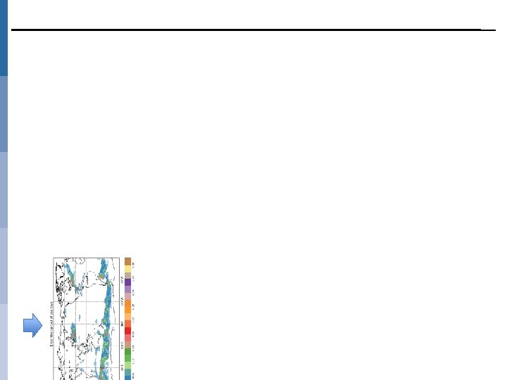
Operational Assimilation of SWH (wave model) ERS-1 15 Aug. 1993 ERS-2 1 May 1996 Envisat 22 Oct. 2003 Jason-1 Envisat 1 Feb. 2006 Jason-2 Envisat 10 Mar. 2009 Jason-1 Jason-2 Envisat 8 Jun. 2009 1 Apr. 2010 Jason-2 7 Apr. 2012 Jason-3 OGDR (~Q 2, 2017); Sentinel-3 (~Q 2, 2017). Assimilation method for SWH data: ü Data are subjected to a quality control process (inc. super-obbing). ü Bias correction is applied. ü Simple optimum interpolation (OI) scheme on SWH. ü The SWH analysis increments wave spectrum adjustments… Jason-2 Cryosat-2 SARAL 12 May 2015
Impact of SWH assimilation Impact of one additional altimeter on the SWH analysis [CS & J 2] - [J 2 only]
Altimeter data in the Ocean Model The altimeter measures the range which can used to determine Sea Surface Height (SSH) SLA = Sea Level Anomaly SLA SSH Assimilated in the ocean model 10 cm 30 m From sea level observation it is possible to infer information on the vertical density structure
El Nino 2015/2016 SL Anomalies Feb 2016 Lon/Depth Temp anom Feb 2016
Operational Assimilation of SLA ü Sea surface height observations from satellite (i. e. AVISO L 3 along track SLA data) are assimilated in ECMWF ocean reanalysis (ORAS 4, ORAP 5 and ORAS 5) system using NEMOVAR. ü Satellite data includes observations from ERS-1/2, Envisat, Jason-1/2 and Topex/Poseidon (In the future also Alti. Ka, HY-2 A). ü The SLA along track data has very high spatial resolution for the 1 degree “class” of ocean assimilation systems Features in the data which the model can not represent. This can be dealt with in different ways: § Inflate the observation error to account for non representativeness of the “real” world in the assimilation system § Construction of “superobs” by averaging § Thinning Obs SLA 10 days Model (1 deg) SLA in 10 days
Impact of SLA assimilation Impact of assimilating altimeter SLA: Time correlation with altimeter SL product CNTL NEMOVAR TS ORAS 4 (TS+Alti)
Altimeter Concluding remarks ECMWF has a long experience with altimetry in the wave model ü Available continuously from 1993 onwards: § ERS 1/2, Envisat, Jason 1/2, Cryosat, Saral… § Future missions: Jason-3, Sentinel-3, … Altimeter wind and wave data are used for: ü Data assimilation ü Error estimation ü Use in reanalyses (assimilation and validation) ü Long term assessments & climate studies ü Monitoring of model performance (inc. model resolution) & Assessment of model changes Altimeter sea level anomaly: ü Use for assimilation and validation ü Significant impact for surface and sub-surface ocean ü Importance for reanalysis and climate studies ü Uncertainty from the ensemble members potentially used for model error