Satellite Basics MAC Smog Blog Training CATHALAC Panama

Satellite Basics MAC Smog Blog Training CATHALAC, Panama, Sept 11 -12, 2008 Jill Engel-Cox & Erica Zell Battelle Memorial Institute engelcoxj@battelle. org, 703 -875 -2144 zelle@battelle. org, 703 -236 -1420

U. S. Ambient Air Monitoring l National Ambient Air Quality Standards à Carbon monoxide, lead, nitrogen dioxide, sulfur oxides, particulate matter (PM 10 and PM 2. 5), and ozone l Typical Real-time Monitors à Hourly Ozone (ppb) à Hourly PM 2. 5 ( g / m 3) l Converted to health-based air quality index (AQI) l Available on U. S. Environmental Protection Agency’s AIRNow website (http: //www. airnow. gov)
")
Key NASA air quality satellite sensors Moderate Resolution Imaging Spectroradiometer (MODIS)

How a Polar Orbiting Satellite orbits…

How a polar orbiting satellite orbits…
 l")
Satellite Data Available for Air Quality l Most useful for particulate matter (PM) l Type of information relevant to PM: àTrue Color (Red, Green, Blue - RGB) - looks like a photograph but is data, shows haze, dust, & smoke àAerosol Optical Depth (AOD) - Non-dimensional measure of total column (satellite-ground) extinction l Limited but improving information on groundlevel ozone, SO 2, CO, vertical distribution of PM l All data is “free”, available globally

MODIS True Color Image 6 July 2002 Engel-Cox, J. et. al. 2004. Atmospheric Environment.

Transport Case Study Illustration MODIS RGB L 1 B Image 25 June 2002 Haze Cloud Sunglint Data provided by NASA Goddard Space Flight Center. Image processed by Battelle using MODIS HDF Look.

MODIS Aerosol Optical Depth 25 June 2002 Data provided by NASA Goddard Space Flight Center. Image processed by Battelle using MODIS HDF Look.
 vs. PM 2. 5 (Ground)")
Relation to Ground-based Data Aerosol Optical Depth (AOD) vs. PM 2. 5 (Ground)

Quantitative Analysis: PM 2. 5 Concentrations vs. MODIS AOD STN-M Site Locations 120 IMPROVE Site Locations PM 2. 5 (μg/m 3) Eastern U. S. , April-September 2002 105 PM 2. 5 (μg/m 3) = 23 AOD + 7 90 N=14, 000 75 60 45 30 15 0 0. 2 0. 4 0. 6 0. 8 1. 0 1. 2 1. 4 Aerosol Optical Depth (unitless) Engel-Cox, J. et. al. 2004. Atmospheric Environment. 1. 6

Engel-Cox, J. et. al. 2004. Atmospheric Environment.

Initial Correlations by Season Daily Fine Mass Winter Spring Summer Fall

July 9 High altitude smoke July 21 Mixed down smoke Old Town TEOM MODIS AOD Aug 10 Normal haze Aug 24 Transported haze MODIS Aerosol Optical Depth PM 2. 5 ( g/m 3) Baltimore, MD Summer 2004
 http: //modis-atmos. gsfc. nasa. gov/ http:")
Sources Sensor Site Moderate Resolution Imaging Spectroradiometer (MODIS) http: //modis-atmos. gsfc. nasa. gov/ http: //rapidfire. sci. gsfc. nasa. gov/ http: //eosdb. ssec. wisc. edu/modisdirect/ Data Sites NASA Goddard Space Flight Center DAAC http: //daac. gsfc. nasa. gov/ NASA Langley Atmospheric Sciences Data Center http: //eosweb. larc. nasa. gov/ NASA Level 1 and Atmosphere Archive and Distribution Center https: //ladsweb. nascom. nasa. gov: 8300/ Imagery Sites NASA Earth Observatory http: //earthobservatory. nasa. gov/ NASA Visible Earth http: //visibleearth. nasa. gov/ NOAA Operational Significant Event Imagery U. S. Air Quality (“Smog Blog”) http: //www. osei. noaa. gov/ http: //alg. umbc. edu/usaq/
 IDEA: http: //idea. ssec. wisc. edu/")
Aerosol Optical Depth (AOD) IDEA: http: //idea. ssec. wisc. edu/

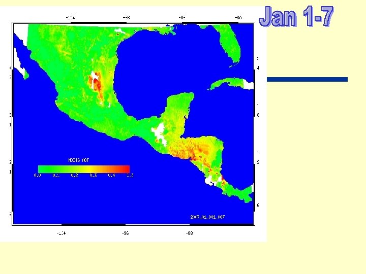
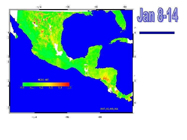
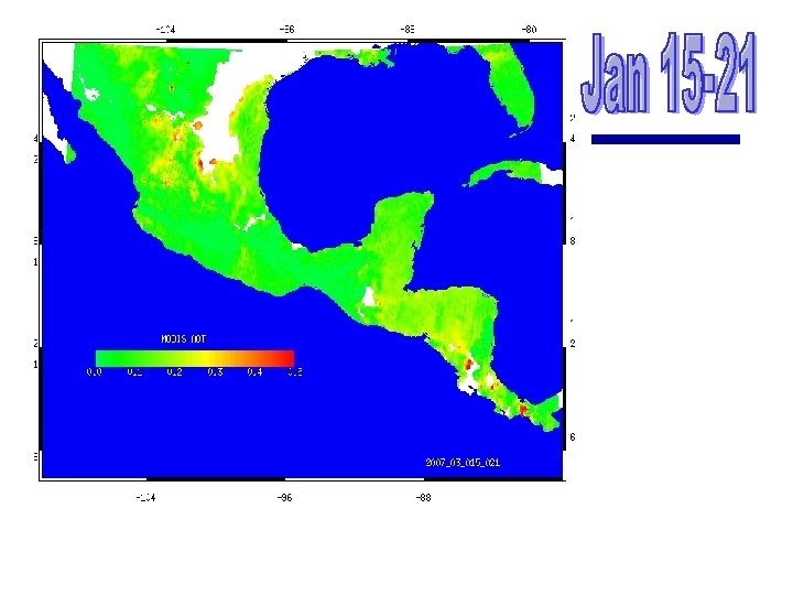
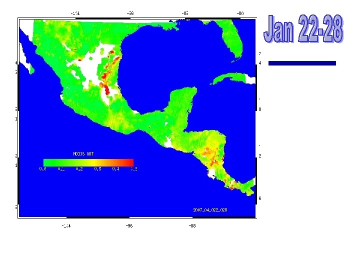
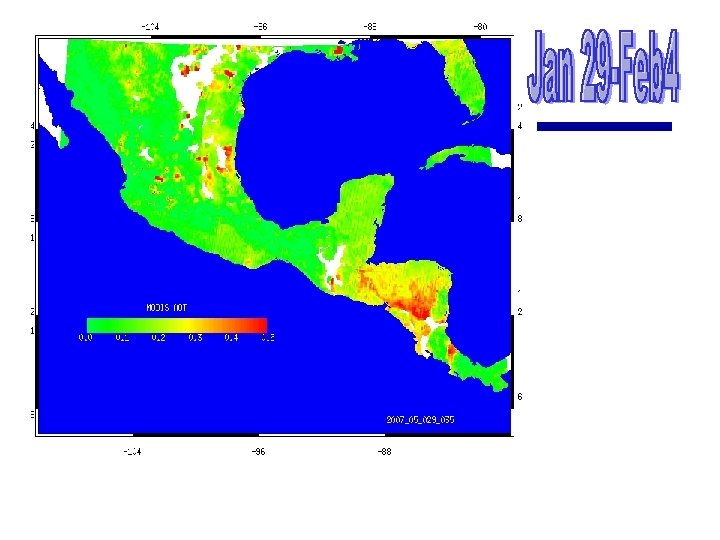
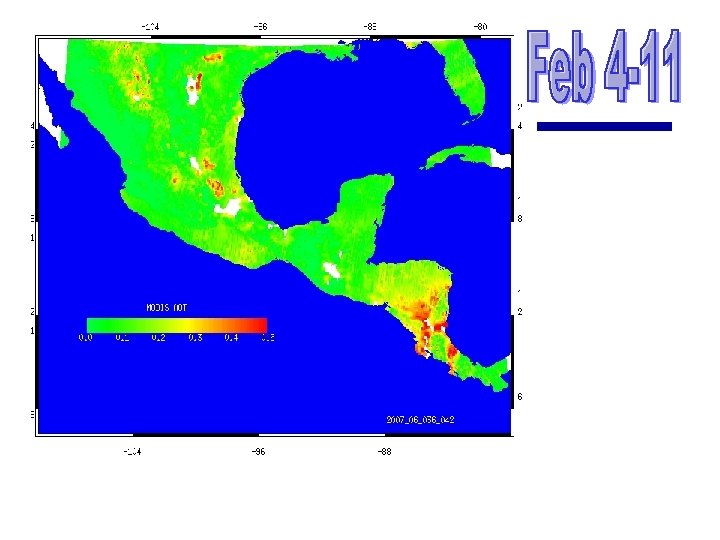
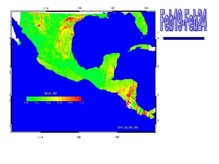
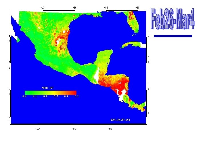
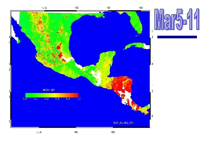
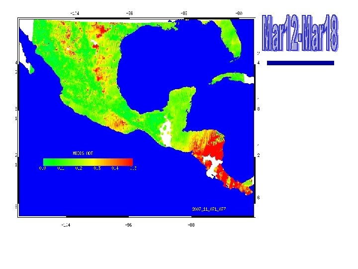
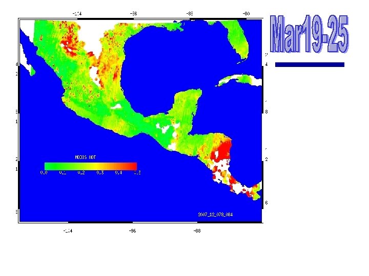
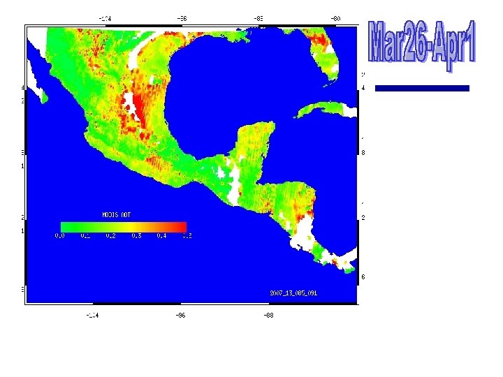
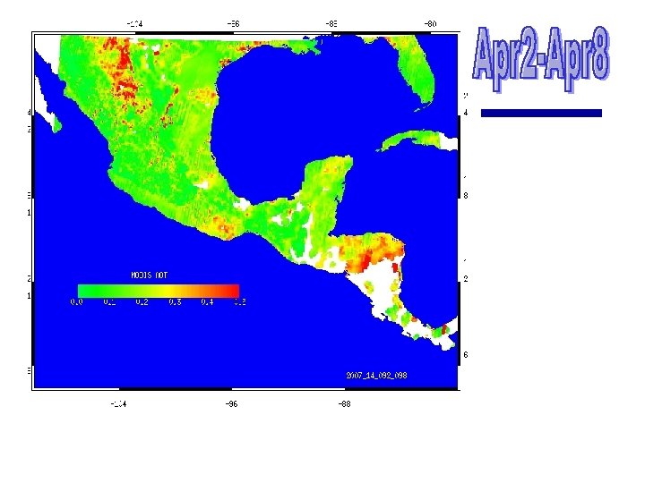
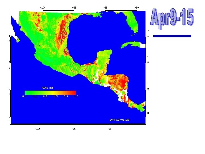
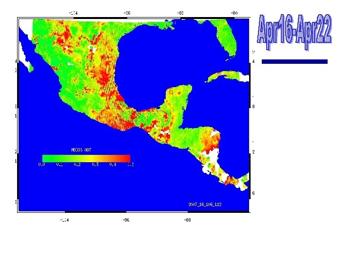
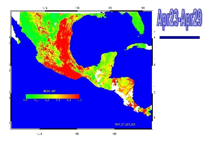
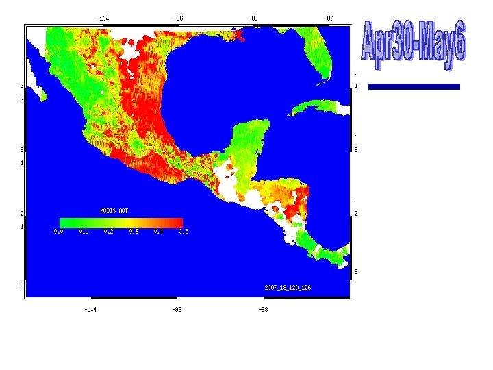
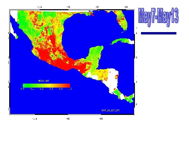
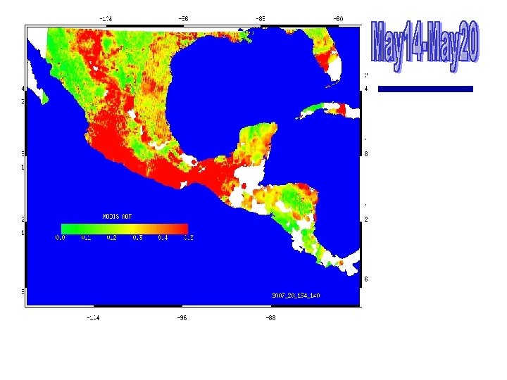
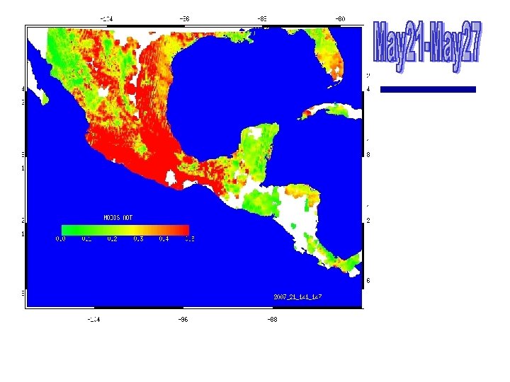
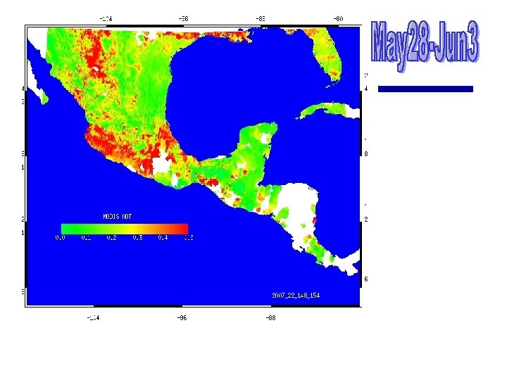
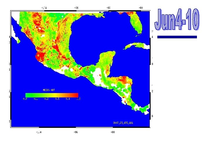
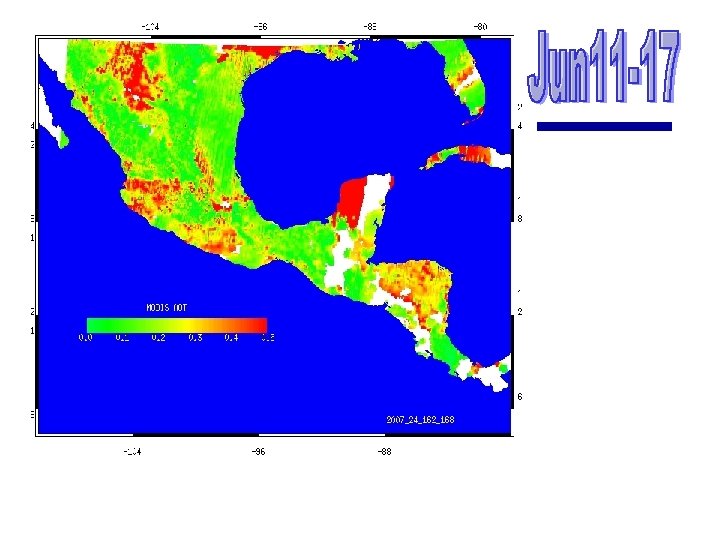
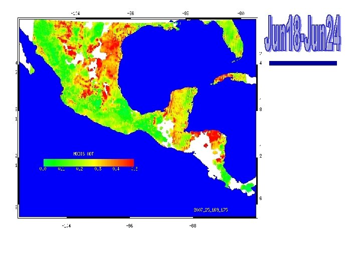
Meso. America Aerosol Optical Depth from MODIS Sundar A. Christopher The University of Alabama in Huntsville l Weekly Composites of MODIS Aerosol Terra Optical Depth for 2007 l Weekly Composites from one satellite provides increases spatial coverage l Further work will use data fusion approaches to combine both Terra and Aqua to fill in the gaps.


Questions?
- Slides: 43