RV ALGUITA AND ALGALITA FOUNDER CHARLIE MOORE Capt


 Get each attribute from Field & Lab b)")


- Slides: 23
RV ALGUITA AND ALGALITA FOUNDER CHARLIE MOORE Capt. Charles Moore with Marine Debris - 2008 Voyage Algalita Marine Research Institute www. algalita. org
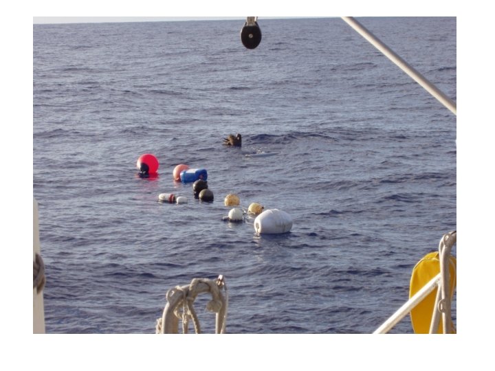
THE MANTA TRAWL
BONGO NETS
TYPES OF FIELD DATA Location: latitude/longitude Time: trawl start and stop Distance Trawl Dimensions Vessel Readings: boat speed, wind speed, barometric pressure, sea state, water temp etc • Observations: wave height, swell height, organisms • More • • •
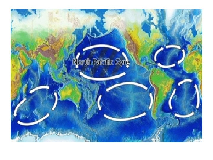
NORTH PACIFIC GYRE SIZE AND TYPE DATA SHEET Site No: Sample Date Lab Technician Longitu Latitude de Trawl Type 0 SIZE 0 Fragments Ct Wt Pellets Ct Wt Line Ct >4. 75 mm 2. 80 -4. 749 mm 1. 00 -2. 79 mm 0. 710 -0. 999 mm 0. 500 -0. 709 mm 0. 355 -0. 499 mm TOTAL COUNTS Tot Count Dens (Count/m 3) TOTAL PLANK TON WET DRY WT (A+B) WT (G) Combn d wt Tare wt Plankto n Wt manta DRY /WE T #DIV /0! Plastic/ Plankto n ratio Thin Film Wt Ct Wt Foam Ct Wt TOTAL COUNT TOTAL WEIGHT Ct Wt
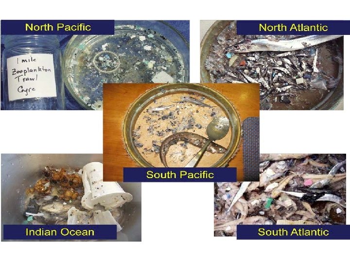
Research Questions • Where is the highest density of plastics in the oceans? • Does sea state impact the amount of plastic collected? • What species are living in environments with high plastic density? Need Data!…
GIS TOOL • ETL = Extract, Transfer, Load
Field & Lab Workbook Data Load Tool Algalita GDB
Tool Overview • Arc. GIS for Desktop 10. 2 • Python script using arcpy, xlrd module • A cross reference file is used to ‘map’ from the Field & Lab sheet to the GDB • 3 main steps • Create Geometry • Get Field & Lab Attributes • Populate GDB
1. 2. 3. 4. Get coordinates from Field & Lab Format to decimal degrees Create start and end point (arcpy. Point) Create line (arcpy. Array; arcpy. Polyline) TRAWL START Time Start Lat (N/S) Start Lon (E/W) Start 1: 45 -22, 32. 44 -6, 11. 32 TRAWL END Time End Lat (N/S) End Lon (E/W) End 2: 45 -22, 35. 11 -6, 12. 7 Lat -22. 35. 11 Long -6, 12. 7 Create Geometry Lat -22. 32. 44 Long -6, 11. 32
5. Use cross reference file a) Get each attribute from Field & Lab b) Map to field in GDB 6. Create Dictionary with ‘Field’ and ‘Value’ Get Field & Lab Attributes Dict = {}; Dict[Sample. ID] = [[Field], [Value]] Trawl # Date Size & Type Sea. Dragon 01152011_4 1/17/2011 Fragment Pellet … TOTAL > 4. 75 3 3 2. 80 -4. 749 4 7 11 30 7 44 … TOTAL {Sea. Dragon 01152011_1 : [[Trawl#, Sz_1_Ct, Sz_2_Ct], [Sea. Dragon 01152011_4, 3, 11]]
7. Add new feature to Trawl feature class arcpy. da. Insert. Cursor; insert. Row Populate GDB