Russian Current Perspective Satellite System Eduard Podgayskiy Grigory

 (запущен 20.")


 Main sensors: PSS (Panchromatic Imaging System): PSS")
- Slides: 10
Russian Current & Perspective Satellite System Eduard Podgayskiy, Grigory Chichasov Materials provided by Vasily Asmus VLMG-6, São José dos Campos, Brazil 8 -12 October 2012
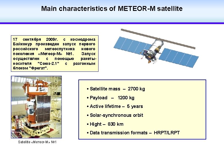
PLANNED RUSSIAN EARTH OBSERVATION SATELLITE SYSTEM (запущен 17. 09. 2009 г. ) (запущен 20. 01. 2011 г. )
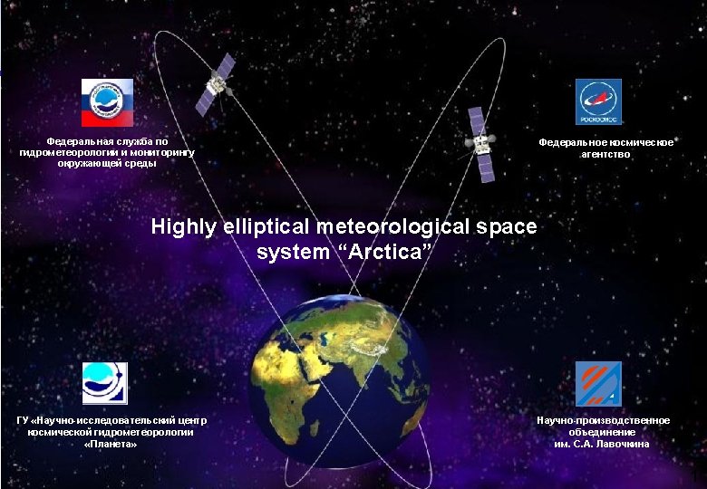
Planned launches of Russian earth observation satellites (Federal space programme of Russia for 2006 -2015) Геостационарная метеорологическая система 2009 2010 2011 2012 2013 2014 2015 2016 2017 2018 2019 2020 2021 2022 Electro № 1 (76°E) – launched 20. 01. 2011 Electro № 2 (14, 5° W) Electro № 3 (166° E) METEOR № 2 METEOR № 3 (Oceanographic) METEOR № 4 METEOR № 5 METEOR № 6 (Oceanographic) Космическая система «Арктика» Полярно-орбитальная метеорологическая система METEOR № 1 - launched 17. 09. 2009 г. ARKTIKA-М № 1, 2 ARKTIKA-R № 1, 2 Природноресурсные спутники CANOPUS-V № 1 launched 22. 07. 2012 CANOPUS-V № 2 RESURS-P № 1 RESURS-P № 2
Geostationary satellite ELECTRO-L • Three-axis high-precision stabilisation • Total mass - 1500 kg • Payload - 370 kg • Active lifetime – 10 years • Точка стояния – 76°E • Data transmission formats –HRIT/LRIT • Images received every 30/15 min
Environmental satellite KANOPUS-V (launched 22. 07. 12) Main sensors: PSS (Panchromatic Imaging System): PSS is an instrument to provide panchromatic imagery for environmental monitoring, agriculture and forestry. It provides high resolution imagery of 2. 5 m on a swath of 20 km. The spectral range is 0. 5 -0. 8 µm. MSS (Multispectral Imaging System): MSS is an instrument to provide multispectral imagery of land coastal surfaces and ice cover. It provides a spatial resolution of 12 m on a swath of 20 km. Four spectral bands are provided: 0. 5 -0. 6 µm; 0. 6 -0. 7 µm; 0. 7 -0. 8 µm; 0. 8 -0. 9 µm. MSU-200 (Multispectral Scanner Unit): MSU-200 is an instrument to provide imagery of land sea surfaces and ice cover. The spatial resolution is 25 m on a swath of 250 km. The spectral coverage is 0. 54 -0. 86 µm. • Monitoring of man-made and natural emergencies, including natural weather phenomena; • Mapping; • Detect pockets of forest fires and emissions of major pollutants in the environment; • Registration abnormal physical phenomena for earthquake prediction; • Monitoring of agriculture, water and coastal resources • Land use