RUSLE 2 Advanced Data Management n n Linda

 Soil map unit")


- Slides: 45
RUSLE 2 Advanced Data Management n n Linda Scheffe, NSSC Agronomist (NRCS RUSLE 2 database manager) Giulio Ferruzzi, WNTSC Agronomist (NRCS RUSLE 2 science lead) Steve Boetger, ENTSC Agronomist Steve Woodruff, ENTSC Agronomist/Forage Specialist Updated April 2015 1
Field Office User Selects – 1. 2. 3. 4. Location (climate) Soil map unit component Slope length and steepness Crop Management (Use Rotation Builder to develop rotation) 5. Supporting Practices
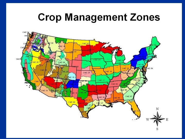
Crop Management Zones n n Map represents common crop management zones or areas where the same crops are grown under similar climatic conditions. Prepared in 2001 to 2004 by Dave Lightle, Agronomist at the NRCS National Soil Survey Center in Lincoln, Nebraska and was designed to be used to organize sets of crop management scenario templates for use in implementing the RUSLE 2 and WEPS models. The CMZ map provided the basis for the creation of standard sets of crop management scenarios for use in areas where the agriculture is similar. Provides level of consistency between counties and field offices within the same crop management zone. 5
Crop Management Zones n n Information sources included: USLE EIdistribution data and Figure 9 from Agriculture Handbook 537, the C-factor zone map previously used in implementing RUSLE 1, National Agriculture Statistics Service (NASS) data on major crops grown and the Usual Planting and Harvest dates for these crops within the crop reporting regions. In addition, Land Resource Regions, Major Land Resource Areas and the USDA Plant Hardiness Zones were also considered in establishing the 6 CMZ zone boundaries.
Crop Management Zones n Input and concurrence was received from all NRCS State Agronomists and Regional RUSLE 2 coordinators during the process in establishing the boundaries, and normalizing the boundaries to county boundaries and to major topographic features in order to aid in the implementation of RUSLE 2 and WEPS in NRCS field 7
Crop Management Zones n Over 30, 000 crop management templates in 78 crop management zones in the Continental US, Caribbean, and Hawaii/Pacific Basin have been updated for representative cropping and management systems, including energy use 8
RUSLE 2 CMZ Map
CMZ Lead Responsibilities n n n Maintenance of CMZ a: and b: management records Work with state agronomists in Zone to achieve input and consensus for CMZ content Request from state agronomists yearly to provide updated CMZ templates
CMZ Lead Responsibilities n CMZ lead provides updated a, b, c and d folders to regional agronomist and RUSLE 2 database manager for review and processing (into Land Management Operations Database and official website)
CMZ Lead Responsibilities n CMZ lead provides updated a, b, c and d folders to regional agronomist and RUSLE 2 database manager for review and processing (into Land Management Operations Database and official website)
State Agronomist Responsibilities n n n Maintenance of CMZ a and b folders with CMZ lead (includes new managements with new vegetations) State agronomists request most representative and utilized c: management records from field offices and then make into a or b records and forward to CMZ lead Maintain soils data for each soil survey area
State Agronomist Responsibilities n n n Request new vegetations/operations to be built through regional agronomist and db manager. Provide area/field office databases and instructions on how to archive/update Should build statewide moses database containing climate, soils, management templates of entire state (for state agronomist use)to enable troubleshooting and overall quality
State Agronomist Responsibilities n n Provide area/field office training Provide ongoing input for changing needs for integrated erosion prediction technology, resources, tools, training State agronomist RUSLE 2 access allows higher access than field office access (should only be one person in state with state agronomist access unless requested in writing) Access only works for version you were
3084 Climate records in the 40 eastern states 7408 Climate records in the 11 western states plus Hawaii, PAC Basin and Caribbean area 594 Support Practice choices 29, 310 Crop Management Scenario Templates in 78 CMZ’s (so far) 611 Tillage and Field operations records 140 Different plant residue records 1, 048, 659 Soil Component records in 649, 032 map units in 3100 Soil Surveys 1360 Crop and vegetation records
Soils Data State Action: * • NASIS SSURGO Downloads created for each county • State agronomist does RUSLE 2 Import for each county from the SSURGO download files Climate Data Developed and Exported Portland NWCC Action • State agronomist creates RUSLE 2 Export file for each county and sends to database manager Database Manager Management Templates Operations Data State Action: * Vegetation Data • CMZ leader coordinates and develops templates, then creates RUSLE 2 export by CMZ and sends export file to database manager Residue Data Practices Developed by: Database Manager: Linda Scheffe Science Lead: Giulio Ferruzzi RUSLE 2 Data Flow Sets Access & Permissions Field Office Computer or private RUSLE 2 user RUSLE 2 Website http: //fargo. nserl. purdue. edu/rusle 2_dataweb/RUSLE 2_Index. htm • Install RUSLE 2 Program • Customize the Base NRCS Database • Copy the necessary files and import into base database • RUSLE 2 Download (Install file) - xyz County Soils * • Base NRCS Database (No soils, climate or management) - State Climate * - CMZ Templates** • Soils by County - 2600 +/- files a: Single Year ** • Climate Data - 50 State files b: Multi-Year ** • Management Templates - 78 CMZ files c: FO created Management “Records” (RWCD permissions at FO level); possibly use State policy to manage development at the FO level (Will eventually migrate to Data Warehouse) * State Agronomist can read, copy, and delete (R-CD) Read only at the FO Level (R---), RWCD for State Agronomist ** State Agron RWCD, Read only at the FO Level (R---)
How do the access and permissions work in RUSLE 2? n Provides a mechanism to limit user access to certain critical parts of the databases.
Permissions Table edited by Database Manager
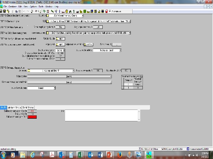
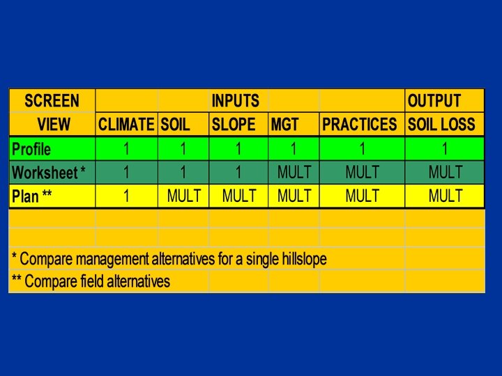
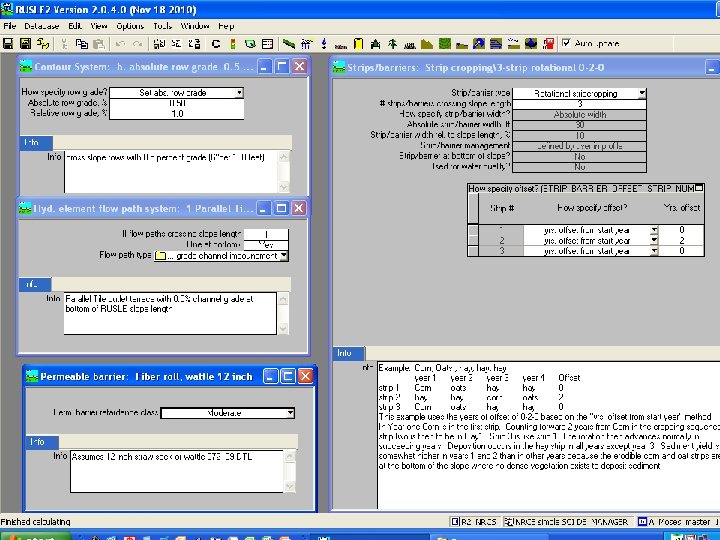
RUSLE 2 Screen View Hierarchy n Plan n Worksheet field 1 n Profile n Management n Profile n n Management Worksheet field 2 n Profile n Management
RUSLE 2 Hierarchy of Screen Views Management A crop and tillage system scenario. Contains crop and yield information, all tillage, planting, and harvest operations with dates, but is not a soil loss calculation. Profile* Contains one erosion calculation for one slope. Combines climate, soil, slope, management and structural practice inputs. Worksheet* Soil, slope and climate information are constant. Compares multiple profiles (alternatives) for one field. All components housed within the moses. gdb database file. *Contain actual soil loss calculations Plan* Climate is constant. Houses worksheets for each field or treatment unit. Each field worksheet has constant soil, and slope but contains multiple profiles with different management and support practice alternatives.
RUSLE 2 Features n Provides for n Single soil loss runs in the Profile view.
Comparing SHMSs in Worksheet View
RUSLE 2 Features n Provides for Single soil loss runs in the Profile view. n Comparison of alternative soil loss runs on the same slope in the Worksheet view. n
Comparing SHMSs or Alternatives in Worksheet View
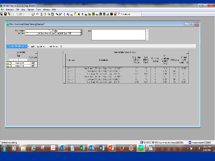
RUSLE 2 Features n Provides for Single soil loss runs in the Profile view. n Comparison of alternative soil loss runs on the same slope in the Worksheet view. n A report of alternatives for each field for all fields on a farm in the Plan view. n
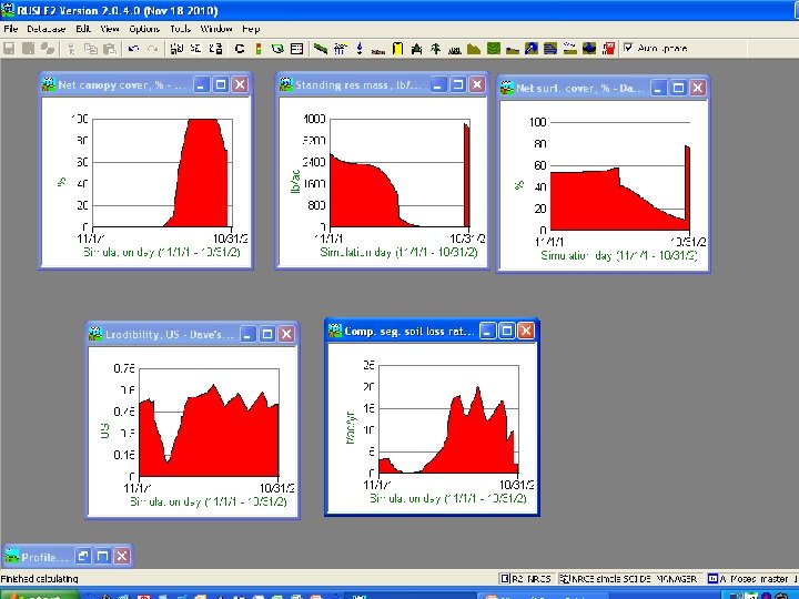
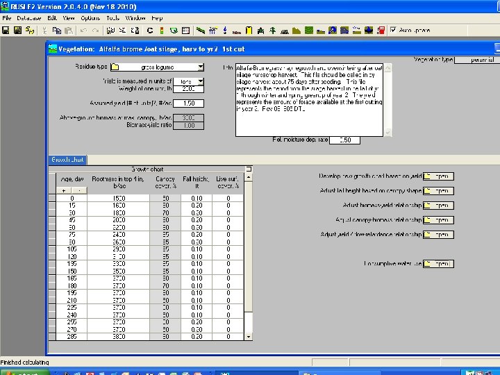
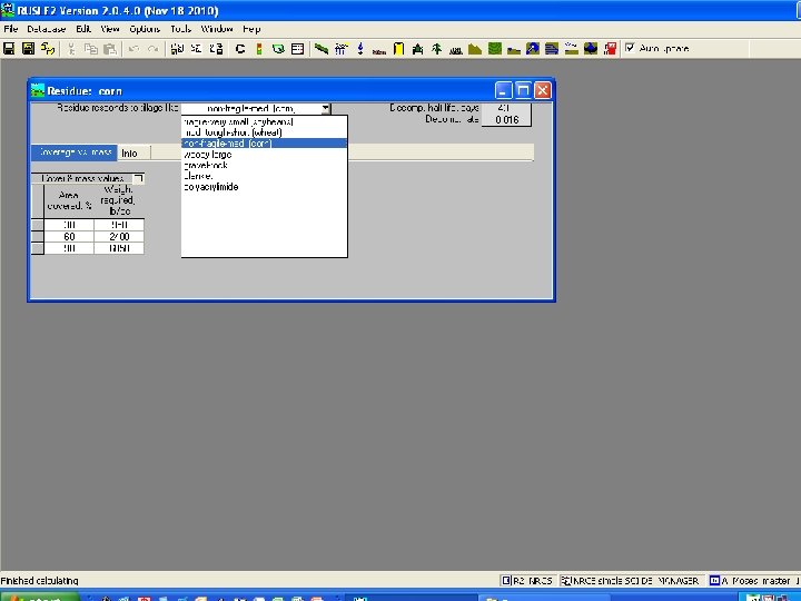
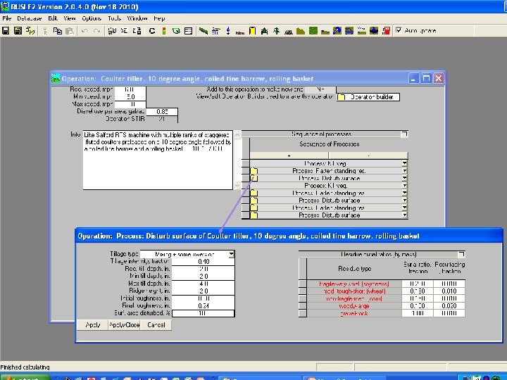
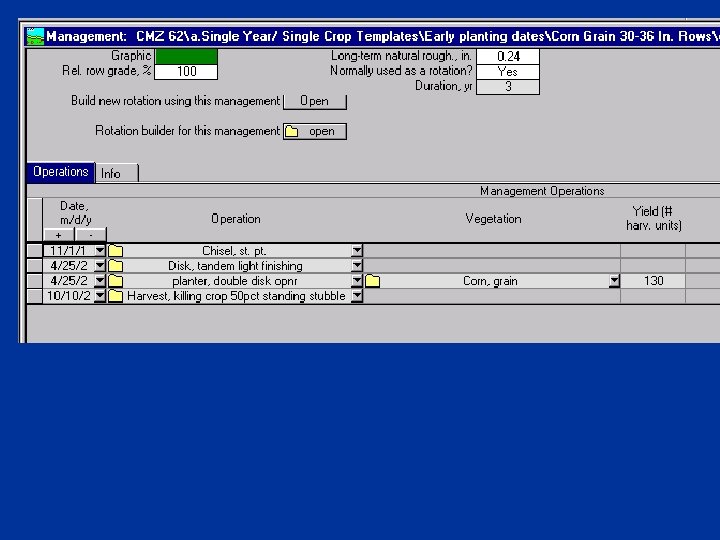
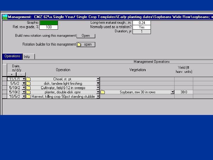
RUSLE 2 Data n When building managements, select appropriate operations and vegetations; n Read information boxes n View in profile, graph canopy cover, etc. to make sure site specific scenario is represented well n Request new
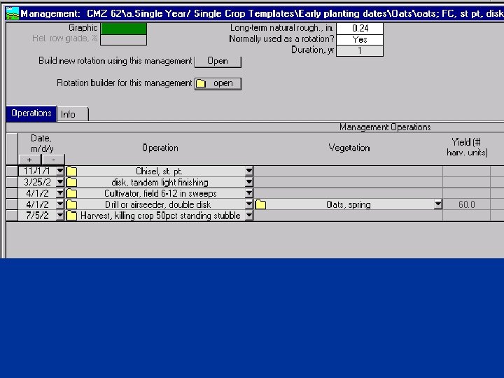
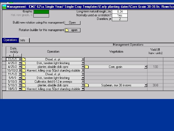
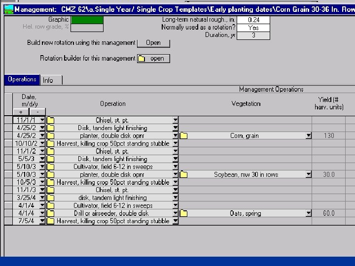
Rotation Builder
ye led ise Soybeans Fall Chiseled year 2 ch Oa sp ts 3 ch ring ise led l fal rn ar Co ar 1 ye Rotation Builder
Current Agronomic Models n n n Each model currently contains it own databases Most utilize similar data n Soil map unit and component data n Climate location data on temperature, precipitation and wind energy n Crop and plant data n Tillage, pesticide, nutrient and manure application, planting and harvest operations n Crop Management Scenarios NRCS is currently developing, trying to maintain and serve up separate databases for each model
Sheet and Rill Erosion Rate Wind Erosion Rate Particulate Emission Concentration Advanced PRISM Climate Data Sediment Delivery ils ase tab Da ue sid So Re O ta da NLEAP Manure Management Program Ann. AGNPS b t en m op ge s Cr ana rio M ena ase Sc atab D l su ria Soil Tillage Intensity Ratings Support Practices Database Bu ue sid Re dule mo Organic Matter Trends RG Nutrient Loading Common User Interface Win. PST SU Pesticide Leaching S/S Carbon Sequestration / Losses SI Nitrate Leaching Phosphorus Runoff Climate generator C ro B sub module p n u o i ld Ro is ti e er ta u Water su tio id mpo ule s e o od b n Erosion R ec m m od D ub Model ul S Phosphorus e SCI and Index STIR NA Detached Particle Information Wind Erosion Model Random Roughness Degradation sub module On-site Field and Landscape Information nd a e ion bas t ata ge Ve op D Cr Field operations database
Future Plans to Reduce Time Spent on Database Development/Maintenance n Land Management Operations Database n Obtain Database from Area of Interest n Access Soils Directly from Soil Data Access Facility