RSMC Miami Tropical Cyclone Products RSMC Miami provides


- Slides: 29

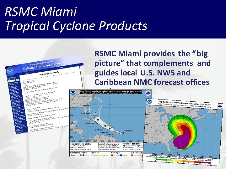
RSMC Miami Tropical Cyclone Products RSMC Miami provides the “big picture” that complements and guides local U. S. NWS and Caribbean NMC forecast offices products

National Hurricane Center Text Products Tropical Weather Outlook Ø Public Advisory Ø Forecast Discussion Ø Wind Speed Probabilities Ø Tropical Cyclone Update Ø Tropical Cyclone Reports Ø Monthly Tropical Weather Summary Ø

RSMC Miami Graphical Products Graphical Tropical Weather Outlook Ø Track Forecast Cone Ø Surface Wind Field Ø Wind Speed Probabilities Ø Cumulative Wind History Ø Storm Surge Probabilities Ø Potential Storm Surge Flooding Map Ø Storm Surge Warning Graphic Ø

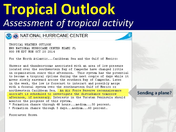
Tropical Outlook Assessment of tropical activity TROPICAL WEATHER OUTLOOK NWS NATIONAL HURRICANE CENTER MIAMI FL 800 PM EDT MON OCT 20 2014 For the North Atlantic. . . Caribbean Sea and the Gulf of Mexico: Showers and thunderstorms associated with an area of low pressure located over the southwestern Bay of Campeche have changed little in organization since this afternoon. This system has the potential to become a tropical cyclone during the next couple of days while it moves slowly eastward across the southern Bay of Campeche. Later in the week, the low is forecast to interact and possibly merge with a frontal system over the southeastern Gulf of Mexico or northwestern Caribbean Sea. An Air Force Reserve reconnaissance aircraft is scheduled to investigate the disturbance tomorrow afternoon, if necessary. Interests in the Yucatan Peninsula should monitor the progress of this system. * Formation chance through 48 hours. . . medium. . . 50 percent. • Formation chance through 5 days. . . medium. . . 60 percent. Forecaster Brown Potential for development? Headed where?

Tropical Outlook Assessment of tropical activity TROPICAL WEATHER OUTLOOK NWS NATIONAL HURRICANE CENTER MIAMI FL 800 PM EDT MON OCT 20 2014 For the North Atlantic. . . Caribbean Sea and the Gulf of Mexico: Showers and thunderstorms associated with an area of low pressure located over the southwestern Bay of Campeche have changed little in organization since this afternoon. This system has the potential to become a tropical cyclone during the next couple of days while it moves slowly eastward across the southern Bay of Campeche. Later in the week, the low is forecast to interact and possibly merge with a frontal system over the southeastern Gulf of Mexico or northwestern Caribbean Sea. An Air Force Reserve reconnaissance aircraft is scheduled to investigate the disturbance tomorrow afternoon, if necessary. Interests in the Yucatan Peninsula should monitor the progress of this system. * Formation chance through 48 hours. . . medium. . . 50 percent. • Formation chance through 5 days. . . medium. . . 60 percent. Forecaster Brown Sending a plane?

Tropical Outlook 2 -Day Formation Potential Current location of disturbances (discussed in the Tropical Weather Outlook) Formation chance during the next 48 hrs • Categorical • Probabilities (Low, Medium, and High)

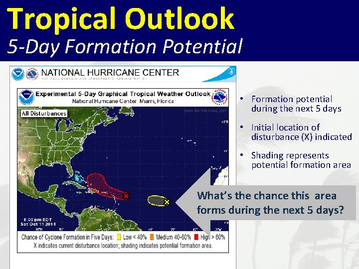
Tropical Outlook 5 -Day Formation Potential • Formation potential during the next 5 days • Initial location of disturbance (X) indicated • Shading represents potential formation area What’s the chance this area forms during the next 5 days?

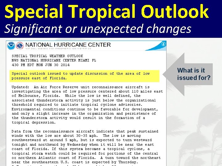
Special Tropical Outlook Significant or unexpected changes SPECIAL TROPICAL WEATHER OUTLOOK NWS NATIONAL HURRICANE CENTER MIAMI FL 430 PM EDT MON JUN 30 2014 Special outlook issued to update discussion of the area of low pressure east of Florida. Updated: An Air Force Reserve unit reconnaissance aircraft is investigating the area of low pressure centered about 110 miles east of Melbourne, Florida. While the low is well defined, the associated thunderstorm activity is just below the organizational threshold required to initiate tropical cyclone advisories. Environmental conditions continue to be favorable for development, and only a slight increase in the organization and persistence of the thunderstorm activity would result in the formation of a tropical depression. Data from the reconnaissance aircraft indicate that peak sustained winds with the low are about 30 -35 mph. The low is moving southwestward at around 5 mph, but is expected to turn westward tonight and northward by Wednesday when it will be near the east coast of Florida. If this system becomes a tropical cyclone, a tropical storm watch could be required for portions of the central or northern Atlantic coast of Florida. A turn toward the northeast near the southeastern U. S. coast is expected by Thursday. What is it issued for?

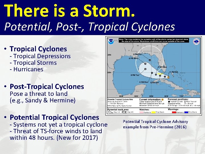
There is a Storm. Potential, Post-, Tropical Cyclones • Tropical Cyclones - Tropical Depressions - Tropical Storms - Hurricanes • Post-Tropical Cyclones Pose a threat to land (e. g. , Sandy & Hermine) • Potential Tropical Cyclones - Systems not yet a tropical cyclone - Threat of TS-force winds to land within 48 hours. (New for 2017) Potential Tropical Cyclone Advisory example from Pre-Hermine (2016)

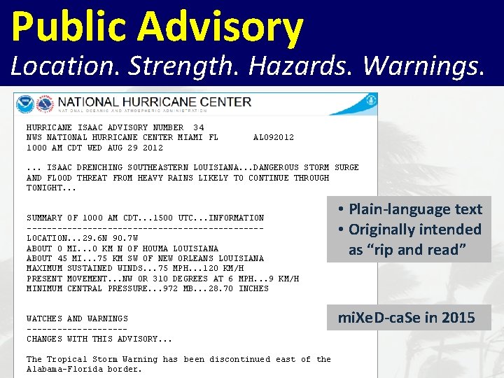
Public Advisory Location. Strength. Hazards. Warnings. HURRICANE ISAAC ADVISORY NUMBER 34 NWS NATIONAL HURRICANE CENTER MIAMI FL AL 092012 1000 AM CDT WED AUG 29 2012 . . . ISAAC DRENCHING SOUTHEASTERN LOUISIANA. . . DANGEROUS STORM SURGE AND FLOOD THREAT FROM HEAVY RAINS LIKELY TO CONTINUE THROUGH TONIGHT. . . SUMMARY OF 1000 AM CDT. . . 1500 UTC. . . INFORMATION -----------------------LOCATION. . . 29. 6 N 90. 7 W ABOUT 0 MI. . . 0 KM N OF HOUMA LOUISIANA ABOUT 45 MI. . . 75 KM SW OF NEW ORLEANS LOUISIANA MAXIMUM SUSTAINED WINDS. . . 75 MPH. . . 120 KM/H PRESENT MOVEMENT. . . NW OR 310 DEGREES AT 6 MPH. . . 9 KM/H MINIMUM CENTRAL PRESSURE. . . 972 MB. . . 28. 70 INCHES WATCHES AND WARNINGS ----------CHANGES WITH THIS ADVISORY. . . The Tropical Storm Warning has been discontinued east of the Alabama-Florida border. • Plain-language text • Originally intended as “rip and read” mi. Xe. D-ca. Se in 2015

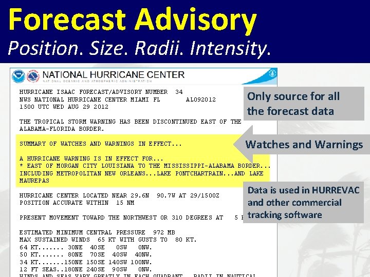
Forecast Advisory Position. Size. Radii. Intensity. Only source for all the forecast data HURRICANE ISAAC FORECAST/ADVISORY NUMBER 34 NWS NATIONAL HURRICANE CENTER MIAMI FL AL 092012 1500 UTC WED AUG 29 2012 THE TROPICAL STORM WARNING HAS BEEN DISCONTINUED EAST OF THE ALABAMA-FLORIDA BORDER. SUMMARY OF WATCHES AND WARNINGS IN EFFECT. . . A HURRICANE WARNING IS IN EFFECT FOR. . . * EAST OF MORGAN CITY LOUISIANA TO THE MISSISSIPPI-ALABAMA BORDER. . . INCLUDING METROPOLITAN NEW ORLEANS. . . LAKE PONTCHARTRAIN. . . AND LAKE MAUREPAS HURRICANE CENTER LOCATED NEAR 29. 6 N 90. 7 W AT 29/1500 Z POSITION ACCURATE WITHIN 15 NM PRESENT MOVEMENT TOWARD THE NORTHWEST OR 310 DEGREES AT 5 KT ESTIMATED MINIMUM CENTRAL PRESSURE 972 MB MAX SUSTAINED WINDS 65 KT WITH GUSTS TO 80 KT. 64 KT. . . . 30 NE 40 SE 0 SW 0 NW. 50 KT. . . . 80 NE 70 SE 40 SW 40 NW. 34 KT. . . . 150 NE 150 SE 140 SW 100 NW. 12 FT SEAS. . 180 NE 240 SE 90 SW 0 NW. Watches and Warnings Data is used in HURREVAC and other commercial tracking software

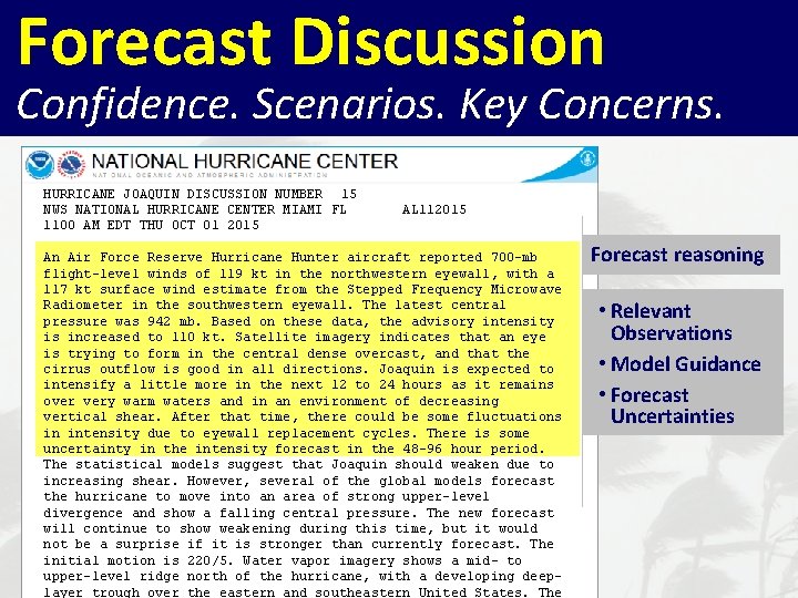
Forecast Discussion Confidence. Scenarios. Key Concerns. HURRICANE JOAQUIN DISCUSSION NUMBER 15 NWS NATIONAL HURRICANE CENTER MIAMI FL AL 112015 1100 AM EDT THU OCT 01 2015 An Air Force Reserve Hurricane Hunter aircraft reported 700 -mb flight-level winds of 119 kt in the northwestern eyewall, with a 117 kt surface wind estimate from the Stepped Frequency Microwave Radiometer in the southwestern eyewall. The latest central pressure was 942 mb. Based on these data, the advisory intensity is increased to 110 kt. Satellite imagery indicates that an eye is trying to form in the central dense overcast, and that the cirrus outflow is good in all directions. Joaquin is expected to intensify a little more in the next 12 to 24 hours as it remains over very warm waters and in an environment of decreasing vertical shear. After that time, there could be some fluctuations in intensity due to eyewall replacement cycles. There is some uncertainty in the intensity forecast in the 48 -96 hour period. The statistical models suggest that Joaquin should weaken due to increasing shear. However, several of the global models forecast the hurricane to move into an area of strong upper-level divergence and show a falling central pressure. The new forecast will continue to show weakening during this time, but it would not be a surprise if it is stronger than currently forecast. The initial motion is 220/5. Water vapor imagery shows a mid- to upper-level ridge north of the hurricane, with a developing deeplayer trough over the eastern and southeastern United States. The Forecast reasoning • Relevant Observations • Model Guidance • Forecast Uncertainties

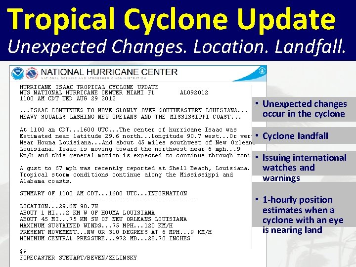
Tropical Cyclone Update Unexpected Changes. Location. Landfall. HURRICANE ISAAC TROPICAL CYCLONE UPDATE NWS NATIONAL HURRICANE CENTER MIAMI FL AL 092012 1100 AM CDT WED AUG 29 2012. . . ISAAC CONTINUES TO MOVE SLOWLY OVER SOUTHEASTERN LOUISIANA. . . HEAVY SQUALLS LASHING NEW ORELANS AND THE MISSISSIPPI COAST. . . • Unexpected changes occur in the cyclone At 1100 am CDT. . . 1600 UTC. . . The center of hurricane Isaac was Estimated near latitude 29. 6 north. . . Longitude 90. 7 west. . . Or very Near Houma Louisiana. . . And about 45 miles southwest of New Orleans Louisiana. Isaac is moving toward the northwest near 6 mph. . . 9 Km/h and this general motion is expected to continue through tonight. • Cyclone landfall A gust to 67 mph was recently reported at Shell Beach, Louisiana. Tropical storm conditions continue along the Mississippi and Alabama coasts. SUMMARY OF 1100 AM CDT. . . 1600 UTC. . . INFORMATION -------------------------LOCATION. . . 29. 6 N 90. 7 W ABOUT 1 MI. . . 2 KM W OF HOUMA LOUISIANA ABOUT 45 MI. . . 75 KM SW OF NEW ORLEANS LOUISIANA MAXIMUM SUSTAINED WINDS. . . 75 MPH. . . 120 KM/H PRESENT MOVEMENT. . . NW OR 310 DEGREES AT 6 MPH. . . 9 KM/H MINIMUM CENTRAL PRESSURE. . . 972 MB. . . 28. 70 INCHES $$ FORECASTER STEWART/BEVEN/ZELINSKY • Issuing international watches and warnings • 1 -hourly position estimates when a cyclone with an eye is nearing land

There is a storm. Where is the greatest concern? When will the hazards begin? • Watches and Warnings

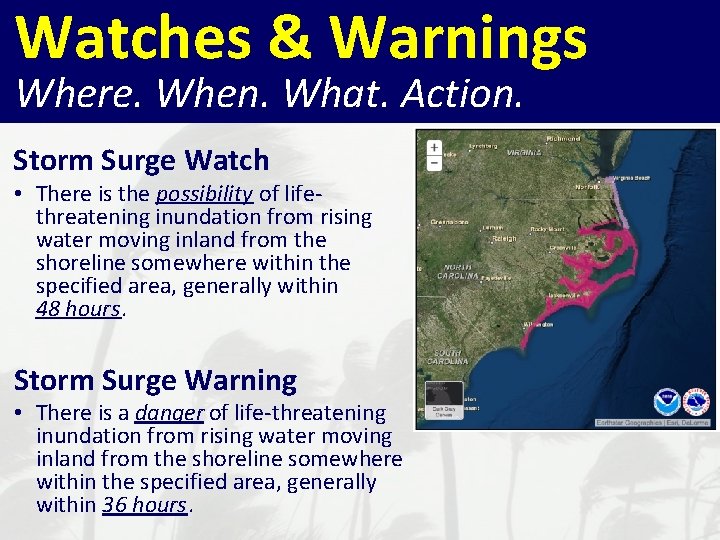
Watches & Warnings Where. When. What. Action. Storm Surge Watch • There is the possibility of lifethreatening inundation from rising water moving inland from the shoreline somewhere within the specified area, generally within 48 hours. Storm Surge Warning • There is a danger of life-threatening inundation from rising water moving inland from the shoreline somewhere within the specified area, generally within 36 hours.

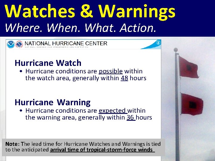
Watches & Warnings Where. When. What. Action. Hurricane Watch • Hurricane conditions are possible within the watch area, generally within 48 hours Hurricane Warning • Hurricane conditions are expected within the warning area, generally within 36 hours Note: The lead time for Hurricane Watches and Warnings is tied to the anticipated arrival time of tropical-storm-force winds

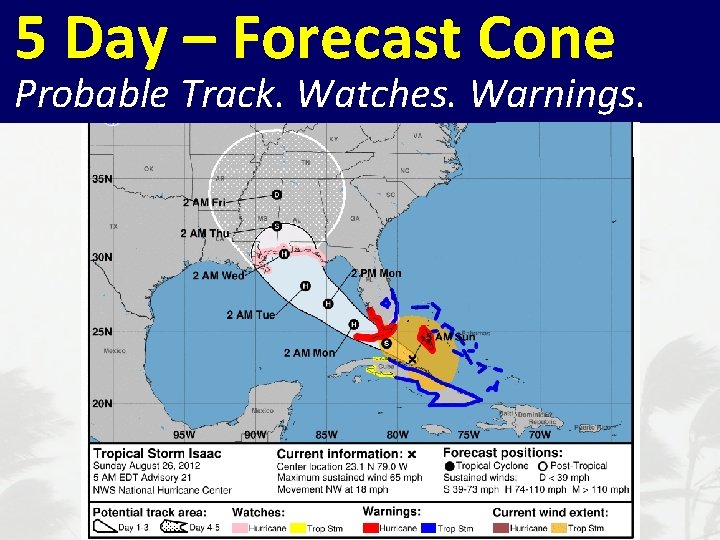
5 Day – Forecast Cone Probable Track. Watches. Warnings.

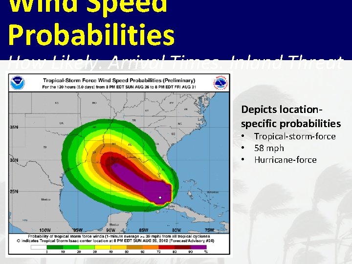
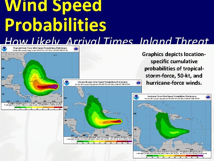
Wind Speed Probabilities How Likely. Arrival Times. Inland Threat Depicts locationspecific probabilities • Tropical-storm-force • 58 mph • Hurricane-force

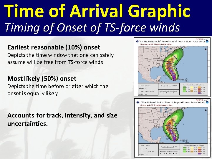
Time of Arrival Graphic Timing of Onset of TS-force winds Earliest reasonable (10%) onset Depicts the time window that one can safely assume will be free from TS-force winds Most likely (50%) onset Depicts the time before or after which the onset is equally likely Accounts for track, intensity, and size uncertainties.

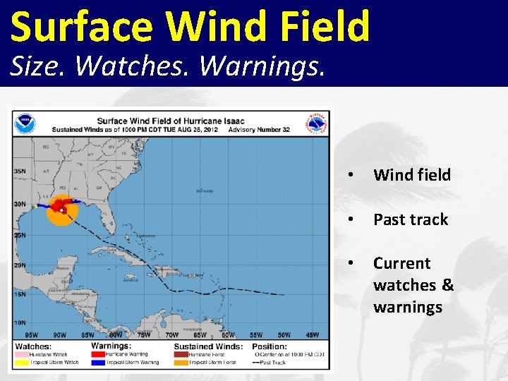
Surface Wind Field Size. Watches. Warnings. • Wind field • Past track • Current watches & warnings

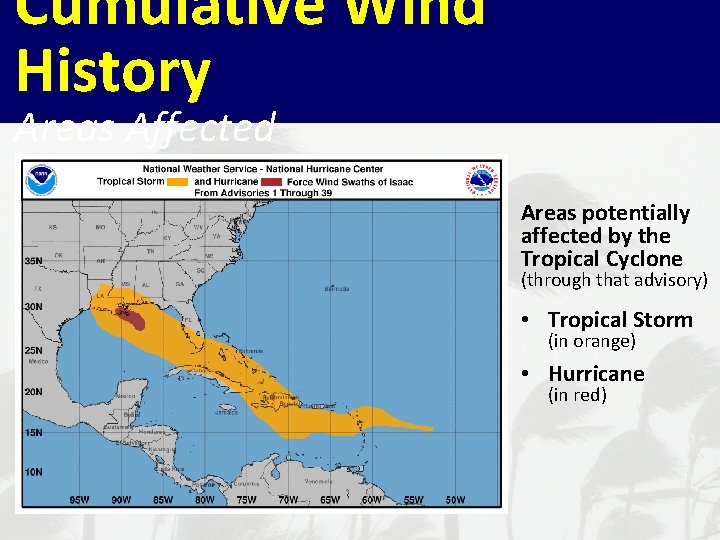
Cumulative Wind History Areas Affected Areas potentially affected by the Tropical Cyclone (through that advisory) • Tropical Storm (in orange) • Hurricane (in red)

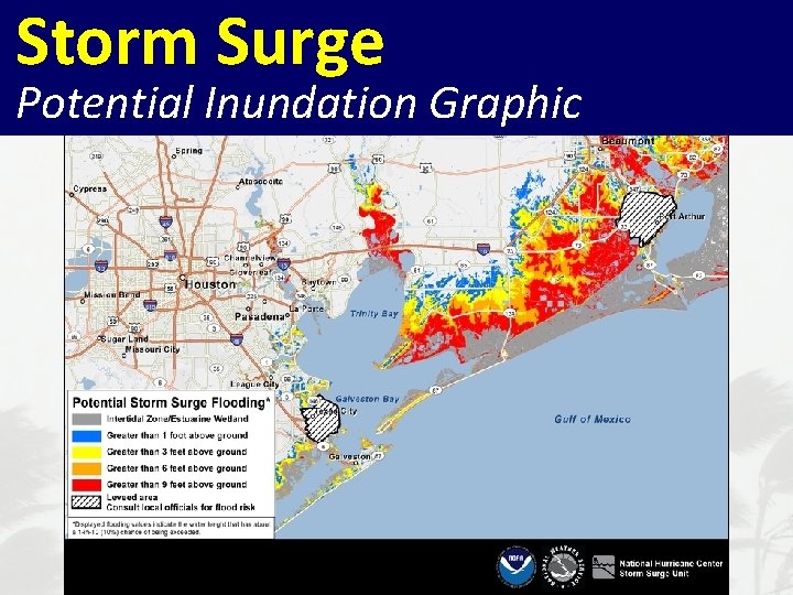
Storm Surge Potential Inundation Graphic

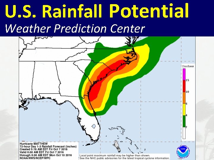
U. S. Rainfall Potential NHC Tropical Cyclone Advisory Products Weather Prediction Center

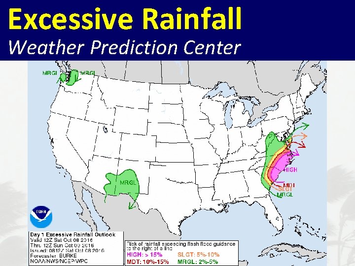
Excessive Rainfall NHC Tropical Cyclone Advisory Products Weather Prediction Center

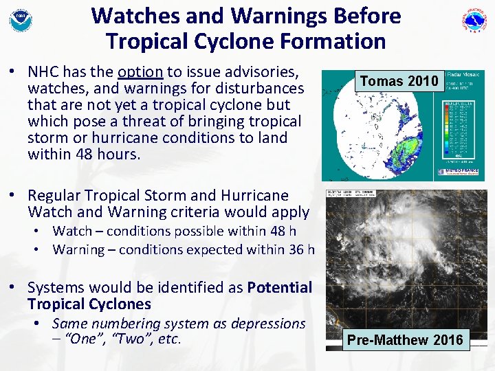
Watches and Warnings Before Tropical Cyclone Formation • NHC has the option to issue advisories, watches, and warnings for disturbances that are not yet a tropical cyclone but which pose a threat of bringing tropical storm or hurricane conditions to land within 48 hours. Tomas 2010 • Regular Tropical Storm and Hurricane Watch and Warning criteria would apply • Watch – conditions possible within 48 h • Warning – conditions expected within 36 h • Systems would be identified as Potential Tropical Cyclones • Same numbering system as depressions – “One”, “Two”, etc. Pre-Matthew 2016

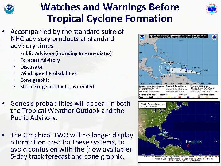
Watches and Warnings Before Tropical Cyclone Formation • Accompanied by the standard suite of NHC advisory products at standard advisory times • • • Public Advisory (including Intermediates) Forecast Advisory Discussion Wind Speed Probabilities Cone graphic Storm surge products, as needed • Genesis probabilities will appear in both the Tropical Weather Outlook and the Public Advisory. • The Graphical TWO will no longer display a formation area for these systems, to avoid confusion with the (now available) 5 -day track forecast and cone graphic. Fourteen X

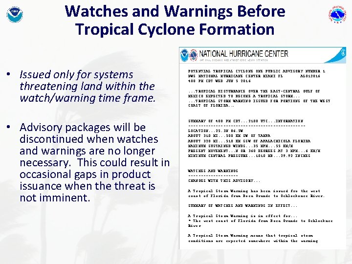
Watches and Warnings Before Tropical Cyclone Formation • Issued only for systems threatening land within the watch/warning time frame. • Advisory packages will be discontinued when watches and warnings are no longer necessary. This could result in occasional gaps in product issuance when the threat is not imminent. POTENTIAL TROPICAL CYCLONE PUBLIC ADVISORY NUMBER 1 NWS NATIONAL HURRICANE CENTER MIAMI FL AL 012016 400 PM CDT WED JUN 5 2016. . . TROPICAL DISTURBANCE OVER THE EAST-CENTRAL GULF OF MEXICO EXPECTED TO BECOME A TROPICAL STORM. . . TROPICAL STORM WARNING ISSUED FOR PORTIONS OF THE WEST COAST OF FLORIDA. . . SUMMARY OF 400 PM CDT. . . 2100 UTC. . . INFORMATION -----------------------LOCATION. . . 25. 3 N 86. 5 W ABOUT 310 MI. . . 500 KM SW OF TAMPA ABOUT 320 MI. . . 510 KM SSW OF APALACHICOLA FLORIDA MAXIMUM SUSTAINED WINDS. . . 35 MPH. . . 55 KM/H PRESENT MOVEMENT. . . N OR 360 DEGREES AT 3 MPH. . . 6 KM/H MINIMUM CENTRAL PRESSURE. . . 1010 MB. . . 29. 92 INCHES WATCHES AND WARNINGS ----------CHANGES WITH THIS ADVISORY. . . A Tropical Storm Warning has been issued fro the west coast of Florida from Boca Grande to Ochlockonee River. SUMMARY OF WATCHES AND WARNINGS IN EFFECT. . . A Tropical Storm Warning is in effect for. . . * The west coast of Florida from Boca Grande to Ochlocknee River A Tropical Storm Warning means that tropical storm conditions are expected somewhere within the warning

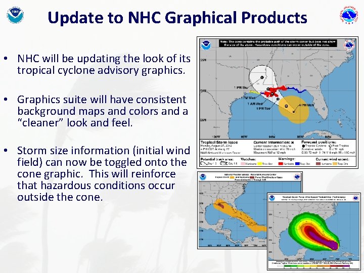
Update to NHC Graphical Products • NHC will be updating the look of its tropical cyclone advisory graphics. • Graphics suite will have consistent background maps and colors and a “cleaner” look and feel. • Storm size information (initial wind field) can now be toggled onto the cone graphic. This will reinforce that hazardous conditions occur outside the cone.

Wind NHC Speed Tropical Cyclone Advisory Products Probabilities How Likely. Arrival Times. Inland Threat Graphics depicts locationspecific cumulative probabilities of tropicalstorm-force, 50 -kt, and hurricane-force winds. 31