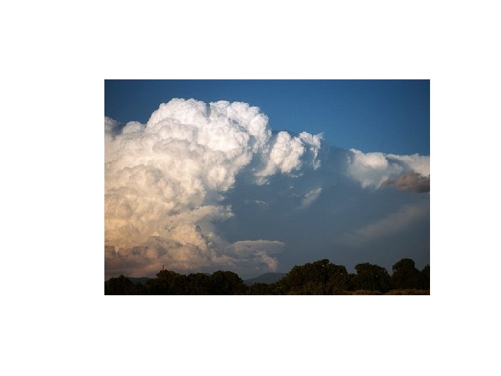
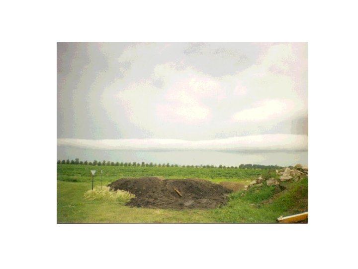
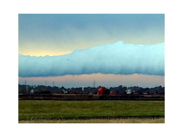
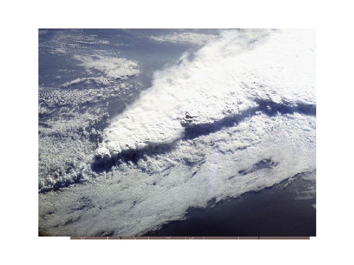
Roll or Arcus Cloud Supercell Thunderstorms Squall Lines


 •")


")
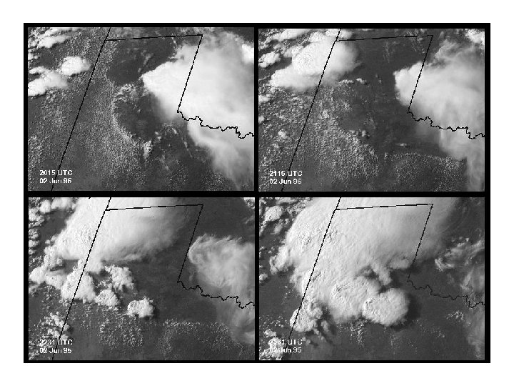
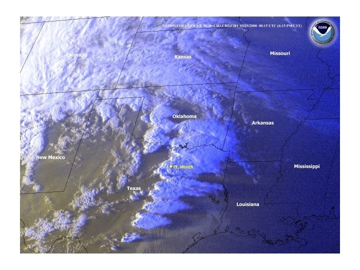
. Surface analysis + satellite images 1900 2100 2000")


- Slides: 69
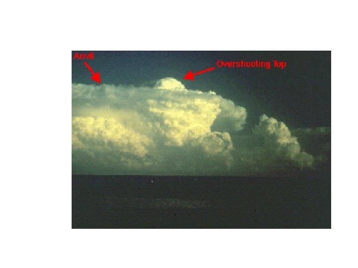
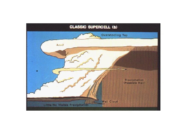
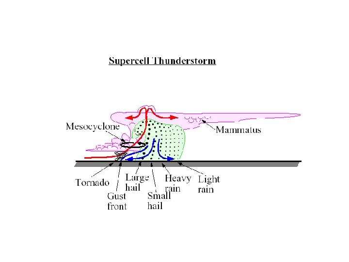
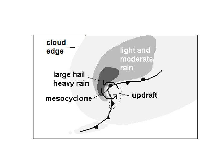
Roll or Arcus Cloud
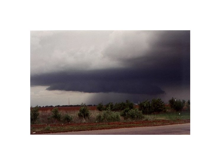
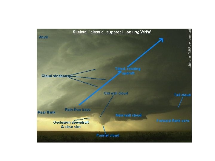
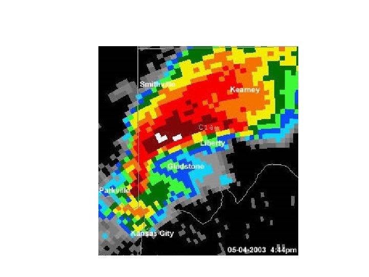
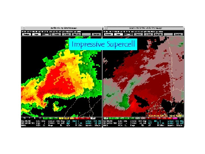
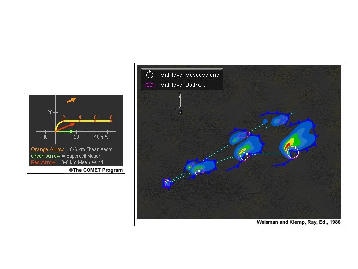
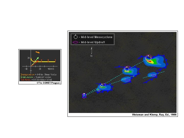
Supercell Thunderstorms
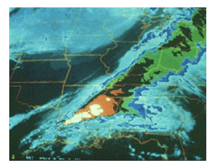
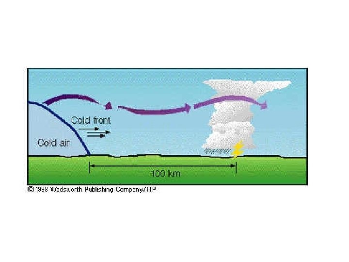
Squall Lines
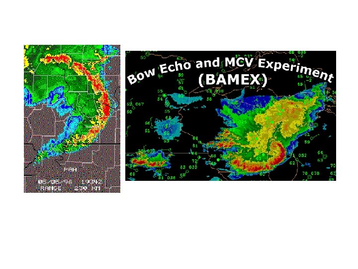
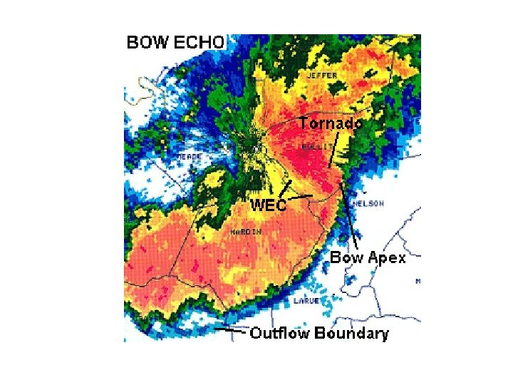
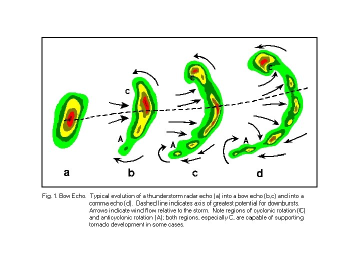
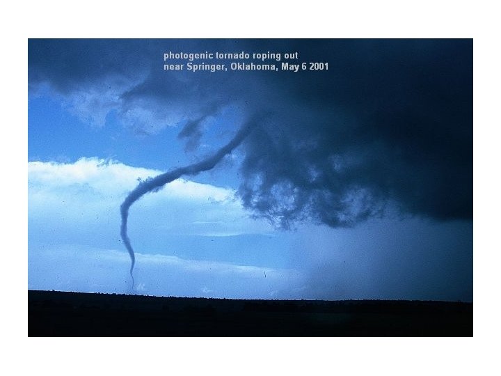
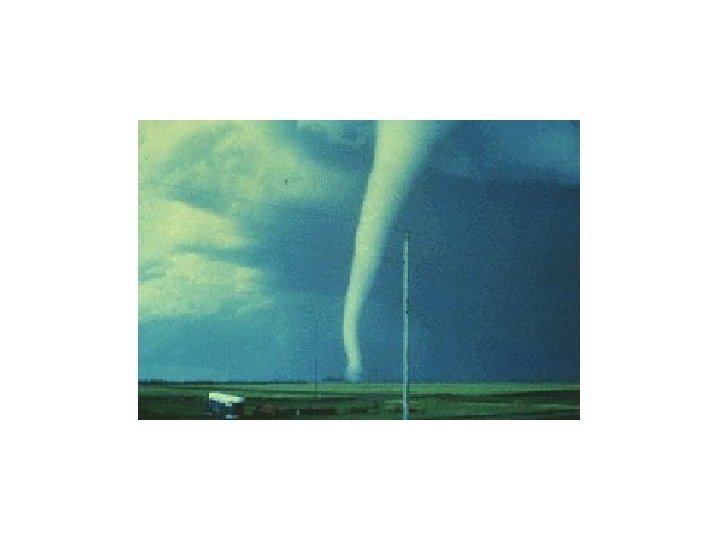
Bow Echos
Often Associated with Strong Straight Line Winds Known as “Derechos” • Can reach 100 -150 mph • http: //www. youtube. com/watch? v=EGJm. Oe DEBtw • Great Derecho Website: http: //www. spc. noaa. gov/misc/Abt. Derechos/d erechofacts. htm
Climatology (Events over 19802001
High Resolution Numerical Prediction of Convection
Explicit Convective Prediction • Requires high resolution (4 km or less grid spacing) • Requires high-resolution analysis of current situation, using radar, surface observations and all other assets. • NCAR (WRF model) and CAPS (Oklahoma, ARPS model) are two leading efforts.
Bow Echo and Mesoscale Convective Vortex Experiment Using the WRF Model Goal: Study the lifecycles of mesoscale convective vortices and bow echoes in and around the St. Louis MO area 10 km WRF forecast domain 4 km WRF forecast domain Field program conducted 20 May – 6 July 2003
Real-time WRF 4 km BAMEX Forecast Initialized 00 UTC 9 June 03 Reflectivity forecast Composite NEXRAD Radar
Real-time WRF 4 km BAMEX Forecast Valid 6/10/03 12 Z 4 km BAMEX forecast 36 h Reflectivity 4 km BAMEX forecast 12 h Reflectivity Composite NEXRAD Radar
27 h WRF BAMEX Forecast Valid 6/10/03 03 Z 4 km Max Reflectivity 10 km Max Reflectivity
30 h WRF BAMEX Forecast Valid 6/10/03 06 Z 4 km Max Reflectivity 10 km Max Reflectivity
Real-time WRF 4 km BAMEX Forecast Initialized 00 UTC 10 June 03 Reflectivity forecast Composite NEXRAD Radar
Real-time 12 h WRF Reflectivity Forecast Valid 6/10/03 12 Z 4 km BAMEX forecast 10 km BAMEX forecast 22 km CONUS forecast Composite NEXRAD Radar
Real-time WRF 4 km BAMEX Forecast Initialized 00 UTC 30 May 03 Reflectivity forecast Composite NEXRAD Radar
Real-time WRF 4 km BAMEX Forecast Valid 5/30/03 23 Z 23 h Reflectivity Forecast Composite NEXRAD Radar Line of Supercells
Realtime WRF 4 km BAMEX Forecast Valid 6/23/03 06 Z 30 h Reflectivity Forecast Composite NEXRAD Radar 6” hail 00 Z Squall line
Real-time WRF 4 km BAMEX Forecast Initialized 00 UTC 11 June 03 Reflectivity forecast Composite NEXRAD Radar
Realtime WRF 4 km BAMEX Forecast Valid 6/12/03 06 Z 30 h Reflectivity Forecast Composite NEXRAD Radar Missed
Real-time WRF 4 km BAMEX Forecast Initialized 00 UTC 24 May 03 Reflectivity forecast Composite NEXRAD Radar
Realtime WRF 4 km BAMEX Forecast Initialized 5/24/03 00 Z Reflectivity Forecast Composite NEXRAD Radar 12 h Squall line 24 h Persists Dissipates
Preliminary BAMEX Forecast Verification Mode for corresponding convective systems For Convective Mode 2 or 3 Cases Observed Yes No Cases Yes Predicted No 61 25 16 21 Probability of detection (POD) = 79% False alarm rate (FAR) = 29% (Done, Davis, and Weisman)
A High-Resolution Modeling Study of the 24 May 2002 Dryline Case during IHOP (Xue and Martin 2006 a, b MWR) Goal: Understand exactly WHEN, WHERE, HOW convection is initiated
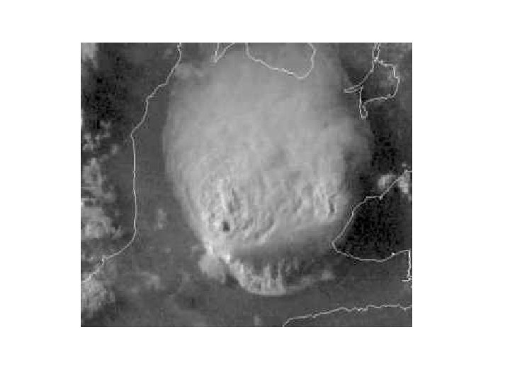
Time and Location of Initiation (Loop time: 17 UTC – 22 UTC)
From Wakimoto et al. (2006 MWR). Surface analysis + satellite images 1900 2100 2000 2200
18 UTC May 24, 2002 I. C. 3 km / 1 km grid
Model Configurations 1200 UTC CI ~ 2000 UTC 1800 UTC 0000 UTC 3 km ADAS 0006 UTC 1 km ADAS • ARPS model with full physics, including ice microphysics + soil model + PBL and TKE-SGS turbulence
t=3 h, 2100 UTC sfc. winds, qv, and composite reflectivity
t=4 h, 2200 UTC
t=5 h, 2300 UTC
t=3 h, 2100 UTC
2000 UTC 2015 UTC 2030 UTC 2045 U t=2 h 15 min t=2 h 30 min t=2 h 45 min C B A C A B B A B C A