Rivers GEO3112 2006 GE 0 3112 Sedimentary processes


- Slides: 51

Rivers GEO-3112 2006 GE 0 -3112 Sedimentary processes and products Lecture 6. Rivers Geoff Corner Department of Geology University of Tromsø 2006 Literature: - Leeder 1999. Ch. 17. Rivers.

Rivers GEO-3112 2006 Contents ► 6. 1 Introduction – importance of fluvial systems ► 6. 2 Fluvial channels ► 6. 3 Floodplains ► 6. 4 Fluvial architecture

Rivers GEO-3112 2006 Importance of fluvial systems ► 1) Rivers are major erosive and sediment transport agents. ► Fluvial sediments are mostly transient but may form thick deposits in several settings. ► Fluvial deposits are sensitive palaeoenvironment indicators.

Rivers GEO-3112 2006 ► 1) Rivers are : § erosive agents § conduits for sediment transport to lacustrine and marine basins.

Rivers GEO-3112 2006 ► 2) Fluvial sediments are mostly transient but form thick deposits in several settings: § coastal plains § intermontane basins § tectonic forelands Modern and Holocene terraced fluvial deposits at Tana, N. Norway.

Rivers GEO-3112 2006 ► 3) Fluvial deposits are sensitive palaeoenvironment indicators: § tectonic slope changes § sourceland geology § climate § sea-level change Postglacial fluvial terraces at Porsanger, N. Norway

Rivers GEO-3112 2006 Fluvial channels ► Size and gradient ► Shape (form) ► Processes ► Bedforms and internal structures

Rivers GEO-3112 2006 Bankfull width ► Channel size is measured as bankfull width. Channel width Normal Bankfull

Rivers GEO-3112 2006 Channel size ► Size varies by four orders of magnitude: § <2 m (small streams) § >20 km (Brahmaputra, Ganges).

Rivers GEO-3112 2006 Channel size vs. discharge Channel width Discharge Q = whu Channel depth Mean flow velocity ► Discharge increases with increasing width, depth and velocity. ► Discharge, width, depth and velocity all increase downstream.

Rivers GEO-3112 2006 Width vs depth ► Depth (h) increases with increasing width (w). ► W/h ratios are higher in low-sinuosity rivers. High sinuosity (low w/h ratios) Low sinuosity (high w/h ratios) NB: Symbols erroneously reversed

Rivers GEO-3112 2006 Long profile ► Downstream changes (in effluent streams): § Discharge increases. § Gradient decreases (the flow is more efficient; with increased discarge the gradient must decrease to maintain equilibrium). Graded river: concave longprofile.

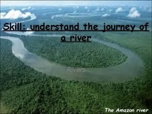
Rivers Downstream changes: Amazon R. GEO-3112 2006

Rivers W Tectonic disturbance of river profiles across the Himalayan front. E GEO-3112 2006

Rivers GEO-3112 2006 Channel shape ► Parameters shape: for describing channel planform § Sinuosity (P) § Braiding § Anastomosing Channel types illustrating characteristics of sinuosity, braiding and anastomosing (Galloway & Hobday 1996).

Rivers ► Sinuosity GEO-3112 2006

Rivers ► Braiding GEO-3112 2006

Rivers ► Anastomosing GEO-3112 2006

Rivers GEO-3112 2006 Controls on channel shape ► Sediment load ► Stream power ► Bank stability

Rivers GEO-3112 2006 Braiding on sandy substrate Meandering on clayey substrate

Rivers GEO-3112 2006 Meandering Channel variability Braided Gandak River, Nepal-India

Rivers GEO-3112 2006 River confluences Deep scour at confluences. ► May be several times deeper than contributing tributaries. ► Mobile scour-and-fill units at the base of a succession. ►

Rivers GEO-3112 2006 Scour pool Jamuna-Ganges confluence, Bangladesh, 1993 -96. Recent scours Infilled scour

Rivers Depositional architecture and stacking patterns Masjok, Tana GEO-3112 2006

Rivers GEO-3112 2006 Channel sediment transport and bedforms ► bars (macrofoms) Point bar ► dunes Mid-channel bar ► ripples Side bar Dunes

Rivers GEO-3112 2006 Point bars and meanders ► Helical flow around a meander bend

Rivers GEO-3112 2006 Point bar deposits Scroll bars Lateral accretion (epsilon cross-stratification)

Rivers GEO-3112 2006 Fluvial point-bar depoits in the Spanish Pyrenees

Rivers ► Fining-upward point-bar successions GEO-3112 2006

Rivers GEO-3112 2006 Channel bars ► Diffluence and confluence ► Downstream accretion

Rivers GEO-3112 2006

Rivers GEO-3112 2006 Linguoid dunes, Tana Planar cross-bedded unit with sigmoidal foresets (dune bedding), Tana

Rivers GEO-3112 2006

Rivers GEO-3112 2006 Braided river succession, Masjok, Tana

Rivers GEO-3112 2006 Anastomosing channels ► Vertical accretion dominates

Rivers GEO-3112 2006 Floodplain ► Important processes: § Overbank flooding § Intermittent avulsion

Rivers GEO-3112 2006 Floodplain deposits ► Vertical accretion of overbank muds and organic sediment. ► Lateral accretion on levees and crevasse splays.

Rivers GEO-3112 2006 Avulsion site, c. 1870 Cumberland Marshes avulsion, Saskatchewan R.

1945 Rivers GEO-3112 2006 1977 Changes 1945 - 1977

Rivers GEO-3112 2006 Crevasse splays Galloway & Hobday 1996

Rivers GEO-3112 2006

Rivers GEO-3112 2006

Rivers GEO-3112 2006 Avulsion and channel belts ► Sudden shift in channel reach (bend cutoff) or whole channel belt. ► Controlled by internal (autocyclicity) or external factors (base-level, climate, tectonics). ► Diversion more likely during extreme flood events or fault movement.

Rivers GEO-3112 2006 Channel belts Palaeochannels of the Holocene Rhine-Meuse. Stacking patterns – fluvial architecture.

Rivers GEO-3112 2006 Incision – aggradation cycles ► Regional cycles of incision and aggradation may occur on the scale of decades or more. ► Causes may be ’intrinsic’ or extrinsic, e. g: § water and sediment discharge variations controlled by climate and catchment characteristics (e. g. ENSO). § eustatic sea level changes. § tectonics.

Rivers GEO-3112 2006 Fluvial incision and knickpoints ► Fall in relative sea-level causes upstream knickpoint migration.

Rivers Depositional architecture and stacking patterns GEO-3112 2006

Rivers Depositional architecture and stacking patterns at Tana Masjok, Tana GEO-3112 2006

Rivers GEO-3112 2006 Fluvial architecture

Rivers GEO-3112 2006 Ancient fluvial deposits

Rivers GEO-3112 2006 Further reading ► Cf. Colloquim literature on fluvial deposits.
 Why are some rivers in texas called “wrong way” rivers?
 Loose solid particles
 Concurrent processes are processes that
 Is a tree biotic
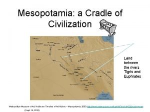
 Mesopotamia land between two rivers
 Se asia rivers
 How to describe a river
 2 rivers in mesopotamia
 Diagram of rivers
 Gcwak
Gcwak City between two rivers
 Important water features of virginia
 Longest river in northern ireland
 Scribes
 Profited from location on major rivers
 I rivers
 Only when all the rivers have run dry
 Lateral thinking riddle
 Why are rivers important
 Investigating rivers
 Rivers passing through sherwood forest
 Jorge beltran la crosse
 Major us rivers
 What 2 rivers surround mesopotamia
 Rivers
 South carolina major rivers
 Land between two rivers
 Different bodys of water
 Label the seine thames elbe tiber and danube rivers
 Cradles of civilization map
 Rivers title page
 Rivers knowledge organiser
 Mesopotamia 2 rivers
 Three august ones
 Sketch map of paris basin
 Bill nye rivers and streams answers
 Holy spirit rivers of living water
 Four rivers district
 Label it
 Which software
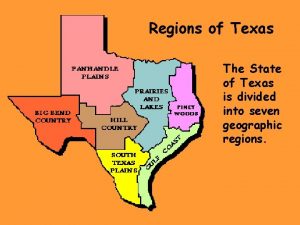
 7 regions of texas
 Psalms by the rivers of babylon
 Journey of river
 Proper noun for city
 Texas regions mountains and basins
 Jane eyre sinjin
 3 rivers optical
 Two rivers in mesopotamia
 What rivers run through iraq
 Major us rivers
 River symbolism
 3 rivers indian clinic muskogee
