RIVER BASINS OF NORTH CAROLINA By Mrs Kovach

RIVER BASINS OF NORTH CAROLINA By Mrs. Kovach th 8 Grade Science

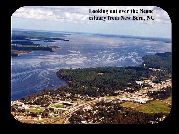
NC RIVER BASINS A river basin is the land that water flows across on its way to a river. Estuary is a semi-enclosed area where fresh water from a river meets salty water from a sea.

• River basins drain all the land around a major river. • Basins can be divided into watersheds • Watersheds all the land drained by a river, stream or lake. • Neuse & Cape Fear are made up of many watersheds
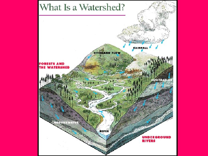

In a watershed all water runs to the lowest point. On its way water travels over the land surface or it seeps into the soil and travels as groundwater. Groundwater is water found in cracks and pores in sand, gravel and rocks below the earth’s surface
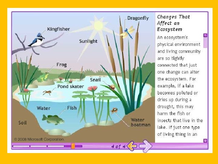
 and nonliving (soil, air,")
Ecosystem is a natural system linked by living (plants, animals) and nonliving (soil, air, water)things. http: //michaelfriel. net/illu_3. html The health of the aquatic ecosystem is directed related to activities on land.

NC has 17 Major River Basins • 5 are part of the Mississippi River Basin (Hiwassee, Little Tennessee, French Broad, Watauga, and New)- This drains at the Gulf of Mexico • The remaining flow to the Atlantic Ocean • 11 of these originate in NC • 4 are only in the entire border of NC (Cape Fear, Neuse, White Oak, & Tar-

What river basin do you live in? This is part of your “ecological address. ” This is made up of 9 different components: (1) River basin (2) topography (3) wetlands (4) Groundwater (5) biodiversity (6) soil (7) Air (8)climate and (9) energy Does the water running off your property enter into a storm drain, ditch,

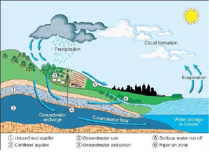
Aquifer is a porous rock layer underground that is a reservoir for water. When water falls as rain it filters into the ground to recharge aquifers and runs along the earth’s surface as creeks, rivers and streams.
- Slides: 12