Review Cloud ceilings Ceilometer used at airports to
- Slides: 36

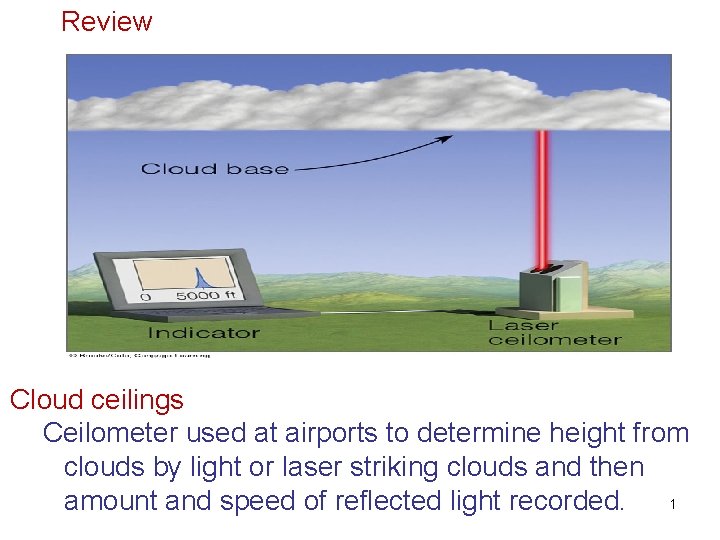
Review Cloud ceilings Ceilometer used at airports to determine height from clouds by light or laser striking clouds and then amount and speed of reflected light recorded. 1

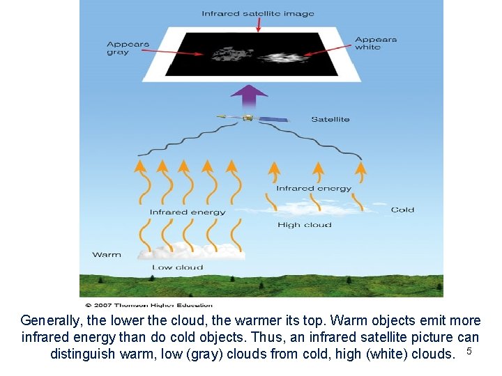
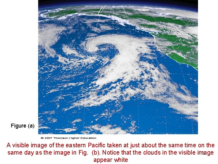
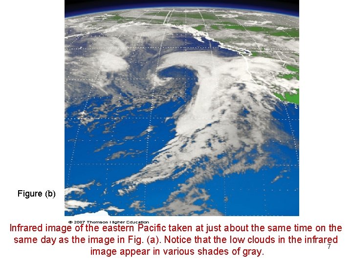
Satellite Observations of Clouds – Geostationary, polar orbiting – Visible light provides a black and white picture of clouds – Infrared approximates cloud temperature which infers height Both are needed to detect the various clyde types. 2

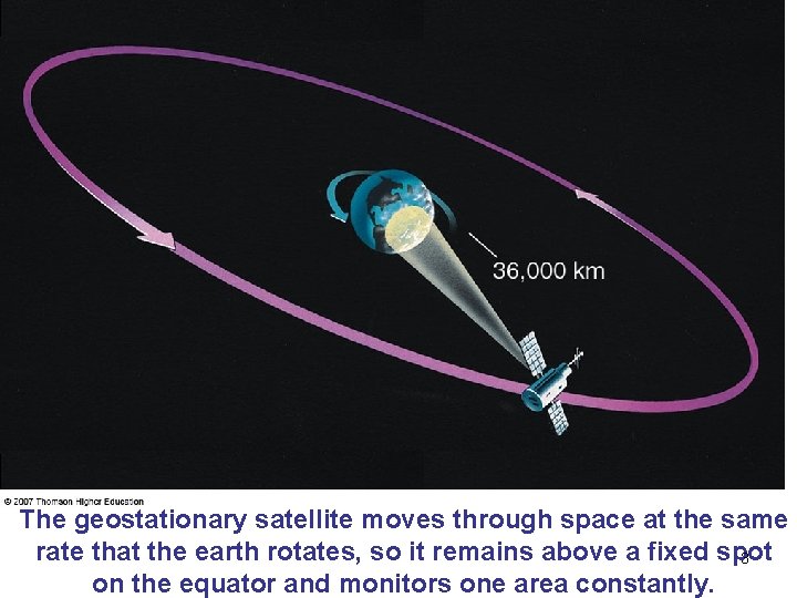
The geostationary satellite moves through space at the same rate that the earth rotates, so it remains above a fixed spot 3 on the equator and monitors one area constantly.

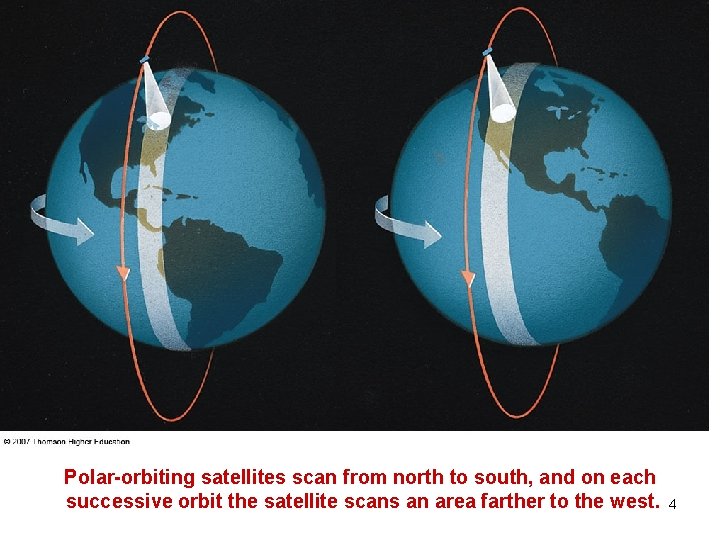
Polar-orbiting satellites scan from north to south, and on each successive orbit the satellite scans an area farther to the west. 4

Generally, the lower the cloud, the warmer its top. Warm objects emit more infrared energy than do cold objects. Thus, an infrared satellite picture can distinguish warm, low (gray) clouds from cold, high (white) clouds. 5

Figure (a) A visible image of the eastern Pacific taken at just about the same time on the 6 same day as the image in Fig. (b). Notice that the clouds in the visible image appear white

Figure (b) Infrared image of the eastern Pacific taken at just about the same time on the same day as the image in Fig. (a). Notice that the low clouds in the infrared 7 image appear in various shades of gray.

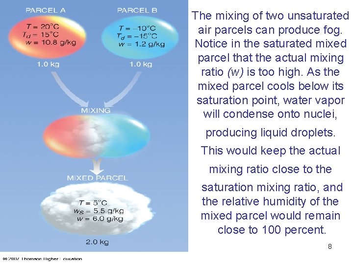
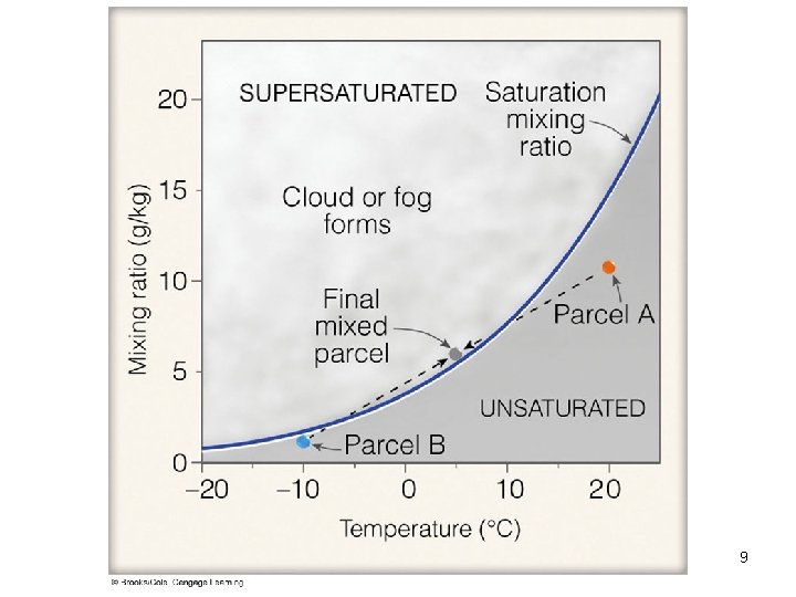
The mixing of two unsaturated air parcels can produce fog. Notice in the saturated mixed parcel that the actual mixing ratio (w) is too high. As the mixed parcel cools below its saturation point, water vapor will condense onto nuclei, producing liquid droplets. This would keep the actual mixing ratio close to the saturation mixing ratio, and the relative humidity of the mixed parcel would remain close to 100 percent. 8

9

AOSC 400 -2009 October 11, Lecture # 11 Stability and cloud development Atmospheric stability v Stable air tends to resist upward motions v Unstable air tends to enhance upward motions Ways of cloud formations

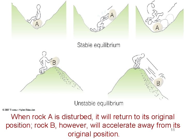
When rock A is disturbed, it will return to its original position; rock B, however, will accelerate away from 11 its original position.

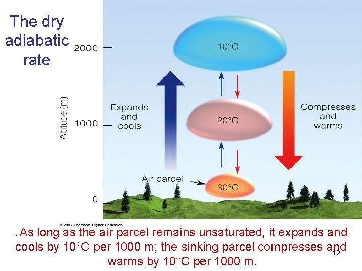
The dry adiabatic rate . As long as the air parcel remains unsaturated, it expands and cools by 10°C per 1000 m; the sinking parcel compresses and 12 warms by 10°C per 1000 m.

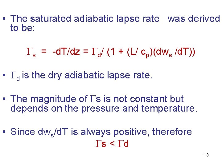
• The saturated adiabatic lapse rate was derived to be: s = -d. T/dz = d/ (1 + (L/ cp)(dws /d. T)) • d is the dry adiabatic lapse rate. • The magnitude of s is not constant but depends on the pressure and temperature. • Since dws/d. T is always positive, therefore s < d 13

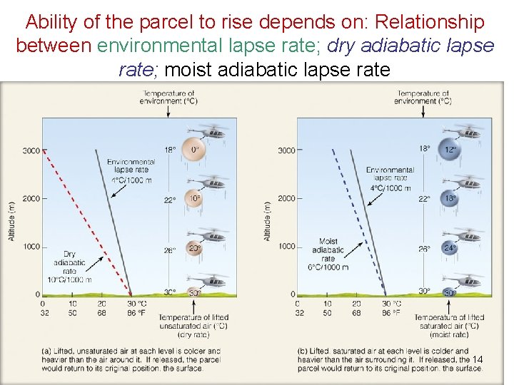
Ability of the parcel to rise depends on: Relationship between environmental lapse rate; dry adiabatic lapse rate; moist adiabatic lapse rate 14

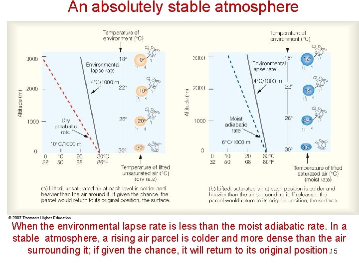
An absolutely stable atmosphere When the environmental lapse rate is less than the moist adiabatic rate. In a stable atmosphere, a rising air parcel is colder and more dense than the air surrounding it; if given the chance, it will return to its original position. 15

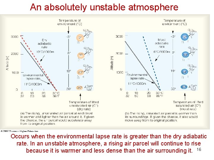
An absolutely unstable atmosphere Occurs when the environmental lapse rate is greater than the dry adiabatic rate. In an unstable atmosphere, a rising air parcel will continue to rise because it is warmer and less dense than the air surrounding it. 16

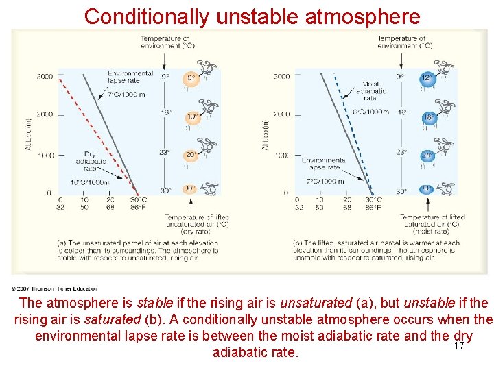
Conditionally unstable atmosphere The atmosphere is stable if the rising air is unsaturated (a), but unstable if the rising air is saturated (b). A conditionally unstable atmosphere occurs when the environmental lapse rate is between the moist adiabatic rate and the dry 17 adiabatic rate.

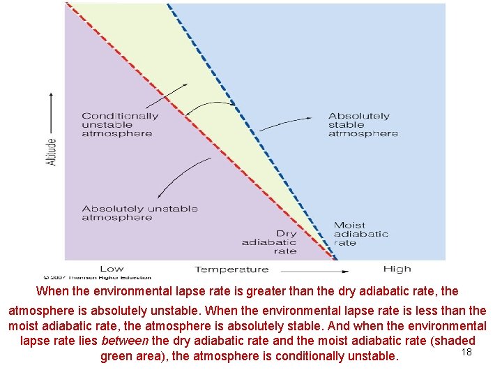
When the environmental lapse rate is greater than the dry adiabatic rate, the atmosphere is absolutely unstable. When the environmental lapse rate is less than the moist adiabatic rate, the atmosphere is absolutely stable. And when the environmental lapse rate lies between the dry adiabatic rate and the moist adiabatic rate (shaded 18 green area), the atmosphere is conditionally unstable.

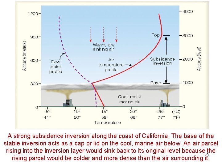
A strong subsidence inversion along the coast of California. The base of the stable inversion acts as a cap or lid on the cool, marine air below. An air parcel rising into the inversion layer would sink back to its original level because the 19 rising parcel would be colder and more dense than the air surrounding it.

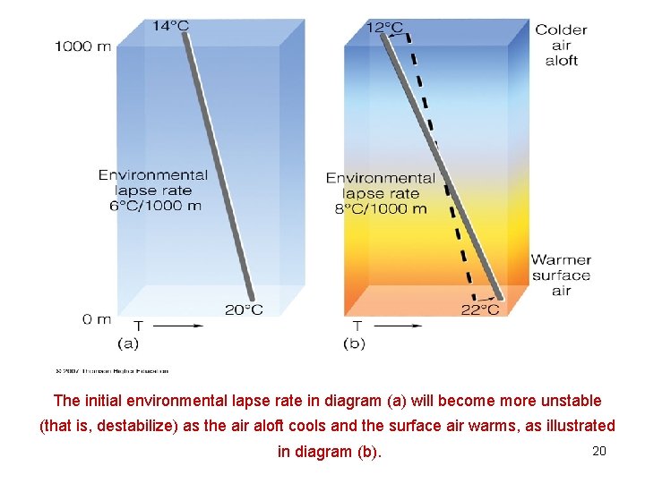
The initial environmental lapse rate in diagram (a) will become more unstable (that is, destabilize) as the air aloft cools and the surface air warms, as illustrated in diagram (b). 20

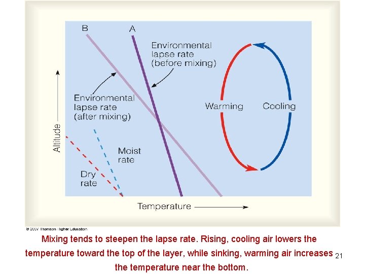
Mixing tends to steepen the lapse rate. Rising, cooling air lowers the temperature toward the top of the layer, while sinking, warming air increases 21 the temperature near the bottom.

The primary ways clouds form (a) surface heating and convection (b) forced lifting along topographic barriers (c) convergence of surface air (d) forced lifting along weather fronts. 22

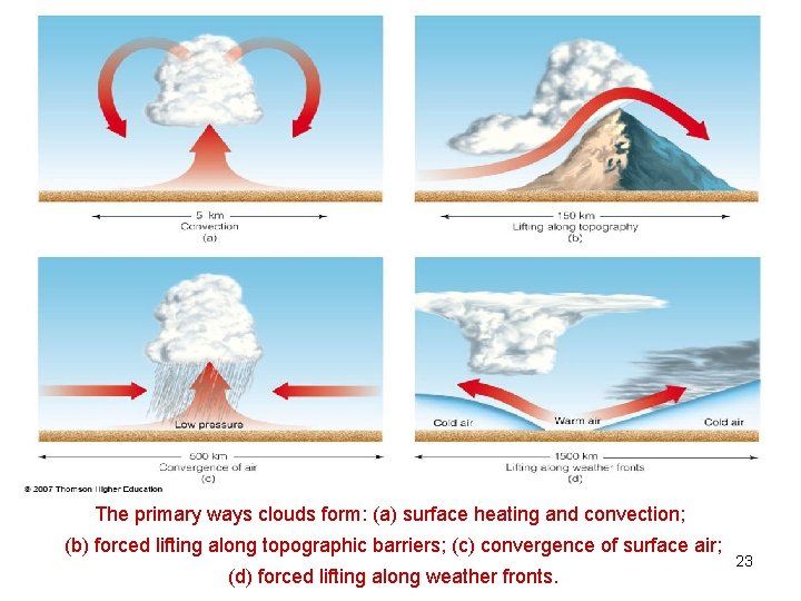
The primary ways clouds form: (a) surface heating and convection; (b) forced lifting along topographic barriers; (c) convergence of surface air; (d) forced lifting along weather fronts. 23

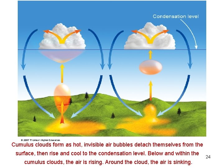
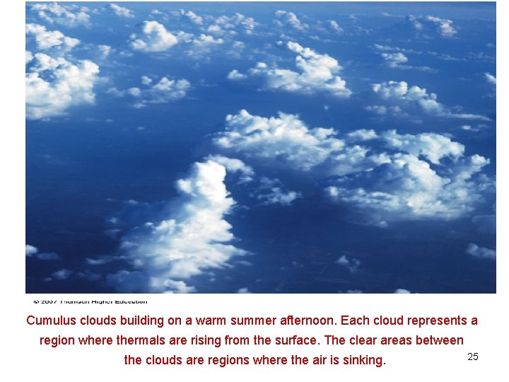
Cumulus clouds form as hot, invisible air bubbles detach themselves from the surface, then rise and cool to the condensation level. Below and within the cumulus clouds, the air is rising. Around the cloud, the air is sinking. 24

Cumulus clouds building on a warm summer afternoon. Each cloud represents a region where thermals are rising from the surface. The clear areas between the clouds are regions where the air is sinking. 25

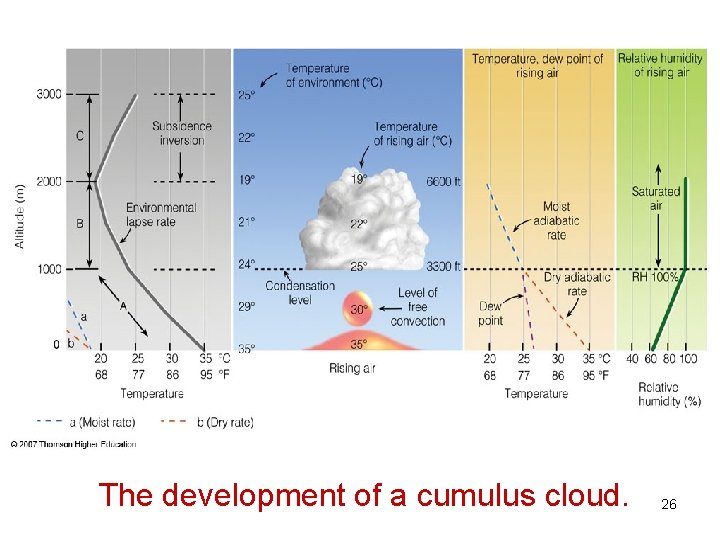
The development of a cumulus cloud. 26

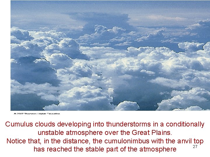
Cumulus clouds developing into thunderstorms in a conditionally unstable atmosphere over the Great Plains. Notice that, in the distance, the cumulonimbus with the anvil top 27 has reached the stable part of the atmosphere

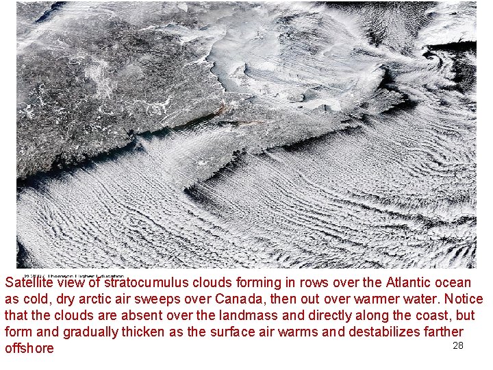
Satellite view of stratocumulus clouds forming in rows over the Atlantic ocean as cold, dry arctic air sweeps over Canada, then out over warmer water. Notice that the clouds are absent over the landmass and directly along the coast, but form and gradually thicken as the surface air warms and destabilizes farther 28 offshore

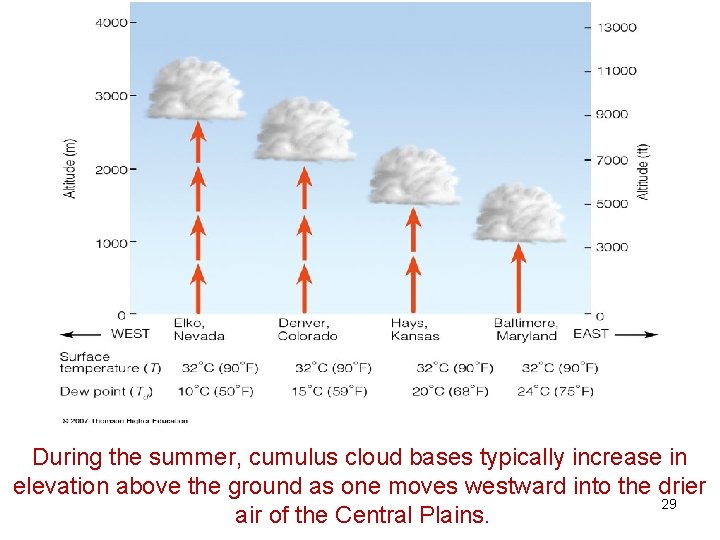
During the summer, cumulus cloud bases typically increase in elevation above the ground as one moves westward into the drier 29 air of the Central Plains.

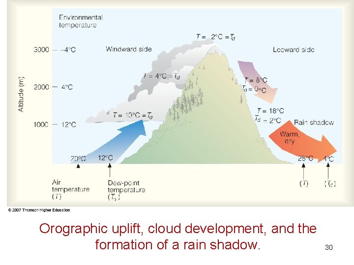
Orographic uplift, cloud development, and the formation of a rain shadow. 30

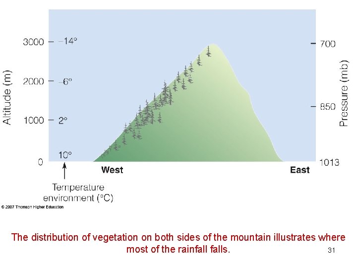
The distribution of vegetation on both sides of the mountain illustrates where 31 most of the rainfalls.

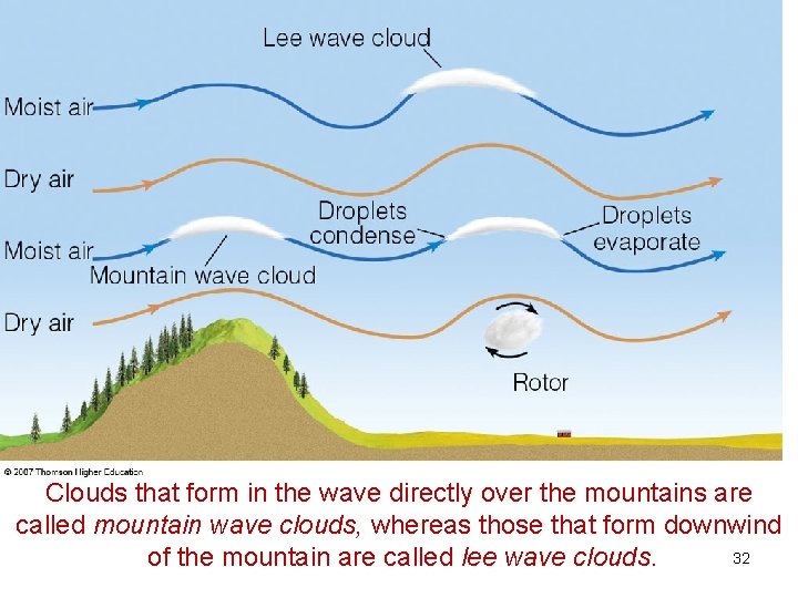
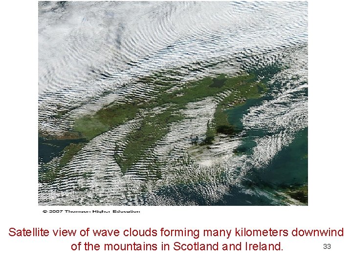
Clouds that form in the wave directly over the mountains are called mountain wave clouds, whereas those that form downwind 32 of the mountain are called lee wave clouds.

Satellite view of wave clouds forming many kilometers downwind 33 of the mountains in Scotland Ireland.

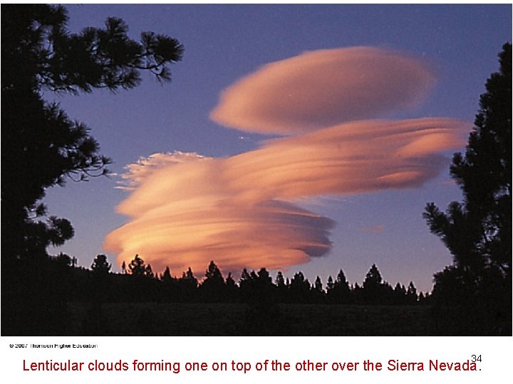
34 Lenticular clouds forming one on top of the other over the Sierra Nevada.

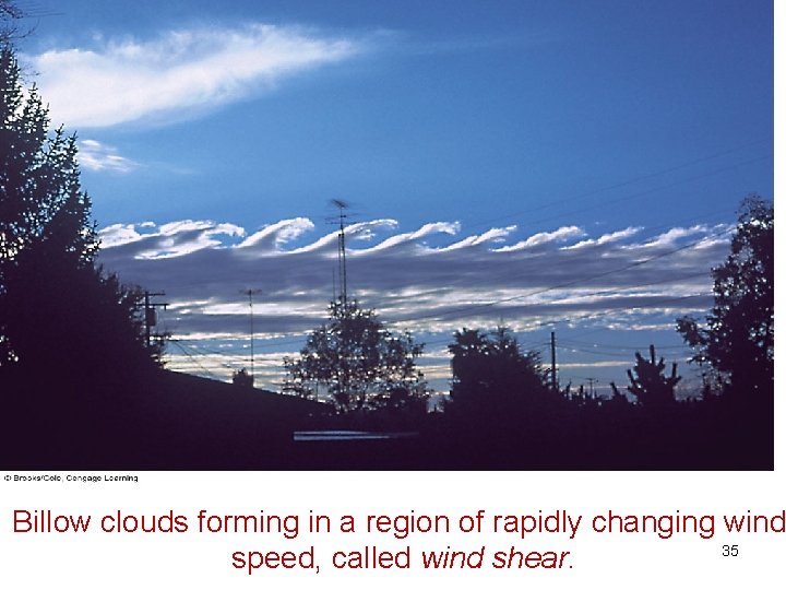
Billow clouds forming in a region of rapidly changing wind 35 speed, called wind shear.

Thermodynamic diagram • Primary function-to produce a graphical display of the lines representing major kinds of processes to which air may be subject: • isobaric, isothermal, dry adiabatic, and pseudoadiabatic. • Lines of constant value of saturation mixing ratio are also needed. • Desired: • As many as possible of fundamental lines be straight • The angle between isotherm and dry adiabats shall be as large as possible • 36