
Research Agenda of Early Warning and CrisesEmergency Management


- Slides: 82
Research Agenda of Early Warning and Crises/Emergency Management: Geoinformatics and Cartography Potentials Milan KONEČNÝ President (Former) ICA President (European Branch) IEAS Vice-President, ISDE Chair of ICA Commission Cartography for EW and CM Director, GIS Laboratory in Masaryk University, Brno, Czech Republic Member of EU-China DRM Project (of highest level) Nanchang, P. R. China, December 06, 2013
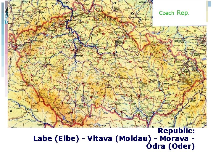
Czech Rep. Main catchment areas of the Czech Republic: Labe (Elbe) - Vltava (Moldau) - Morava - Odra (Oder)
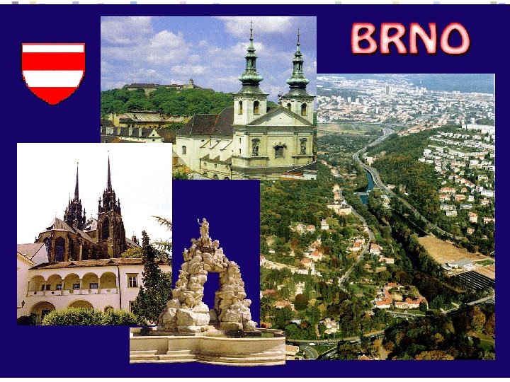
• Masaryk University, Brno, Czech republic
CONTENT 1. Early Warning and Disaster Management: General Problems 2. Where we are? SDIs, GMES, Inspire, …and next? 3. Knowledge and lessons learned from disasters: where is our Cartography community position and tasks? 4. New Areas of Cartography: trends and expectations 5. Conclusions
The impacts of natural hazards continue to increase around the world; the frequency of recorded disasters affecting communities significantly rose from about 100 per decade in the period 1900 -1940, to 650 per decade in the 1960 s and 2000 per decade in the 1980 s, and reached almost 2800 per decade in the 1990 s. Hundreds of thousands of people are killed and millions injured, affected or displaced each year because of disasters, and the amount of property damage has been doubling about every seven years over the past 40 years.
Although earthquakes and tsunamis can have horrific impacts, most disaster losses stem from climate-related hazards such as hurricanes, cyclones, other major storms, floods, landslides, wildfires, heat waves and droughts. Current evidence demonstrates that changes in the global climate will continue to increase the frequency and severity of climate-related hazards.
The increases in costs of disasters are taking place in both developed and developing countries, which suggest that reducing the risks from hazards is not simply a matter of economic growth and development. There is a great shortfall in current research on how science is used to shape social and political decisionmaking in the context of hazards and disasters. These issues also highlight the need for more systematic and reliable information on such events.
KOBE - Hyogo Declaration: it was recognized that a culture of disaster prevention and resilience, and associated pre-disaster strategies, must be fostered at all levels, ranging from the individual to the international levels. Human societies have to live with the risk of hazards posed by nature.
People-Centred Early Warning Systems The objective : - to empower individuals and communities threatened by hazards to act in sufficient time and in an appropriate manner so as to reduce the possibility of personal injury, loss of life, damage to property and the environment and of livelihoods.
To be effective, early warning systems must be people-centred and must integrate four elements : 1. knowledge of the risks faced; 2. technical monitoring and warning service; 3. dissemination of meaningful warnings to those at risk; and 4. public awareness and preparedness to act. 1. Failure in any one of these elements can
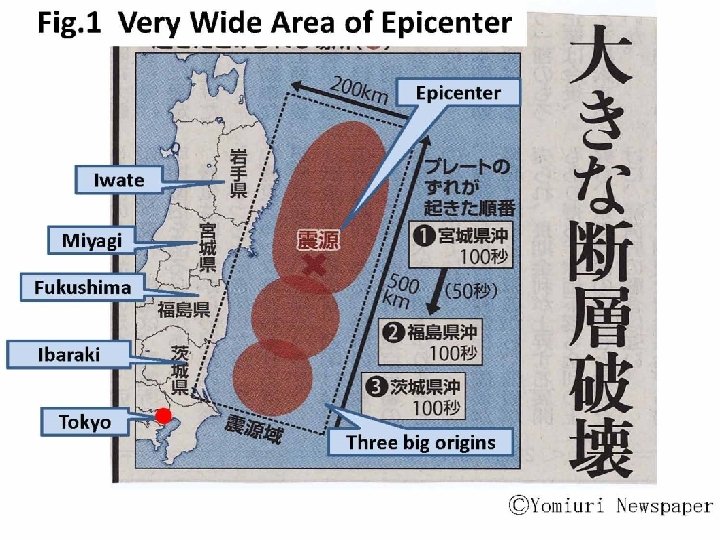
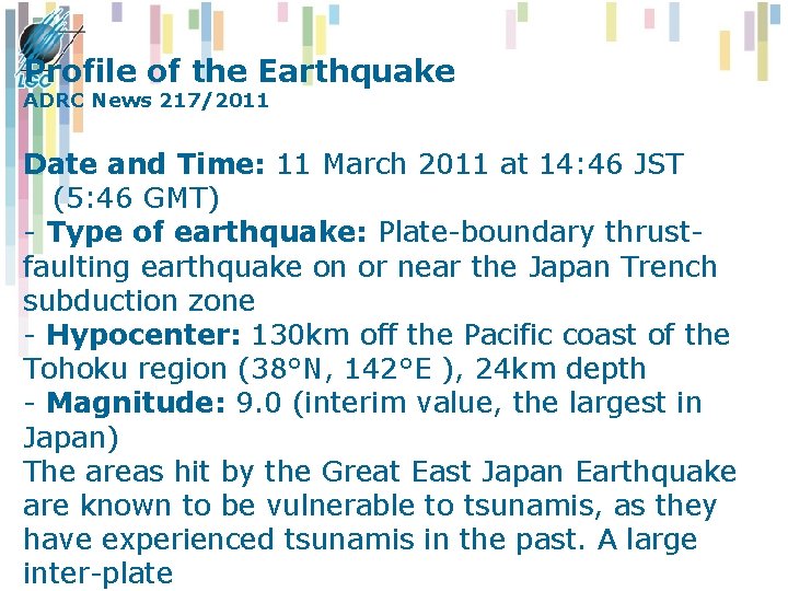
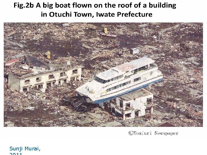
Profile of the Earthquake ADRC News 217/2011 Date and Time: 11 March 2011 at 14: 46 JST (5: 46 GMT) - Type of earthquake: Plate-boundary thrustfaulting earthquake on or near the Japan Trench subduction zone - Hypocenter: 130 km off the Pacific coast of the Tohoku region (38°N, 142°E ), 24 km depth - Magnitude: 9. 0 (interim value, the largest in Japan) The areas hit by the Great East Japan Earthquake are known to be vulnerable to tsunamis, as they have experienced tsunamis in the past. A large inter-plate
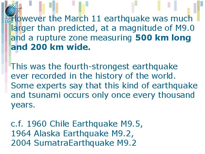
However the March 11 earthquake was much larger than predicted, at a magnitude of M 9. 0 and a rupture zone measuring 500 km long and 200 km wide. This was the fourth-strongest earthquake ever recorded in the history of the world. Some experts say that this kind of earthquake and tsunami occurs only once every thousand years. c. f. 1960 Chile Earthquake M 9. 5, 1964 Alaska Earthquake M 9. 2, 2004 Sumatra. Earthquake M 9. 2
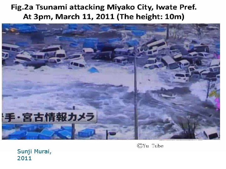
Sunji Murai, 2011
Sunji Murai,
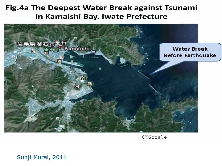
Kamaishi City, Iwate Prefecture constructed huge breakwaters 2 km long, 20 m thick, 8 m above sea level and 65 m deep, which have been registered as the deepest breakwaters in the Guinness World Records (see Fig. 4 a and 4 b).
Sunji Murai, 2011
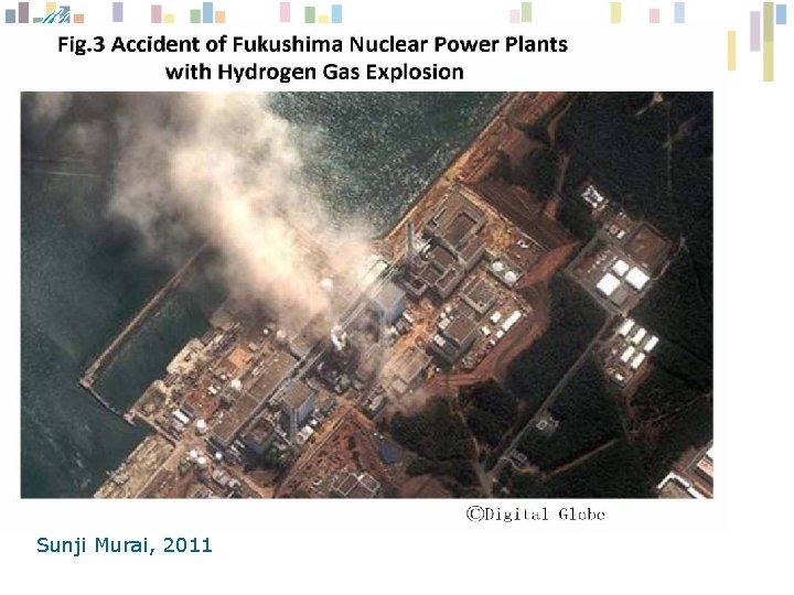
Sunji Murai, 2011
Sunji Murai, 2011
We should have learnt the lessons that ‘hardware’ including very high breakwaters, cannot save people but we need to use ‘software’ including procedures for providing early warning and evacuation systems.
Five major characteristics of disasters that make them hard to overcome (NRC 2007, …. ): 1. Disasters are large, rapid-onset incidents relative to the size and resources of an affected jurisdiction. …. if pre-accident data are available, geospatial analysis can provide important insight into the nature and extent of changes wrought by disasters. 2. Disasters are uncertain with respect to both their occurences and their outcomes. …causal relationship between hazards and disasterr event is porly understood and risks are hard to memasure… Geospatial models: predisctions of locations, footprints, times, durations of events, the damage they may cause, so that jurisdiction can better
3. Risks and benefits are difficult to assess and compare. … accuracy of risk assessmement…. . . Geospatial data are invaluable in making the necessary assessments of the geographic distribution of risk and in estimating the quality of each assessment. 4. Disasters and dynamic events. …human actions and natural forces…Response strategies has to be flexible and argues for the value of analysis in helping responders undesrtand adapt to the changing conditions they face. …. . geospatial data and tools can help incident managers to visualize the event over time, track the activities of responders, and predict
5. Disasters are relatively rare. ……public service conserns readily displace disaster preparedness as a priority. …. Specialized capabilities, such as geospatial data and tools are especially vulnerableto budget cuts and resource realocation. Magnitude, scope , uncertainity, dynamism, and infrequency of disasters give rise to some important QUESTIONS.
…. disaster prevention must be integrated into other EU policies, including development policy, . . establishing a European-wide inventory of existing information and best practices, developing guidelines on hazard and risk-mapping, and improving access to early warning systems, disaster prevention within the EU should aim at further development of knowledge-based disaster prevention policies at all levels of government (i. e. local, regional, national and EU-level); EU should support and encourage the exchange of information related to disasters and their social, economic and environmental impact.
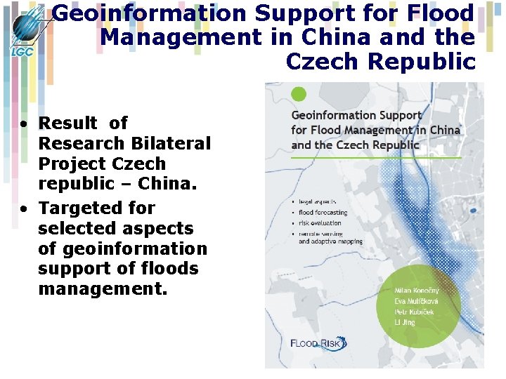
Geoinformation Support for Flood Management in China and the Czech Republic • Result of Research Bilateral Project Czech republic – China. • Targeted for selected aspects of geoinformation support of floods management.
Where we are as Cartographic community? SDIs, GMES, INSPIRE, , , , Digital Earth…and next? President William J. Clinton (13 August 1994): “Geographic information is critical to promote economic development, improve our stewardship of natural resources, and protect the environment. Modern technology now permits improved acquisition, distribution, and utilization of geographic (or geospatial) data and mapping. . NSDI (National Spatial Data Infrastructure) Al Gore, January 1998: Digital Earth is “A multi-resolution, three-dimensional representation of the planet, into which we can embed vast quantities of geo-referenced data. “ Chinese footprint: Internat. Society on Digital Earth (ISDE)
Global Monitoring for Environment and Security (INSPIRE/ESDI)
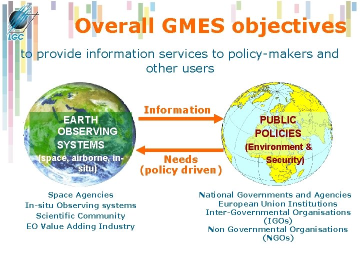
Overall GMES objectives to provide information services to policy-makers and other users EARTH OBSERVING SYSTEMS (space, airborne, insitu) Space Agencies In-situ Observing systems Scientific Community EO Value Adding Industry Information Needs (policy driven) PUBLIC POLICIES (Environment & Security) National Governments and Agencies European Union Institutions Inter-Governmental Organisations (IGOs) Non Governmental Organisations (NGOs)
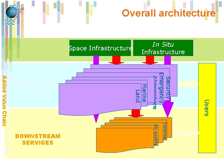
Overall architecture Space Infrastructure Users Security Emergency Atmosphere Farming ICZM Air quality DOWNSTREAM SERVICES Marine Land Added Value Chain CORE SERVICES In Situ Infrastructure
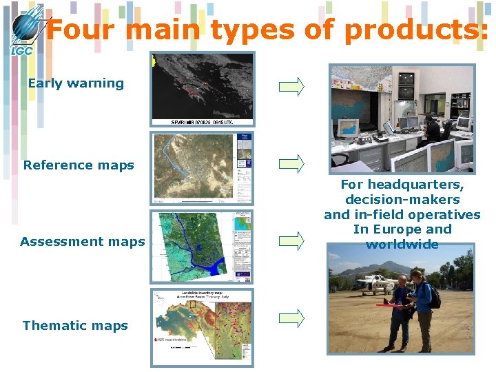
Four main types of products: Early warning Reference maps Assessment maps Thematic maps For headquarters, decision-makers and in-field operatives In Europe and worldwide
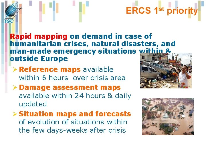
ERCS 1 st priority Rapid mapping on demand in case of humanitarian crises, natural disasters, and man-made emergency situations within & outside Europe Ø Reference maps available within 6 hours over crisis area Ø Damage assessment maps available within 24 hours & daily updated Ø Situation maps and forecasts of evolution of situations within the few days-weeks after crisis
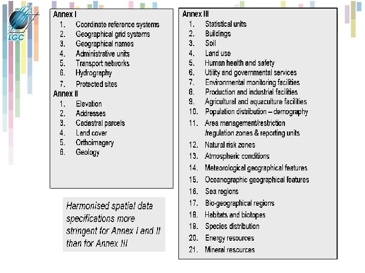
INSPIRE Infrastructure for Spatial Information in Europe
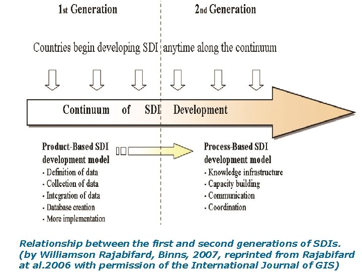
SDI Generations From 1 st to 2 nd Generation and to Spatially-Enabled Society
Relationship between the first and second generations of SDIs. (by Williamson Rajabifard, Binns, 2007, reprinted from Rajabifard at al. 2006 with permission of the International Journal of GIS)
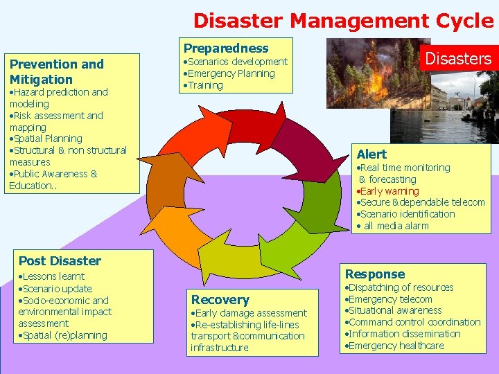
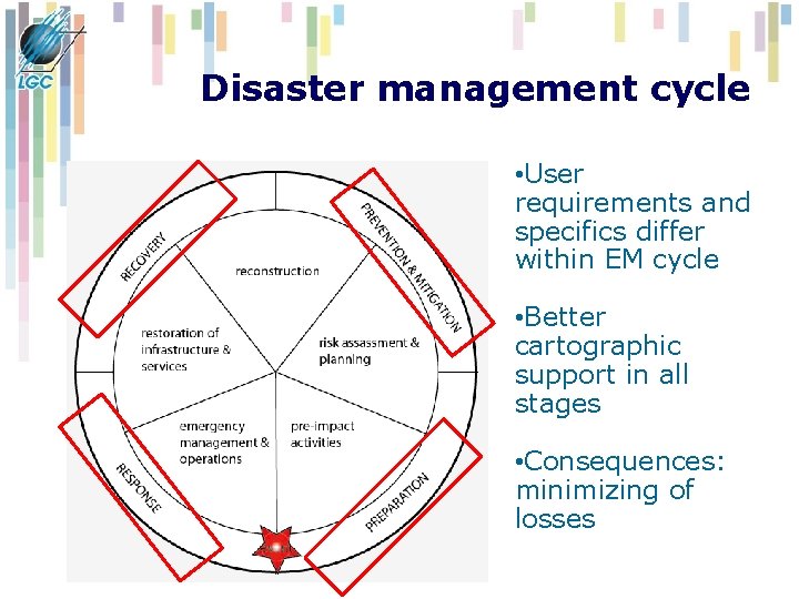
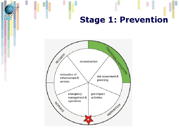
Disaster Management Cycle Preparedness Prevention and Mitigation • Hazard prediction and modeling • Risk assessment and mapping • Spatial Planning • Structural & non structural measures • Public Awareness & Education. . Alert • Real time monitoring & forecasting • Early warning • Secure &dependable telecom • Scenario identification • all media alarm Post Disaster • Lessons learnt • Scenario update • Socio-economic and environmental impact assessment • Spatial (re)planning Disasters • Scenarios development • Emergency Planning • Training Response Recovery • Early damage assessment • Re-establishing life-lines transport &communication infrastructure • Dispatching of resources • Emergency telecom • Situational awareness • Command control coordination • Information dissemination • Emergency healthcare
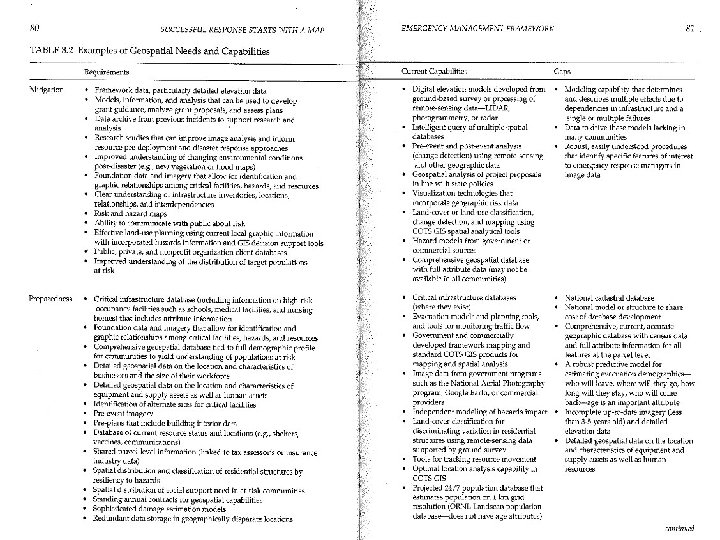
Knowledge and lessons learned from disasters: where is our GI community position and tasks? National Academy Reports in USA (after huricane Katrina) Successful Response Starts with a Map. Improving Geospatial Support for Disaster Management, NRC. 2007 Elevation data for Floodplain Mapping. The National Academy. 2007.
Geospatial Data Needs -Ability to assess risk and resilience, -Pre-incident forecasts about hazard behaviour, likely damage, property vulnerability, and potential victims, -Decision aids to support recommendations for pre positionning resources and evaluation, -Timely, incident-specific locational information with respect to hazards, damage, victims, …. including information about people and their needs,
-Ongoing monitoring and evolving hazards, response efforts, and resource status, and -Insight into the interdependence and status of infratsructure components (energy, water, sanitation, road, communications, …. security system, etc. ) and awareness of critical infrastructure and facility vulnerability and status (refineries, chemical facilities, hazardous waste sites, bridges, …. .
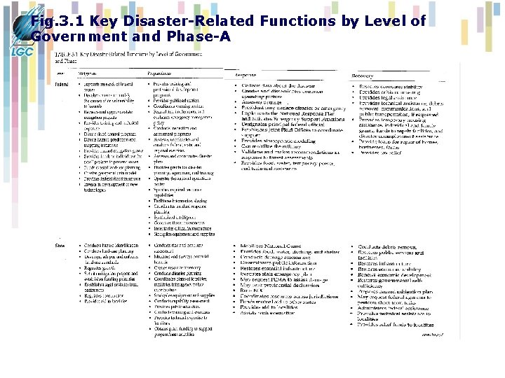
Fig. 3. 1 Key Disaster-Related Functions by Level of Government and Phase-A
Disaster management cycle • User requirements and specifics differ within EM cycle • Better cartographic support in all stages • Consequences: minimizing of losses
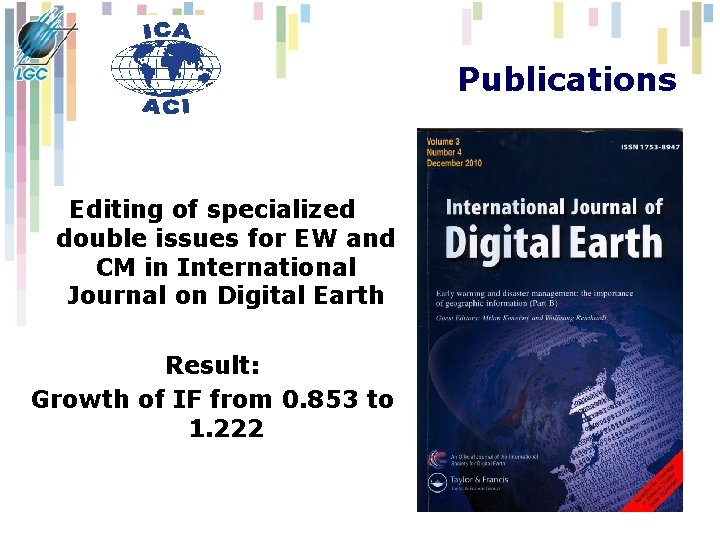
Publications Editing of specialized double issues for EW and CM in International Journal on Digital Earth Result: Growth of IF from 0. 853 to 1. 222
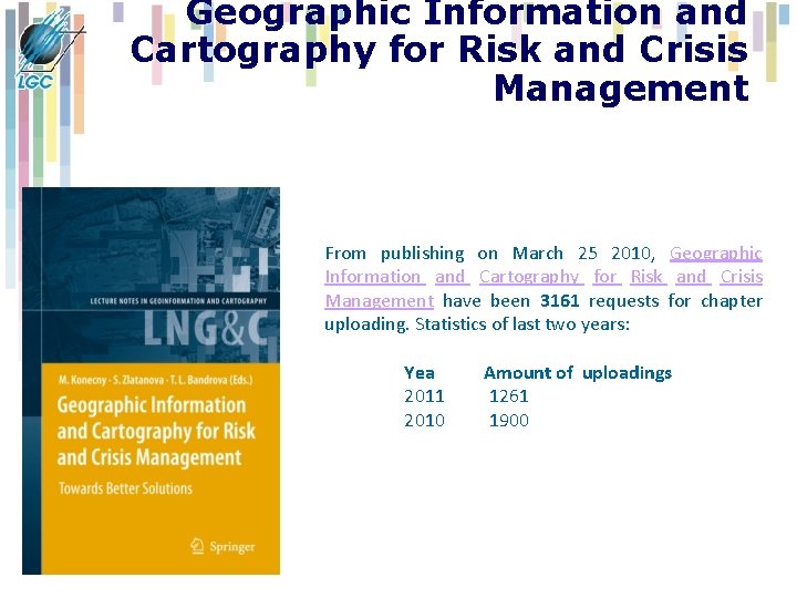
Geographic Information and Cartography for Risk and Crisis Management From publishing on March 25 2010, Geographic Information and Cartography for Risk and Crisis Management have been 3161 requests for chapter uploading. Statistics of last two years: Yea 2011 2010 Amount of uploadings 1261 1900
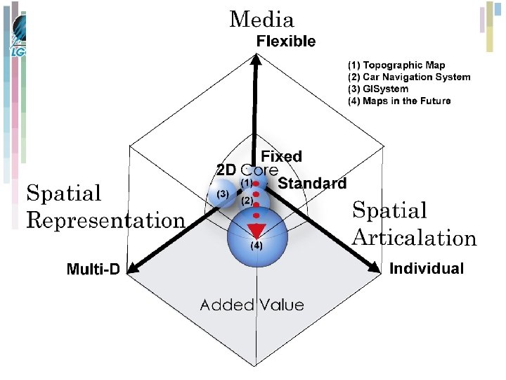
Potentials of cartography: context and adaptive cartography
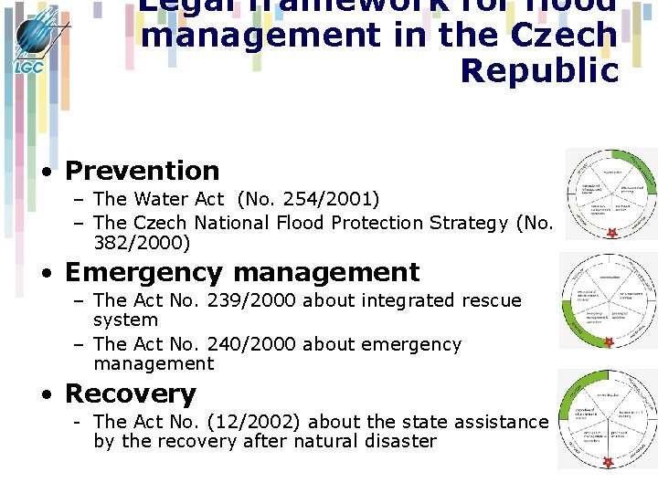
Legal framework for flood management in the Czech Republic • Prevention – The Water Act (No. 254/2001) – The Czech National Flood Protection Strategy (No. 382/2000) • Emergency management – The Act No. 239/2000 about integrated rescue system – The Act No. 240/2000 about emergency management • Recovery - The Act No. (12/2002) about the state assistance by the recovery after natural disaster
Stage 1: Prevention
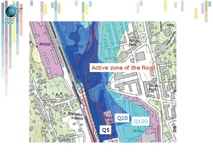
Flood mapping in the Czech Republic • Flood zone map – Public availability • Maps of historical floods – Public availability • Insurance map – Commercial bases
Determination of flood zones • Legal notice No. 236/2002 about process of elaboration of the flood areas • Set for discharges that occure once per – 5 – 20 – 100 years • Active zone of flood area: urban areas that influence drainage during floods
Active zone of the flood Q 20 Q 5 Q 100
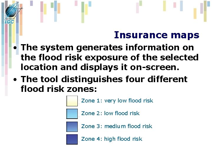
Insurance maps • The system generates information on the flood risk exposure of the selected location and displays it on-screen. • The tool distinguishes four different flood risk zones: Zone 1: very low flood risk Zone 2: low flood risk Zone 3: medium flood risk Zone 4: high flood risk
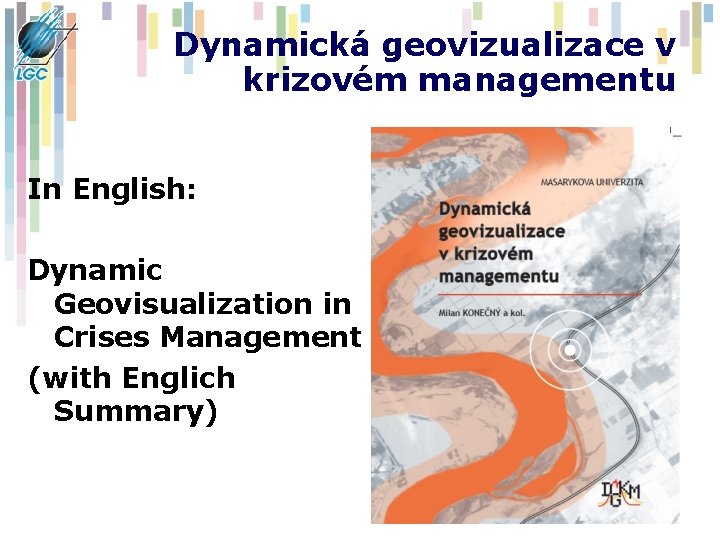
Dynamická geovizualizace v krizovém managementu In English: Dynamic Geovisualization in Crises Management (with Englich Summary)
Traditional vs. adaptive map • Traditional map – Static – Universal – As much information as possible (level of legibility) – Demand on high level of user knowledge • Adaptive map – As little information as needed for interpretation – No redundancy of information – Individual
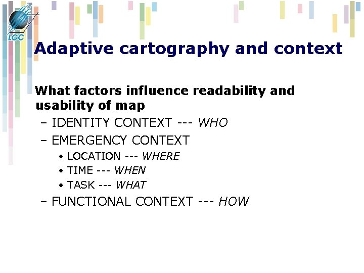
Adaptive cartography and context What factors influence readability and usability of map – IDENTITY CONTEXT --- WHO – EMERGENCY CONTEXT • LOCATION --- WHERE • TIME --- WHEN • TASK --- WHAT – FUNCTIONAL CONTEXT --- HOW
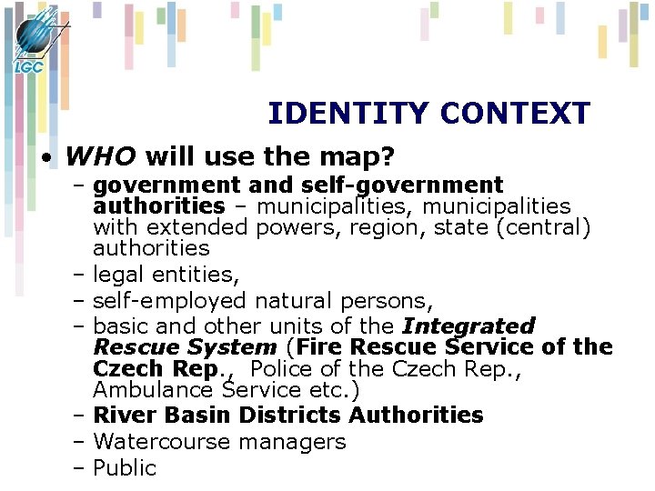
IDENTITY CONTEXT • WHO will use the map? – government and self-government authorities – municipalities, municipalities with extended powers, region, state (central) authorities – legal entities, – self-employed natural persons, – basic and other units of the Integrated Rescue System (Fire Rescue Service of the Czech Rep. , Police of the Czech Rep. , Ambulance Service etc. ) – River Basin Districts Authorities – Watercourse managers – Public
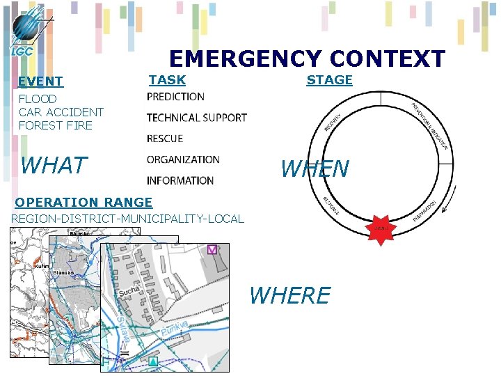
EMERGENCY CONTEXT EVENT TASK STAGE FLOOD CAR ACCIDENT FOREST FIRE WHAT WHEN OPERATION RANGE REGION-DISTRICT-MUNICIPALITY-LOCAL WHERE
ADAPTIVE CARTOGRAPHY Adaptability of Cartographic Representation 1. User level–operational units, dispatching units and stakeholders need different scales, themes and map extent, but over the same data. 2. User background–different educational and map use bias. 3. Theme importance – different features in map content and variable significance with changing emergency situation.
ADAPTIVE CARTOGRAPHY 4. New phenomena – new features reflecting the emergency status need to be inserted into map consistently. 5. Interaction device and environment – various electronic visualization devices are used and they are also in interaction with environment which is influencing visibility and amount of information used.
Context-Based Cartography
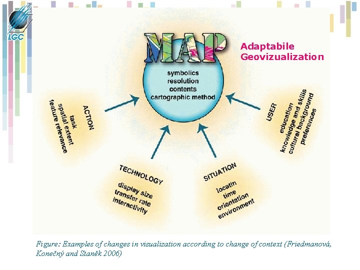
Adaptabile Geovizualization Figure: Examples of changes in visualization according to change of context (Friedmanová, Konečný and Staněk 2006)
The subject-matter of adaptive cartography is automatic creation of correct geodata visualization with regard to situation, purpose and the user. Adaptive maps are still maps in the conventional sense – they are correct and well-readable medium for transfer of spatial information. The user controls map modifications indirectly via modification of context.
The term context refers to a set of characteristics providing answers to the following questions: Who is the map reader – information on abilities of the user to read maps, their visual preferences, level of knowledge and/or education. This information forms the user profile. What is the purpose of the map – information on solved problems, spatial extent of the problem and information on hierarchy of map content items depending on the given problem.
Where is the map used – information on place, time, orientation and natural conditions influencing map perception (e. g. light conditions) What is the device displaying the map – set of information related to parameters of the display, transmission capacity and software characteristics of client application.
Usability of Selected Base Maps for Crises Management - Users Perspectives COGNITIVE STYLE GI 4 DM, Torino 2010
Personality of map users Cognitive style or "thinking style" is a term used in cognitive psychology to describe the way individuals think, perceive and remember information, or their preferred approach to using such information to solve problems. Cognitive style differs from cognitive ability…. (Konecny et al. , 2011 Usability of selected base maps for crises management – users perspectives. Applied Geomatics, DOI 10. 1007/s 12518 -011 -0053 -1. Springer JW. 2011, pp. 1 -10. ISSN 1866 -9298. )
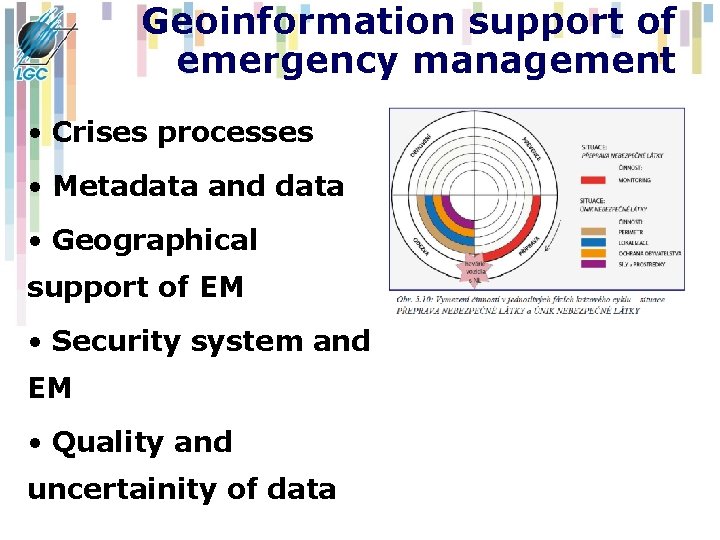
Geoinformation support of emergency management • Crises processes • Metadata and data • Geographical support of EM • Security system and EM • Quality and uncertainity of data
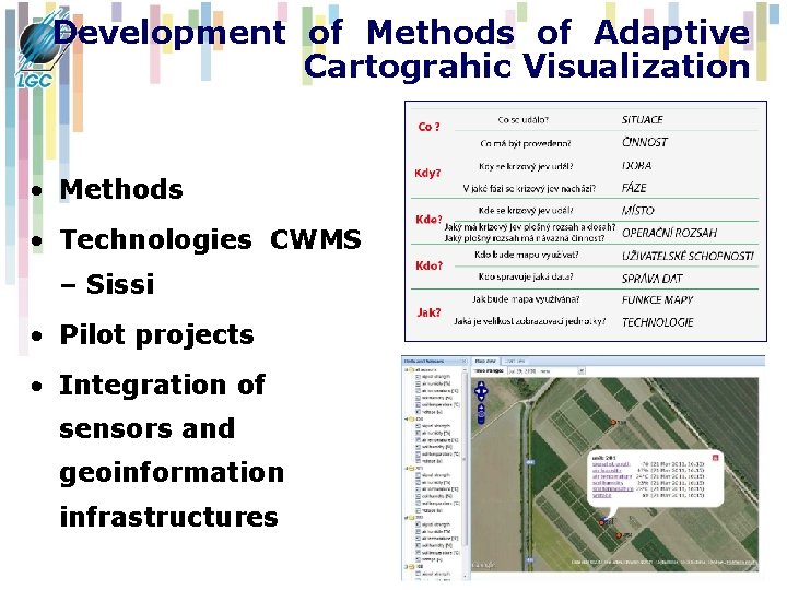
Development of Methods of Adaptive Cartograhic Visualization • Methods • Technologies CWMS – Sissi • Pilot projects • Integration of sensors and geoinformation infrastructures
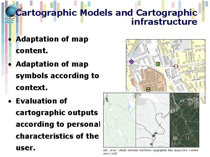
Cartographic Models and Cartographic infrastructure • Adaptation of map content. • Adaptation of map symbols according to context. • Evaluation of cartographic outputs according to personal characteristics of the user.
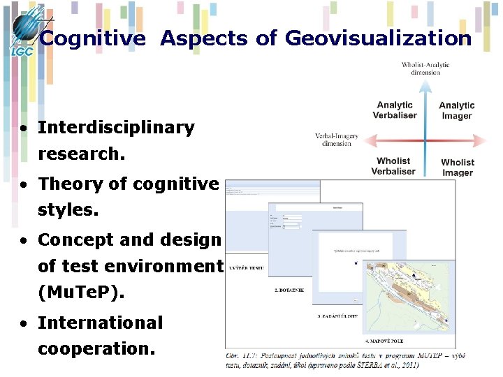
Cognitive Aspects of Geovisualization • Interdisciplinary research. • Theory of cognitive styles. • Concept and design of test environment (Mu. Te. P). • International cooperation.
How to manage volunteer geographic information? Chaos or help?
Volunteer geographic information VGI: “The terms, “crowdsourcing” and “collective intelligence” draw attention to the notion that the collective contribution of a number of individuals may be more reliable than those of any one individual. The term VGI refers specifically to geographic information and to the contrast between the actions of amateurs and those of authoritative agencies. ” Goodchild (2009, p. 18)
The term asserted that geographic information draws attention to the fact that such information is not subject to the normal checks and quality control mechanisms of those agencies, while neo-geography emphasizes the contrast between the grass-roots phenomenon and the current state of the academic discipline of geography.
Next relevant activities: 2013: December 3 -5, ICA Commission for Cartography for EW and Crises Management, Wuhan, China 2014: Inter. Expo Geosiberiam April 18 -18 5 th Cartography and GIS Conference; Seminar on EW and CM, June 16 - 20, 2014, Albena, Bulgaria
FALEMINDERIT CHVALA Bardzo Dziekuje Xie, Xie!!!!! THANK YOU Muchas Gracias Terima Kasim O Brigada Kammsa Hamida Aligator SHUKRAN BLAGODARJA DĚKUJI ( in Czech)
Danke Schon!!!!! Rachmed THANK YOU Muchas Gracias O Brigada Kammsa Hamida Aligator SHUKRAN BLAGODARJA DĚKUJI ( in Czech)