Representing Climate Data continued Weather Radar radar Radio
 Weather Radar")
 Allows us to look inside of clouds and “see”")

 • detect small targets • (e. g. ,")


 • Combine radar with topography, roads, county")


: good for flooding,")

- Slides: 31
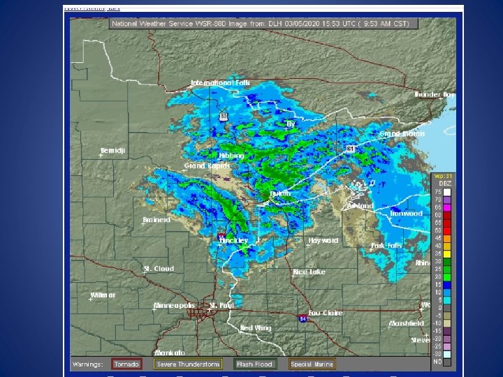
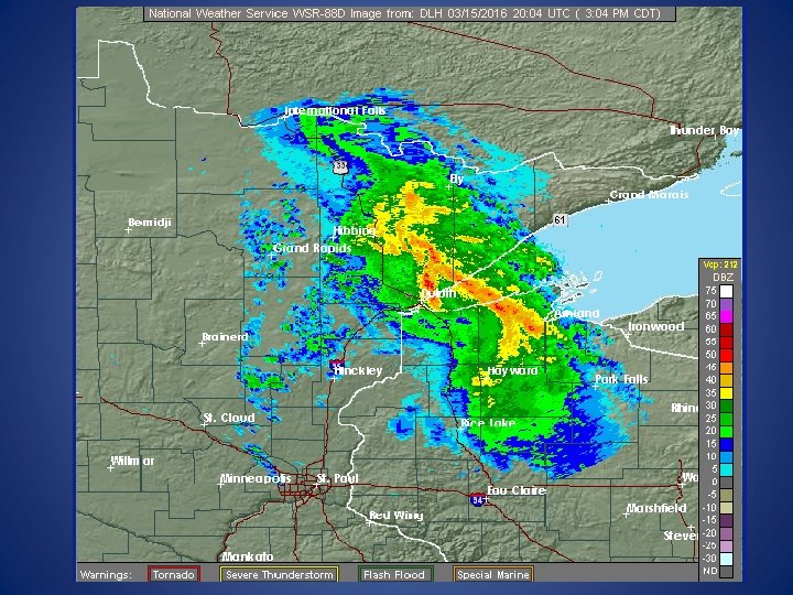
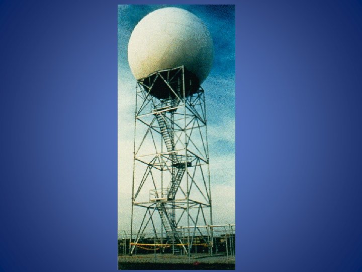
Representing Climate Data (continued) Weather Radar
radar (Radio Detection and Ranging) Allows us to look inside of clouds and “see” types of precipitation.
• A transmitter sends microwave pulses. • “Targets” scatter energy back to receiver. • Amplified and displayed as echo • Time between emitting energy and receiving it back from target tells distance to target.
• Shorter microwavelengths (~1 cm) • detect small targets • (e. g. , tiny droplets of water in clouds) • Longer micro-wavelengths (3 -10 cm) • detect larger targets • (e. g. , precipitation) • Brightness of echo • Amount of precipitation
Reflectivity units d. BZ : decibels of Z • “Z” is energy reflected back to radar • Values increase with strength of signal and intensity of ppt Two Modes: 1. Clear air 2. Precipitation • d. BZ equate to approximate rainfall rates
Clear Air Mode
Precipitation Mode
• Makes repeated 360˚scans of atmosphere at increasing elevation angles. • 2 modes: • Clear Air mode • No rain • Dust, light snow • VCP 31, 32, 35 (volume coverage pattern) • Precipitation mode • Rain or snow • VCP 12, 215
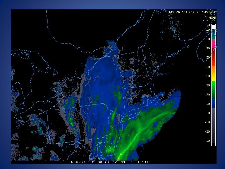
Ground clutter • Ground, buildings, trees, cars • Within 25 km of radar • Not moving with respect to radar, so can be detected by radial velocity • Insects • Birds • Turbulence • Effects density • Particulate Matter
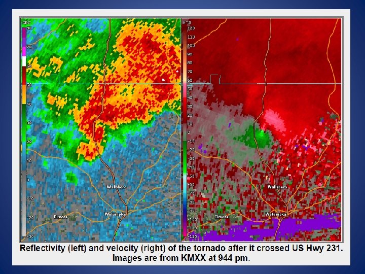
Doppler Radar • Based on principle of Doppler shift: • Waves moving towards observer have different frequencies than waves moving away from observer. • e. g. , sound from approaching vs. leaving ambulance • Doppler radar can measure direction • Knowing wind speeds and directions within clouds gives info about vorticity (spin)
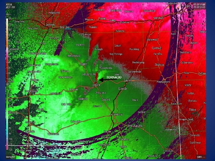
Velocity units • Radial velocities in knots • Red: wind moving AWAY • Green: TOWARD radar • Need to know where radar is!
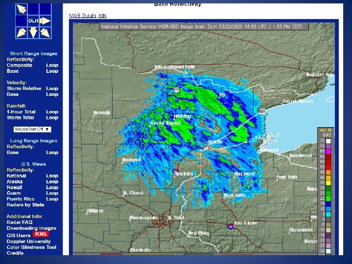
Base reflectivity • Reflectivity in lowest elevation “slice” • Used to survey area close to radar
Composite reflectivity • Combines all elevation scans • Shows highest reflectivity
Dual-Polarization radar • Conventional radar receives pulses in horizontal directions. • Dual-pole : horizontal and vertical • Get a better picture of what exactly the targets are: hail, rain, snow, melting snow, insects!
Example of use of dual pole radar: can detect hail
Example of tornadic debris ball using dual pole
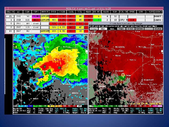
RIDGE (Radar Integrated Display with Geospatial Elements) • Combine radar with topography, roads, county lines, rivers, warnings • Overlay maps as layers • Toggle layers on or off • GIS compatible NWS Duluth
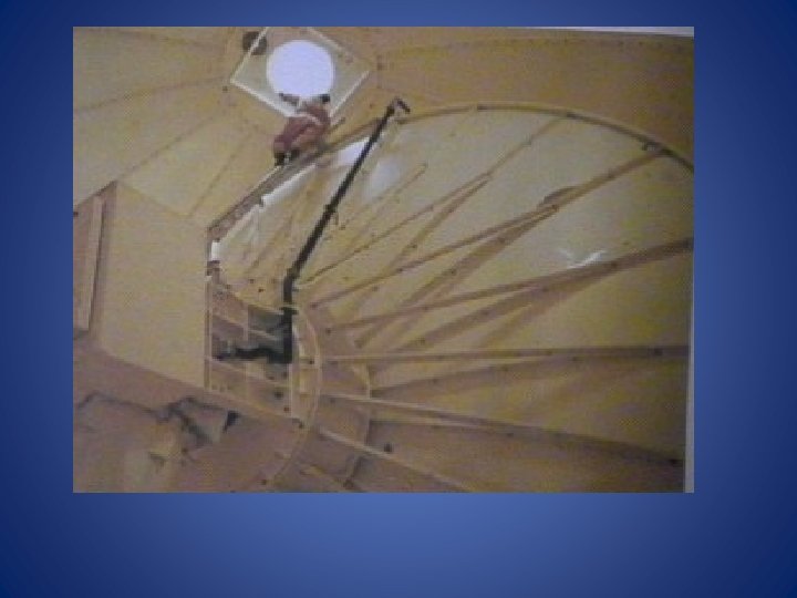
Links to interesting and helpful short videos: 1. BATS in Texas were detected on weather radar: Check this out! Full link: https: //weather. com/science/weather-explainers/news/2020 -03 -20 radar-strange-cool-things-bats 2. Take a tour inside the “giant soccer ball” to see what’s inside: Tour the radome! Full link: http: //hot 1047. com/go-inside-a-doppler-radar-with-the-national-weather -service-video/ 3. Have a look at the latest radar technology: dual pole Dual pole Full link: https: //www. youtube. com/watch? v=Qdv. AODg-lts
REVIEW • Geostationary and polar-orbiting satellites • Visible satellite imagery: • • • Records albedo Only useful during daylight hours Shows all cloud cover, land/water, frontal systems, snow surfaces Transmitted through shortwave window NEW GOES bands: • BLUE (0. 47µm): good for aerosols • RED (0. 64 µm) : good for snow/ice • Infrared satellite imagery: • Thermal IR • • • Records emitted IR Records day and night Detects temperature Reads cloud height NEW GOES bands: • CLOUD TOP PHASE ( 8. 4 µm): good for cloud composition • CLEAN IR WINDOW (10. 3µm): good for cloud heights
• Near IR Solar; Daytime only Veggie Band (0. 86µm): good for flooding, burn scars, types of vegetation, fog cirrus (not lower troposphere because water vapor absorption) Cirrus Band (1. 37 µm) : good for cirrus clouds, volcanic ash Water vapor satellite imagery: Records infrared at 6. 2 – 7. 3 µ emitted by water vapor Upper, middle, lower troposphere Tracks moisture Shows storm (low) centers Shows jet streams and sinking air Good for observing structure of storms
RADAR: Is an active form of remote sensing because it sends out energy. “target” (precipitation) scatters energy, some back to receiver, which displays it as “echo”. Brightness is intensity of precipitation Two Modes: Clear Air (can pick up ground clutter) and Precipitation d. BZ values: decibels of Z = strength of return signal Doppler : provides direction of targets toward or away from radar. Velocity image : used to identify rotation Dual polarization: can decipher and identify targets better RIDGE: GIS compatible