
Remote Sensing and Active Tectonics Barry Parsons and
Remote Sensing and Active Tectonics Barry Parsons and Richard Walker Michaelmas Term 2013 Lecture 2
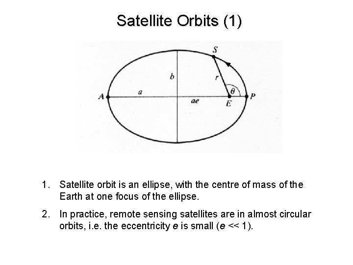
Satellite Orbits (1) 1. Satellite orbit is an ellipse, with the centre of mass of the Earth at one focus of the ellipse. 2. In practice, remote sensing satellites are in almost circular orbits, i. e. the eccentricity e is small (e << 1).
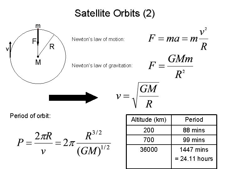
Satellite Orbits (2) m v F Newton’s law of motion: R M Period of orbit: Newton’s law of gravitation: Altitude (km) Period 200 88 mins 700 99 mins 36000 1447 mins = 24. 11 hours

Istanbul Athens
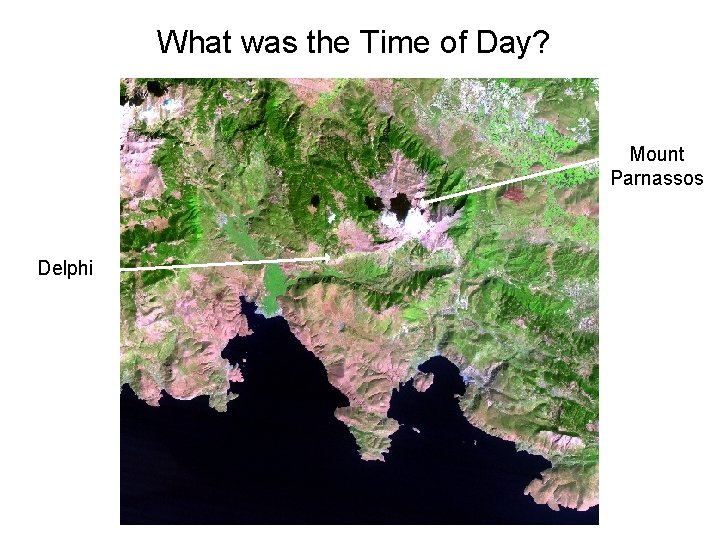
What was the Time of Day? Mount Parnassos Delphi
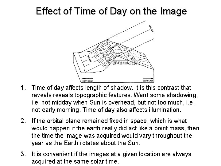
Effect of Time of Day on the Image 1. Time of day affects length of shadow. It is this contrast that reveals topographic features. Want some shadowing, i. e. not midday when Sun is overhead, but not too much, i. e. not early morning. Time of day also affects illumination. 2. If the orbital plane remained fixed in space, which is what would happen if the earth really did act like a point mass, then the time the image was acquired would vary throughout the year as the Earth rotates about the Sun. 3. It is convenient if the images at a given location are always acquired at the same solar time.
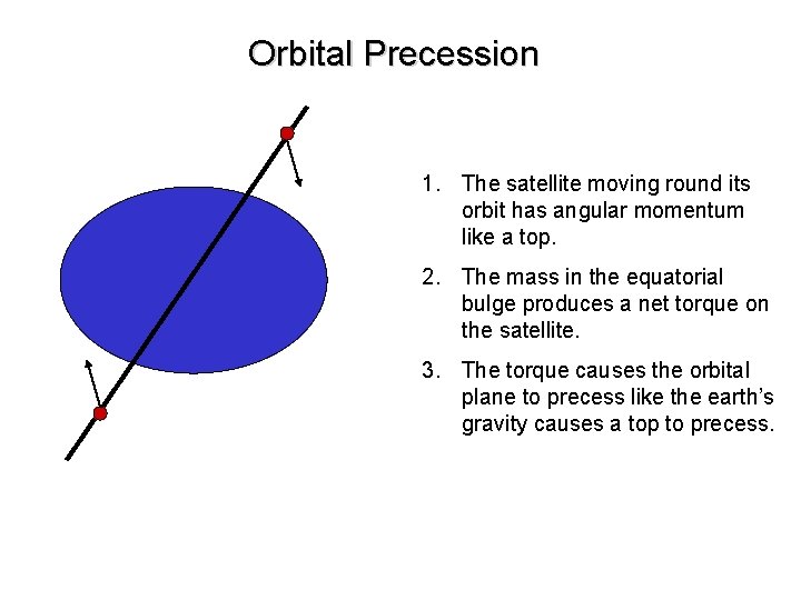
Orbital Precession 1. The satellite moving round its orbit has angular momentum like a top. 2. The mass in the equatorial bulge produces a net torque on the satellite. 3. The torque causes the orbital plane to precess like the earth’s gravity causes a top to precess.
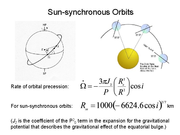
Sun-synchronous Orbits Rate of orbital precession: For sun-synchronous orbits: km (J 2 is the coefficient of the P 20 term in the expansion for the gravitational potential that describes the gravitational effect of the equatorial bulge. )
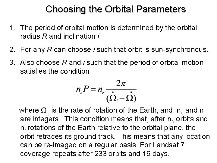
Choosing the Orbital Parameters 1. The period of orbital motion is determined by the orbital radius R and inclination i. 2. For any R can choose i such that orbit is sun-synchronous. 3. Also choose R and i such that the period of orbital motion satisfies the condition where Ωe is the rate of rotation of the Earth, and no and nr are integers. This condition means that, after no orbits and nr rotations of the Earth relative to the orbital plane, the orbit retraces its ground track. This means that any location can be re-imaged on a regular basis. For Landsat 7 coverage repeats after 233 orbits and 16 days.
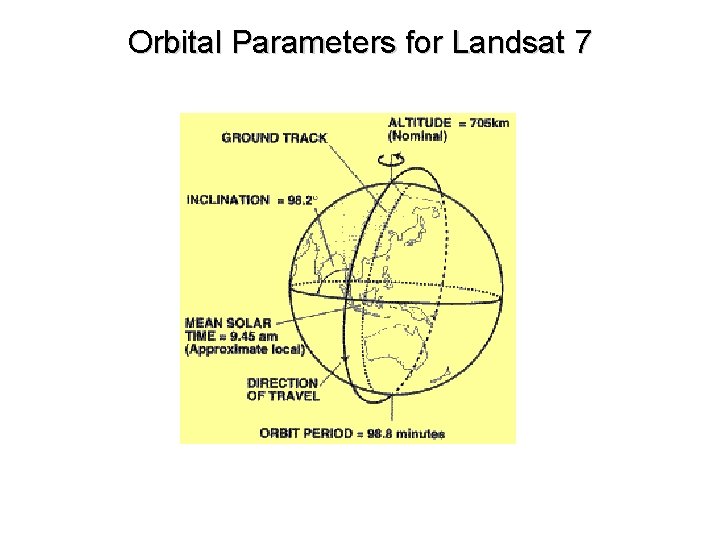
Orbital Parameters for Landsat 7
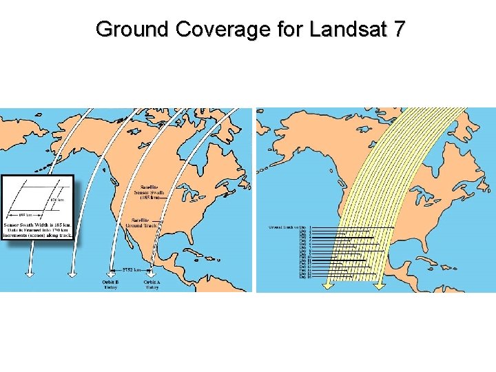
Ground Coverage for Landsat 7
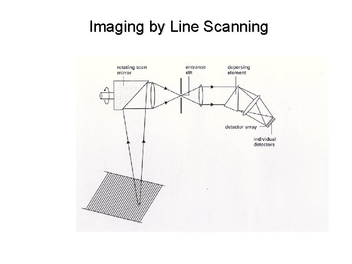
Imaging by Line Scanning
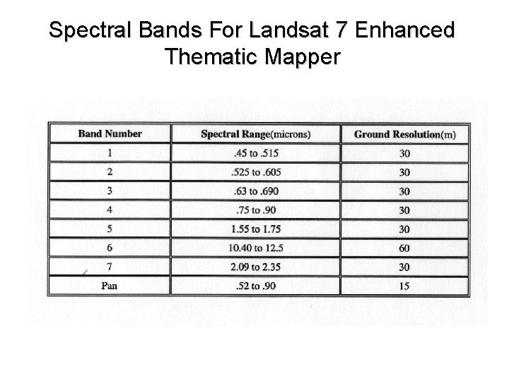
Spectral Bands For Landsat 7 Enhanced Thematic Mapper
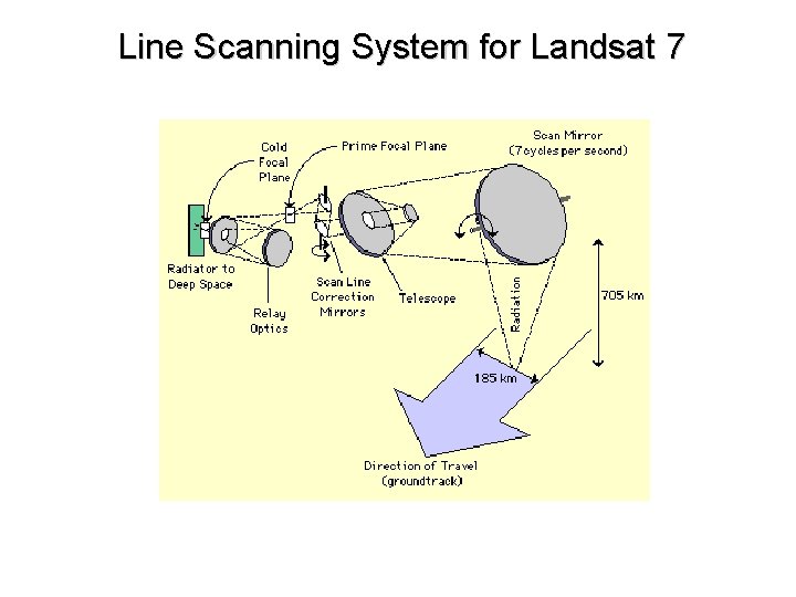
Line Scanning System for Landsat 7
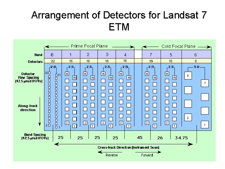
Arrangement of Detectors for Landsat 7 ETM
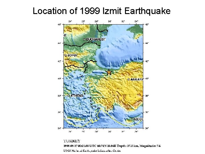
Location of 1999 Izmit Earthquake
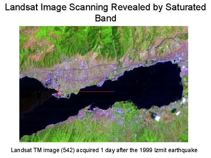
Landsat Image Scanning Revealed by Saturated Band Landsat TM image (542) acquired 1 day after the 1999 Izmit earthquake
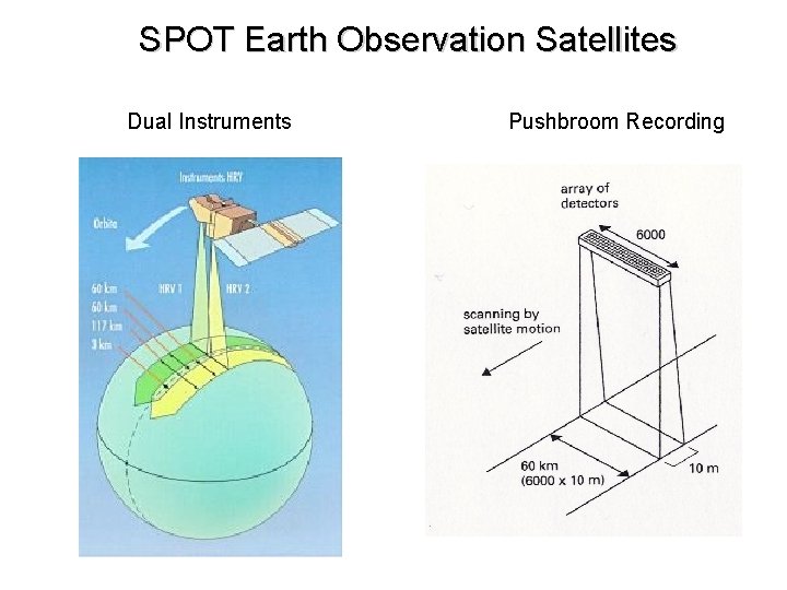
SPOT Earth Observation Satellites Dual Instruments Pushbroom Recording
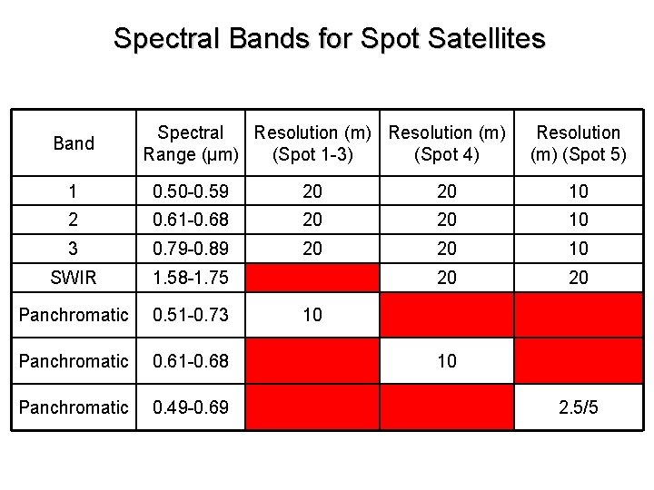
Spectral Bands for Spot Satellites Band Spectral Resolution (m) Range (μm) (Spot 1 -3) (Spot 4) Resolution (m) (Spot 5) 1 0. 50 -0. 59 20 20 10 2 0. 61 -0. 68 20 20 10 3 0. 79 -0. 89 20 20 10 SWIR 1. 58 -1. 75 20 20 Panchromatic 0. 51 -0. 73 Panchromatic 0. 61 -0. 68 Panchromatic 0. 49 -0. 69 10 10 2. 5/5
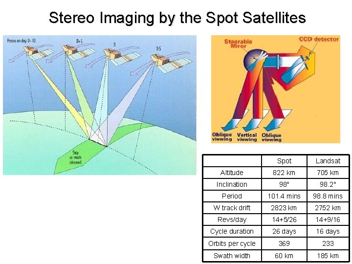
Stereo Imaging by the Spot Satellites Spot Landsat Altitude 822 km 705 km Inclination 98° 98. 2° Period 101. 4 mins 98. 8 mins W track drift 2823 km 2752 km Revs/day 14+5/26 14+9/16 Cycle duration 26 days 16 days Orbits per cycle 369 233 Swath width 60 km 185 km

- Slides: 21