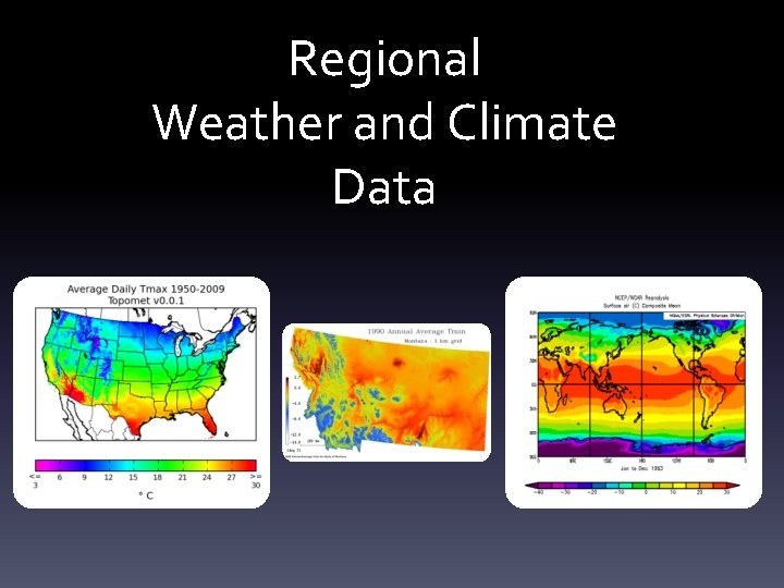
Regional Weather and Climate Data Weather and Climate
- Slides: 27

Regional Weather and Climate Data

Weather and Climate • Climate is a key driver of ecological and hydrological processes • Climate variables form one of the most important set of inputs for environmental models – Surface air temperature – Precipitation – Surface air humidity – Incident shortwave radiation • Problems: – Meteorological variables rarely observed at locations of interest – Weather observation points have relatively low spatial density – Spatial data products often do not match spatial and/or temporal scale of research

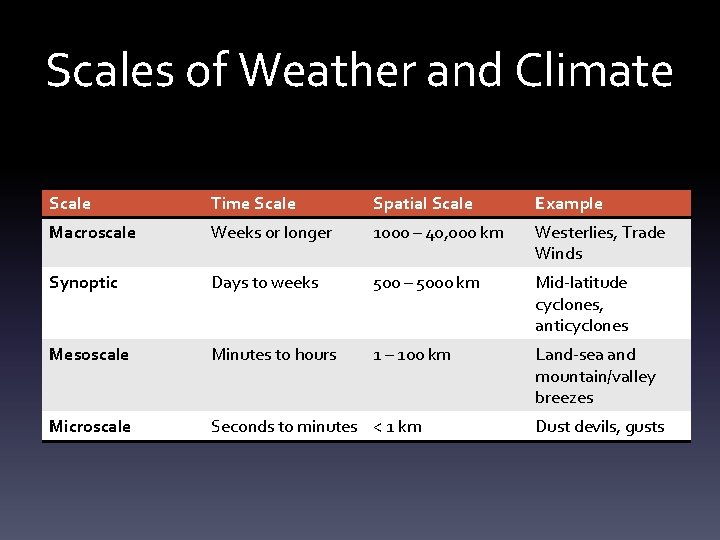
Scales of Weather and Climate Scale Time Scale Spatial Scale Example Macroscale Weeks or longer 1000 – 40, 000 km Westerlies, Trade Winds Synoptic Days to weeks 500 – 5000 km Mid-latitude cyclones, anticyclones Mesoscale Minutes to hours 1 – 100 km Land-sea and mountain/valley breezes Microscale Seconds to minutes < 1 km Dust devils, gusts

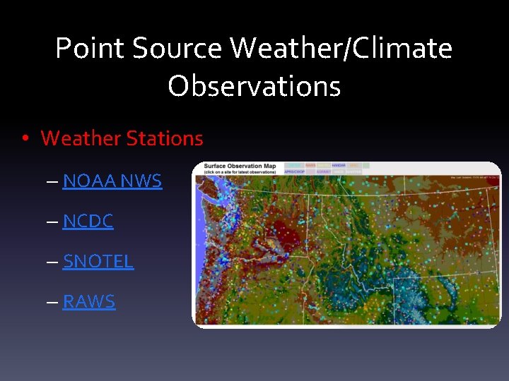
Point Source Weather/Climate Observations • Weather Stations – NOAA NWS – NCDC – SNOTEL – RAWS

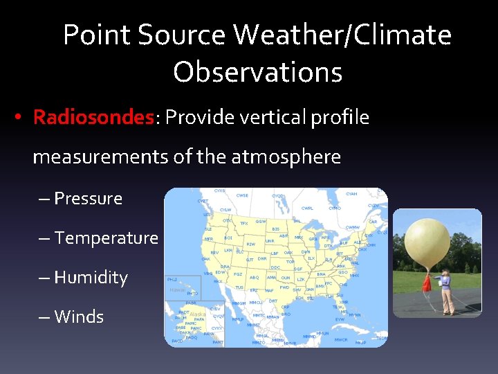
Point Source Weather/Climate Observations • Radiosondes: Provide vertical profile measurements of the atmosphere – Pressure – Temperature – Humidity – Winds

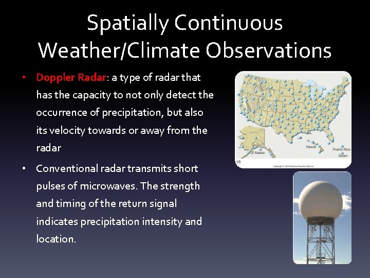
Spatially Continuous Weather/Climate Observations • Doppler Radar: a type of radar that has the capacity to not only detect the occurrence of precipitation, but also its velocity towards or away from the radar • Conventional radar transmits short pulses of microwaves. The strength and timing of the return signal indicates precipitation intensity and location.

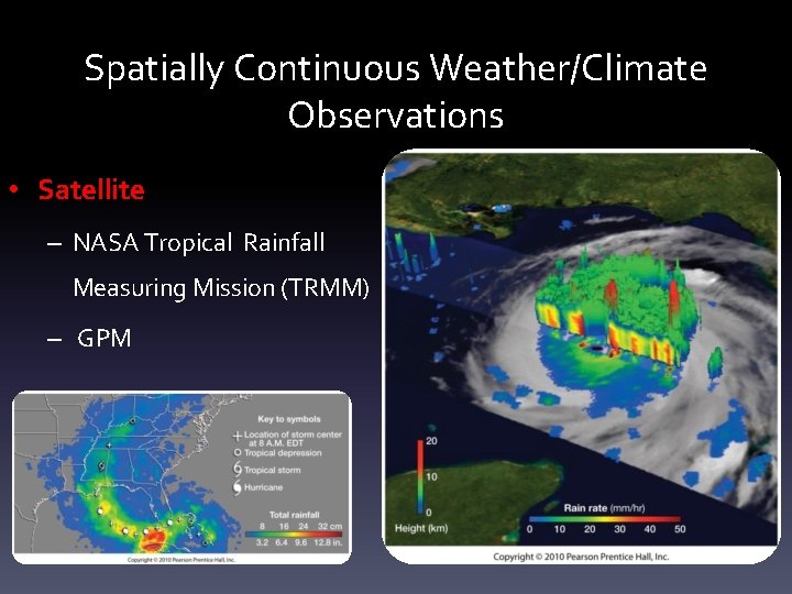
Spatially Continuous Weather/Climate Observations • Satellite – NASA Tropical Rainfall Measuring Mission (TRMM) – GPM NASA TRMM

MODELS

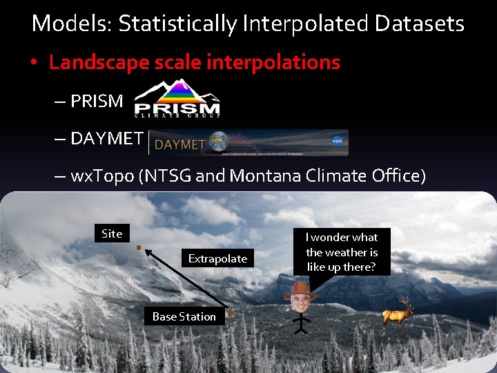
Models: Statistically Interpolated Datasets • Landscape scale interpolations – PRISM – DAYMET – wx. Topo (NTSG and Montana Climate Office) Site Extrapolate Base Station I wonder what the weather is like up there?

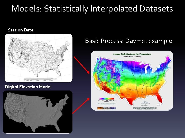
Models: Statistically Interpolated Datasets Station Data Basic Process: Daymet example Digital Elevation Model

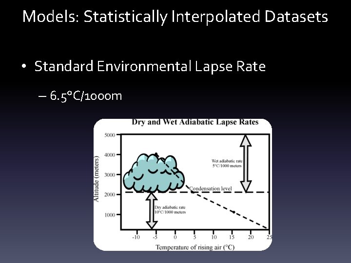
Models: Statistically Interpolated Datasets • Standard Environmental Lapse Rate – 6. 5°C/1000 m

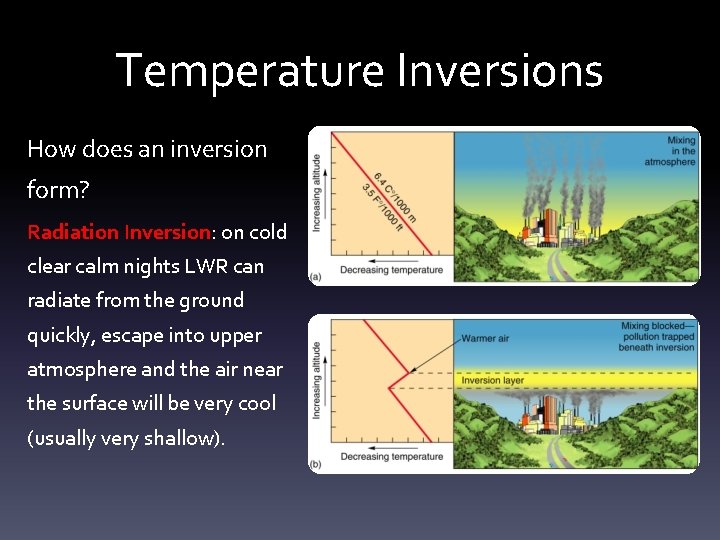
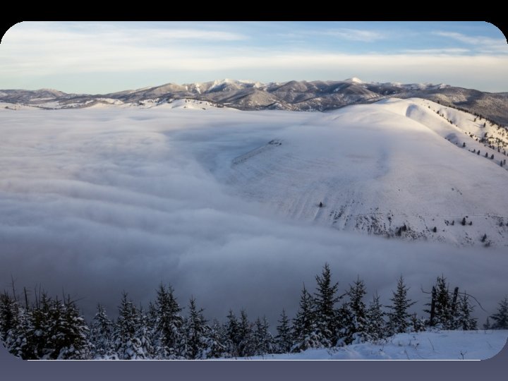
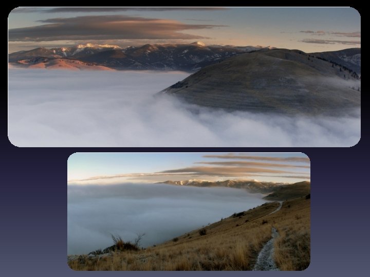
Temperature Inversions How does an inversion form? Radiation Inversion: on cold clear calm nights LWR can radiate from the ground quickly, escape into upper atmosphere and the air near the surface will be very cool (usually very shallow).

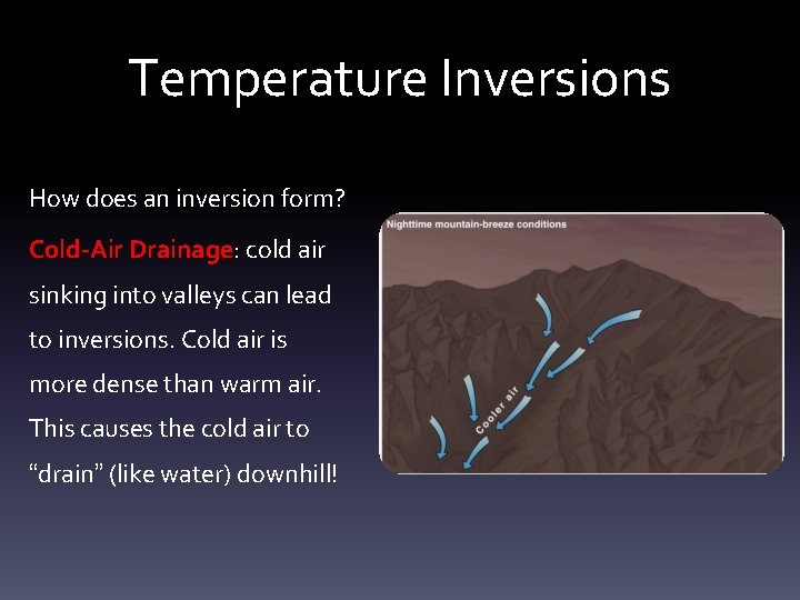
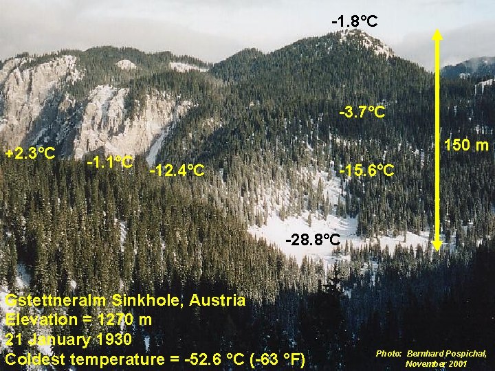
Temperature Inversions How does an inversion form? Cold-Air Drainage: cold air sinking into valleys can lead to inversions. Cold air is more dense than warm air. This causes the cold air to “drain” (like water) downhill!

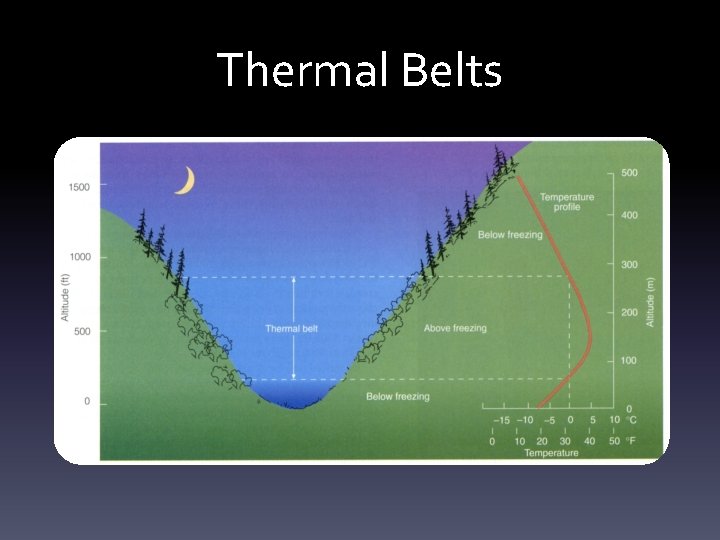
Thermal Belts


-1. 8°C -3. 7°C +2. 3°C 150 m -1. 1°C -12. 4°C -15. 6°C -28. 8°C Gstettneralm Sinkhole, Austria Elevation = 1270 m 21 January 1930 Coldest temperature = -52. 6 °C (-63 °F) Photo: Bernhard Pospichal, November 2001

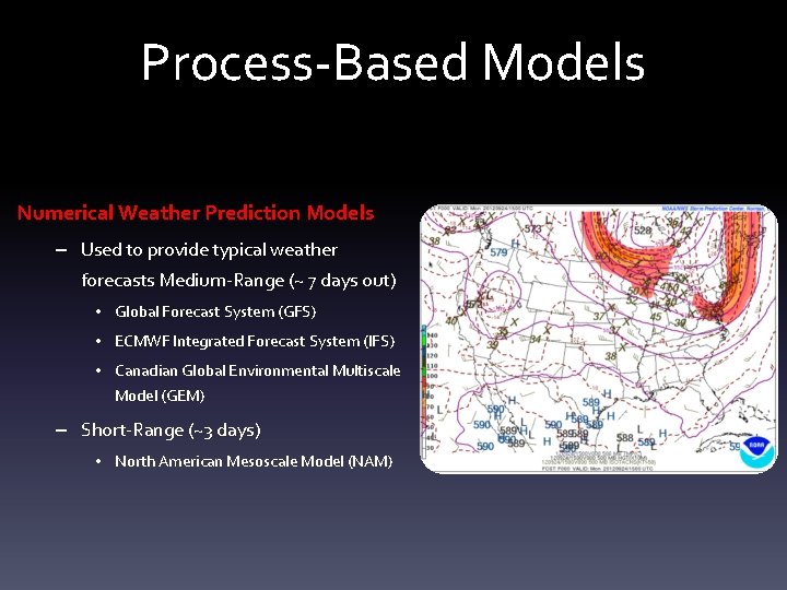
Process-Based Models Numerical Weather Prediction Models – Used to provide typical weather forecasts Medium-Range (~ 7 days out) • Global Forecast System (GFS) • ECMWF Integrated Forecast System (IFS) • Canadian Global Environmental Multiscale Model (GEM) – Short-Range (~3 days) • North American Mesoscale Model (NAM)

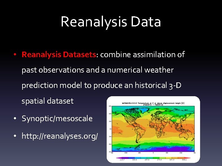
Reanalysis Data • Reanalysis Datasets: combine assimilation of past observations and a numerical weather prediction model to produce an historical 3 -D spatial dataset • Synoptic/mesoscale • http: //reanalyses. org/

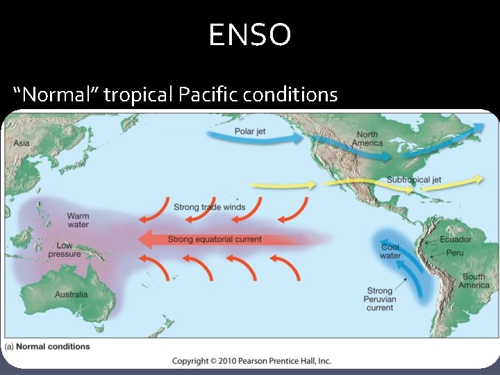
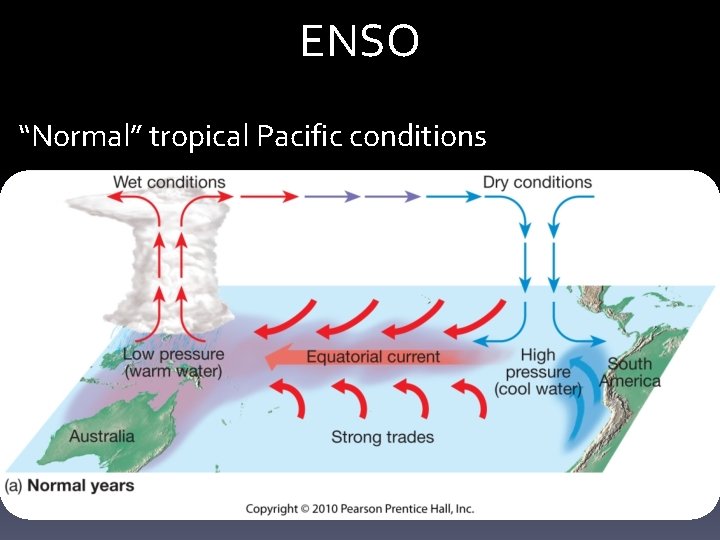
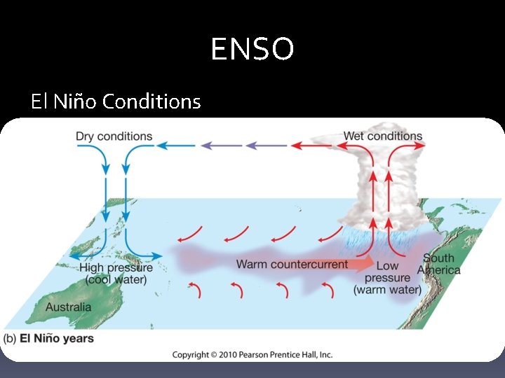
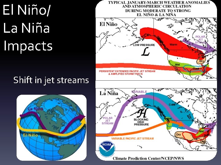
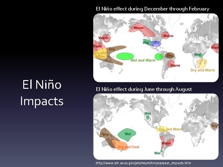
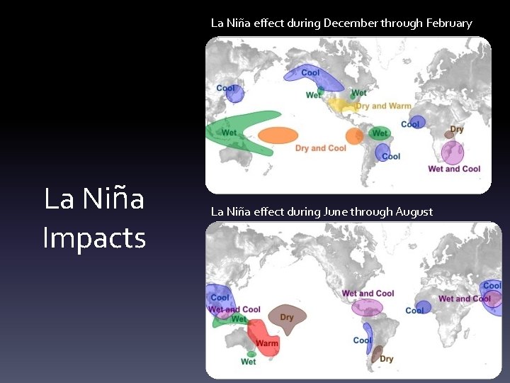
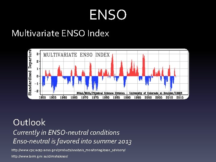
El Niño-Southern Oscillation (ENSO) • A system of interactions between the tropical Pacific Ocean and the atmosphere above it – El Niño: warm phase – La Niña: cold phase • Interval of El Niño occurrence is 3 – 5 years but can be anywhere from 2 – 12 years • Produces the greatest interannual variability of temperature and precipitation on a global scale

ENSO “Normal” tropical Pacific conditions

ENSO “Normal” tropical Pacific conditions

ENSO El Niño Conditions

El Niño/ La Niña Impacts Shift in jet streams

El Niño effect during December through February El Niño Impacts El Niño effect during June through August http: //www. srh. noaa. gov/jetstream/tropics/enso_impacts. htm

La Niña effect during December through February La Niña Impacts La Niña effect during June through August

ENSO Multivariate ENSO Index Outlook Currently in ENSO-neutral conditions Enso-neutral is favored into summer 2013 http: //www. cpc. ncep. noaa. gov/products/analysis_monitoring/enso_advisory/ http: //www. bom. gov. au/climate/enso/