ReDesign Of NablusDeir Sharaf Road Prepared by Enas

Re-Design Of Nablus-Deir Sharaf Road Prepared by Enas Saleh Haneen Hetti Supervisor Prof. Sameer Abu-Eisheh

Outline 123456789 - General information about the road. Data Collections. Analysis. Design Control and criteria. Geometric Design. Traffic Control Device. Design of intersections. Bill of Quantities. Summary.

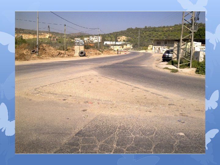
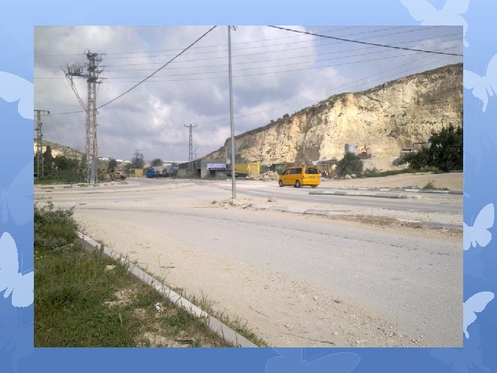
General information about the road. Nablus-Deir Sharf road is a major road that connects Nablus city and Deir Sharf village and then branches to Tulkrem and Jenin. The study case of the road is starting from Deir Sharaf intersection and ending at Tunis intersection. with length is about 7 km and ROW is 30 m. The road includes four major intersections; Deir Sharf, Quseen, Sheikh Mohammed bin Rashed Al-Maktoom and Tunis intersections

General information about the road. Start of the Road d e Roa E th nd of

Data Collection problems which observed: v Problem and defects found in the pavement. v The design of the lanes of the road with limited capacity that causes safety problem. v Insufficient lane width, which result problems in the intersections. v At commercial and residential area, we did not observe parking lanes. v Restricted sight distance at exist certain regions.
")
Analysis By analyzing the LOS for the two lane (which is the existing ) for a 20 years period, the LOS is founded to be D, which is not accepted for such highway. So, the analysis is done based on four lane and founded to be B, which is suitable for such a highway.

Analysis LOS at the Intersections. By using Syncro 2007 program. The result found for existing intersection.

Design control and criteria v Functional classification Nablus – Deir Sharf road is classified as an arterial; it has two regions; the urban area starting from Wadi At-Tuffah to Quseen intersection where the road can be classified as an urban arterial, and the rural area from Quseen intersection to Deir Sharf village where the road can be classified as a rural arterial. So the general classification of the road is suburban arterial road.

Design control and criteria v Design Vehicle. Based on the proportion of trucks and the size of the largest vehicle pass on the road of Nablus-Deir Sharaf was selected vehicle WB-20. v Design Speed the topography can be considered as a rolling terrain, and the road is suburban arterial, based on AASHTO standers the design speed considered should be between (50 -100 km/h), so we have selected the design speed of 60 km/h.

Superelevation. . For highway design in urban areas a maximum rate of 4% to 6% is applicable This project lies in urban or suburban area that means the maximum superelevation is 6%. Superelevation. For 60 Km/h design speed and 6% superelevation the minimum radius is 135 m.

Geometric Design 1 - Design of Cross Section Elements. 2 - Design of Horizontal and Vertical alignment.

Design of Cross Section Elements. Ø Lane width. According to percentage of trucks and high traffic volume and as for the road is classified an arterial. We consider taking 4 lanes, two lanes in each direction, with each lane has width 3. 6 m. Shoulders. According to road classified the shoulder width taken as 2. 4 m

Design of Cross Section Elements. Median Nablus- Deir Sharf is classified as suburban arterial and the ROW is restricted, so we take the width of median 4 m. Side Walks In this project the sidewalk width will be 3. 4 m in urban area. Parking Lane. Parking lane is parked at the commercial strip area, as usually restricted area, so parking lane is needed. The parking lane width is 2. 4 m.


Location of Shoulder, sidewalk and parking Lane Type From Station To Station Sidewalk 0+000 0+340 Sidewalk and Parking Lane 0+340 1+120 Shoulder 1+120 1+940 Sidewalk 1+940 5+340 Sidewalk and Parking Lane 5+340 6+000 Sidewalk 6+000 6+784

Design of alignments. Vertical Alignment Horizontal Alignment

Horizontal Alignment

Type of HC

Existing Condition “ HC “ There a lot of HC Some Curve do not meet AASHTO standard Restricted Sight distance in some curve

Existing Condition “ VC “ All grades of VC are satisfied the Standard

Design of H. A Lmin AASHTO 2001 = 3× v= 180 22 curves
 Simple HC 1 0+144. 510 0+286. 665")
Type ID PC PT Radius Length (m) Simple HC 1 0+144. 510 0+286. 665 142. 155 Simple HC 2 0+386. 455 0+459. 663 100 73. 209 Simple HC 3 0+562. 726 0+703. 896 140 141. 17 Simple HC 4 0+899. 337 0+997. 976 320 98. 639 Simple HC 5 1+548. 786 1+742. 356 2200 193. 57 Simple HC 6 1+837. 490 2+017. 509 500 180. 019 Simple HC 7 2+133. 284 2+329. 643 1600 196. 360 Simple HC 8 2+591. 895 2+683. 562 350 91. 667

Simple HC 9 2+855. 50 2+947. 63 7 5 300 92. 132 Simple HC 10 3+152. 685 3+228. 321 190 75. 636 Simple HC 11 3+626. 907 3+685. 894 420 58. 986 Simple HC 12 4+006. 179 4+117. 561 500 111. 382 Simple HC 13 4+469. 067 4+712. 574 3200 243. 507 Simple HC 14 5+034. 146 5+082. 096 70 47. 950 Simple HC 15 5+185. 040 5+276. 841 150 91. 801 Simple HC 16 5+314. 612 5+407. 707 350 93. 094

Simple HC 17 5+577. 463 5+664. 017 200 87. 154 Simple HC 18 5+759. 055 5+868. 245 270. 377 112. 184 Simple HC 19 6+095. 812 6+167. 038 200 71. 226 Simple HC 20 6+220. 280 6+248. 859 135 28. 579 44. 804 Compound HC 21 4+847. 398 4+937. 243 160 16. 410 24. 310 34. 279 Compound HC 22 6+632. 351 6+697. 202 110 30. 573

Design of V. A Profile

Type of VC

This road is urban arterial in a rolling terrain design speed is 60 K/hr. so the maximum grade is 6%


Intersections Design Four major intersection Minor intersection Three leg Four leg Deir Sharaf intersection “ Three leg intersection “. Quseen intersection “ Three leg intersection “. Tunis intersection “ Three leg intersection “. Sheikh Mohammed bin Rashed Al-Maktoom intersection “ Roundabout”.

Intersections Design
- Slides: 33