
Provision of Data Beyond Charts WENDs S100 Future
Provision of Data Beyond Charts WEND’s S-100 Future Challenges Office of Coast Survey National Oceanic and Atmospheric Administration
Council 2 Actions • C 2/30 - IRCC to instruct and provide guidance to the WENDWG in order to investigate the applicability of the WEND-like Principles to the production and dissemination of S-101 ENCs and the first generation of S 100 based products and to report back at C-3 • C 2/31 - Council, HSSC, IRCC Chairs and Sec. Gen to draft an implementation strategy/roadmap for a transition plan aiming to the regular and harmonized production and dissemination of S-100 based products for further discussion at A-2 and for the preparation of the 20212023 IHO Work Programme Office of Coast Survey National Oceanic and Atmospheric Administration
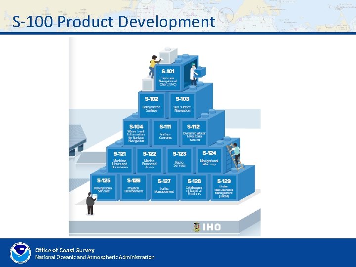
S-100 Product Development Office of Coast Survey National Oceanic and Atmospheric Administration
Challenges • Distribution Model – should we use a central distribution model (as we do with RENCs) or should data be hosted by national hydrographic offices via national portals? Could there be a hybrid approach? • Distribution frequency – weekly, daily, hourly, more? • System integration – how to include all of this in ECDIS and beyond Office of Coast Survey National Oceanic and Atmospheric Administration
Challenges • How will the RENCs be involved? Quality control? Encryption? Etc. • How will we approach new data schemes? • WEND Principles to be adjusted? • Other considerations? Office of Coast Survey National Oceanic and Atmospheric Administration
Council 2 Actions • C 2/30 - IRCC to instruct and provide guidance to the WENDWG in order to investigate the applicability of the WEND-like Principles to the production and dissemination of S-101 ENCs and the first generation of S 100 based products and to report back at C-3 • C 2/31 - Council, HSSC, IRCC Chairs and Sec. Gen to draft an implementation strategy/roadmap for a transition plan aiming to the regular and harmonized production and dissemination of S-100 based products for further discussion at A-2 and for the preparation of the 20212023 IHO Work Programme Office of Coast Survey National Oceanic and Atmospheric Administration
Thank You Office of Coast Survey National Oceanic and Atmospheric Administration
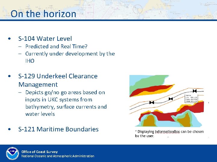
On the horizon • S-104 Water Level – Predicted and Real Time? – Currently under development by the IHO • S-129 Underkeel Clearance Management – Depicts go/no go areas based on inputs in UKC systems from bathymetry, surface currents and water levels • S-121 Maritime Boundaries Office of Coast Survey National Oceanic and Atmospheric Administration
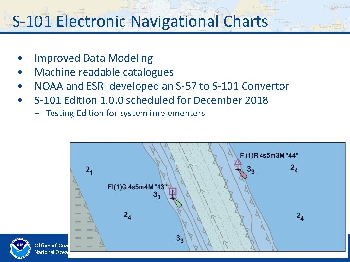
S-101 Electronic Navigational Charts • • Improved Data Modeling Machine readable catalogues NOAA and ESRI developed an S-57 to S-101 Convertor S-101 Edition 1. 0. 0 scheduled for December 2018 – Testing Edition for system implementers New Feature to control text placement on the ECDIS Office of Coast Survey National Oceanic and Atmospheric Administration
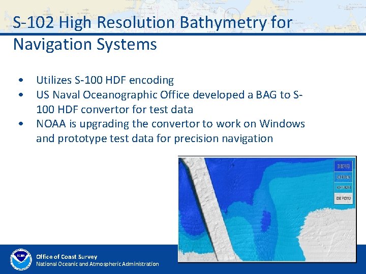
S-102 High Resolution Bathymetry for Navigation Systems • Utilizes S-100 HDF encoding • US Naval Oceanographic Office developed a BAG to S 100 HDF convertor for test data • NOAA is upgrading the convertor to work on Windows and prototype test data for precision navigation Office of Coast Survey National Oceanic and Atmospheric Administration
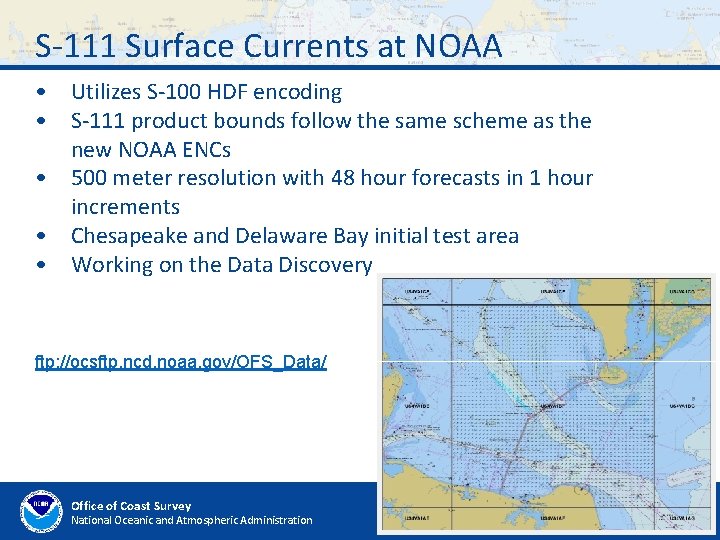
S-111 Surface Currents at NOAA • Utilizes S-100 HDF encoding • S-111 product bounds follow the same scheme as the new NOAA ENCs • 500 meter resolution with 48 hour forecasts in 1 hour increments • Chesapeake and Delaware Bay initial test area • Working on the Data Discovery ftp: //ocsftp. ncd. noaa. gov/OFS_Data/ Office of Coast Survey National Oceanic and Atmospheric Administration
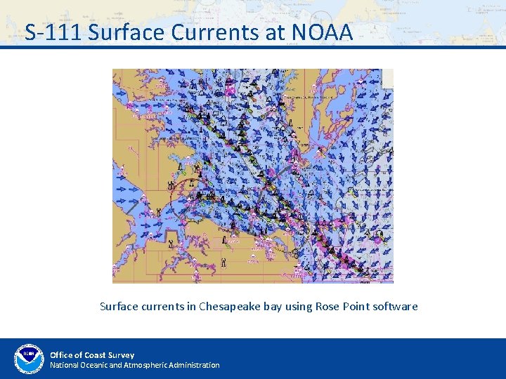
S-111 Surface Currents at NOAA Surface currents in Chesapeake bay using Rose Point software Office of Coast Survey National Oceanic and Atmospheric Administration
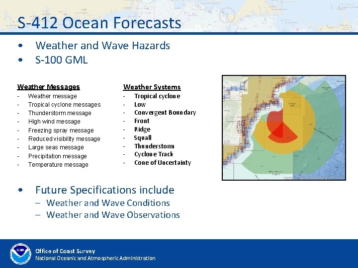
S-412 Ocean Forecasts • Weather and Wave Hazards • S-100 GML Weather Messages - Weather message Tropical cyclone messages Thunderstorm message High wind message Freezing spray message Reduced visibility message Large seas message Precipitation message Temperature message Weather Systems - Tropical cyclone Low Convergent Boundary Front Ridge Squall Thunderstorm Cyclone Track Cone of Uncertainty • Future Specifications include – Weather and Wave Conditions – Weather and Wave Observations Office of Coast Survey National Oceanic and Atmospheric Administration
- Slides: 13