Proposed Methodology for Assessing Aquatic Habitat Loss Due

Proposed Methodology for Assessing Aquatic Habitat Loss Due to FCRPS Prepared by the CBFWA Resident Fish Advisory Committee

Why Assess Habitat Losses? • To illustrate amount of resident fish habitat lost due to hydro-construction and subsequent inundation

MFWP’s Habitat Loss Assessment • Identify stream orders inundated • Measure length of mainstem inundated • Measure length of tributary blocked

RFAC Proposed Habitat Loss Assessment • How many acres of mainstem river were lost to inundation? • How many acres of aquatic habitat in tributaries was lost? • How many acres of aquatic habitat blocked by roads?

Benefits of Using Area of Habitat • No need to determine stream order/type • Provides automatic accounting of channel width • No need to find similar habitat for acquisition • Provides for mitigation even when no similar habitat available
")
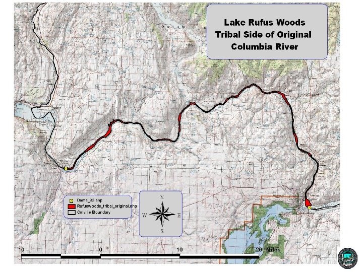
Calculating the Area of Lost Habitat • Select area to assess (Lake Rufus Woods)
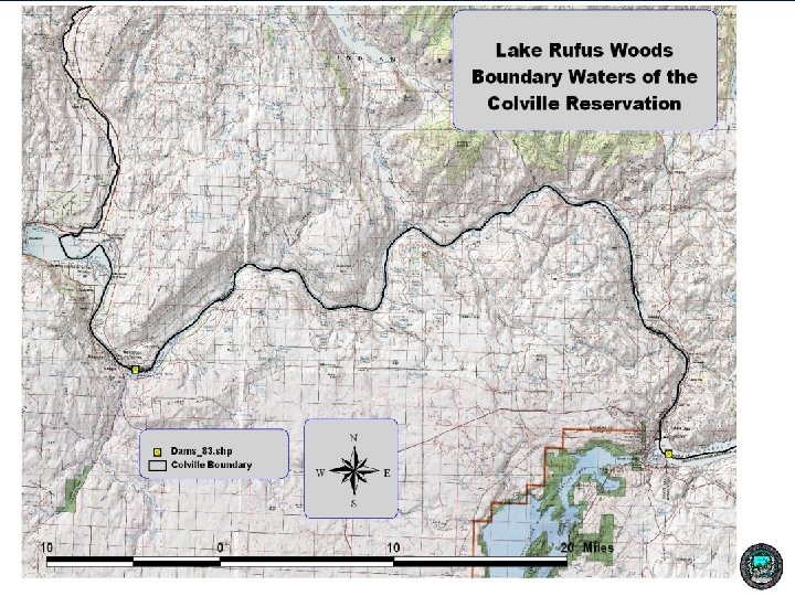

Calculating the Area of Lost Mainstem Habitat • Select area to assess (Lake Rufus Woods) • Created GIS shapefile of original river and clipped to Reservation boundary • Clip to high water line of original river

Determine Tributaries Impacted by Inundation • Three tributaries used for this test – Nespelem River – Peter Dan Creek – Coyote Creek
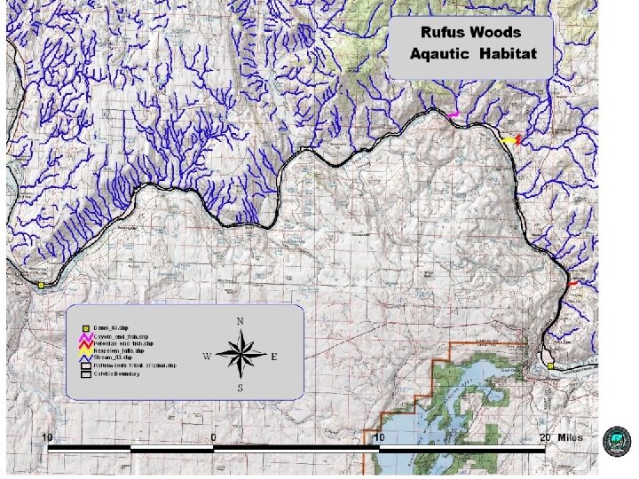

Tributary Inundated Blocked Mainstem Inundated

Results Stream Name Acres Columbia River Mainstem 4017. 38 50. 86 165. 44 1. 34 Coyote Creek 1. 07 0. 85 Peter Dan Creek 0. 99 0. 56 4184. 88 53. 61 Nespelem River Total Miles
- Slides: 13