
Projections Projection The system used to transfer locations



- Slides: 20
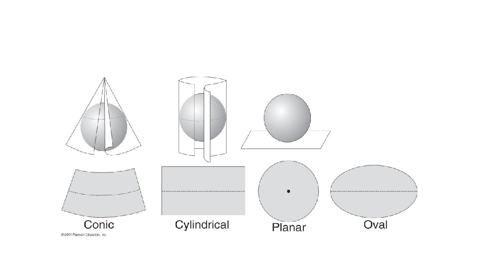
Projections • Projection – The system used to transfer locations from Earth’s surface to a flat map. • Types • • • Robinson Mercator Goode’s homolosine And many others General classes • Conic • Cylindrical • Planar (azimuthal)
Task: 1) In your group peel an orange without breaking any pieces off. Orange Peel Game!! 2) Once you have completely peeled your orange, lay it flat onto a sheet of blank white paper. 3) Trace the outline of your peel flat onto the white sheet of paper. 4) Fit all 7 continents accurately into the outline of your peel.
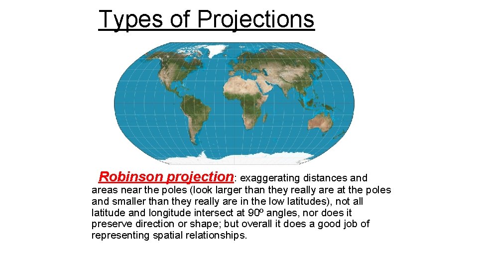
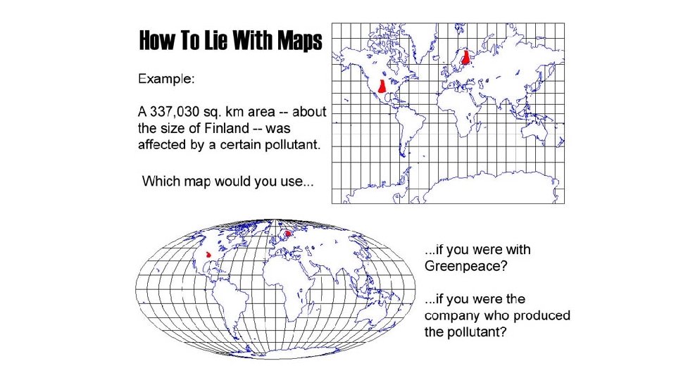
Types of Projections Robinson projection: exaggerating distances and areas near the poles (look larger than they really are at the poles and smaller than they really are in the low latitudes), not all latitude and longitude intersect at 90º angles, nor does it preserve direction or shape; but overall it does a good job of representing spatial relationships.
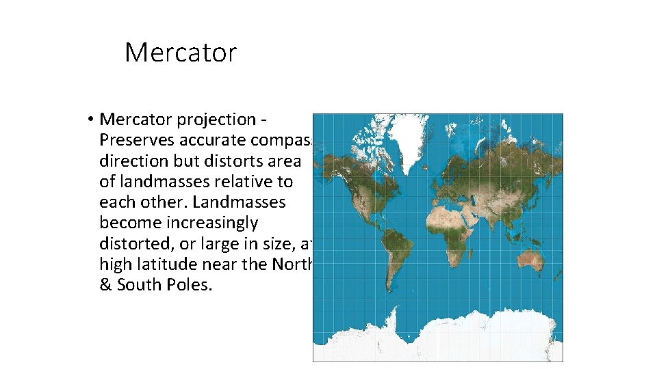
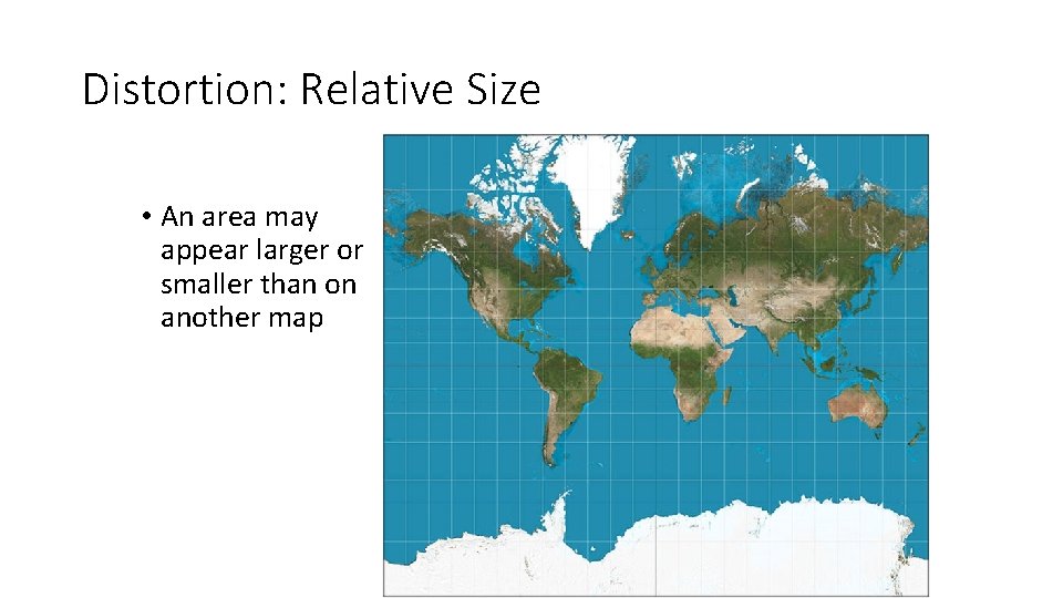
Mercator • Mercator projection Preserves accurate compass direction but distorts area of landmasses relative to each other. Landmasses become increasingly distorted, or large in size, at high latitude near the North & South Poles.
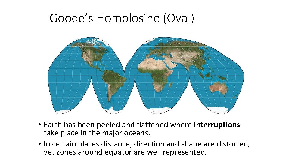
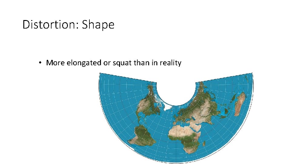
Goode’s Homolosine (Oval) • Earth has been peeled and flattened where interruptions take place in the major oceans. • In certain places distance, direction and shape are distorted, yet zones around equator are well represented.
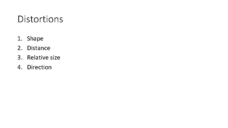
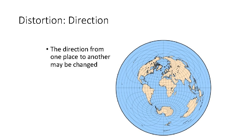
Distortions 1. 2. 3. 4. Shape Distance Relative size Direction
Distortion: Shape • More elongated or squat than in reality
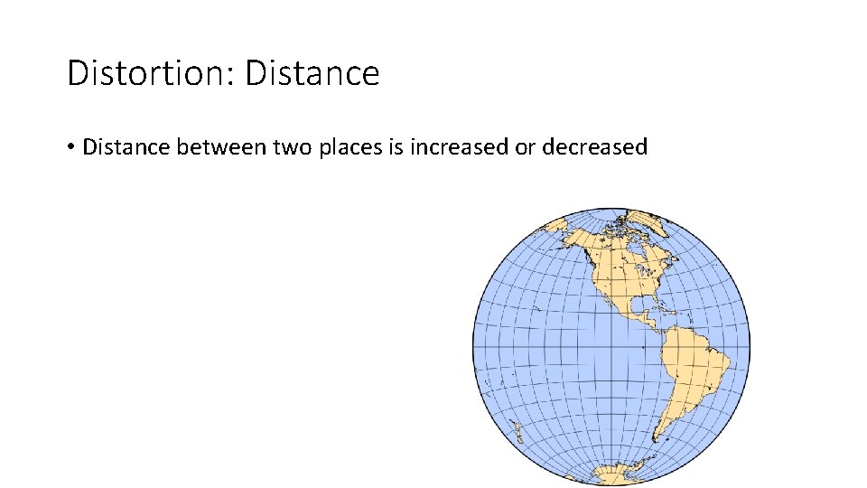
Distortion: Distance • Distance between two places is increased or decreased
Distortion: Relative Size • An area may appear larger or smaller than on another map
Distortion: Direction • The direction from one place to another may be changed
Locations on a Map
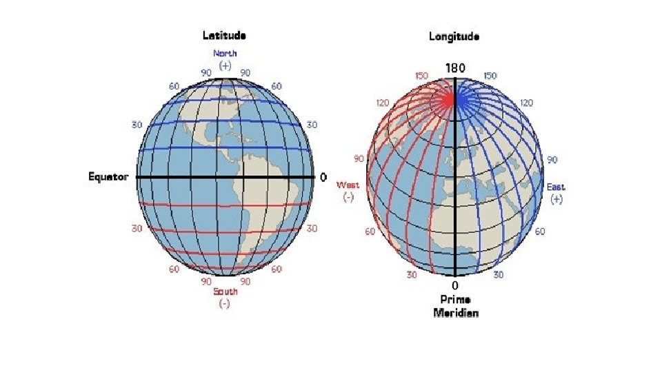
Mathematical Location • Meridian: arc from North pole to South pole • Longitude – The numbering system used to indicate the location of meridians drawn on a globe and measuring distance east and west of the prime meridian (0˚). • Parallel: circle drawn around the globe parallel to the equator • Latitude – The numbering system used to indicate the location of parallels drawn on a globe and measuring distance north and south of the equator (0˚). • Reno: 39˚ 25’ 22” N/119˚ 42’ 45” W
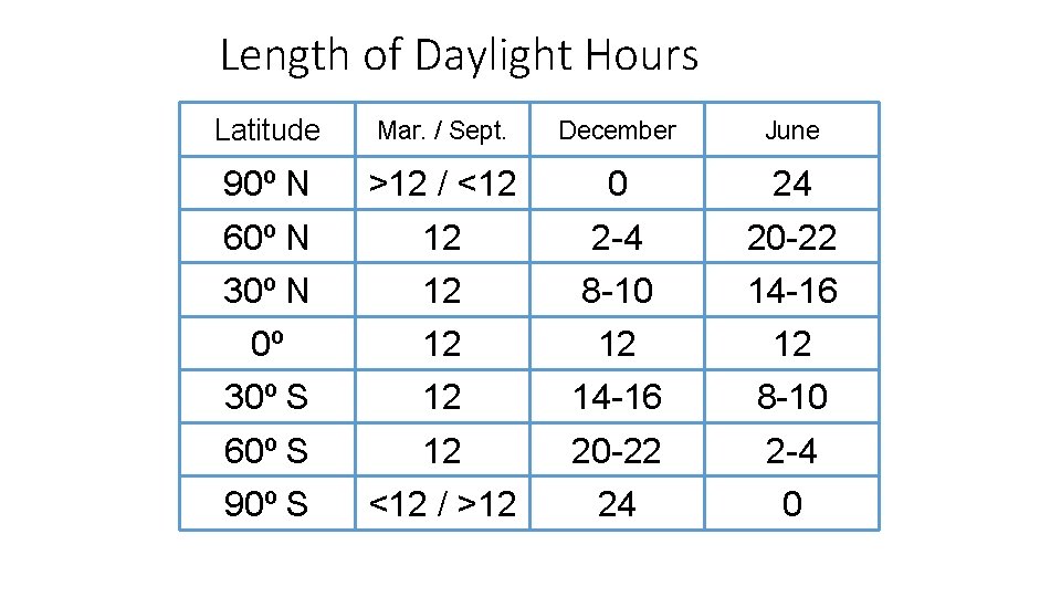
Length of Daylight Hours Latitude Mar. / Sept. December June 90º N >12 / <12 0 24 60º N 12 2 -4 20 -22 30º N 12 8 -10 14 -16 0º 12 12 12 30º S 12 14 -16 8 -10 60º S 12 20 -22 2 -4 90º S <12 / >12 24 0
Lines of Latitude/Longitude • Equator – The great circle of the earth that is equidistant from the North Pole and South Pole. • 0˚ latitude • Prime Meridian – The meridian, designated as 0˚ longitude, that passes through the Royal Observatory at Greenwich, England. • 0˚ longitude • International Date Line – An arc that for the most part follows 180˚ longitude, although it deviates in several places to avoid dividing land areas. When you cross the International Date Line heading east (toward America), the clock moves back 24 hours, or one entire day. When you go west (toward Asia), the calendar moves ahead one day. • 180˚ longitude (generally) • Kiribati: chain of islands in Pacific • 1997: moved the IDL 2000 miles east and as such don’t fall under standard time • 1 st country to see each day’s sunrise