
Project Brief Li DAR for the North East
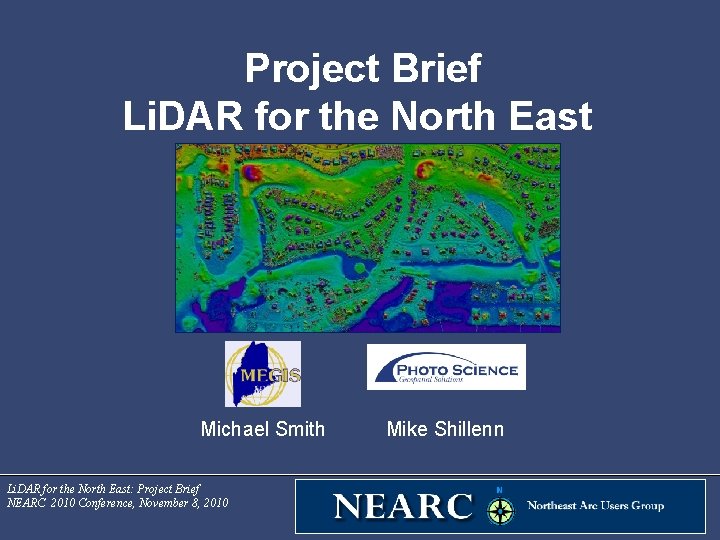
Project Brief Li. DAR for the North East Michael Smith Li. DAR for the North East: Project Brief NEARC 2010 Conference, November 8, 2010 Mike Shillenn
Agenda • • Project Background Project Benefits Supported Applications Project Management Work Plan Deliverables Accuracies Schedule Li. DAR for the North East: Project Brief NEARC 2010 Conference, November 8, 2010
Project Background: Timeline • • • Fall 2008 - UNH proposal covering watersheds in NH and ME developed Spring 2009 – ARRA funding indicated, project idea grows to New England Summer 2009 – Northeast coalition (NY added) grows and starts gathering support and match funding Fall 2009 – details come together and states draft ARRA proposal, with MEGIS as principal investigator Nov 30 2009 – Li. DAR for the Northeast Proposal submitted to USGS, $2. 7 M total budget, $1. 4 M requested from ARRA funding January 2010 – Award letter announces full funding of the project Spring/Summer 2010 – Additional funding brought forward to further increase project footprint and products June 2010 – first task order issued for ARRA-funded portion to Photo Science September 2010 – second task order issued for all other funding portion to Photo Science Final project is approximately 8, 000 sq miles of new data Li. DAR for the North East: Project Brief NEARC 2010 Conference, November 8, 2010
Project Background: Coordination • Each state worked through it’s state coordinator for non-profit and statelevel funding and requirements • USGS liaisons coordinated other federal contributions • Maine state coordinator worked with each state coordinator to bring the state and nonprofit portions together • Maine’s USGS liaison worked with other regional USGS liaisons to bring the federal portions together • NGTOC handles contracting through Geospatial Products and Services Contract v 2 (GPSC-2) Li. DAR for the North East: Project Brief NEARC 2010 Conference, November 8, 2010
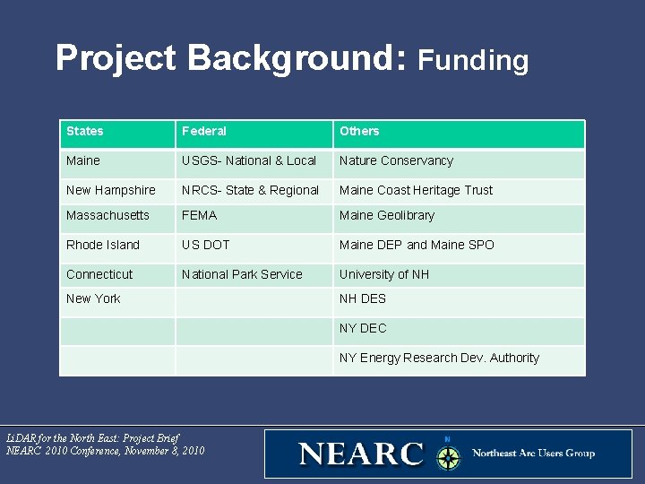
Project Background: Funding States Federal Others Maine USGS- National & Local Nature Conservancy New Hampshire NRCS- State & Regional Maine Coast Heritage Trust Massachusetts FEMA Maine Geolibrary Rhode Island US DOT Maine DEP and Maine SPO Connecticut National Park Service University of NH New York NH DES NY DEC NY Energy Research Dev. Authority Li. DAR for the North East: Project Brief NEARC 2010 Conference, November 8, 2010
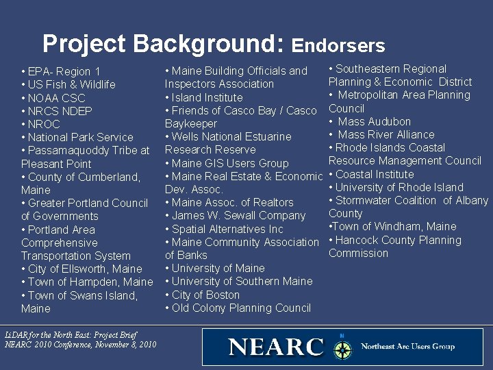
Project Background: Endorsers • EPA- Region 1 • US Fish & Wildlife • NOAA CSC • NRCS NDEP • NROC • National Park Service • Passamaquoddy Tribe at Pleasant Point • County of Cumberland, Maine • Greater Portland Council of Governments • Portland Area Comprehensive Transportation System • City of Ellsworth, Maine • Town of Hampden, Maine • Town of Swans Island, Maine Li. DAR for the North East: Project Brief NEARC 2010 Conference, November 8, 2010 • Southeastern Regional • Maine Building Officials and Planning & Economic District Inspectors Association • Metropolitan Area Planning • Island Institute • Friends of Casco Bay / Casco Council • Mass Audubon Baykeeper • Mass River Alliance • Wells National Estuarine • Rhode Islands Coastal Research Reserve Resource Management Council • Maine GIS Users Group • Maine Real Estate & Economic • Coastal Institute • University of Rhode Island Dev. Assoc. • Stormwater Coalition of Albany • Maine Assoc. of Realtors County • James W. Sewall Company • Town of Windham, Maine • Spatial Alternatives Inc • Maine Community Association • Hancock County Planning Commission of Banks • University of Maine • University of Southern Maine • City of Boston • Old Colony Planning Council
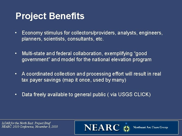
Project Benefits • Economy stimulus for collectors/providers, analysts, engineers, planners, scientists, consultants, etc. • Multi-state and federal collaboration, exemplifying “good government” and model for the national elevation program • A coordinated collection and processing effort will result in real tax payer savings (map it once, used by many) • Data freely available to general public ( via USGS CLICK) Li. DAR for the North East: Project Brief NEARC 2010 Conference, November 8, 2010
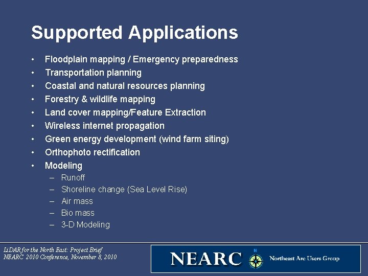
Supported Applications • • • Floodplain mapping / Emergency preparedness Transportation planning Coastal and natural resources planning Forestry & wildlife mapping Land cover mapping/Feature Extraction Wireless internet propagation Green energy development (wind farm siting) Orthophoto rectification Modeling – – – Runoff Shoreline change (Sea Level Rise) Air mass Bio mass 3 -D Modeling Li. DAR for the North East: Project Brief NEARC 2010 Conference, November 8, 2010
Project Management: USGS NGTOC “The U. S. Geological Survey National Geospatial Technical Operations Center (NGTOC) provides essential support for the acquisition and management of trusted geospatial data, products, and services, through world-class geospatial technical expertise and customer service, for the USGS and the Nation. NGTOC supports The National Map (TNM) and the National Atlas of the United States®, among other related efforts. ” üTask Order Administration üIndependent Quality Assurance Testing üTask Order Management üDeliverable Validation & Acceptance üClient/Producer Liaison üData Dissemination üTechnical Domain Expertise Li. DAR for the North East: Project Brief NEARC 2010 Conference, November 8, 2010
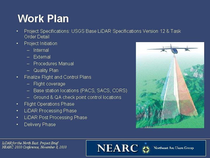
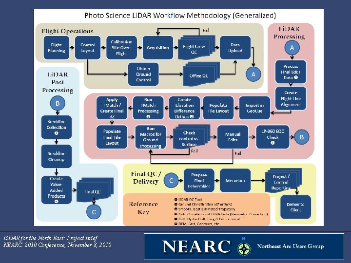
Work Plan • • Project Specifications: USGS Base Li. DAR Specifications Version 12 & Task Order Detail Project Initiation – Internal – External – Procedures Manual – Quality Plan Finalize Flight and Control Plans – Flight coverage – Base station locations (PACS, SACS, CORS) – Ground & QA check point control locations Flight Operations Phase Li. DAR Processing Phase Li. DAR Post Processing Phase Delivery Phase Li. DAR for the North East: Project Brief NEARC 2010 Conference, November 8, 2010
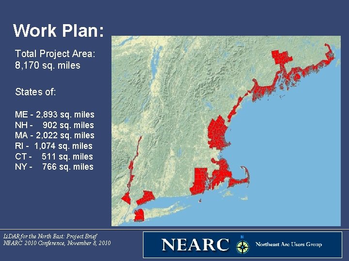
Work Plan: Total Project Area: 8, 170 sq. miles States of: ME - 2, 893 sq. miles NH - 902 sq. miles MA - 2, 022 sq. miles RI - 1, 074 sq. miles CT - 511 sq. miles NY - 766 sq. miles Li. DAR for the North East: Project Brief NEARC 2010 Conference, November 8, 2010
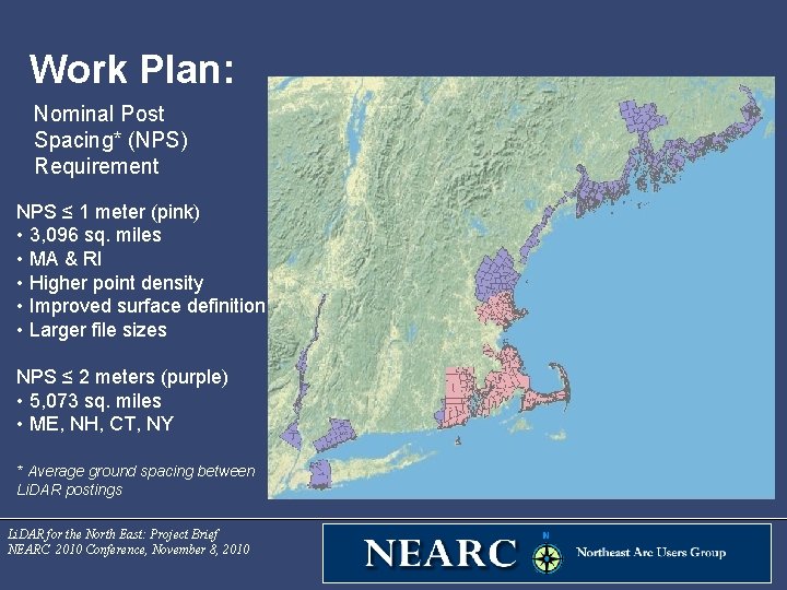
Work Plan: Nominal Post Spacing* (NPS) Requirement NPS ≤ 1 meter (pink) • 3, 096 sq. miles • MA & RI • Higher point density • Improved surface definition • Larger file sizes NPS ≤ 2 meters (purple) • 5, 073 sq. miles • ME, NH, CT, NY * Average ground spacing between Li. DAR postings Li. DAR for the North East: Project Brief NEARC 2010 Conference, November 8, 2010
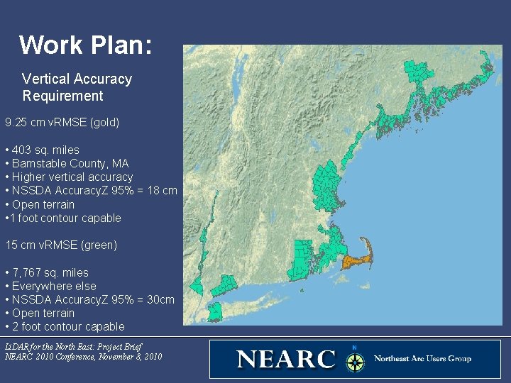
Work Plan: Vertical Accuracy Requirement 9. 25 cm v. RMSE (gold) • 403 sq. miles • Barnstable County, MA • Higher vertical accuracy • NSSDA Accuracy. Z 95% = 18 cm • Open terrain • 1 foot contour capable 15 cm v. RMSE (green) • 7, 767 sq. miles • Everywhere else • NSSDA Accuracy. Z 95% = 30 cm • Open terrain • 2 foot contour capable Li. DAR for the North East: Project Brief NEARC 2010 Conference, November 8, 2010
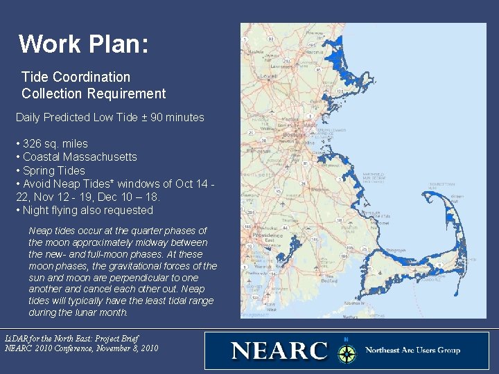
Work Plan: Tide Coordination Collection Requirement Daily Predicted Low Tide ± 90 minutes • 326 sq. miles • Coastal Massachusetts • Spring Tides • Avoid Neap Tides* windows of Oct 14 - 22, Nov 12 - 19, Dec 10 – 18. • Night flying also requested Neap tides occur at the quarter phases of the moon approximately midway between the new- and full-moon phases. At these moon phases, the gravitational forces of the sun and moon are perpendicular to one another and cancel each other out. Neap tides will typically have the least tidal range during the lunar month. Li. DAR for the North East: Project Brief NEARC 2010 Conference, November 8, 2010
Li. DAR for the North East: Project Brief NEARC 2010 Conference, November 8, 2010
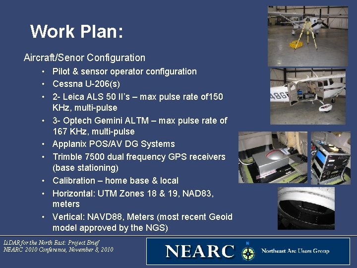
Work Plan: Aircraft/Senor Configuration • Pilot & sensor operator configuration • Cessna U-206(s) • 2 - Leica ALS 50 II’s – max pulse rate of 150 KHz, multi-pulse • 3 - Optech Gemini ALTM – max pulse rate of 167 KHz, multi-pulse • Applanix POS/AV DG Systems • Trimble 7500 dual frequency GPS receivers (base stationing) • Calibration – home base & local • Horizontal: UTM Zones 18 & 19, NAD 83, meters • Vertical: NAVD 88, Meters (most recent Geoid model approved by the NGS) Li. DAR for the North East: Project Brief NEARC 2010 Conference, November 8, 2010
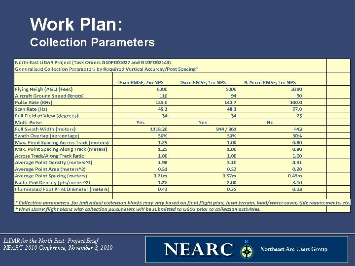
Work Plan: Collection Parameters Li. DAR for the North East: Project Brief NEARC 2010 Conference, November 8, 2010
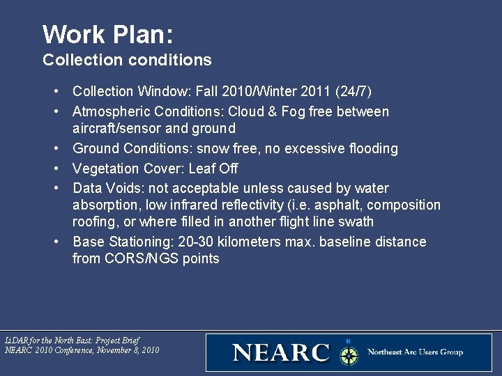
Work Plan: Collection conditions • Collection Window: Fall 2010/Winter 2011 (24/7) • Atmospheric Conditions: Cloud & Fog free between aircraft/sensor and ground • Ground Conditions: snow free, no excessive flooding • Vegetation Cover: Leaf Off • Data Voids: not acceptable unless caused by water absorption, low infrared reflectivity (i. e. asphalt, composition roofing, or where filled in another flight line swath • Base Stationing: 20 -30 kilometers max. baseline distance from CORS/NGS points Li. DAR for the North East: Project Brief NEARC 2010 Conference, November 8, 2010
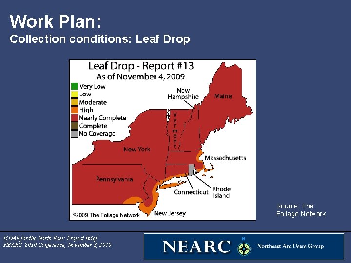
Work Plan: Collection conditions: Leaf Drop Source: The Foliage Network Li. DAR for the North East: Project Brief NEARC 2010 Conference, November 8, 2010
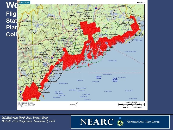
Work Plan: Flight & Base Station Control Plan for Maine Collection Areas Li. DAR for the North East: Project Brief NEARC 2010 Conference, November 8, 2010
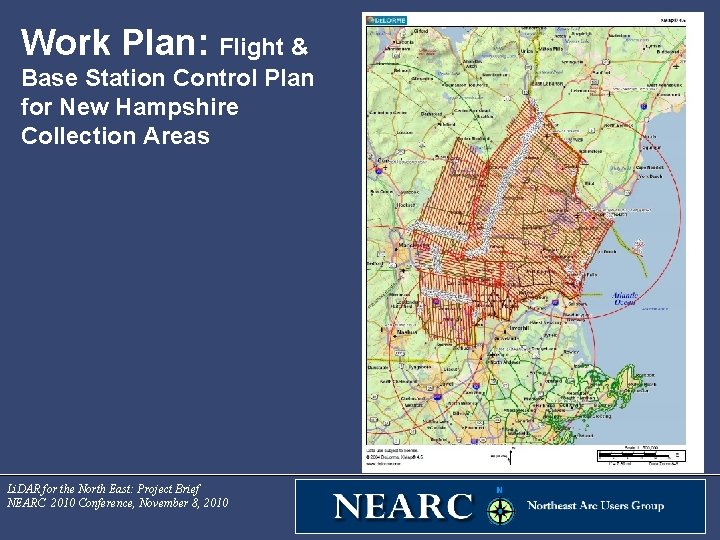
Work Plan: Flight & Base Station Control Plan for New Hampshire Collection Areas Li. DAR for the North East: Project Brief NEARC 2010 Conference, November 8, 2010
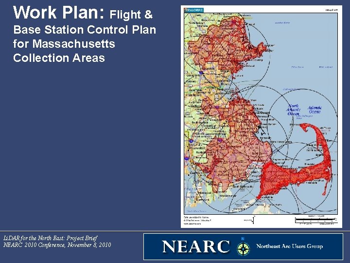
Work Plan: Flight & Base Station Control Plan for Massachusetts Collection Areas Li. DAR for the North East: Project Brief NEARC 2010 Conference, November 8, 2010
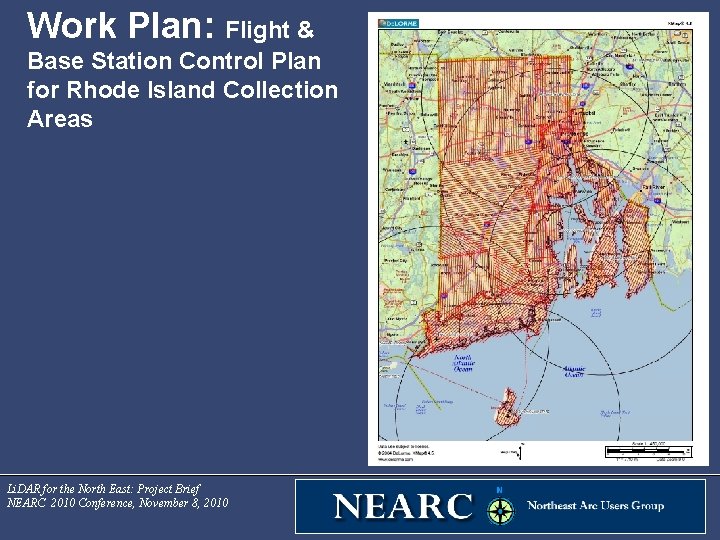
Work Plan: Flight & Base Station Control Plan for Rhode Island Collection Areas Li. DAR for the North East: Project Brief NEARC 2010 Conference, November 8, 2010
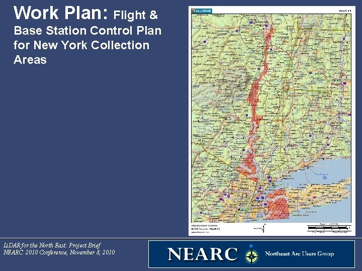
Work Plan: Flight & Base Station Control Plan for New York Collection Areas Li. DAR for the North East: Project Brief NEARC 2010 Conference, November 8, 2010
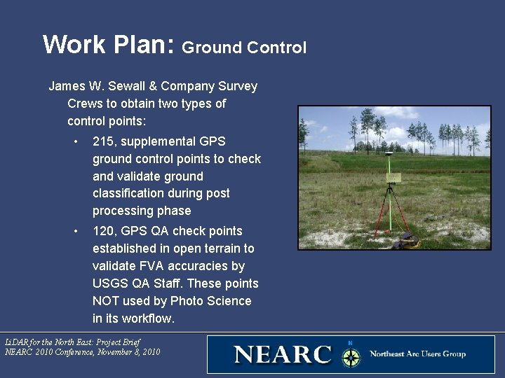
Work Plan: Ground Control James W. Sewall & Company Survey Crews to obtain two types of control points: • 215, supplemental GPS ground control points to check and validate ground classification during post processing phase • 120, GPS QA check points established in open terrain to validate FVA accuracies by USGS QA Staff. These points NOT used by Photo Science in its workflow. Li. DAR for the North East: Project Brief NEARC 2010 Conference, November 8, 2010
Work Plan: Li. DAR Processing Process unclassified return point cloud in. las format V 1. 2 for each 1500 m x 1500 m tile that contains: • The return number for each signal • Horizontal and Vertical Position (x, y, z) in the specified horizontal and vertical datum • Intensity return values for each return signal • GPS Timestamp of capture for each point Li. DAR for the North East: Project Brief NEARC 2010 Conference, November 8, 2010
Work Plan: Li. DAR Processing Additional automated and manual processing to classify point cloud in. las format V 1. 2 for each 1500 m x 1500 m tile that contains the following classes: • Unclassified (non-ground) – Class 1 • Ground (bare-earth extra points) – Class 2 • Noise (low or high, manually identified, if needed) – Class 7 • Water- Class 9 • Ignored Ground (Breakline Proximity) – Class 10 Li. DAR for the North East: Project Brief NEARC 2010 Conference, November 8, 2010
Work Plan: Li. DAR Processing Photo Science’s classification/filtering workflow: • is utilized to process the multi-return digital surface model (DSM) dataset to bare earth conditions • is based on project specific terrain, vegetation density, and development (urban, suburban, and rural) conditions • utilizes Terra Solid (Terra. Scan and Terra. Modeler) and Geo. Cue software, coupled with proprietary filtering routines • typically results in the non-ground classification of approximately 75% - 80% of the above-ground (non-bare earth) DSM data points • includes supplementing automated terrain filtering with interactive processing to achieve bare earth conditions. Li. DAR for the North East: Project Brief NEARC 2010 Conference, November 8, 2010
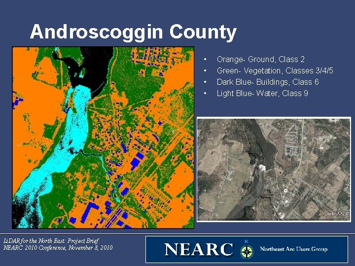
Androscoggin County • • Li. DAR for the North East: Project Brief NEARC 2010 Conference, November 8, 2010 Orange- Ground, Class 2 Green- Vegetation, Classes 3/4/5 Dark Blue- Buildings, Class 6 Light Blue- Water, Class 9
Work Plan: Li. DAR Processing Photo Science’s classification/filtering workflow typically results in: ü minimum performance for artifact/feature classification from the bare earth surface model: • • 95% artifacts classified 95% outliers classified 95% of vegetation classified 98% of buildings classified ü dense vegetation data voids will be minimized by automated and manual removal process ü data which is not bare earth will not be filtered to reduce the point density. ü unfiltered data will maintain the initial Points per Square Meter ü hydrographic break lines will be used to classify hydrography features (hydro flattening) during post processing phase Li. DAR for the North East: Project Brief NEARC 2010 Conference, November 8, 2010
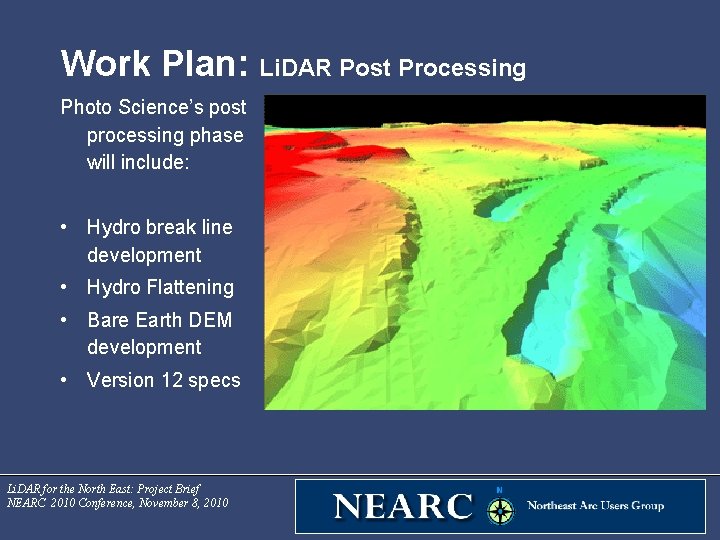
Work Plan: Li. DAR Post Processing Photo Science’s post processing phase will include: • Hydro break line development • Hydro Flattening • Bare Earth DEM development • Version 12 specs Li. DAR for the North East: Project Brief NEARC 2010 Conference, November 8, 2010
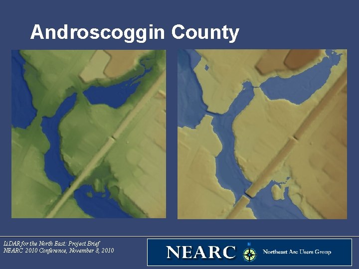
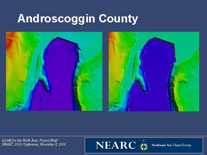
Work Plan: Li. DAR Post Processing • Hydro Flattening (Version 12 Spec) – Approach maintains consistent character of National Elevation Model (NED) as a traditional DEM – Typically accomplished through the use of breaklines – Represents the ground surface as viewed from a top down perspective – Natural depressions and road fills over culverts are desirable – Hydrologic analysis applications typically require alternative approaches including hydro-conditioning and hydroenforcement • Hydro Conditioned- flow of water is continuous across project area • Hydro Enforced- drainage feature specific, enables H&H model to depict unimpeded flow of water through artificial barriers (bridges and culverts) Li. DAR for the North East: Project Brief NEARC 2010 Conference, November 8, 2010
Androscoggin County Li. DAR for the North East: Project Brief NEARC 2010 Conference, November 8, 2010
Work Plan: Li. DAR Post Processing Version 12 Hydro Flattening: Hydro Break Line Development • Develop hydro breaklines for inland ponds, lakes, streams, rivers, non-tidal and non-tidal waters using Li. DAR intensity images and bare earth surface • Inland ponds & lakes • ~2 acres or greater (~350’ diameter) • Flatten and level water body (single elevation for every vertex) • Water edge elevation will be just at or below surrounding terrain • Reservoirs, inlets, fjords whose surface elevations drop moving downstream will be treated like rivers Li. DAR for the North East: Project Brief NEARC 2010 Conference, November 8, 2010
Androscoggin County Li. DAR for the North East: Project Brief NEARC 2010 Conference, November 8, 2010
Work Plan: Li. DAR Post Processing Version 12 Hydro Flattening: Hydro Break Line Development • Inland Streams & Rivers • Collect only if 100’ nominal width or wider • Flat and level bank to bank with gradient following immediately surrounding terrain • Water surface edge at or just below surrounding surface • Break at roads crossings (culvert locations) • Do not break at bridge crossing • Bridge to be removed from ground surface Li. DAR for the North East: Project Brief NEARC 2010 Conference, November 8, 2010
Work Plan: Li. DAR Post Processing Version 12 Hydro Flattening: Hydro Break Line Development • • Non Tidal Boundary Waters • Represents the edge(s) of project area, opposing shore not required • Water surface edge at or below surrounding terrain • Elevations will be consistent along the edge(s) having single elevation (lake) or gradient (river) Tidal Boundary Waters • Oceans, seas, gulfs, bays, inlets salt marshes, etc affected by tidal variations • Breakline discontinuities along shorelines are normal and expected • Final DEM should include as much ground as collected data permits • Variations in water surface elevations caused by tidal variation across project area will not be removed or adjusted Li. DAR for the North East: Project Brief NEARC 2010 Conference, November 8, 2010
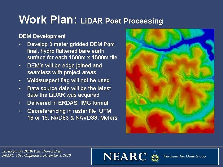
Work Plan: Li. DAR Post Processing DEM Development • Develop 3 meter gridded DEM from final, hydro flattened bare earth surface for each 1500 m x 1500 m tile • DEM’s will be edge joined and seamless with project areas • Void/suspect flag will not be used • Data source date will be the latest date the Li. DAR was acquired • Delivered in ERDAS. IMG format • Georeferencing in raster file: UTM 18 or 19, NAD 83 & NAVD 88, Meters Li. DAR for the North East: Project Brief NEARC 2010 Conference, November 8, 2010
Deliverables 1. All Return Data (raw point cloud data) • Delivered by flight swath (< 2 GB) in. las version 1. 2 • Georeferenced • Intensity values • GPS timestamp • All points delivered 2. Fully Classified Point Cloud • 1500 m x 1500 m tiles, no overlap, . las version 1. 2 • Classes 1, 2, 7, 9 & 10 • Hydro flattened • Georeferenced • GPS Time Stamp • Intensity values Li. DAR for the North East: Project Brief NEARC 2010 Conference, November 8, 2010 3. Raster Bare Earth DEM • 3 meter cell size • ERDAS. img format • Georeferenced • 1500 m x 1500 m tiles • No edge artifacts or mismatched • Void areas code with “Nodata” value • Depressions (sinks) not to be filled • Hydro Flattened 4. Hydro Breaklines (shape files) 5. Project Reports 6. Metadata- Project, Lift and Product Group
Accuracies Two Fundamental Vertical Accuracies (FVA) based on collection area : 1) Bare earth TIN will be 30 cm at a 95% confidence level, derived according to NSSDA, i. e. , based on RMSE of 15 cm in the “open terrain” land cover category. 2) Barnstable County- Bare earth TIN will be 18 cm at a 95% confidence level, derived according to NSSDA, i. e. , based on RMSE of 9. 25 cm in the “open terrain” land cover category. Li. DAR for the North East: Project Brief NEARC 2010 Conference, November 8, 2010
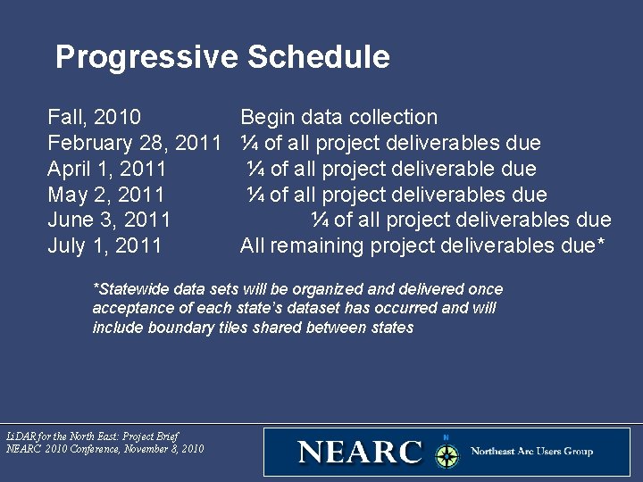
Progressive Schedule Fall, 2010 February 28, 2011 April 1, 2011 May 2, 2011 June 3, 2011 July 1, 2011 Begin data collection ¼ of all project deliverables due ¼ of all project deliverables due All remaining project deliverables due* *Statewide data sets will be organized and delivered once acceptance of each state’s dataset has occurred and will include boundary tiles shared between states Li. DAR for the North East: Project Brief NEARC 2010 Conference, November 8, 2010
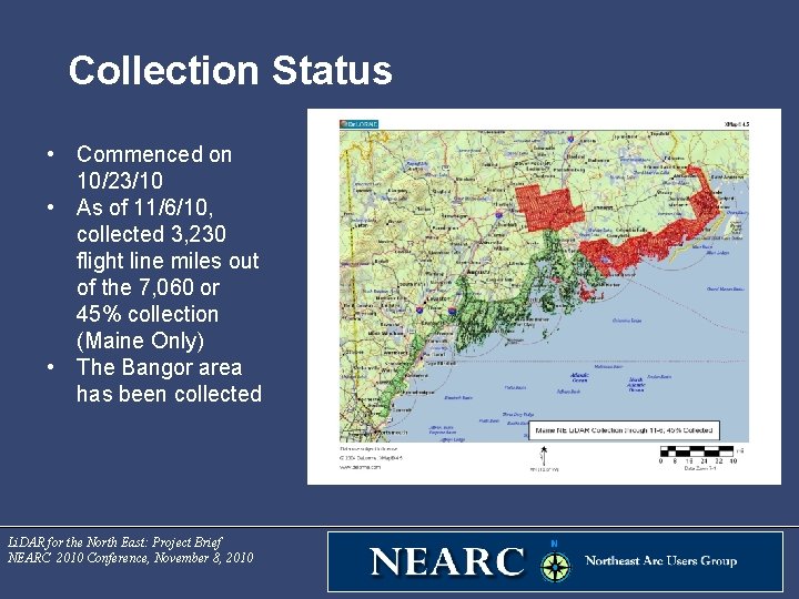
Collection Status • Commenced on 10/23/10 • As of 11/6/10, collected 3, 230 flight line miles out of the 7, 060 or 45% collection (Maine Only) • The Bangor area has been collected Li. DAR for the North East: Project Brief NEARC 2010 Conference, November 8, 2010
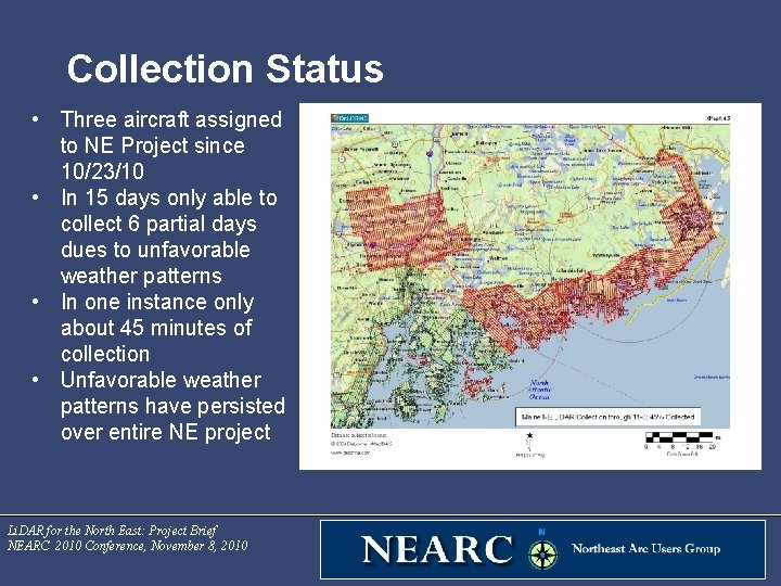
Collection Status • Three aircraft assigned to NE Project since 10/23/10 • In 15 days only able to collect 6 partial days dues to unfavorable weather patterns • In one instance only about 45 minutes of collection • Unfavorable weather patterns have persisted over entire NE project Li. DAR for the North East: Project Brief NEARC 2010 Conference, November 8, 2010
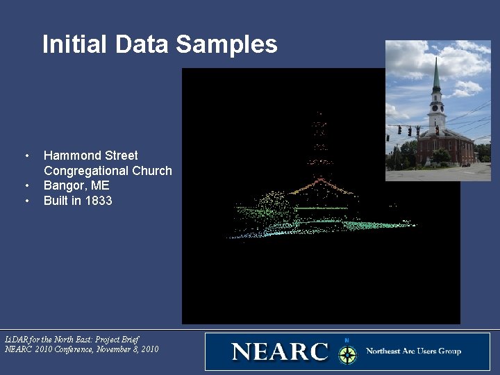
Initial Data Samples • • • Hammond Street Congregational Church Bangor, ME Built in 1833 Li. DAR for the North East: Project Brief NEARC 2010 Conference, November 8, 2010
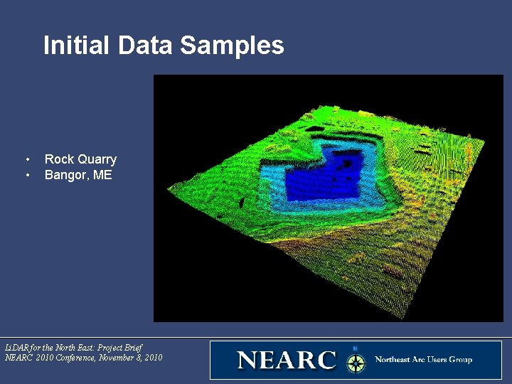
Initial Data Samples • • Rock Quarry Bangor, ME Li. DAR for the North East: Project Brief NEARC 2010 Conference, November 8, 2010
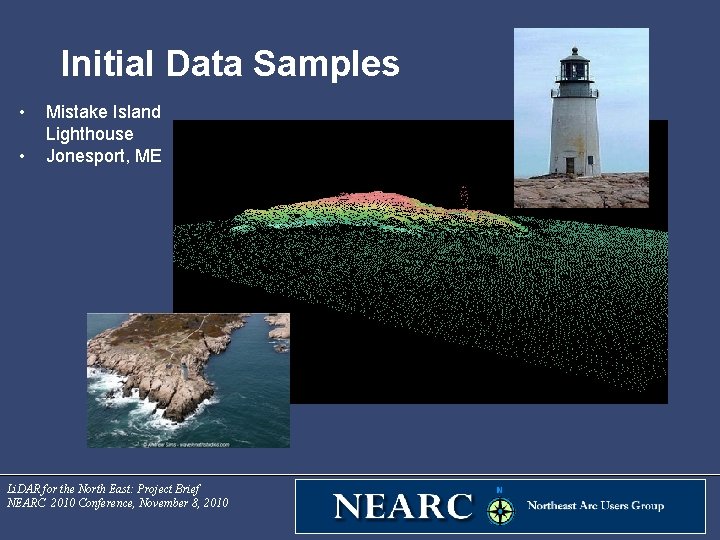
Initial Data Samples • • Mistake Island Lighthouse Jonesport, ME Li. DAR for the North East: Project Brief NEARC 2010 Conference, November 8, 2010
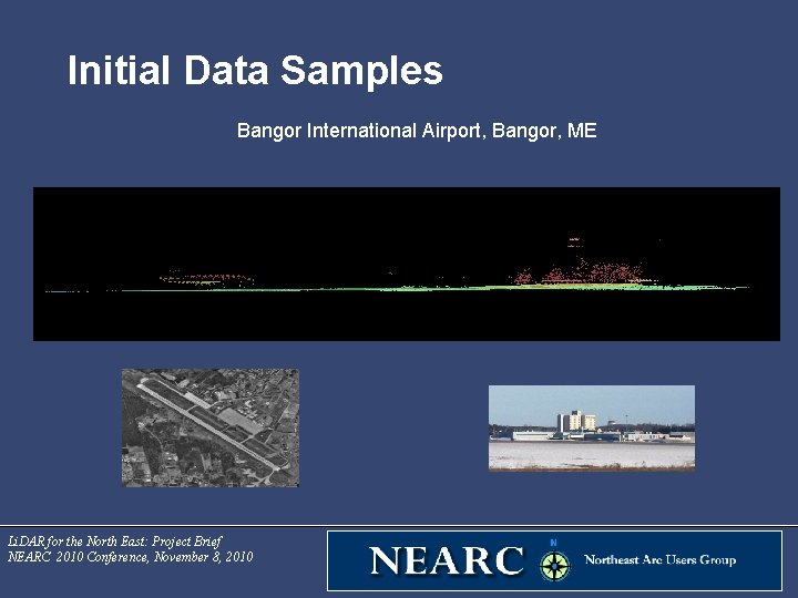
Initial Data Samples Bangor International Airport, Bangor, ME Li. DAR for the North East: Project Brief NEARC 2010 Conference, November 8, 2010
Contact Information Michael Smith State GIS Manager, Maine Office of GIS, Maine OIT State House Station 174 264 Civic Center Drive (207) 215 -5530 Michael. Smith@maine. gov Li. DAR for the North East: Project Brief NEARC 2010 Conference, November 8, 2010 Michael Shillenn, CP Photo Science 104 S. Church Street West Chester, PA 19382 610 -344 -0890 mshillenn@photoscience. com
- Slides: 48