Profiles Topographic Maps Latitude Longitude Elevation Earth Contour


 Equator = 0° b) Tropic of Cancer = 23.")


- Slides: 37
Profiles Topographic Maps Latitude Longitude Elevation Earth Contour Lines Prime Meridian Altitude Equator Isoline Slope Gradient
Earth’s Shape • Earth appears spherical from space. oblate spheroid • Earth is actually an ________. It is slightly "flattened" at the poles, and "bulges" slightly at the equator due to rotation on its axis. How can we prove the Earth’s shape?
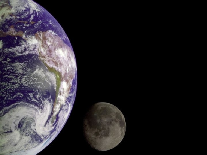
Photographs from space
Lunar Eclipse Earth’s shadow on the moon
Lunar Eclipse – Note the curved shadow
Explorers sailed around the world
Ships seem to rise or sink over horizon
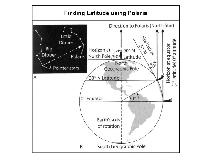
Polaris ______+______= POLATITUDE Latitude In the N. Hemisphere, the altitude of Polaris changes with your latitude
Polaris clip
Weight varies slightly from the poles to the equator, because the equator is slightly further from the center of mass than the poles. (weight = mass * force of gravity)
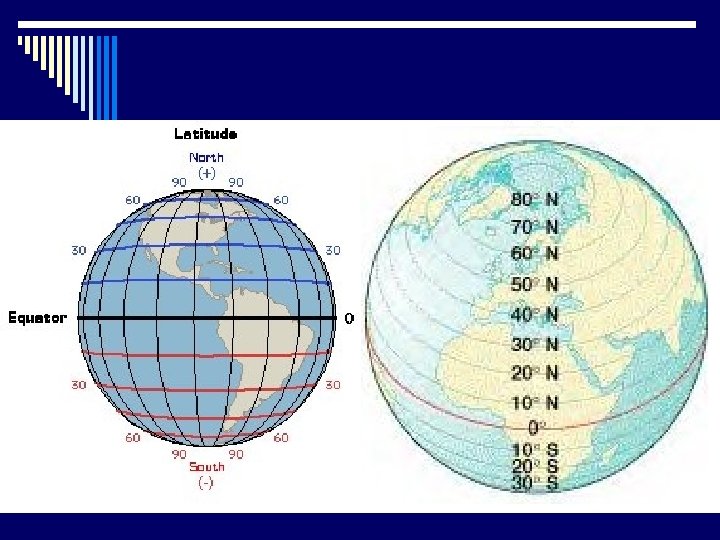
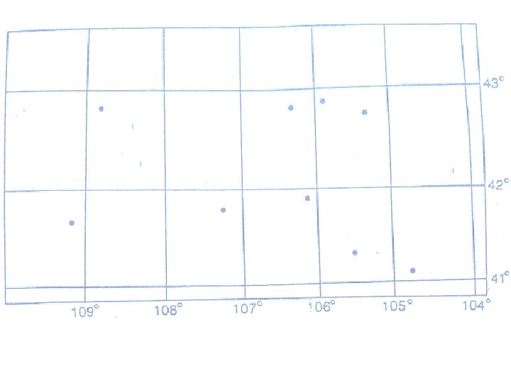
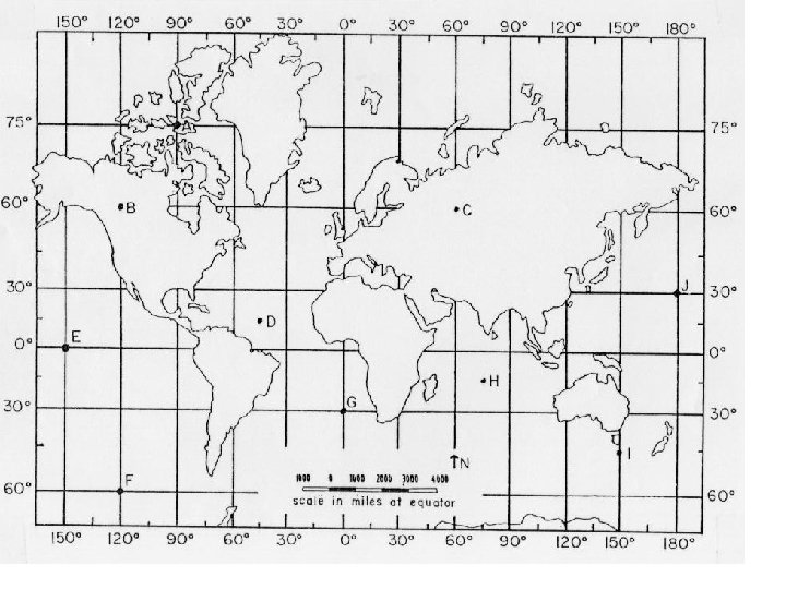
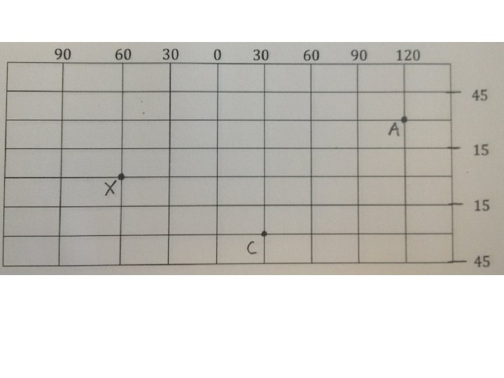
Latitude of latitude run East & West _ across the Earth, but measure North ______& _____. South ► Lines ► The reference lines for all lines of latitude is the equator _____. ► The ► All equator is at 0° latitude. parallel to the equator. lines of latitude run_______
Lines of Latitude ★ Latitude can be determined by finding the altitude of Polaris = Latitude = 42°N 42° 83° = 83°N 10°S Can not see = the N. Star in the S. Hemi
Important Lines of Latitude a) Equator = 0° b) Tropic of Cancer = 23. 5°N c) Tropic of Capricorn = 23. 5°S d) Arctic Circle = 66. 5°N e) Antarctic Circle = 66. 5°S f) North Pole = 90°N g) South Pole = 90°S
North Pole 90°N Arctic Circle 66. 5°N Tropic of Cancer 23. 5°N Equator 0° Tropic of Capricorn 23. 5°S Antarctic Circle 66. 5°N South Pole 90°S
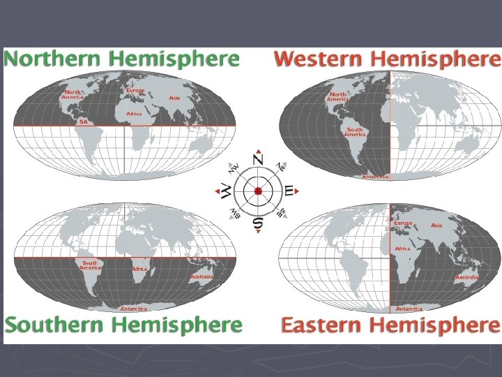
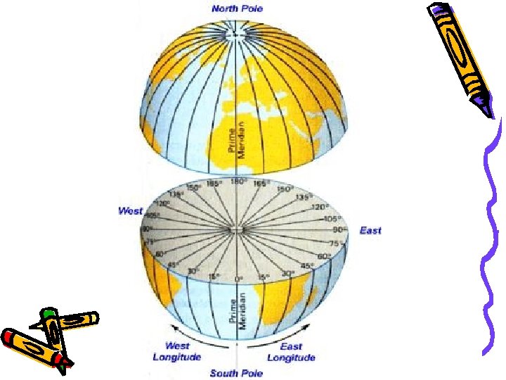
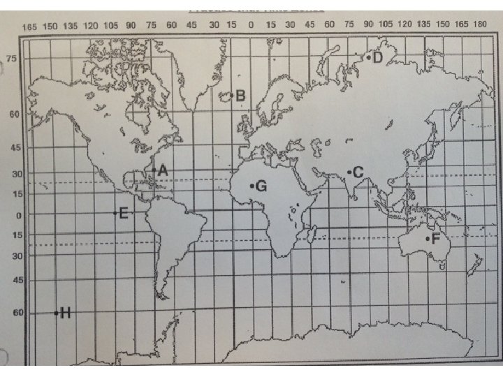
Longitude ► Lines North & _______ South of longitude run ____ East West across the Earth, but measure ______&_____. ► The reference line for all lines of longitude is Meridian the _____ ___. Prime 0° ► The Prime Meridian is at ______ longitude. ► Line of longitude DO NOT run parallel to each other like lines of latitude. Lines of longitude closer are _______ to each other by the farther poles and ______ from each other by the equator.
Longitude ► The furthest West you can travel from the 180° Prime Meridian is ____ which is the Line. _______ International ____ Date
Time Zones and Longitude Local Noon is defined as the time when the sun is directly overhead of an observer
Time Zones and Longitude • The Earth rotates 360 o in a 24 hours period. (a rate of 15 o per hour) • Because of the Earth’s rotation, different parts of the Earth are in daylight at different times of the day • This requires humans to set-up some standards in terms of world times
Important Longitudes and Time Zones • 180 o Longitude is the International Date Line, where the day begins. – If you move cross the Int’l Date Line from the east you gain a day – If you move cross the Int’l Date Line from the west you lose a day • 0 o Longitude is set at Greenwich Mean Time (GMT)
Using Longitude to Find Times • Differences of 15 o Longitude, relates to a difference of 1 hour of time • Add or subtract hours from local time based upon motions east or west. hours - Move East =add ________ - Move West subtract =____ hours _______
Time Zones
True Time Zones