Products and Forecasts Examples and experiences Yuejian Zhu





- Slides: 38

Products and Forecasts - Examples and experiences Yuejian Zhu and Hong Guan Ensemble Team EMC/NCEP/NWS/NOAA Presents for NWP Forecast Training Class March 31, 2015, Fuzhou, Fujian, China

Background • NDGD – National Digit Guidance Database • Guidance's are produced from NWP output, post process and et al. • NDFD – National Digit Forecast Database • Forecasts are issued from WFO forecasters based on all different guidance • Coverage and resolution – – – CONUS – 2. 5 km Alaska – 3 km Hawaii – 2. 5 km Puerto Rico – 2. 5 km Guam – 2. 5 km

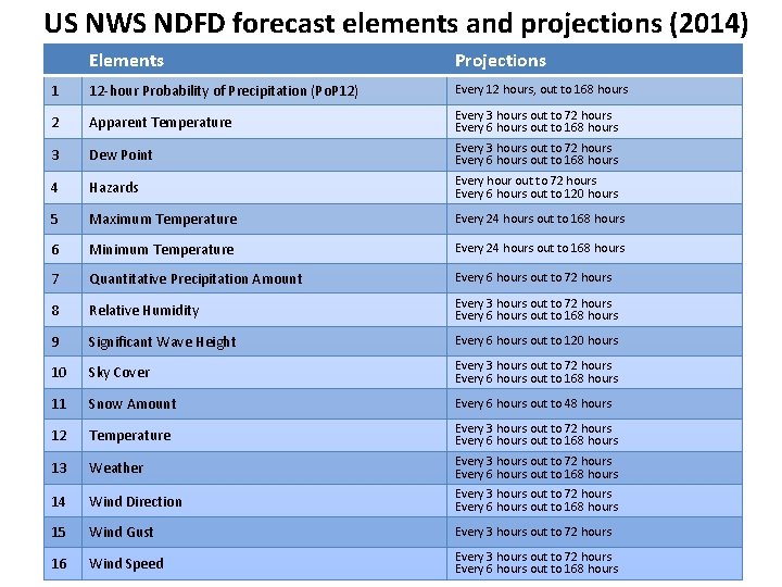
US NWS NDFD forecast elements and projections (2014) Elements Projections 1 12 -hour Probability of Precipitation (Po. P 12) Every 12 hours, out to 168 hours 2 Apparent Temperature Every 3 hours out to 72 hours Every 6 hours out to 168 hours 3 Dew Point Every 3 hours out to 72 hours Every 6 hours out to 168 hours 4 Hazards Every hour out to 72 hours Every 6 hours out to 120 hours 5 Maximum Temperature Every 24 hours out to 168 hours 6 Minimum Temperature Every 24 hours out to 168 hours 7 Quantitative Precipitation Amount Every 6 hours out to 72 hours 8 Relative Humidity Every 3 hours out to 72 hours Every 6 hours out to 168 hours 9 Significant Wave Height Every 6 hours out to 120 hours 10 Sky Cover Every 3 hours out to 72 hours Every 6 hours out to 168 hours 11 Snow Amount Every 6 hours out to 48 hours 12 Temperature Every 3 hours out to 72 hours Every 6 hours out to 168 hours 13 Weather Every 3 hours out to 72 hours Every 6 hours out to 168 hours 14 Wind Direction Every 3 hours out to 72 hours Every 6 hours out to 168 hours 15 Wind Gust Every 3 hours out to 72 hours 16 Wind Speed Every 3 hours out to 72 hours Every 6 hours out to 168 hours

High Impact Weather and Extreme Forecast

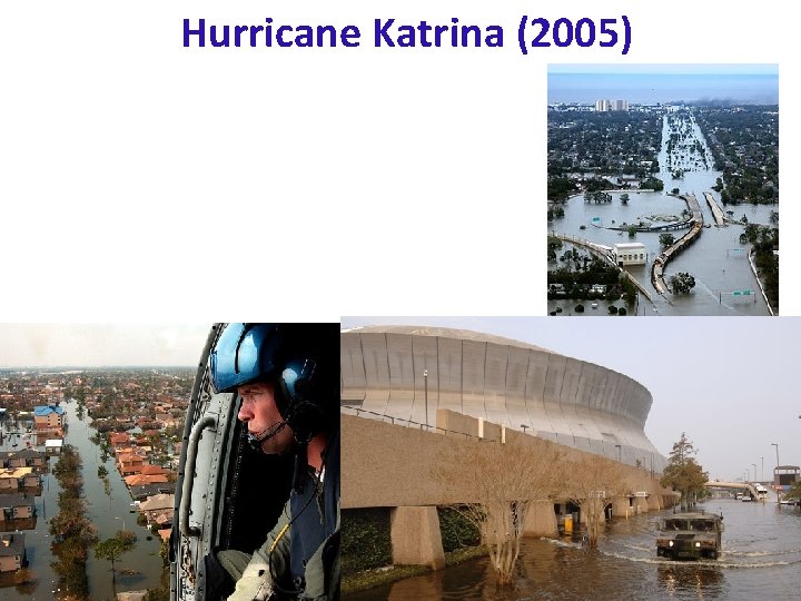
Hurricane Katrina (2005)

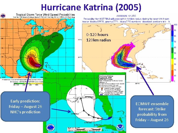
Hurricane Katrina (2005) 0 -120 hours 120 km radius Early prediction: Friday – August 26 NHC’s prediction ECMWF ensemble forecast: Strike probability from Friday – August 26

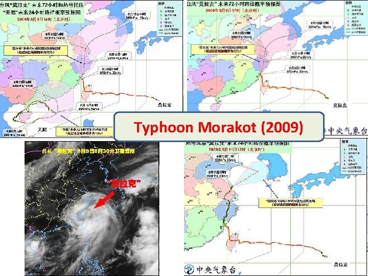
Typhoon Morakot (2009)

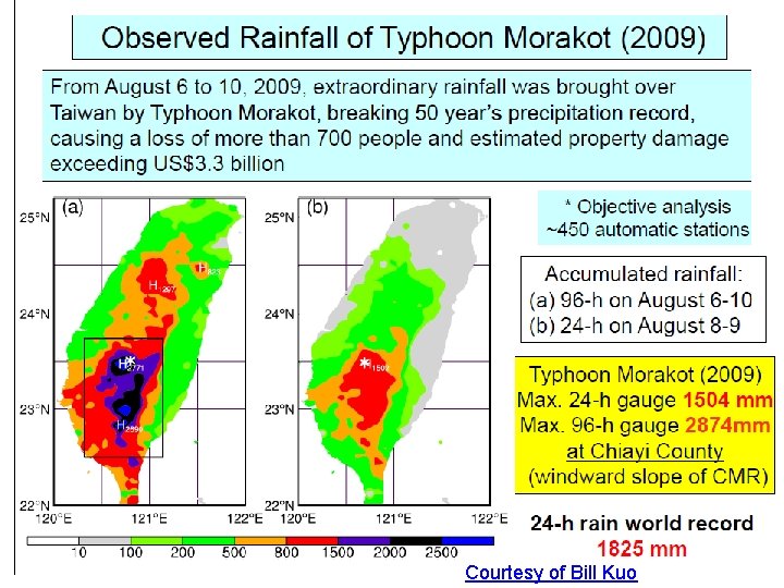
Courtesy of Bill Kuo

Courtesy of Bill Kuo

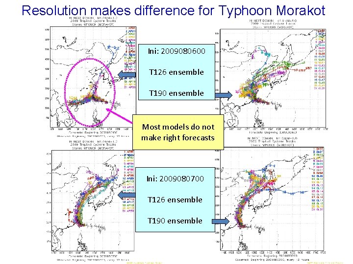
Resolution makes difference for Typhoon Morakot Ini: 2009080600 T 126 ensemble T 190 ensemble Most models do not make right forecasts Ini: 2009080700 T 126 ensemble T 190 ensemble 10

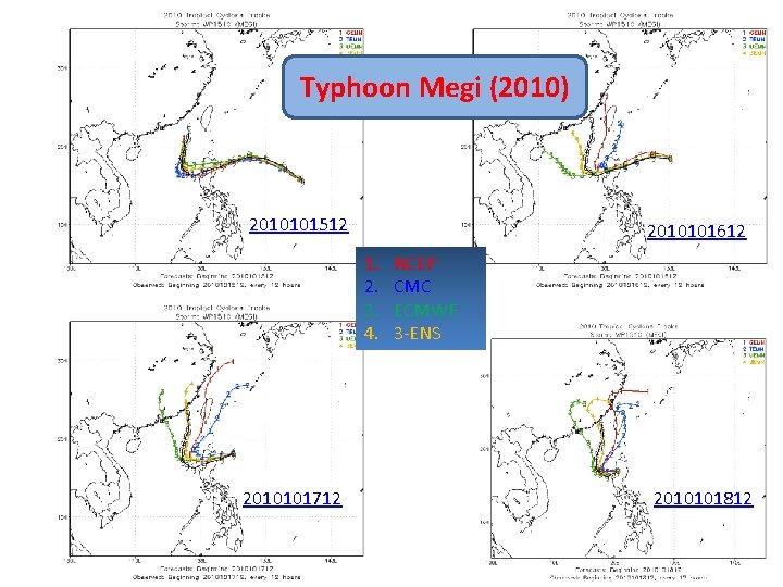
Typhoon Megi (2010) 2010101512 2010101612 1. 2. 3. 4. 2010101712 NCEP CMC ECMWF 3 -ENS 2010101812

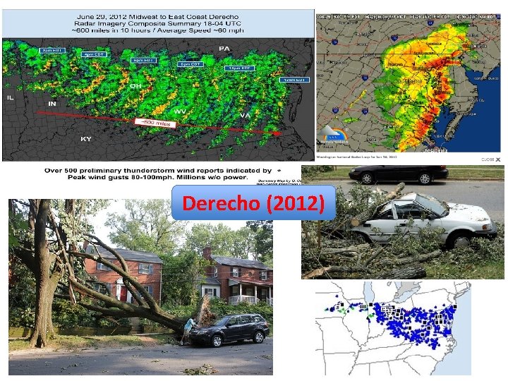
Derecho (2012)

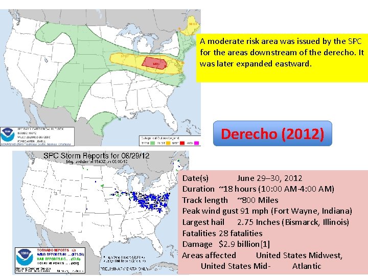
A moderate risk area was issued by the SPC for the areas downstream of the derecho. It was later expanded eastward. Derecho (2012) Date(s) June 29– 30, 2012 Duration ~18 hours (10: 00 AM-4: 00 AM) Track length ~800 Miles Peak wind gust 91 mph (Fort Wayne, Indiana) Largest hail 2. 75 Inches (Bismarck, Illinois) Fatalities 28 fatalities Damage $2. 9 billion[1] Areas affected United States Midwest, United States Mid. Atlantic

Sandy Case Study for NEXT GEFS Period: 10/22 – 10/28/2012 Named: 10/23/2012 Yuejian Zhu EMC/NCEP September 15 2014 Acknolegements: Dingchen Hou, Xiaqiong Zhou and Jiayi Peng

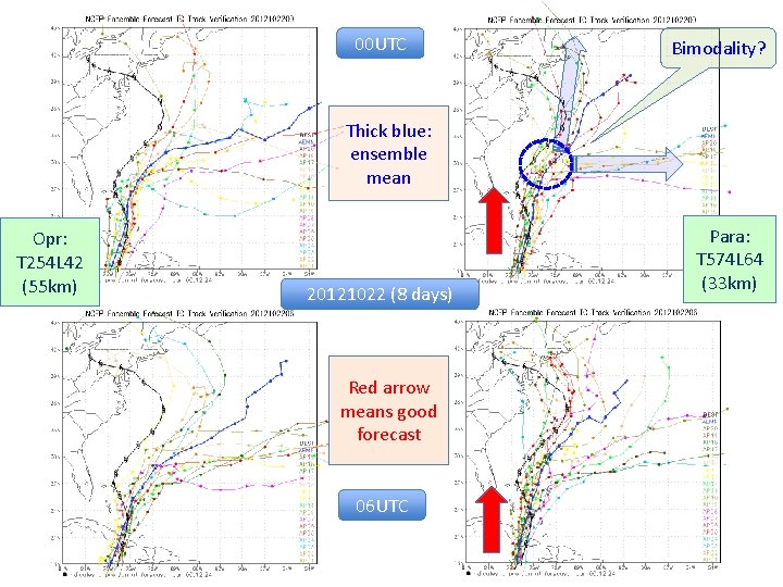
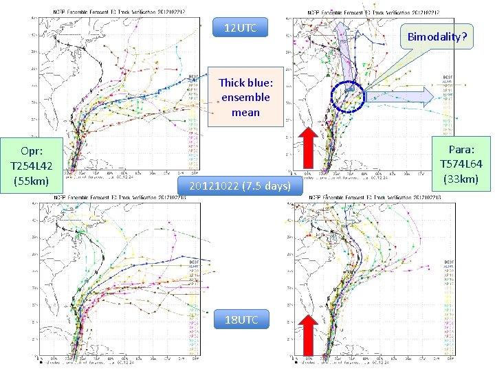
00 UTC Bimodality? Thick blue: ensemble mean Opr: T 254 L 42 (55 km) 20121022 (8 days) Red arrow means good forecast 06 UTC Para: T 574 L 64 (33 km)

12 UTC Bimodality? Thick blue: ensemble mean Opr: T 254 L 42 (55 km) 20121022 (7. 5 days) 18 UTC Para: T 574 L 64 (33 km)

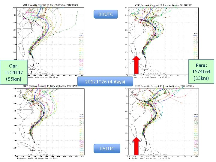
00 UTC Opr: T 254 L 42 (55 km) 20121026 (4 days) 06 UTC Para: T 574 L 64 (33 km)

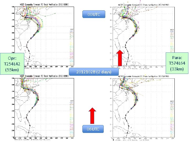
00 UTC Opr: T 254 L 42 (55 km) 20121028 (2 days) 06 UTC Para: T 574 L 64 (33 km)

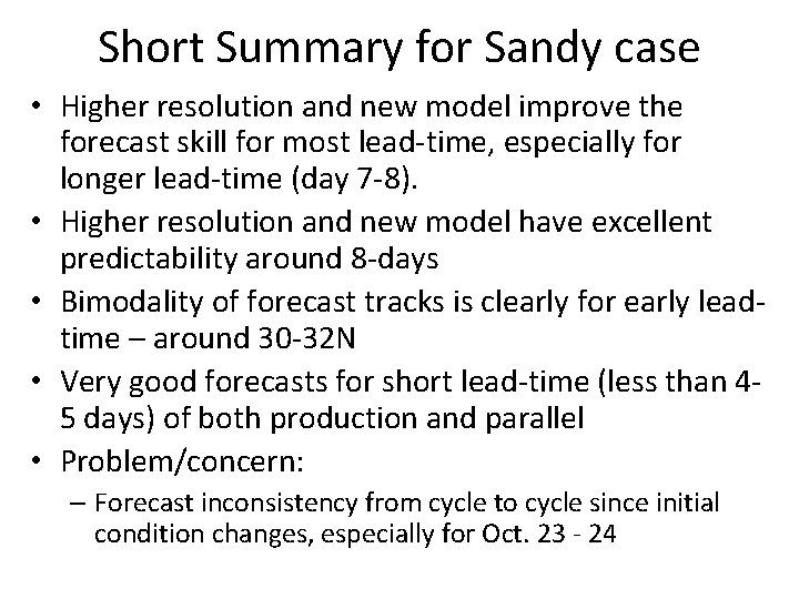
Short Summary for Sandy case • Higher resolution and new model improve the forecast skill for most lead-time, especially for longer lead-time (day 7 -8). • Higher resolution and new model have excellent predictability around 8 -days • Bimodality of forecast tracks is clearly for early leadtime – around 30 -32 N • Very good forecasts for short lead-time (less than 45 days) of both production and parallel • Problem/concern: – Forecast inconsistency from cycle to cycle since initial condition changes, especially for Oct. 23 - 24

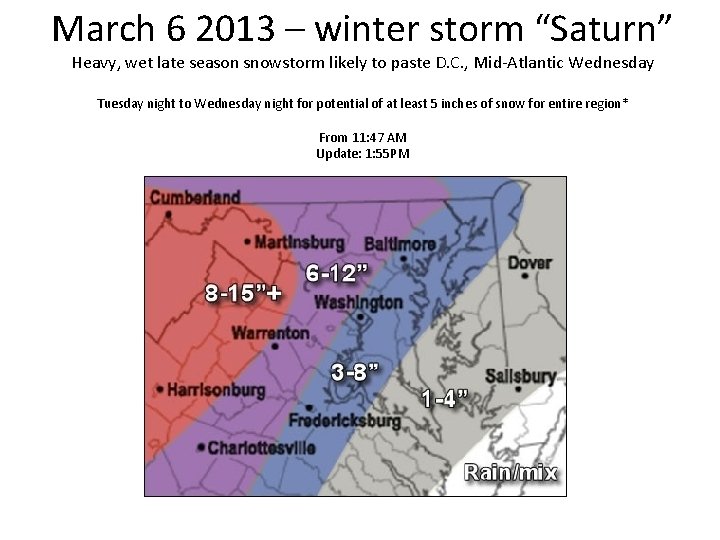
March 6 2013 – winter storm “Saturn” Heavy, wet late season snowstorm likely to paste D. C. , Mid-Atlantic Wednesday Tuesday night to Wednesday night for potential of at least 5 inches of snow for entire region* From 11: 47 AM Update: 1: 55 PM

FEDERAL OFFICES in the Washington, DC, area are CLOSED. Emergency and telework-ready employees (employees with approved individual telework agreements) required to work must follow their agency’s policies, including their approved individual telework agreement All Howard County public schools and offices are closed today, Wednesday, March 6, 2013. All evening activities in schools, both school-sponsored and community-sponsored, are canceled. This includes high school athletic practices and games.

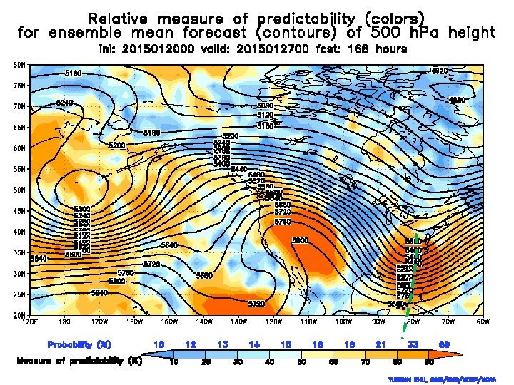
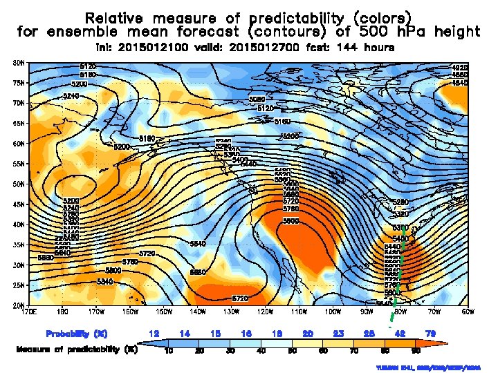
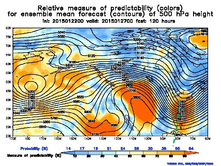
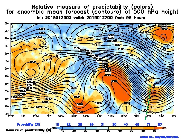
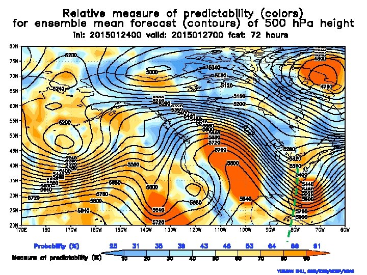
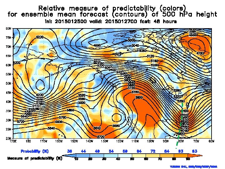
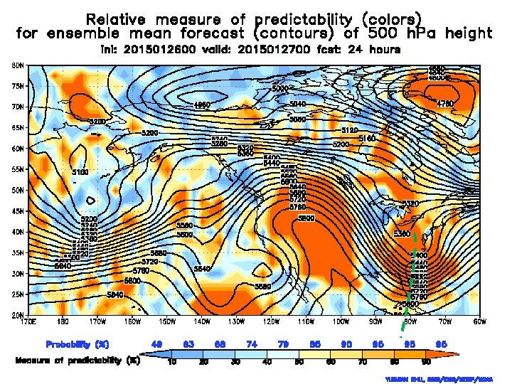
Review of 2015 NE Blizzard 01/26 12 UTC – 01/27 12 UTC 2015 Yuejian Zhu EMC/NCEP/NWS Jan. 27 2015 Acknowledgements: Hong Guan, Yan Luo and Xiaxiong Zhou ESRL’s EFI maps

WFO forecast (48 hours accumulation)

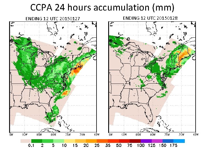
CCPA 24 hours accumulation (mm) ENDING 12 UTC 20150127 ENDING 12 UTC 20150128


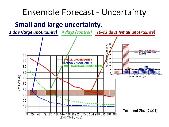
Ensemble Forecast - Uncertainty Small and large uncertainty. 1 day (large uncertainty) = 4 days (control) = 10 -13 days (small uncertainty) Toth and Zhu (2001)


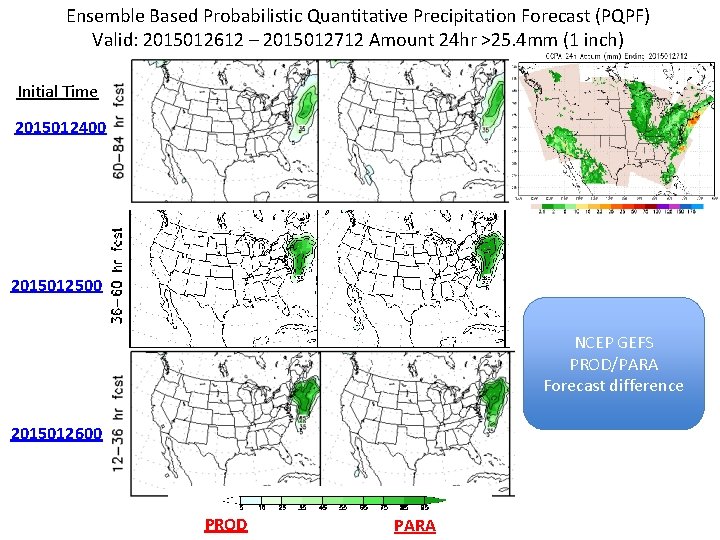
Ensemble Based Probabilistic Quantitative Precipitation Forecast (PQPF) Valid: 2015012612 – 2015012712 Amount 24 hr >25. 4 mm (1 inch) Initial Time 2015012400 2015012500 NCEP GEFS PROD/PARA Forecast difference 2015012600 PROD PARA

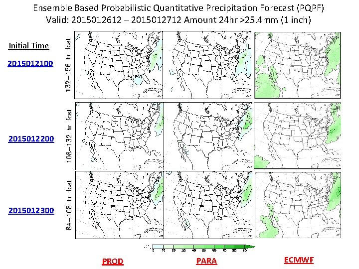
Ensemble Based Probabilistic Quantitative Precipitation Forecast (PQPF) Valid: 2015012612 – 2015012712 Amount 24 hr >25. 4 mm (1 inch) Initial Time 2015012100 2015012200 2015012300 PROD PARA ECMWF

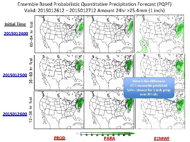
Ensemble Based Probabilistic Quantitative Precipitation Forecast (PQPF) Valid: 2015012612 – 2015012712 Amount 24 hr >25. 4 mm (1 inch) Initial Time 2015012400 2015012500 Here is the difference EC’s ensemble predicted 50%+ chance for 1 inch prcip over NY city 2015012600 PROD PARA ECMWF

NCEP GEFS failed on Oct. 3 -4 2014 • First fail – 18 UTC Oct. 3 rd 2014 – Friday – No product for GEFS, SREF, Wave and NAEFS • Second fail – 12 UTC Oct. 4 th 2014 – Saturday – Delayed 3 hrs for all products and downstream • Where is the problem? – Failed on first integration time step • Point to short wave radiation – In fact, the problem is longwave radiation code • secdiff(j) = a 0(j) + a 1(j) * exp( a 2(j)*pwvcm) < 0. 0 • It was never happened before – Protect – cost? • Morning of Oct. 10 th 2014 – Friday – Announced we found a problem

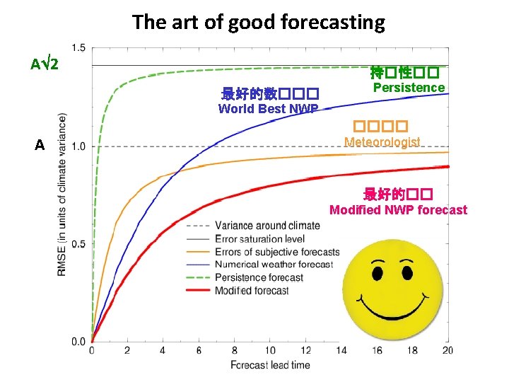
The art of good forecasting A 2 持�性�� 最好的数��� Persistence World Best NWP ���� A Meteorologist 最好的�� Modified NWP forecast