Pressure Fronts air masses WEATHER Air Pressure The


- Slides: 29

Pressure, Fronts, air masses WEATHER

Air Pressure The weight of air pressing down on a given area of Earth’s surface Measured with barometer Changes in air pressure Falling: stormy weather is coming Rising: fair weather is coming Steady: existing weather will continue

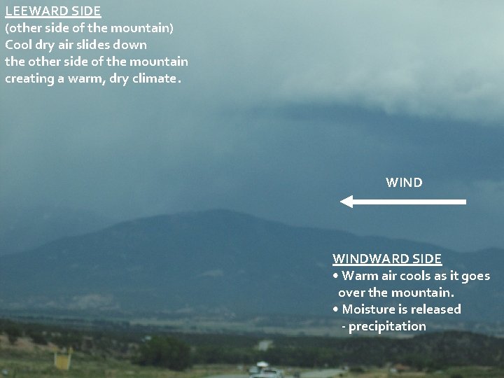
LEEWARD SIDE (other side of the mountain) Cool dry air slides down the other side of the mountain creating a warm, dry climate. WINDWARD SIDE • Warm air cools as it goes over the mountain. • Moisture is released - precipitation

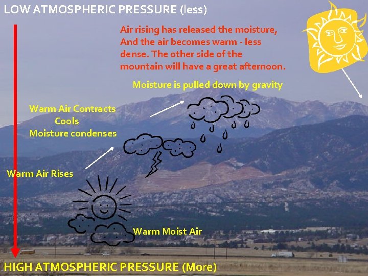
LOW ATMOSPHERIC PRESSURE (less) Air rising has released the moisture, And the air becomes warm - less dense. The other side of the mountain will have a great afternoon. Moisture is pulled down by gravity Warm Air Contracts Cools Moisture condenses Warm Air Rises Warm Moist Air HIGH ATMOSPHERIC PRESSURE (More)

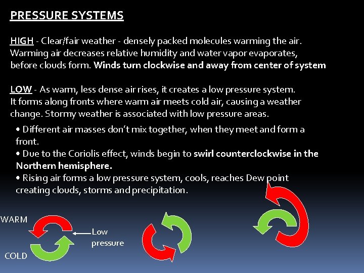
PRESSURE SYSTEMS HIGH - Clear/fair weather - densely packed molecules warming the air. Warming air decreases relative humidity and water vapor evaporates, before clouds form. Winds turn clockwise and away from center of system LOW - As warm, less dense air rises, it creates a low pressure system. It forms along fronts where warm air meets cold air, causing a weather change. Stormy weather is associated with low pressure areas. • Different air masses don’t mix together, when they meet and form a front. • Due to the Coriolis effect, winds begin to swirl counterclockwise in the Northern hemisphere. • Rising air forms a low pressure system, cools, reaches Dew point creating clouds, storms and precipitation. WARM Low pressure COLD

Wind Currents Sun drives convection currents in air Wind is moving air, caused by differences in air pressure Wind moves from high to low pressure The greater the pressure difference the greater the wind Local winds=local weather (sea breezes and land breezes) Global winds= circle Earth in wide belts (jet stream) Wind vane: determines wind direction; points to the direction from which the wind is blowing Anemometer: measures wind speed; Beaufort scale (0 -12) relates common observations to wind speed

Local Winds Sea breeze- convection current blows wind from the cooler sea toward the warmer land during the day Land Breeze- at night, air moves toward the water as the land cools more rapidly than the water

Ocean Currents Wind blowing over the ocean’s surface pushing the water, producing a current of seawater 2 types (due to differences in density of seawater) Cold: move from polar regions to equator Warm: move from tropical equatorial latitudes to polar regions

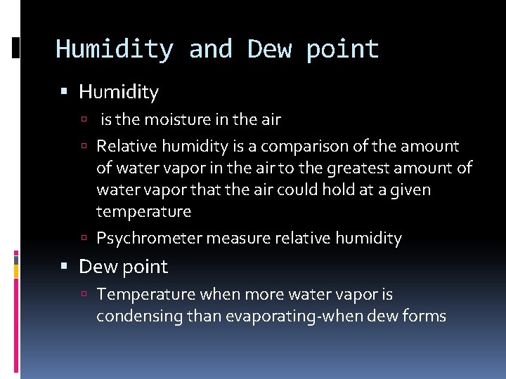
Humidity and Dew point Humidity is the moisture in the air Relative humidity is a comparison of the amount of water vapor in the air to the greatest amount of water vapor that the air could hold at a given temperature Psychrometer measure relative humidity Dew point Temperature when more water vapor is condensing than evaporating-when dew forms

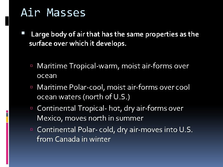
Air Masses Large body of air that has the same properties as the surface over which it develops. Maritime Tropical-warm, moist air-forms over ocean Maritime Polar-cool, moist air-forms over cool ocean waters (north of U. S. ) Continental Tropical- hot, dry air-forms over Mexico, moves north in summer Continental Polar- cold, dry air-moves into U. S. from Canada in winter

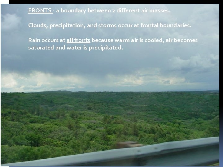
FRONTS - a boundary between 2 different air masses. Clouds, precipitation, and storms occur at frontal boundaries. Rain occurs at all fronts because warm air is cooled, air becomes saturated and water is precipitated.

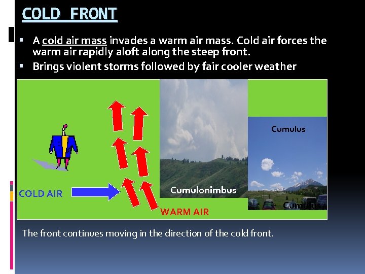
COLD FRONT A cold air mass invades a warm air mass. Cold air forces the warm air rapidly aloft along the steep front. Brings violent storms followed by fair cooler weather Cumulus COLD AIR Cumulonimbus WARM AIR The front continues moving in the direction of the cold front. Cumulus

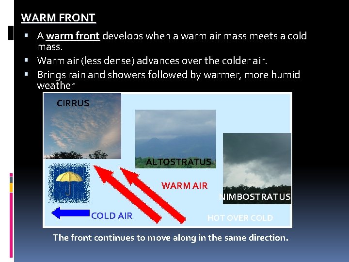
WARM FRONT A warm front develops when a warm air mass meets a cold mass. Warm air (less dense) advances over the colder air. Brings rain and showers followed by warmer, more humid weather CIRRUS ALTOSTRATUS WARM AIR COLD AIR NIMBOSTRATUS HOT OVER COLD The front continues to move along in the same direction.

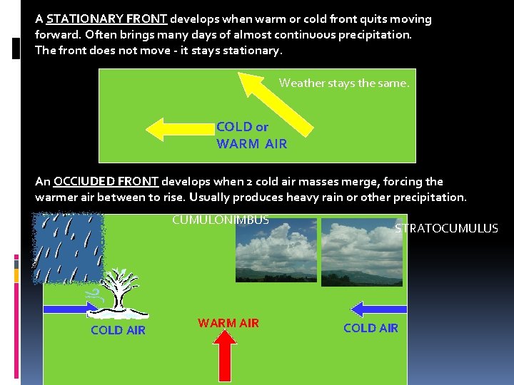
A STATIONARY FRONT develops when warm or cold front quits moving forward. Often brings many days of almost continuous precipitation. The front does not move - it stays stationary. Weather stays the same. COLD or WARM AIR An OCCl. UDED FRONT develops when 2 cold air masses merge, forcing the warmer air between to rise. Usually produces heavy rain or other precipitation. CUMULONIMBUS COLD AIR WARM AIR STRATOCUMULUS COLD AIR

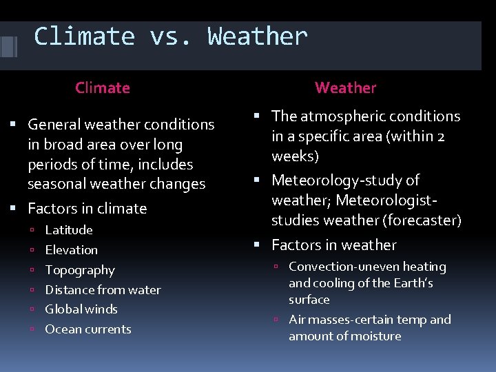
Climate vs. Weather Climate General weather conditions in broad area over long periods of time, includes seasonal weather changes Factors in climate Latitude Elevation Topography Distance from water Global winds Ocean currents Weather The atmospheric conditions in a specific area (within 2 weeks) Meteorology-study of weather; Meteorologiststudies weather (forecaster) Factors in weather Convection-uneven heating and cooling of the Earth’s surface Air masses-certain temp and amount of moisture

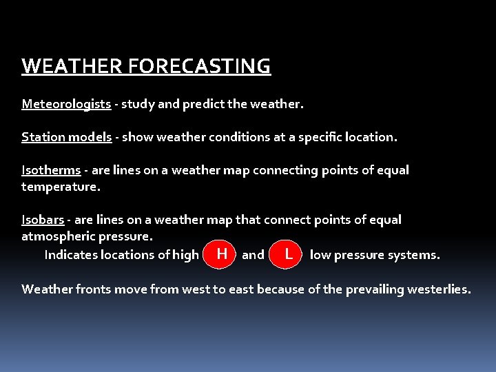
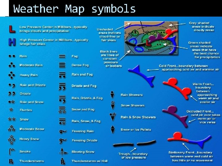
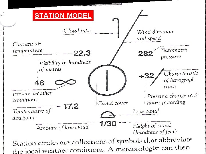
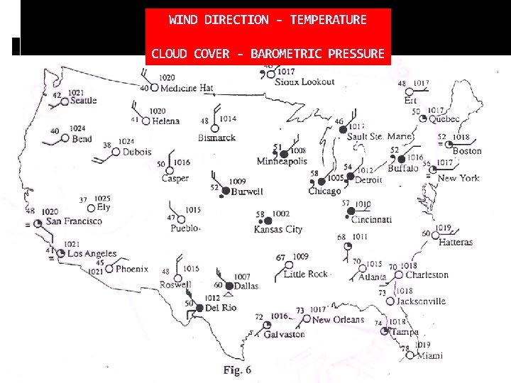
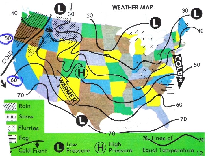
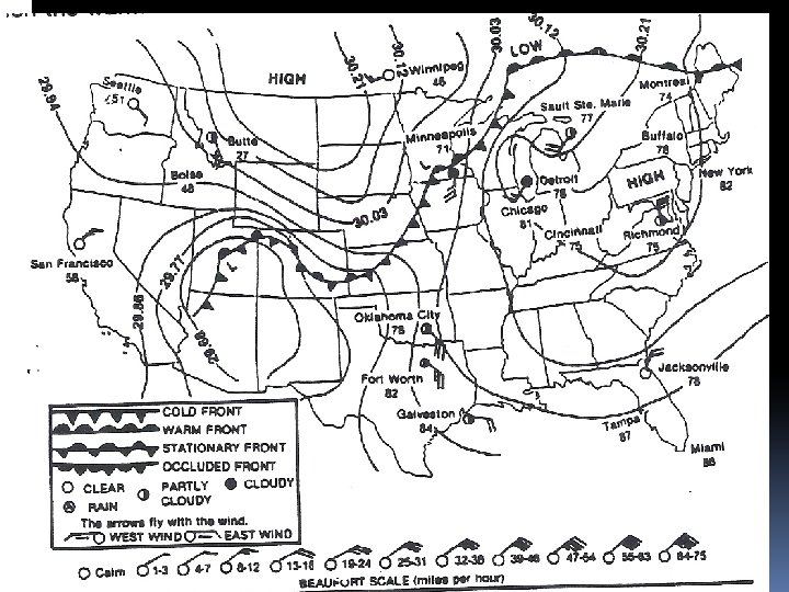
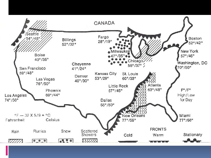
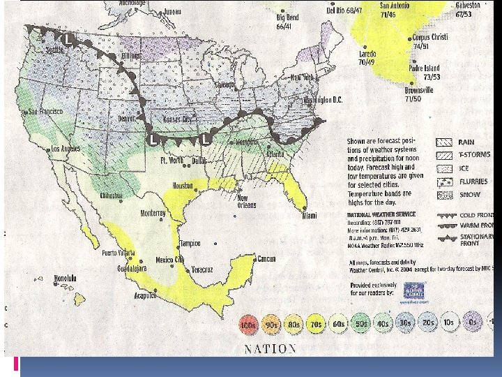
WEATHER FORECASTING Meteorologists - study and predict the weather. Station models - show weather conditions at a specific location. Isotherms - are lines on a weather map connecting points of equal temperature. Isobars - are lines on a weather map that connect points of equal atmospheric pressure. Indicates locations of high H and L low pressure systems. Weather fronts move from west to east because of the prevailing westerlies.

Weather Map symbols

STATION MODEL

WIND DIRECTION - TEMPERATURE CLOUD COVER - BAROMETRIC PRESSURE


SEVERE WEATHER SAFETY WATCH - means conditions are favorable for severe weather to develop. WARNING - means that severe weather conditions already exist.

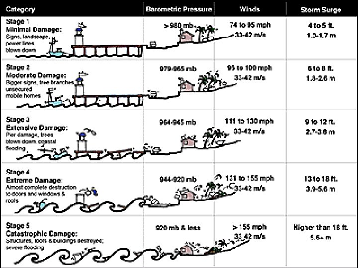
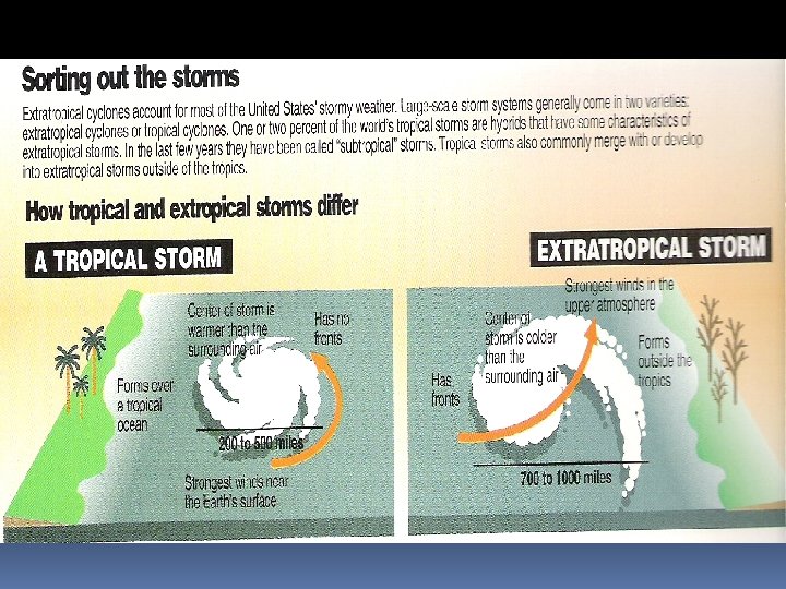
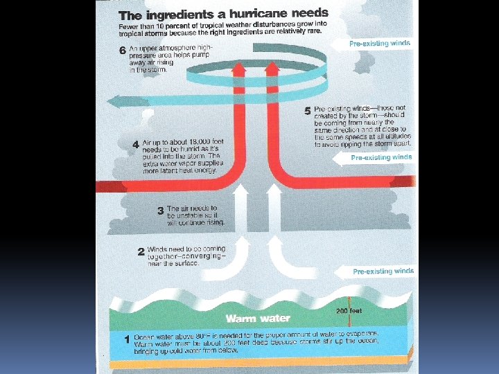
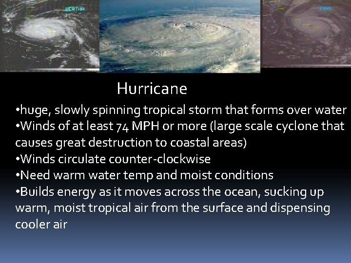
Hurricane • huge, slowly spinning tropical storm that forms over water • Winds of at least 74 MPH or more (large scale cyclone that causes great destruction to coastal areas) • Winds circulate counter-clockwise • Need warm water temp and moist conditions • Builds energy as it moves across the ocean, sucking up warm, moist tropical air from the surface and dispensing cooler air
