PRACTICAL TAF WRITING Karen Oudeman NWS Jackson KY



- Slides: 23

PRACTICAL TAF WRITING Karen Oudeman NWS – Jackson, KY October 16, 2003

References üDaniel Cobb Jr. “Practically Perfect TAF” Presentation üDLAC Web Module “Writing Effective TAFs”

Practical TAF Writing Today’s Objectives and Format • Present a methodology forecasters • Skills in writing effective, practical, user-friendly TAFs • Run through an example • Summery of TAF creation thought process

Formal TAF Definition Terminal Aerodrome Forecast (TAF) • A NWS TAF will consist of the expected meteorological conditions significant to aviation at an airport (terminal) for a specified time period. • The U. S. definition of a terminal is the area within five (5) statute miles (SM) of the center of an airport's runway • • complex. Forecasters will prepare and monitor TAFs using the best professional judgment to optimize timeliness and representativeness, with an awareness of the potential operational impact of each forecast element. Forecasters will also keep in mind the Critical TAF Period Philosophy; defined as hours 2 -6 from the current valid time within the TAF. NWSI 10 -813

Keep in Mind… ü “Worst case scenario” drives operational decisions ü Flight categories ü Impact thresholds ü Critical TAF period (2 -6 hrs) ü Know your airfields: restrictions and minimums ü Commercial vs. GA

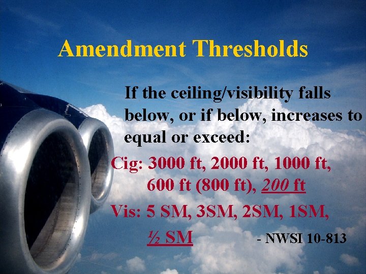
Amendment Thresholds If the ceiling/visibility falls below, or if below, increases to equal or exceed: Cig: 3000 ft, 2000 ft, 1000 ft, 600 ft (800 ft), 200 ft Vis: 5 SM, 3 SM, 2 SM, 1 SM, ½ SM - NWSI 10 -813

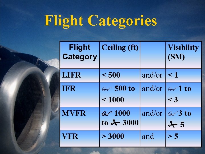
Flight Categories Flight Ceiling (ft) Category Visibility (SM) LIFR < 500 IFR $ 500 to and/or $1 to < 1000 <3 MVFR 1000 and/or $3 to to 3000 5 > 3000 and >5 VFR and/or < 1

TAF Writing • Avoid writing the: ØUn-amendable TAF ØAmbiguous TAF Instead, try to strive for an effective, practical, userfriendly TAF Don’t look at it completely through a meteorologist’s eyes – think about it through the user’s eyes

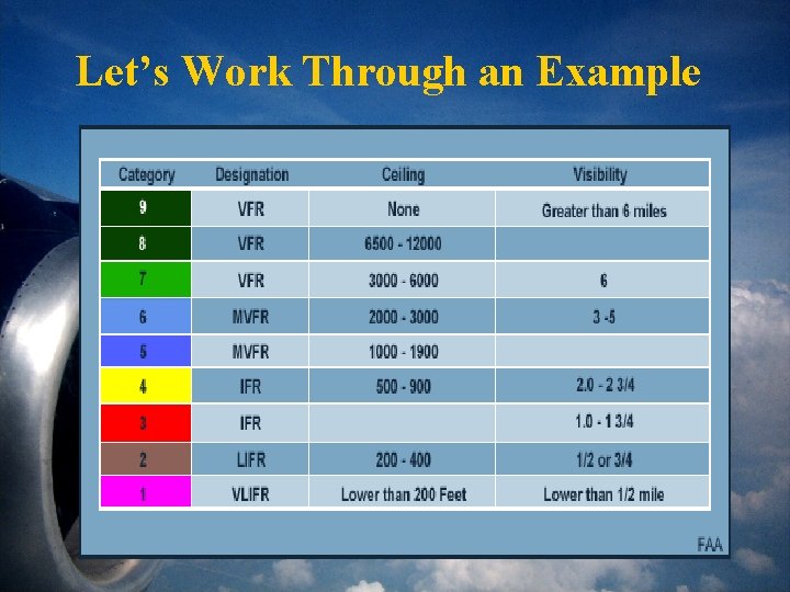
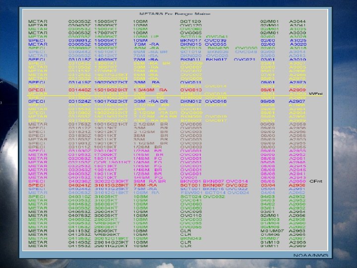
Let’s Work Through an Example


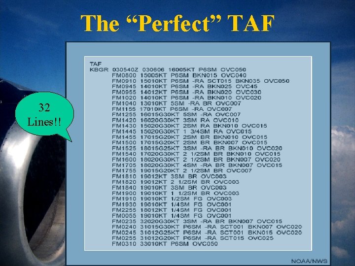
The “Perfect” TAF 32 Lines!!

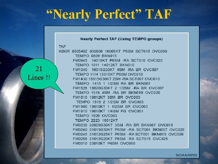
“Nearly Perfect” TAF 21 Lines !!

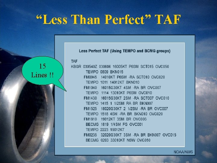
“Less Than Perfect” TAF 15 Lines !!

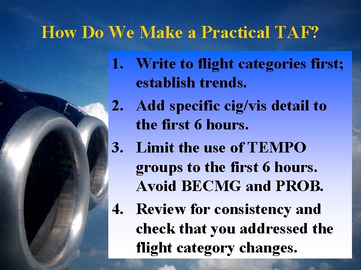
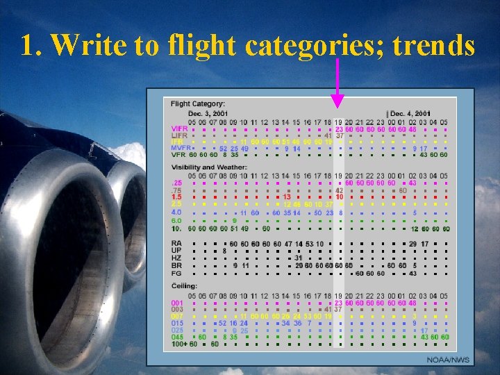
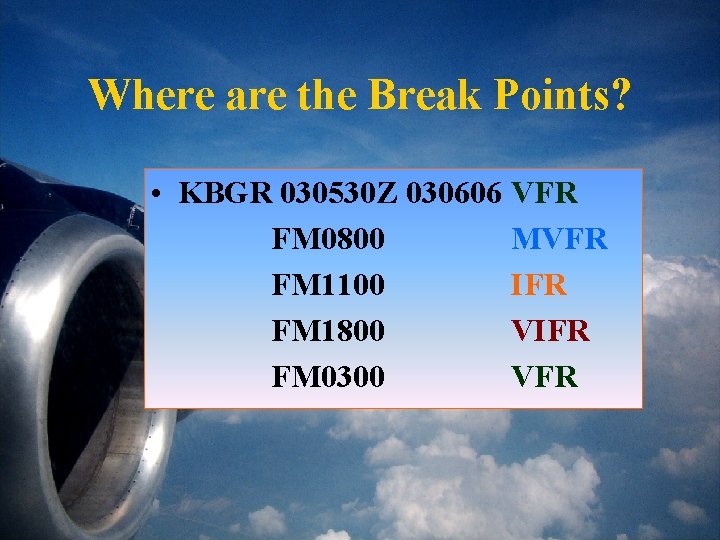
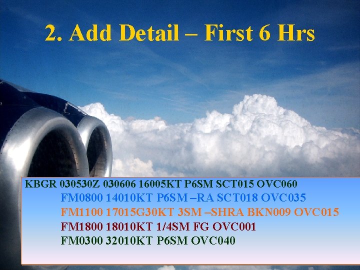
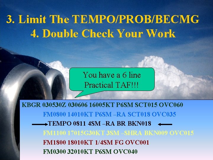
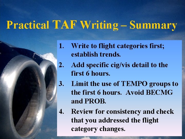
How Do We Make a Practical TAF? 1. Write to flight categories first; establish trends. 2. Add specific cig/vis detail to the first 6 hours. 3. Limit the use of TEMPO groups to the first 6 hours. Avoid BECMG and PROB. 4. Review for consistency and check that you addressed the flight category changes.

1. Write to flight categories; trends

Where are the Break Points? • KBGR 030530 Z 030606 VFR FM 0800 MVFR FM 1100 IFR FM 1800 VIFR FM 0300 VFR

2. Add Detail – First 6 Hrs KBGR 030530 Z 030606 16005 KT P 6 SM SCT 015 OVC 060 FM 0800 14010 KT P 6 SM –RA SCT 018 OVC 035 FM 1100 17015 G 30 KT 3 SM –SHRA BKN 009 OVC 015 FM 1800 18010 KT 1/4 SM FG OVC 001 FM 0300 32010 KT P 6 SM OVC 040

3. Limit The TEMPO/PROB/BECMG 4. Double Check Your Work You have a 6 line Practical TAF!!! KBGR 030530 Z 030606 16005 KT P 6 SM SCT 015 OVC 060 FM 0800 14010 KT P 6 SM –RA SCT 018 OVC 035 TEMPO 0811 4 SM –RA BR BKN 018 FM 1100 17015 G 30 KT 3 SM –SHRA BKN 009 OVC 015 FM 1800 18010 KT 1/4 SM FG OVC 001 FM 0300 32010 KT P 6 SM OVC 040

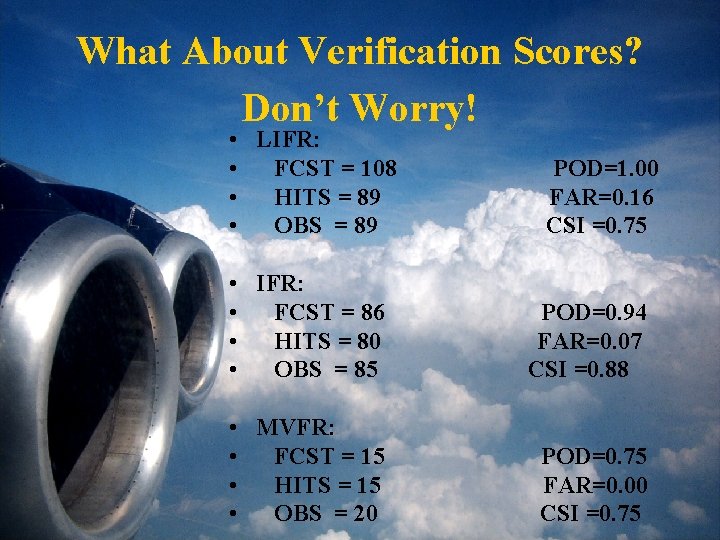
What About Verification Scores? Don’t Worry! • LIFR: • FCST = 108 • HITS = 89 • OBS = 89 POD=1. 00 FAR=0. 16 CSI =0. 75 • IFR: • FCST = 86 • HITS = 80 • OBS = 85 POD=0. 94 FAR=0. 07 CSI =0. 88 • MVFR: • FCST = 15 • HITS = 15 • OBS = 20 POD=0. 75 FAR=0. 00 CSI =0. 75

Practical TAF Writing – Summary 1. Write to flight categories first; establish trends. 2. Add specific cig/vis detail to the first 6 hours. 3. Limit the use of TEMPO groups to the first 6 hours. Avoid BECMG and PROB. 4. Review for consistency and check that you addressed the flight category changes.

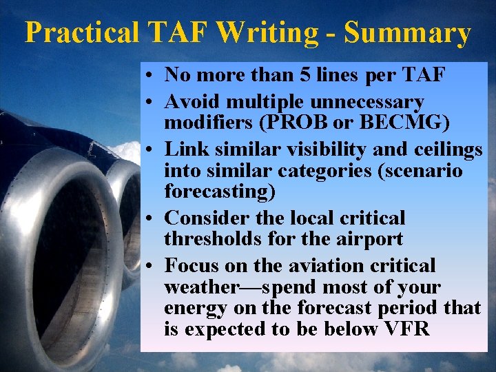
Practical TAF Writing - Summary • No more than 5 lines per TAF • Avoid multiple unnecessary modifiers (PROB or BECMG) • Link similar visibility and ceilings into similar categories (scenario forecasting) • Consider the local critical thresholds for the airport • Focus on the aviation critical weather—spend most of your energy on the forecast period that is expected to be below VFR

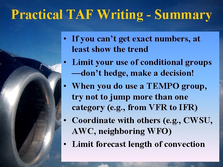
Practical TAF Writing - Summary • If you can’t get exact numbers, at least show the trend • Limit your use of conditional groups —don’t hedge, make a decision! • When you do use a TEMPO group, try not to jump more than one category (e. g. , from VFR to IFR) • Coordinate with others (e. g. , CWSU, AWC, neighboring WFO) • Limit forecast length of convection

PRACTICAL TAF WRITING End Result: Effective, User-Friendly, Practical TAFs Karen Oudeman NWS – Jackson, KY October 16, 2003