Polygons Stands Staying in Sync GIS and Forest


 – last year’s veg layer –")


 Version 6. 4")
- Slides: 47
Polygons & Stands: Staying in Sync GIS and Forest Management: A Practitioner’s Forum October 29 -30, 2003 Wilsonville, Oregon James D. Arney, Ph. D. Forest Biometrics JDArney@forestbiometrics. com
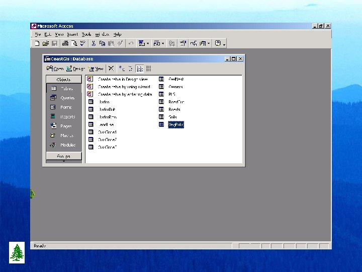
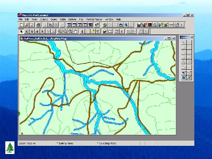
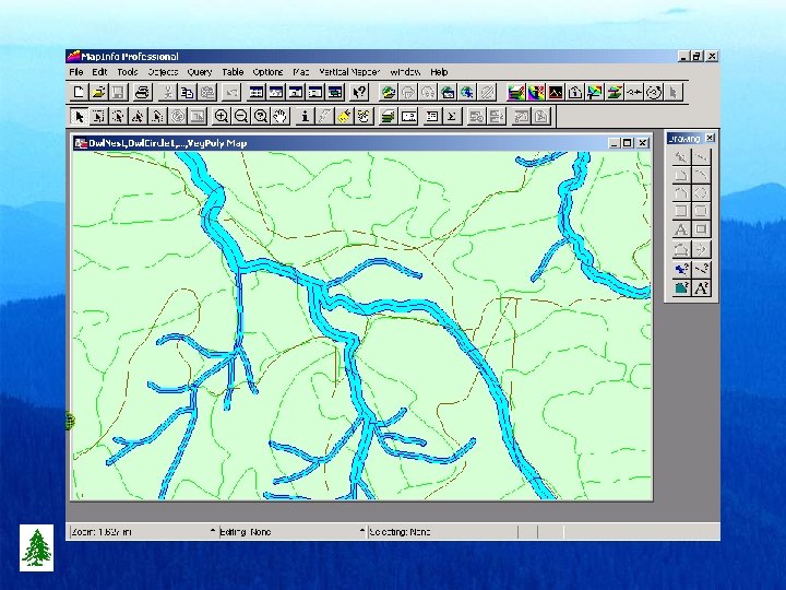
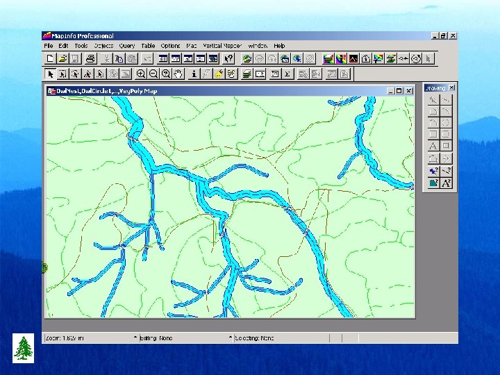
Basic Gis Functionality • • Units are standard between Fps and Gis Complete Read/Write linkages both ways Fps – Microsoft Access (97, 2000, Xp) Gis linkable file structures – Arc. View 3. 2 - only d. Base attribute tables – Arc 8. x - may use Microsoft Access – Map. Info 6. + - may use Microsoft Access
FPS Automated Cruise Selection • Use FPS Menu – Set Sample size – Run Selection – Pass to GIS Map • Go To Field
Cruise Selection
Harvest Scheduling w/Green-Up
Harvest Schedule w/o constraints
Harvest Schedule with greenup constraints
Common Parameters • Fps Admin table – – – – – Gis_ID Flag Plan. Year Xgis & Ygis Physical Site Index Basin Elevation Aspect Slope • Gis Veg. Poly table – – – – – Gis_ID Flag Theme Xgis & Ygis Site Index Basin Elevation Aspect Slope
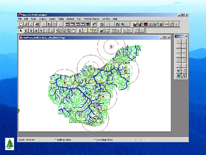
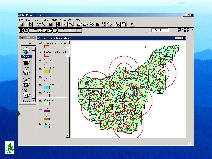
Fps Database vs Gis Database • Stand boundary was shifted, what next? • New harvest polygon doesn’t match previous polygon boundaries? • New roads have been added? • Stream buffer regulations have changed? • Stand boundaries split at section lines? • Should Riparian buffers be polygons?
Adjusting for Road Areas
Adjusting for Stream Buffers
Lumping & Splitting Polygons
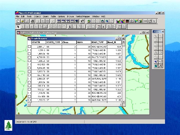
Managing Road Reductions • Roads layer – – Road ID Road Label Road Class Width • Roads Buffer – Vegetation ID – Area (acres/hectares)
Managing Stream Buffers • Hydro Layer – – Hydro ID Hydro Label Hydro Class Width • Hydro Buffer – Vegetation ID – Area (acres/hectares) – Roads included • Hydro Row – Vegetation ID – Area (acres/hectares) – Road area removed
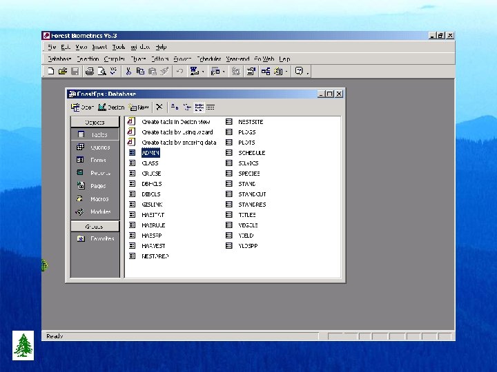
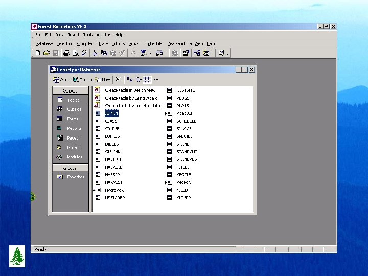
Managing Vegetation Polygons • FPS Access Database • Admin table – – – Std_ID Gis_ID Area_Gis (Gross) Area_Net (-Roads) Area_Rpt(-Rds & Hyd) • GIS Access Database • Veg. Poly table – – – Gis_ID Std_ID Acres (hectares) Roads Buffer (hydro)
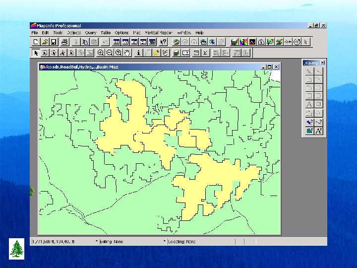
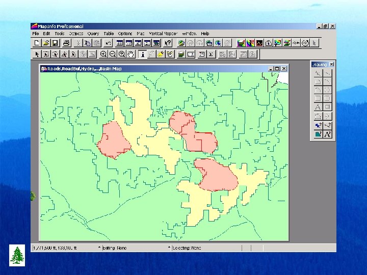
Update Fps from Gis • Veg. Poly (2002) – last year’s veg layer – Gis_ID = Old_ID • Veg. Poly (2003) – this year’s veg layer – Gis_ID = New_ID • Veg. Step (2003/2002) overlay split – Old_ID (2002) – New_ID (2003) – Area (acres/hectares) of each sliver polygon
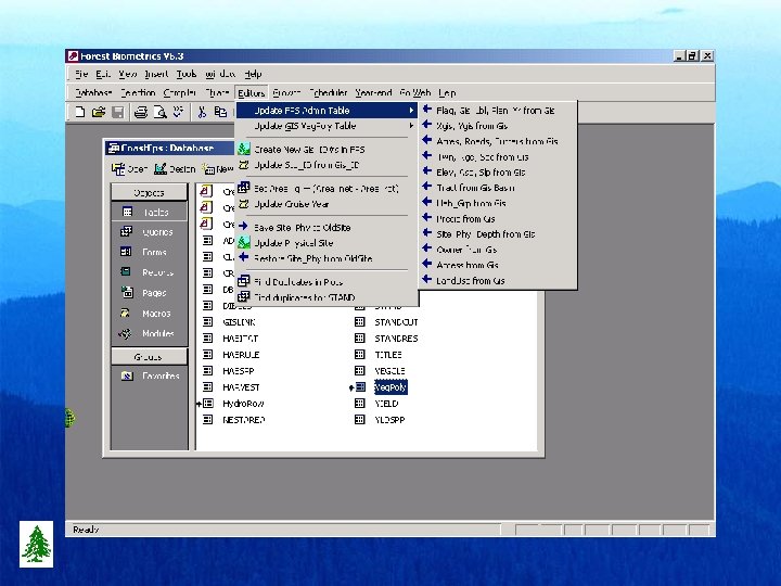
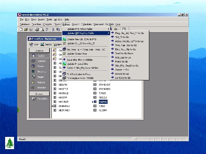
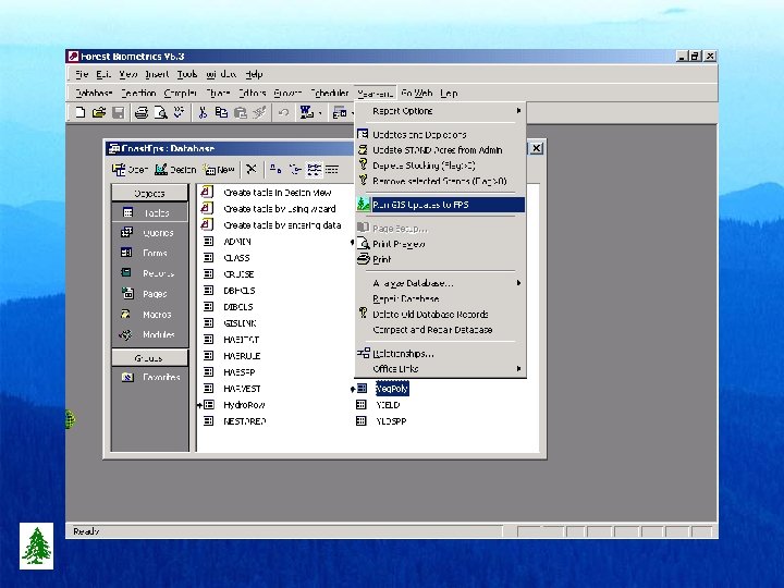
Fps Process for Gis Update • • • Copy Coast. Fps 2002 to Coast. Fps 2003 Open Coast. Fps 2003 Link Coast. Gis Veg. Step table to Coast. Fps Execute “Run Gis Updates to Fps” Menu Coast. Fps 2003 database now in sync w/Gis – Update Roads from Road. Buf (2003) – Update Hydro from Hydro. Row (2003)
Order of Flow for Updates • Always start in Gis database with updates • Maintain unique and consistent Gis_IDs – Std_ID may be different, but also unique • • • Create duplicate of current Gis layer Make all edits in duplicate layer Overlay original with duplicate layers Pass resultant overlay to Fps database Process overlay updates into Fps database
Standard Update Methods • New Roads? – Update Net Forested Area • Modified Hydro Buffers? – Update Road & Stream Buffers in Veg. Poly • Adjusted acres in existing polygons? – Re-Run Roads & Stream Buffers • Harvest Units? – Run Lump/Split on old/new vegetation layers – Update Road & Stream Buffers in Veg. Poly
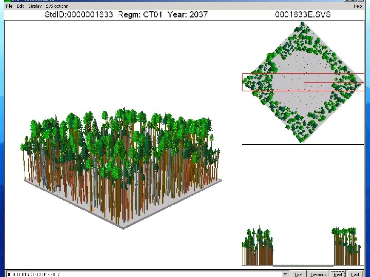
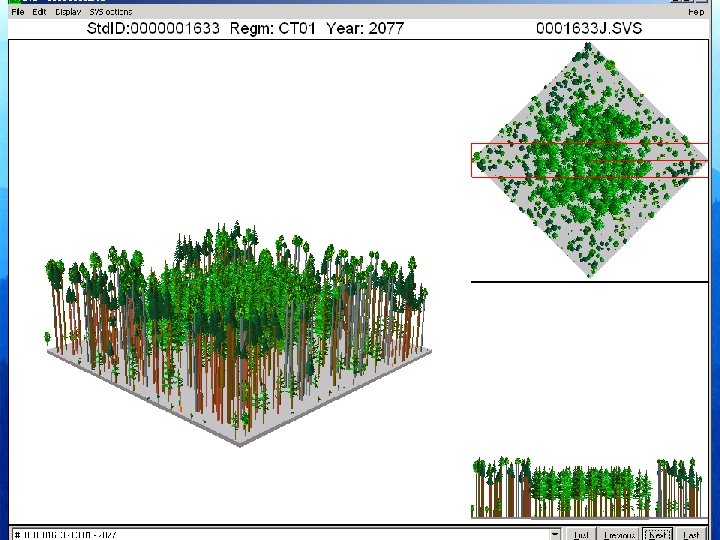
Spatial Pattern within an Existing DF, WH Clumpy Mature Stand
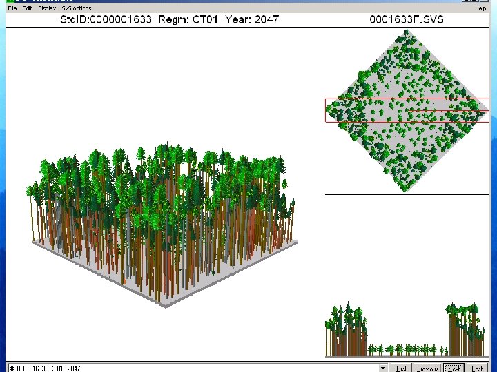
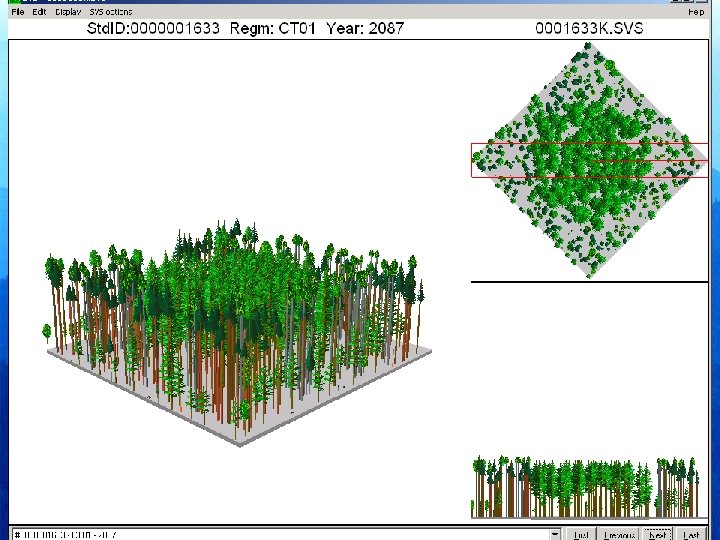
Apply 1 -acre group selection thinning
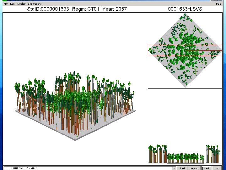
Control brush & animals to facilitate natural regeneration
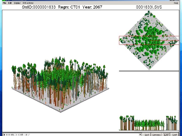
Apply overstory removal
Forest Projection & Planning System (FPS) Version 6. 4