Plate Tectonics and Earthquakes Natural Disasters 5 th


 2. Support a. Puzzle fit 1. Suess (1900)Gondwana 2. Wegner")
 b. Similar rock ages c. Similar geologic structures d. Fossil")


 4. 0 3. 0 2. 0 Ocean crust")
 2. Magnetic anomaly a. Normal-positive anomaly b. Reverse-negative")


- Slides: 51
Plate Tectonics and Earthquakes Natural Disasters, 5 th edition, Chapter 3
Plate Tectonics I. III. IV. The Discovery of Plate Tectonics The Mosaic of Plates Rates and History of Motion Mantle Convection
I. Discovery of Plate Tectonics A. Continental Drift B. Seafloor Spreading
A. Continental Drift 1. Continental drift: large-scale movements of continents
A. Continental Drift (continued) 2. Support a. Puzzle fit 1. Suess (1900)Gondwana 2. Wegner (1915)Pangea
A. Continental Drift (continued) b. Similar rock ages c. Similar geologic structures d. Fossil Evidence e. Climate Evidence
B. Seafloor Spreading 1. Convection currents move plates around 2. Mantle source 3. Post-WWII: Mid. Atlantic Ridge 4. Hess & Dietz (1960’s) propose new and recycled seafloor
II. The Mosaic of Plates A. Lithospheric Plates B. Divergent Boundaries C. Convergent Boundaries D. Transform-Fault Boundaries
A. Lithospheric Plates 1. Mosaic of large moving plates 2. Geologic activities occur at plate boundaries a. b. c. d. e. Earthquakes Volcanoes Rifts Folding Faulting
B. Divergent Boundaries 1. Narrow rifts 2. Continental plate separation 3. Oceanic plate separation-spreading centers
Divergent Boundaries Oceanic Plate Separation Mid. Atlantic Ridge an c i r e m A th r o e N Plat Eur asia n Pla te
Divergent Boundaries Oceanic Plate Separation Volcanoes and earthquakes concentrate. an c i r e m A th r o e N Plat Mid. Atlantic Ridge Eur asia n Pla te
Divergent Boundaries Continental Plate Separation East African Rift Valley ate l P an c i r f A Soma li Sub plate
Divergent Boundaries Continental Plate Separation Parallel valleys; volcanoes and earthquakes. East African Rift Valley ate l P an c i r f A Soma li Sub plate
C. Convergent Boundaries 1. Conservation of Earth’s surface area 2. Ocean-ocean convergence 3. Ocean-continent convergence 4. Continent-continent convergence
Convergent Boundaries Ocean-Ocean Convergence Mariana Islands e n i p p i Phil e Plat Marianas Trench Pacif ic Pla te
Convergent Boundaries Ocean-Ocean Convergence Deep-sea trench; volcanic island arc. Mariana Islands e n i p p i Phil e Plat Marianas Trench Pacif ic Pla te
Convergent Boundaries Ocean-Continent Convergence Andes Mountains Peru-Chile Trench te a l P a c Naz South American Plate
Convergent Boundaries Ocean-Continent Convergence A volcanic belt of mountains forms. Andes Mountains Peru-Chile Trench te a l P a c Naz South American Plate
Convergent Boundaries Continent-Continent Convergence Himalaya In late P n a i l a r t dian-Aus Tibetan Plateau Main thrust fault Eurasian Plate
Convergent Boundaries Continent-Continent Convergence Crust crumbles, creating high mountains and a wide plateau. Himalaya late P n a i l a r t s Indian-Au Tibetan Plateau Main thrust fault Eurasian Plate
D. Transform-Fault Boundaries 1. Plates slide past one another 2. Fracture with relative displacement
Transform-Fault Boundaries Mid-Ocean Ridge Transform Fault Eurasi late P n a c i er m A h t r No an Pla te
Transform-Fault Boundaries Mid-Ocean Ridge Transform Fault Spreading centers offset. Eurasi late P n a c i er m A h t r No an Pla te
Transform-Fault Boundaries Continental Transform Fault ate l P c i f Paci North Ameri can Pl ate
Transform-Fault Boundaries Continental Transform Fault Offset continental crust. ate l P c i f Paci North Ameri can Pl ate
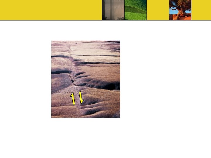
As plates move past each other. . .
As plates move past each other. . . …creek beds are offset
As plates move past each other. . . as re nd A …creek beds are offset n Sa San Francisco fau Los Angeles lt
III. Rates and History of Motion A. Seafloor Magnetic Tape Recorder B. Geodesy
A. Seafloor Magnetic Tape Recorder 1. Magnetic reversals a. Switching strength to the south b. Preserved in lava c. Age can be dated d. Magnetic chrons- ½ million years e. Magnetic subchrons – 200 000 years
Magnetic anomalies also in volcanic lava.
Magnetic anomalies also in volcanic lava. Normal Reversed
Magnetic anomalies also in volcanic lava. Earth’s magnetic field reverses direction. Normal Reversed Layers “remember”. Older layers preserve their direction. Scientists constructed a magnetic time scale.
Subchrons 5. 0 Ma 4. 0 Gilbert reversed chron 3. 0 Gauss normal chron 2. 0 1. 0 Matuyama reversed chron Present Brunhes normal chron
Mid-ocean ridge Million years ago (Ma) 4. 0 3. 0 2. 0 Ocean crust today . 5. 3 2 3 ion l l i m 5. 0 rs old yea 0. 7 0 0. 7 3. 3 5. 2 5. 0
A. Seafloor Magnetic Tape Recorder (continued) 2. Magnetic anomaly a. Normal-positive anomaly b. Reverse-negative anomaly 3. Seafloor ages a. Speed = distance / time
Magnetic mapping can measure the rate of seafloor spreading An oceanic survey over the Reykjanes Ridge, part of the Mid-Atlantic Ridge southwest of Iceland, showed an oscillating pattern of magnetic field strength. This figure illustrates how scientists worked out the explanation of this pattern. Mid-Atlantic High intensit y Low intensity Ridge
Magnetic mapping can measure the rate of seafloor spreading An oceanic survey over the Reykjanes Ridge, part of the Mid-Atlantic Ridge southwest of Iceland, showed an oscillating pattern of magnetic field strength. This figure illustrates how scientists worked out the explanation of this pattern. A sensitive magnetometer records magnetic anomalies, … Mid-Atlantic High intensit y Low intensity Ridge
Magnetic mapping can measure the rate of seafloor spreading An oceanic survey over the Reykjanes Ridge, part of the Mid-Atlantic Ridge southwest of Iceland, showed an oscillating pattern of magnetic field strength. This figure illustrates how scientists worked out the explanation of this pattern. A sensitive magnetometer records magnetic anomalies, … Iceland Mid-Atlantic High intensit y Low intensity Ridge Mid. Atlantic Ridge
Magnetic mapping can measure the rate of seafloor spreading An oceanic survey over the Reykjanes Ridge, part of the Mid-Atlantic Ridge southwest of Iceland, showed an oscillating pattern of magnetic field strength. This figure illustrates how scientists worked out the explanation of this pattern. A sensitive magnetometer records magnetic anomalies, … …alternating bands of high and low magnetism. Iceland Mid-Atlantic High intensit y Low intensity Ridge Mid. Atlantic Ridge Symmetrical bands on both sides. Why?
B. Geodesy 1. Astronomical Positioning a. Position with respect to fixed stars b. 100 m error 2. Global Positioning a. 24 Earth-orbiting satellites b. Measure plate movement
IV. Mantle Convection A. Driving Forces B. Plate Recycling C. Convection Currents
A. Driving Forces 1. Mantle convection 2. Gravitational pull
B. Plate Recyling 1. New lithosphereridges 2. Old lithospheresubduction 3. Recycling within upper and lower mantle-seismic waves
Whole-mantle convection Mantle Outer core Inner core Upper mantle 700 km Lower mantle 2900 km Outer core
Whole-mantle convection Upper mantle 700 km Lower mantle 2900 km Outer core
Stratified convection Boundary near 700 km separates the two convection systems.
C. Convection Currents 1. Movement of lithospheric plates 2. Mantle plumes a. Hot spots b. Deep mantle
Plate Tectonics I. III. IV. The Discovery of Plate Tectonics The Mosaic of Plates Rates and History of Motion Mantle Convection