
Plate Tectonics 102715 Layers of the Earth Crust















- Slides: 63
Plate Tectonics 10/27/15
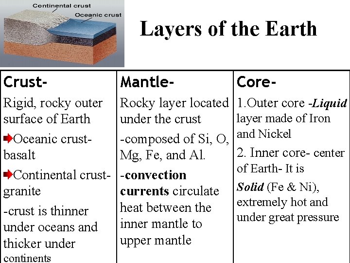
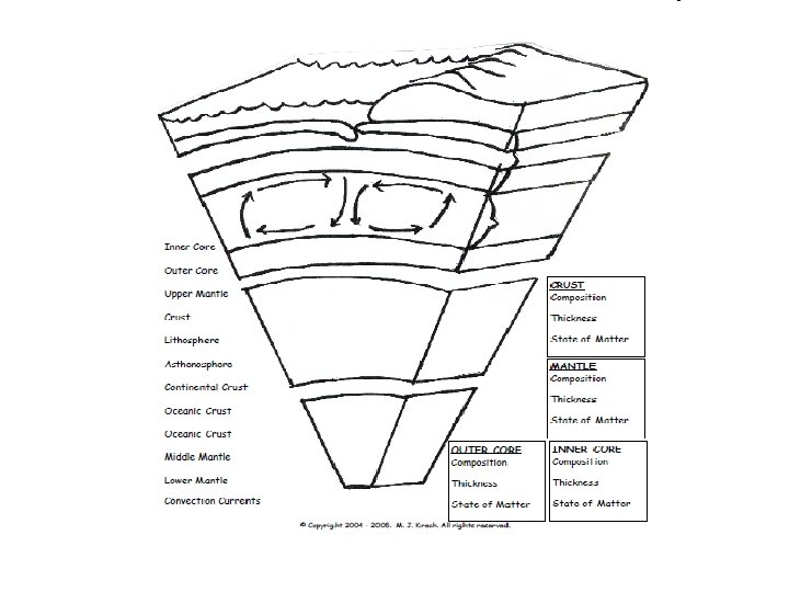
Layers of the Earth Crust- Mantle- Core- Rigid, rocky outer surface of Earth Oceanic crustbasalt Continental crustgranite -crust is thinner under oceans and thicker under Rocky layer located under the crust -composed of Si, O, Mg, Fe, and Al. -convection currents circulate heat between the inner mantle to upper mantle 1. Outer core -Liquid continents layer made of Iron and Nickel 2. Inner core- center of Earth- It is Solid (Fe & Ni), extremely hot and under great pressure
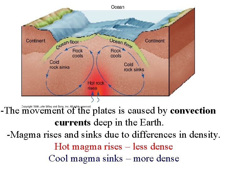
-The movement of the plates is caused by convection currents deep in the Earth. -Magma rises and sinks due to differences in density.
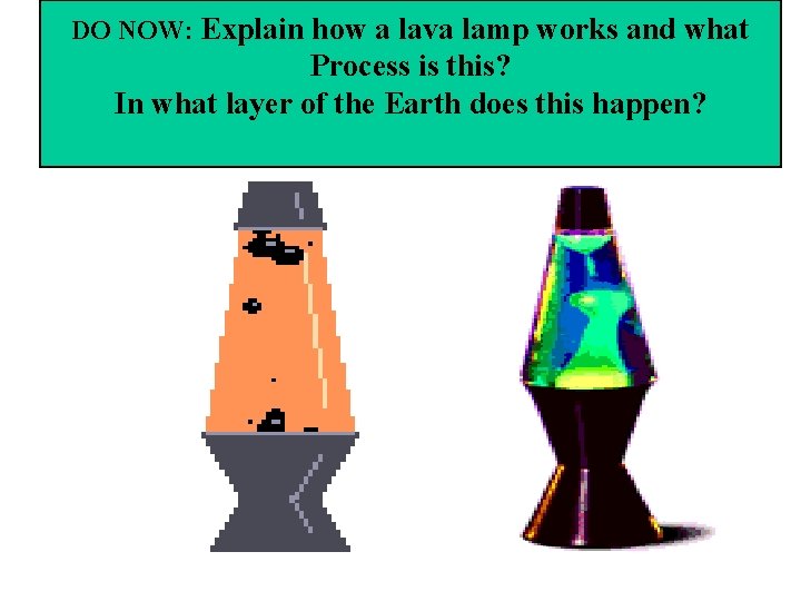
DO NOW: Explain how a lava lamp works and what Process is this? In what layer of the Earth does this happen?
Use page 3 of workbook to answer these questions: • 1. At what depth does the inner core start? • 2. Which layer would have material with a density of 5. 3 g/cm 3? • 3. What is the pressure at 4, 000 km? • 4. At approximately what depth is the internal temperature of the earth thought to be 2000 K?
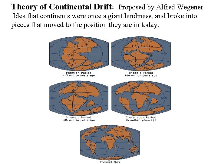
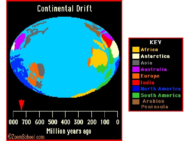
Theory of Continental Drift: Proposed by Alfred Wegener. Idea that continents were once a giant landmass, and broke into pieces that moved to the position they are in today.
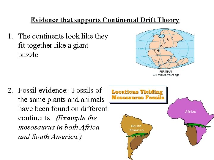
Evidence that supports Continental Drift Theory 1. The continents look like they fit together like a giant puzzle 2. Fossil evidence: Fossils of the same plants and animals have been found on different continents. (Example the mesosaurus in both Africa and South America. )
More fossil evidence
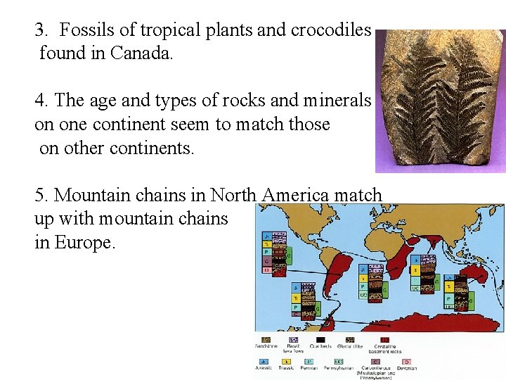
3. Fossils of tropical plants and crocodiles found in Canada. 4. The age and types of rocks and minerals on one continent seem to match those on other continents. 5. Mountain chains in North America match up with mountain chains in Europe.
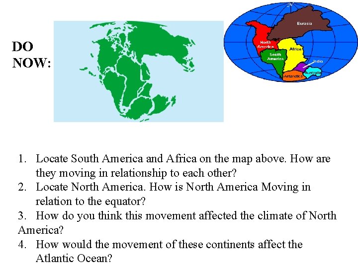
DO NOW: 1. Locate South America and Africa on the map above. How are they moving in relationship to each other? 2. Locate North America. How is North America Moving in relation to the equator? 3. How do you think this movement affected the climate of North America? 4. How would the movement of these continents affect the Atlantic Ocean?
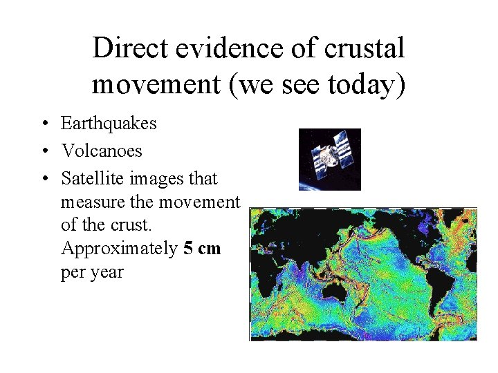
Direct evidence of crustal movement (we see today) • Earthquakes • Volcanoes • Satellite images that measure the movement of the crust. Approximately 5 cm per year
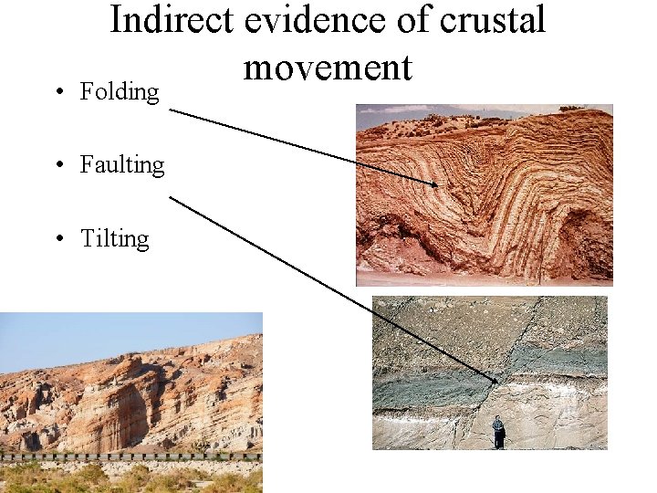
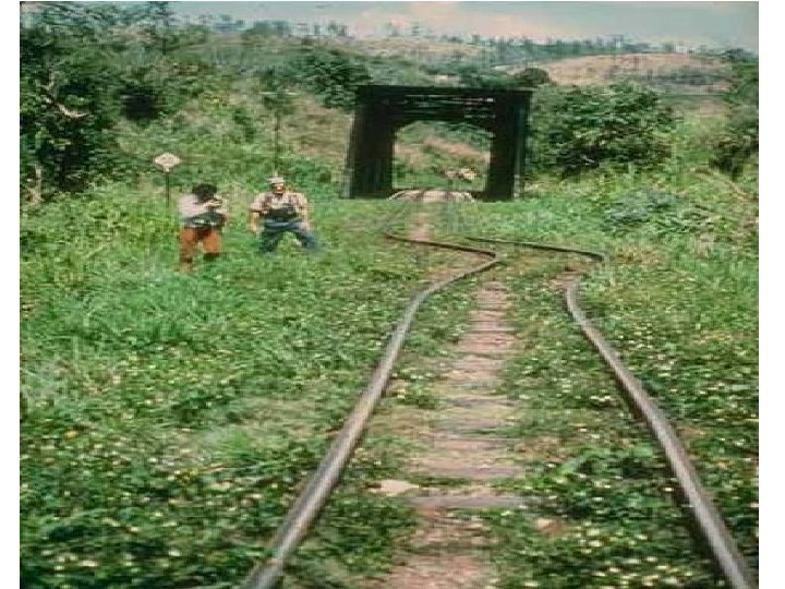
• Indirect evidence of crustal movement Folding • Faulting • Tilting
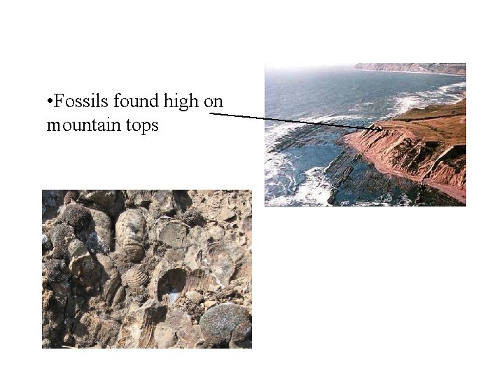
• Fossils found high on mountain tops
Tilting Horizontal Folding Faulting
The next Pangea, "Pangea Ultima" will form as a result of the subduction of the ocean floor of the North and South Atlantic beneath eastern North America and South America. This supercontinent will have a small ocean basin trapped at its center.
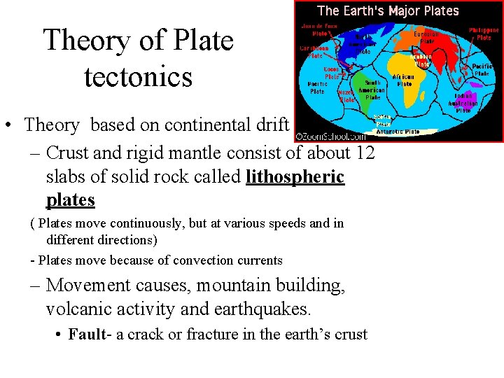
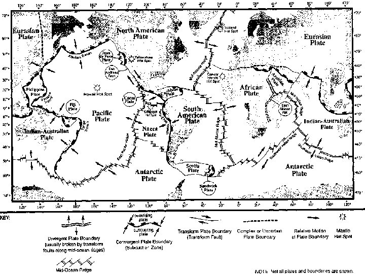
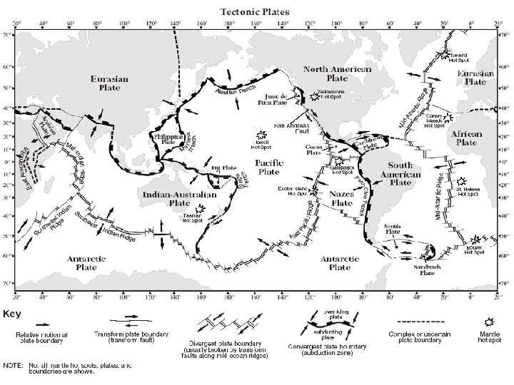
Theory of Plate tectonics • Theory based on continental drift – Crust and rigid mantle consist of about 12 slabs of solid rock called lithospheric plates ( Plates move continuously, but at various speeds and in different directions) - Plates move because of convection currents – Movement causes, mountain building, volcanic activity and earthquakes. • Fault- a crack or fracture in the earth’s crust
-The movement of the plates is caused by convection currents deep in the Earth. -Magma rises and sinks due to differences in density. Hot magma rises – less dense Cool magma sinks – more dense
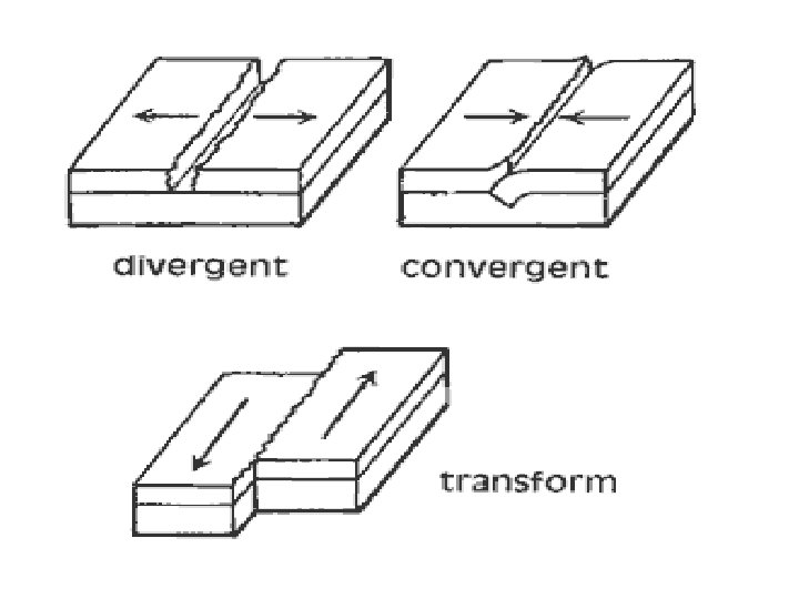
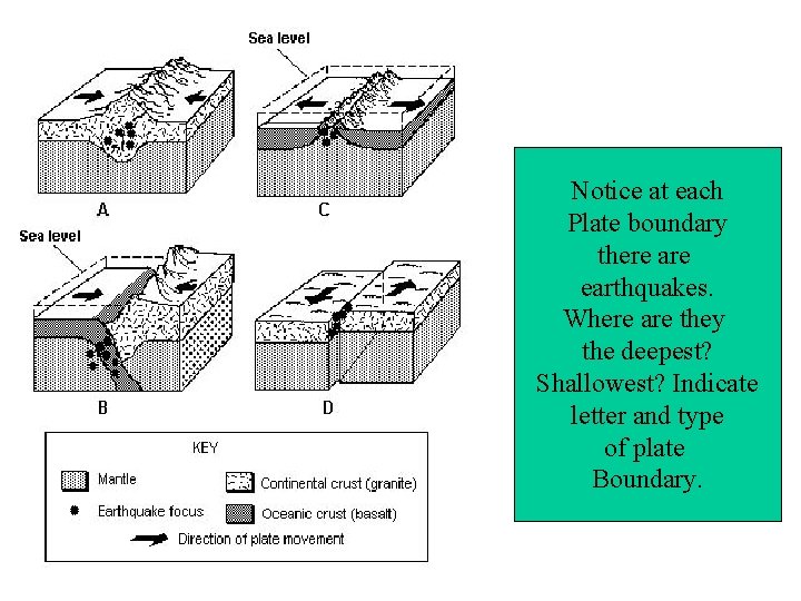
Faults and Plate boundaries Type of fault Description Boundary Type Convergent Compression Plates push together Normal- Plates pull apart Divergent Reverse- tension Strike-slip - Plates slide past Transform Shearing each other
At what plate boundary does 1 occur? 2? 3? 4?
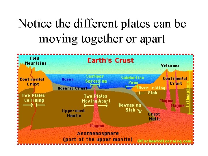
Notice the different plates can be moving together or apart
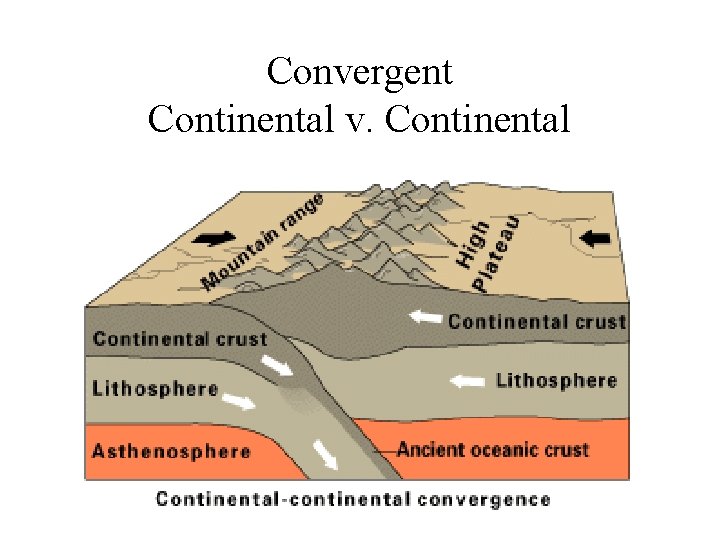
Convergent Continental v. Continental
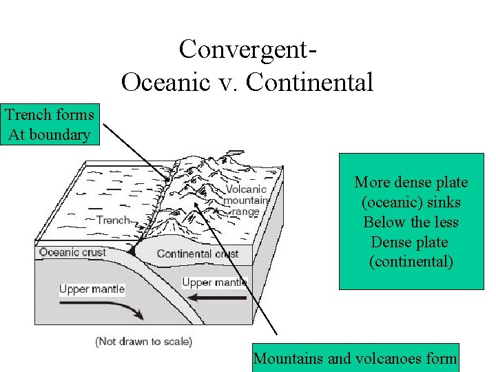
Convergent. Oceanic v. Continental Trench forms At boundary More dense plate (oceanic) sinks Below the less Dense plate (continental) Mountains and volcanoes form
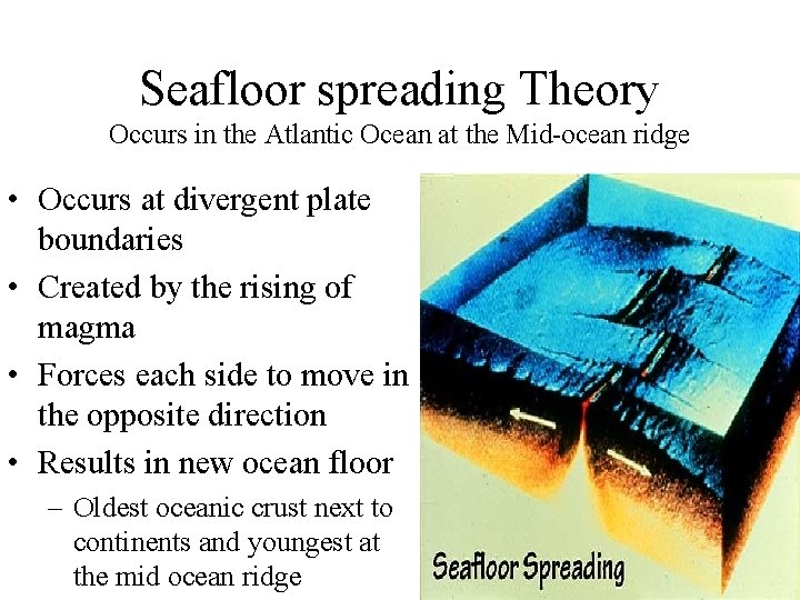
Divergent Oceanic v. Oceanic Seafloor spreading is when 2 oceanic plates move apart
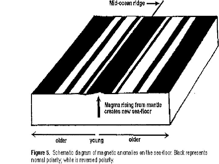
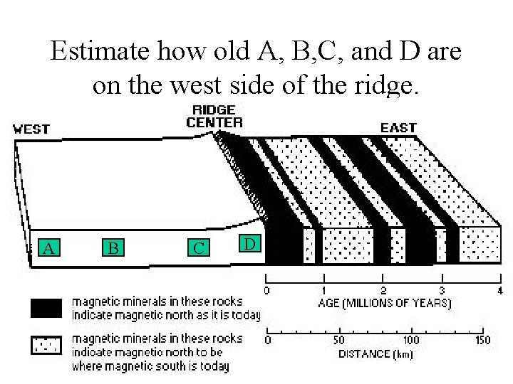
Seafloor spreading Theory Occurs in the Atlantic Ocean at the Mid-ocean ridge • Occurs at divergent plate boundaries • Created by the rising of magma • Forces each side to move in the opposite direction • Results in new ocean floor – Oldest oceanic crust next to continents and youngest at the mid ocean ridge
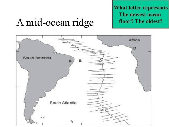
A mid-ocean ridge What letter represents The newest ocean floor? The oldest?
Estimate how old A, B, C, and D are on the west side of the ridge. A B C D
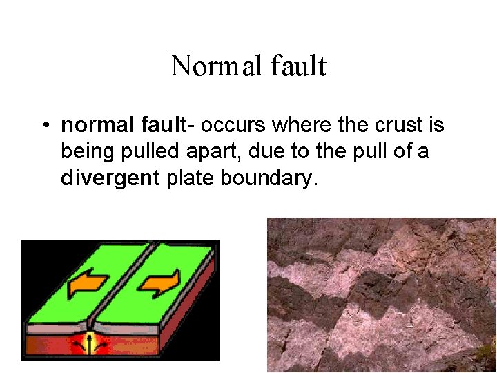
Normal fault • normal fault- occurs where the crust is being pulled apart, due to the pull of a divergent plate boundary.
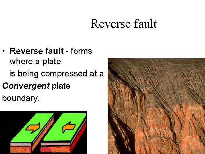
Reverse fault • Reverse fault - forms where a plate is being compressed at a Convergent plate boundary.
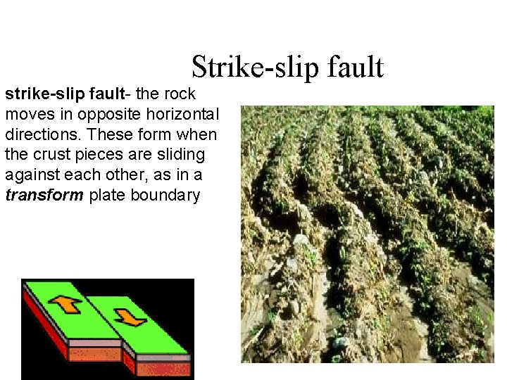
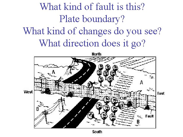
Strike-slip fault strike-slip fault- the rock moves in opposite horizontal directions. These form when the crust pieces are sliding against each other, as in a transform plate boundary
What kind of fault is this? Plate boundary? What kind of changes do you see? What direction does it go?
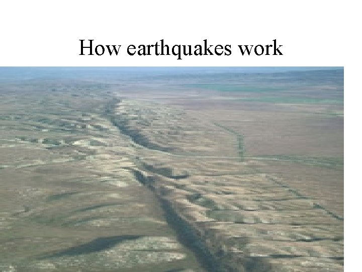
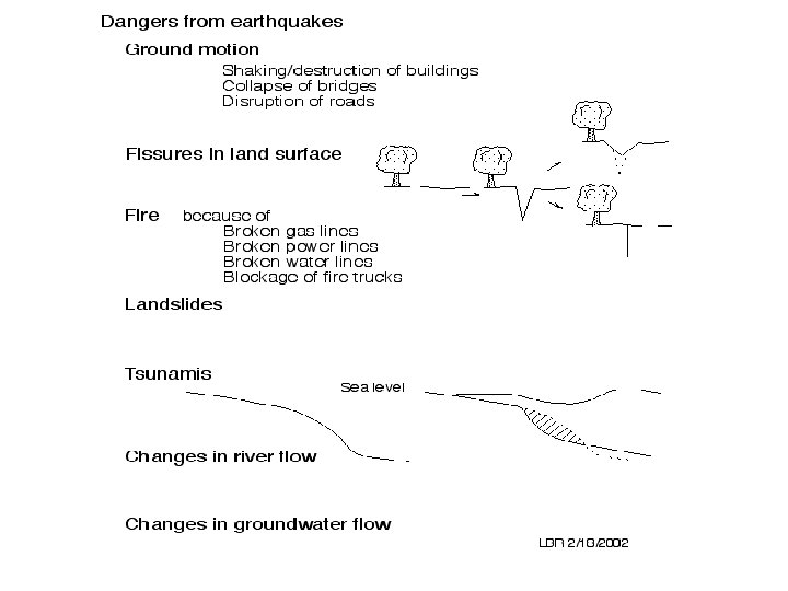
How earthquakes work
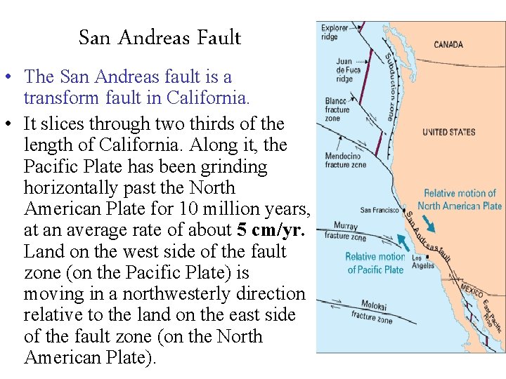
San Andreas Fault • The San Andreas fault is a transform fault in California. • It slices through two thirds of the length of California. Along it, the Pacific Plate has been grinding horizontally past the North American Plate for 10 million years, at an average rate of about 5 cm/yr. Land on the west side of the fault zone (on the Pacific Plate) is moving in a northwesterly direction relative to the land on the east side of the fault zone (on the North American Plate).
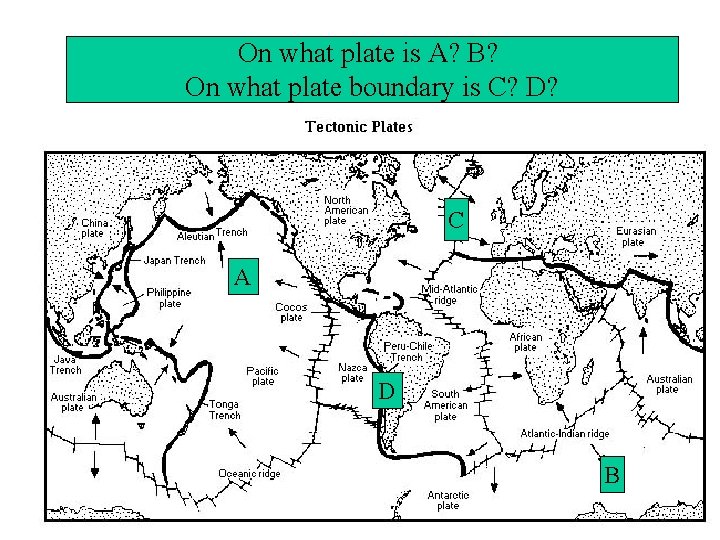
On what plate is A? B? On what plate boundary is C? D? C A D B
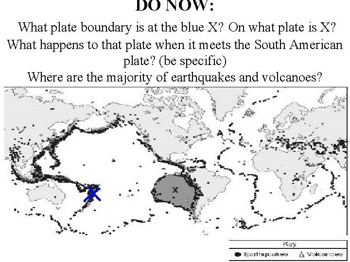
DO NOW: What plate boundary is at the blue X? On what plate is X? What happens to that plate when it meets the South American plate? (be specific) Where are the majority of earthquakes and volcanoes?
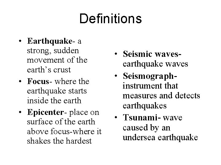
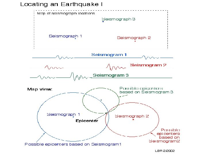
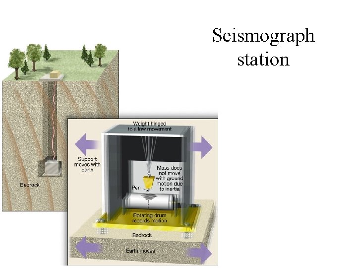
Definitions • Earthquake- a strong, sudden movement of the earth’s crust • Focus- where the earthquake starts inside the earth • Epicenter- place on surface of the earth above focus-where it shakes the hardest • Seismic wavesearthquake waves • Seismographinstrument that measures and detects earthquakes • Tsunami- wave caused by an undersea earthquake
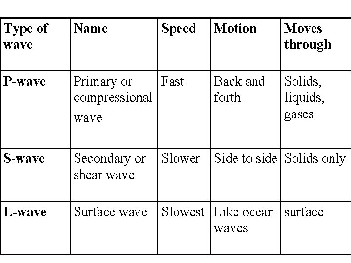
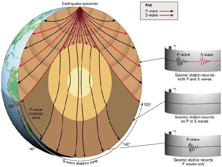
Type of wave Name P-wave Speed Motion Moves through Primary or Fast compressional wave Back and forth Solids, liquids, gases S-wave Secondary or shear wave Slower Side to side Solids only L-wave Surface wave Slowest Like ocean surface waves
• https: //www. youtube. com/watch? v=_7 Efz_i LHz. E
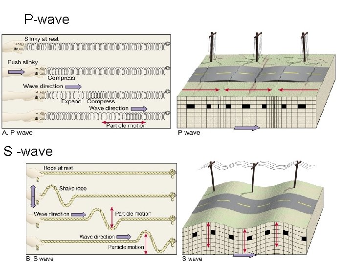
P-wave S -wave
Shadow zone-Areas on the surface of the Earth where no P-waves or S-waves from a particular earthquake are received. • caused by the refraction (bending) of waves as they pass through the different layers of the Earth.
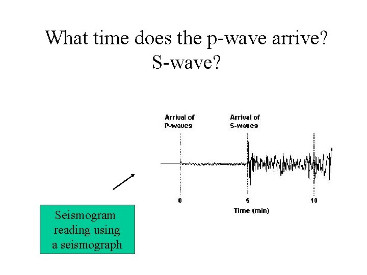
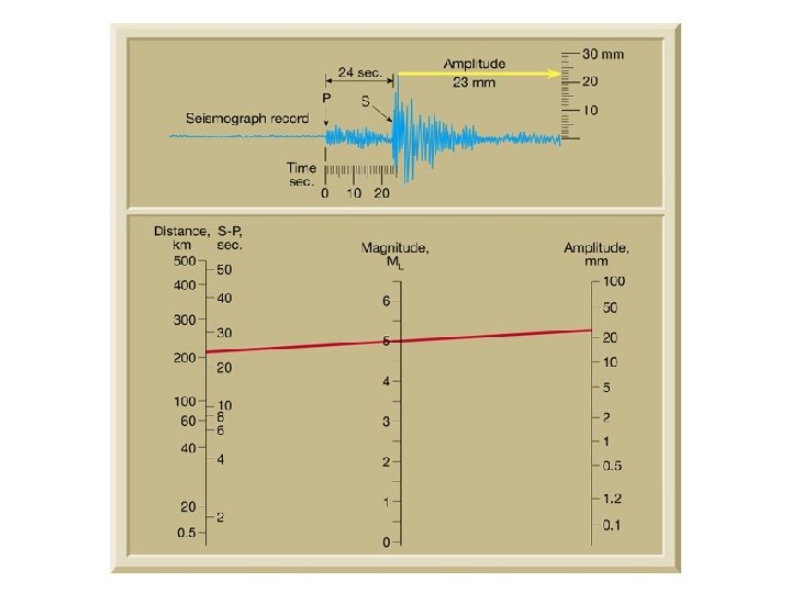
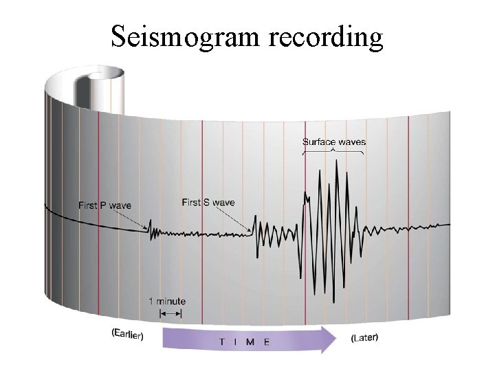
What time does the p-wave arrive? S-wave? Seismogram reading using a seismograph
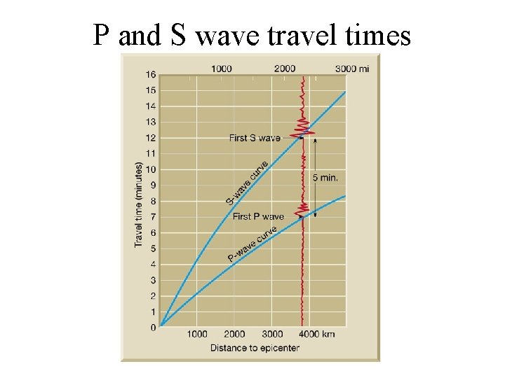
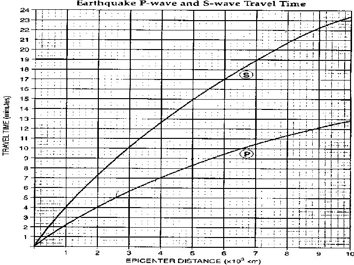
Time math is used because P and S waves arrive at different times Time math works almost the same way except instead of taking over ten from the neighboring column you’ll take one minute and convert it into 60 seconds. 3: 13: 25 (“ 3 hours, 13 minutes, and 25 seconds”) -1: 09: 37 turns into: 3: 12: 85 (3 hrs, 12 min, 85 secs is the same as 13: 25) -1: 09: 37 2: 03: 48 http: //www. mrsciguy. com/eq. html
P and S wave travel times
Notice at each Plate boundary there are earthquakes. Where are they the deepest? Shallowest? Indicate letter and type of plate Boundary.
Seismogram recording
Seismograph station