Physiographic Map Study of China Chinas geography is


- Slides: 54
Physiographic Map Study of China “China’s geography is an assemblage of pieces. ”
Map Study Directions • Be prepared to discuss the 5 guiding questions. Take Cornell Notes to assist you in the class discussion. • You need a black line map of China. • You need pen/pencil/colored pencils. • Read through the slide show. • Complete the map as you read through the slide show. • Answer 1 question at the end of the slide show on a separate sheet of paper.
Guiding Questions • How would you describe China’s physical borders? • How would you characterize the western part of China? The eastern? The southern? The northern? The central? • Given these physical attributes, why might it be difficult for a government to rule China? • How might a government unify such a vast and diverse country?
Question to be answered at the completion of the slide show. Answer the following question in complete sentences: • What does the following quote mean to you? “China’s geography is an assemblage of pieces. ” Provide examples to illustrate your point of view.
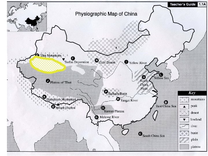
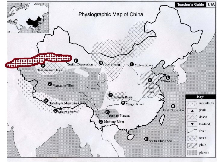
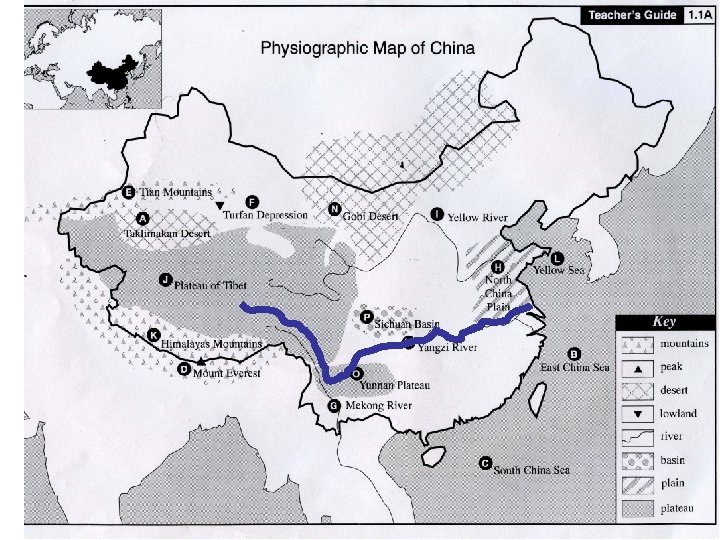
Taklimakan Desert 1. 1 A e l p m a S Because of Copyright issues, I could not include the content which was provided by TCI History Alive unit on Ancient China. See Resources at conclusion.
Taklimakan Desert 1. 1 A
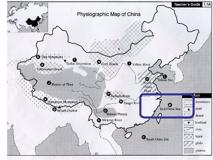
East China Sea 1. 1 B
East China Sea 1. 1 B
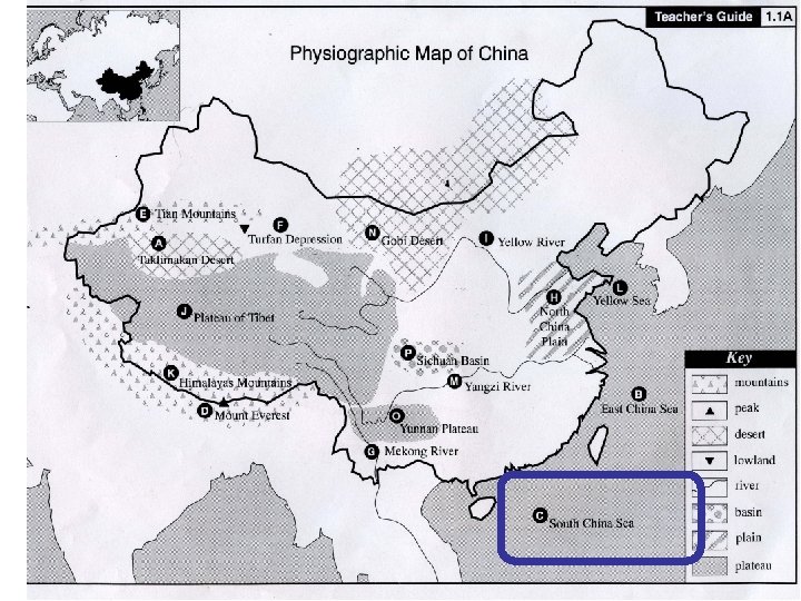
South China Sea 1. 1 C
South China Sea 1. 1 C
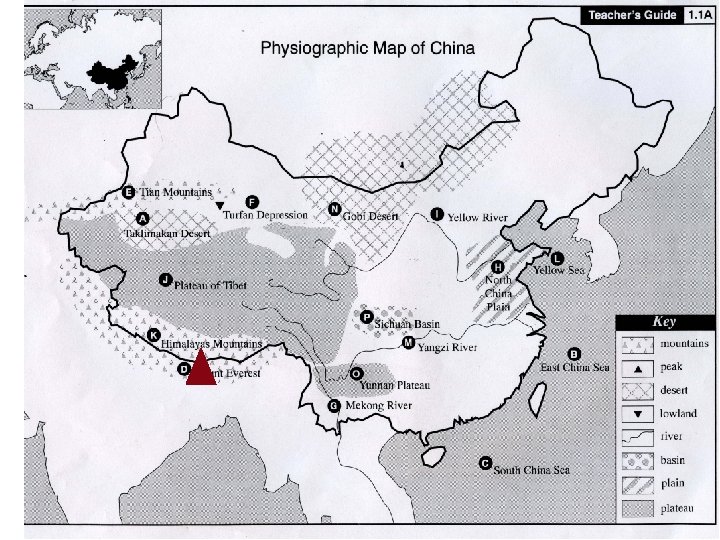
Mount Everest 1. 1 D
Mount Everest 1. 1 D
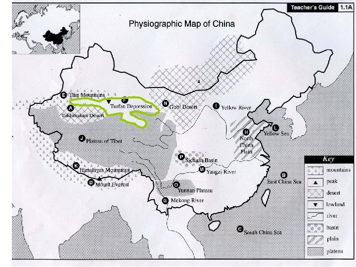
Tian Mountains 1. 1 E
Tian Mountains 1. 1 E
Turfan Depression 1. 1 F
Turfan Depression 1. 1 F
Mekong River 1. 1 G
Mekong River 1. 1 G
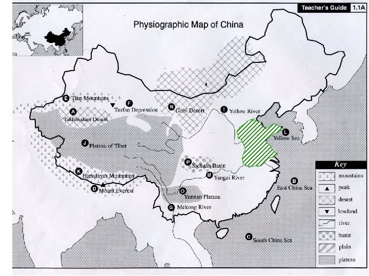
North China Plain 1. 1 H
North China Plain 1. 1 H
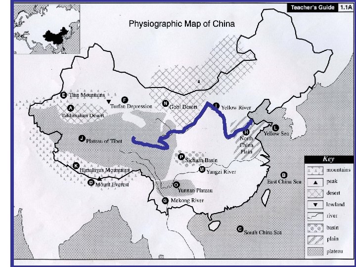
Yellow River 1. 1 I
Yellow River 1. 1 I
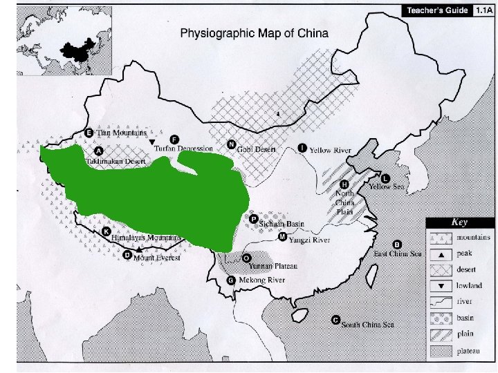
Plateau of Tibet 1. 1 J
Plateau of Tibet 1. 1 J
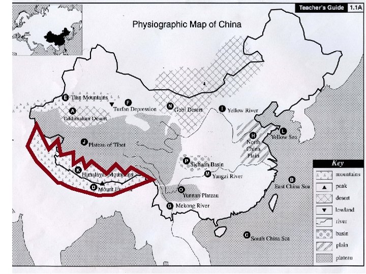
Himalayas Mountains 1. 1 K
Himalayas Mountains 1. 1 K
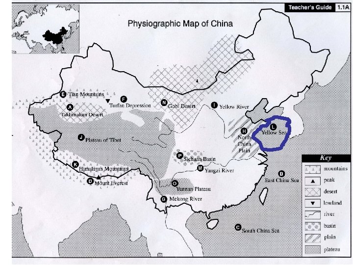
Yellow Sea 1. 1 L
Yellow Sea 1. 1 L
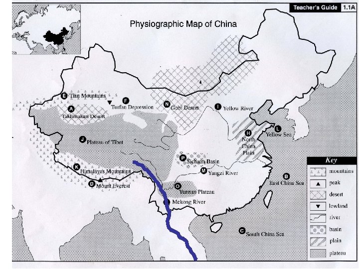
Yangzi River 1. 1 M
Yangzi River 1. 1 M
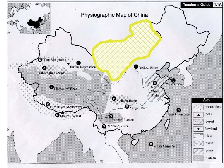
Gobi Desert 1. 1 N
Gobi Desert 1. 1 N
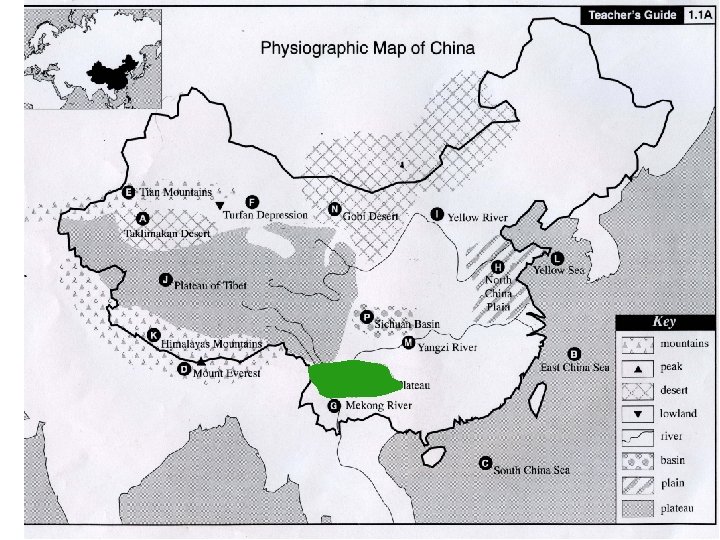
Yunnan Plateau 1. 1 O
Yunnan Plateau 1. 1 O
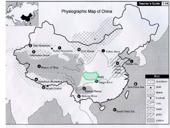
Sichuan Basin 1. 1 P
Sichuan Basin 1. 1 P
Question to be answered at the completion of the slide show. On a separate piece of paper answer the following question in complete sentences: • What does the following quote mean to you? “China’s geography is an assemblage of pieces. ” Provide examples to illustrate your point of view.
Resources • Photographs were taken from the Internet. • Content material comes from TCI History Alive unit on China. TCI provides slides, but I found it easier to utilize the Internet http: //www. historyalive. com/