Physical Geography of Southeast Asia Oceania and Antarctica


- Slides: 29
Physical Geography of Southeast Asia, Oceania, and Antarctica: A Region of Extremes This wide and varied region includes the South Pole icescape, volcanic Pacific islands, Southeast Asian tropics, and Australian deserts.
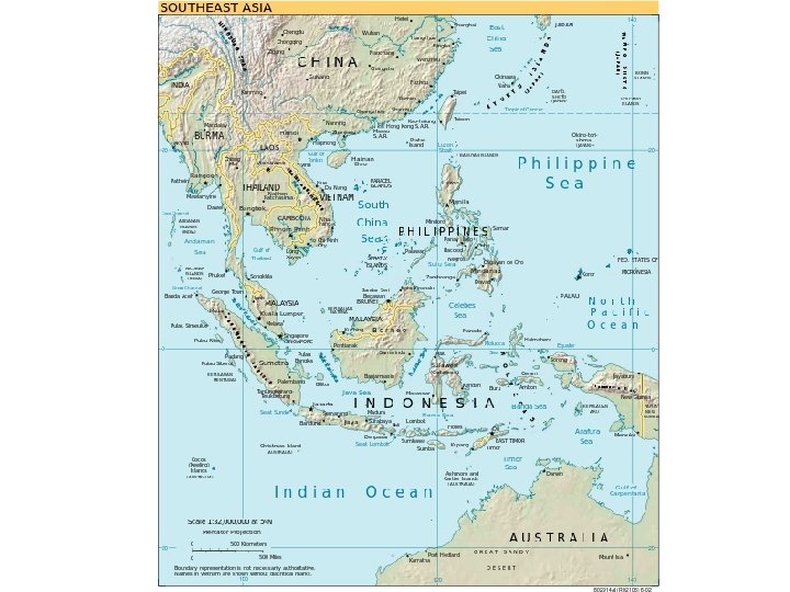
Section 1 Landforms and Resources • This region includes two peninsulas of Asia, two continents, and more than 20, 000 islands. • Its landforms include mountains, plateaus, and major river systems.
Southeast Asia: Mainland Islands Peninsulas and Islands • Mainland Southeast Asia lies on two peninsulas - rectangular Indochinese Peninsula is south of China - Malay Peninsula is 700 -mile strip south from mainland • Malay Peninsula bridges mainland island archipelagoes - archipelago—set of closely grouped islands, often in a curved arc - Malay Archipelago includes the Philippines, Indonesian islands
continued Southeast Asia: Mainland Islands Mountains and Volcanoes • Mainland mountain ranges, like Annamese Cordillera, run northsouth - fan out from northern mountainous area • Island mountains are volcanic in origin, part of Pacific Ring of Fire - volcanic eruptions, earthquakes are common in region
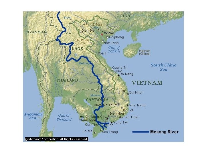
continued Southeast Asia: Mainland Islands Rivers and Coastlines • Several large mainland rivers run south through mountain valleys - spread out into fertile deltas near coast • Mekong River starts in China, ends in wide delta on Vietnam coast - farming, fishing along river support millions of people Resources • Volcanic activity, flooding rivers create nutrient-rich, fertile soil • Rivers, seas provide fish; some areas have petroleum, tin, gems
Lands of the Pacific and Antarctica No Exact Number • No one knows how many islands there are in the Pacific - some estimate there are more than 20, 000 - hard to count because islands vanish and new ones appear • As a group, the Pacific Islands are called Oceania - includes New Zealand, Australia (a continent, not an island) - doesn’t include Philippines, Indonesia—culturally Asian
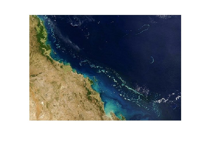
continued Lands of the Pacific and Antarctica Flat Australia • Australia is earth’s smallest, flattest continent • Great Dividing Range—chain of highlands parallel to east coast • West of range are plains and plateaus • Murray River is largest of continent’s few rivers • Little forestry, but rich in bauxite, diamonds, opals, lead, coal • Great Barrier Reef— 1, 250 -mile chain of 2, 500 reefs, islands
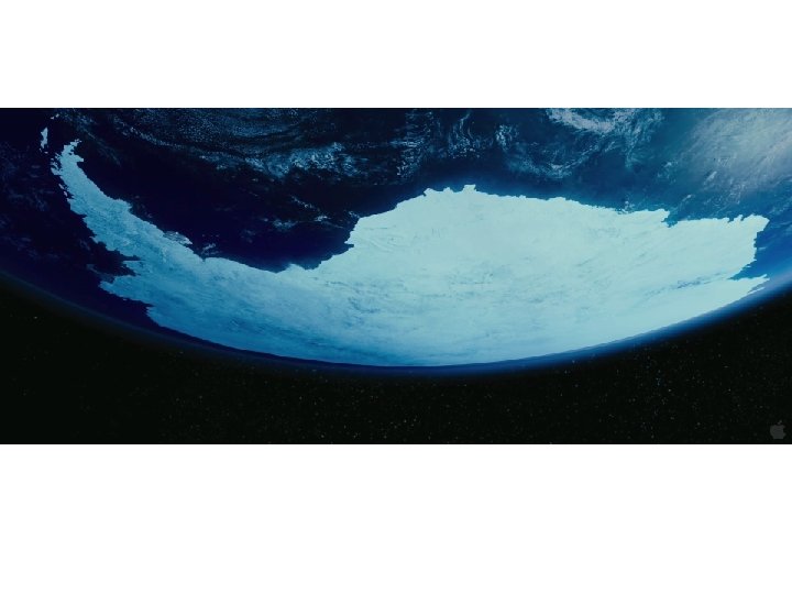
continued Lands of the Pacific and Antarctica Icy Antarctica • Fifth-largest continent is circular in shape, centered on South Pole • Thick ice sheet covers landscape—world’s largest freshwater supply • Transantarctic Mountains divide continent - East Antarctica is plateau surrounded by mountains, valleys - West Antarctica is group of separate islands linked by ice • There could be coal, minerals, petroleum under ice - in 1991, 26 nations agreed not to mine region for 50 years
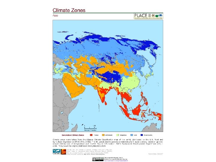
Climate and Vegetation • This region’s climates range from tropical to desert to polar icecap. • There is a great diversity of plant and animal life, including some species found nowhere else in the world.
Widespread Tropics Year-Round Rains • Tropical wet climate in coastal Myanmar, Thailand, Vietnam, Oceania - also in most of Malaysia, Indonesia, Philippines • High temperatures—annual average of 80 degrees in Southeast Asia • Parts of Southeast Asia get 100, even 200 inches of rain annually • Some variations—high elevations in Indonesia have glaciers
continued Widespread Tropics Wet and Dry Seasons • Tropical wet and dry climate borders the wet climate - weather is shaped by monsoons - found in parts of Myanmar, Thailand, Laos, Cambodia, Vietnam • Temperatures are consistently hot, but rainfall varies • Monsoon areas often have disastrous weather - typhoons can occur in region during the wet season
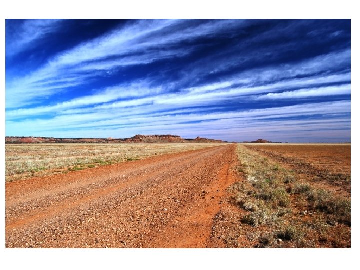
Hot and Cold Deserts Arid Australia • One-third of Australia is desert, located in the continent’s center - under 10 inches of rain annually; too dry for agriculture • Band of semiarid climate encircles desert - 20 inches of rain annually; crops need irrigation • Dryness caused by tropical, subtropical heat that evaporates rain • Few live in dry inland region called the outback
continued Hot and Cold Deserts The White Desert • Antarctica is earth’s coldest, driest continent - icecap climate: temperatures can drop to – 70 degrees • Cold air doesn’t hold moisture well - has 1/10 the water vapor of temperate zones • Area receives little precipitation; called a polar desert • Plants are lichens, mosses; animals are sea life, birds (penguins)
Human-Environment Interaction • Pacific Islanders developed technology that enabled them to travel the Pacific Ocean. • This region has been damaged by nuclear testing and the introduction of European animals.
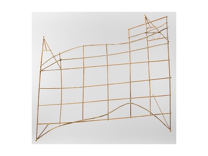
Traveling the Pacific Navigation Charts • It’s believed Pacific Island settlers came from Southeast Asia - use land bridges, small rafts, canoes to reach nearest islands • Later venture further out, use stars and charts to navigate - on charts, sticks show wave patterns, shells show islands • Islanders keep secrets of charts until late 1800 s - then begin using European navigation methods
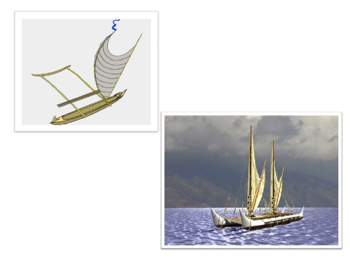
continued Traveling the Pacific Special Canoes • To sail ocean, islanders develop special voyaging canoes - double hulls stabilize canoe, allow it to carry lots of weight - canoes use sails, sometimes have cabin on top for shelter - carry plants to be grown at destination • Large voyaging canoes are awkward in island lagoons - use outrigger canoe—float attached on one side for balance
Invasion of the Rabbits The Rabbit Problem • European colonizers bring animals to Australia, including rabbits • In 1859, Thomas Austin releases 24 rabbits into Australia to hunt - one pair can have 184 descendents in 18 months - Australia has over one billion rabbits by 1900 • Rabbits strip sparse vegetation, ruin sheep pastures, cause erosion - resulting lack of food endangers native animals
continued Invasion of the Rabbits Control Measures • Efforts are made to control number of rabbits - import foxes to prey on them, but foxes also endanger native wildlife • In 1950 s, they’re intentionally infected with myxomatosis; 90% die - ranches then able to support twice as many sheep - rabbits become immune to disease; back to 300 million by 1990 s • Today a combination of poisons, diseases, fences are used
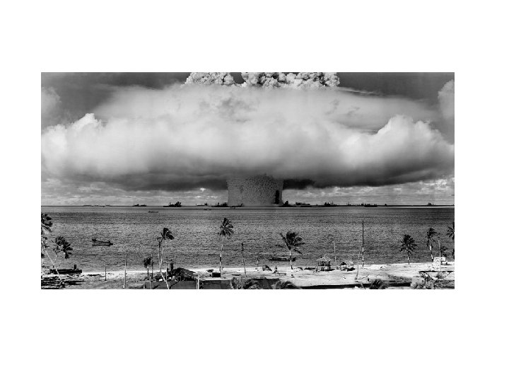
Nuclear Testing Tests in Bikini Atoll • Nuclear arms race between U. S. , USSR begins in the 1940 s - U. S. conducts 66 nuclear bomb tests on Bikini, Enewetak atolls - atoll—ringlike coral island, or islands, surrounding a lagoon • Marshall Islands’ Bikini Atoll is far from shipping, air routes • “Bravo” hydrogen bomb test vaporizes several islands - radiation contamination injures or sickens many islanders
continued Nuclear Testing Long-Term Effects • Bikini Islanders moved to the island of Kili in 1948 - conditions there don’t allow them to fish or grow enough food • U. S. declares Bikini safe in late 1960 s, some islanders return - in 1978, doctors find dangerous radiation levels in islanders - islanders leave again • Cleanup of Bikini Atoll begins in 1988 - still unknown when Bikini will be suitable for humans again