Physical Europe Landforms Europe stretches from the Atlantic


- Slides: 17
Physical Europe Landforms Europe stretches from the Atlantic Ocean to the Ural Mountains and from the Arctic Ocean to the Mediterranean Sea. The major islands include Great Britain, Ireland, Iceland. Europe is divided into four major landform regions: Europe’s Physical Regions 1. Northwest Highlands 2. Northern European Plain 3. Central Upland 4. Alpine Mountain System
The Northwest Highlands This region stretches from the British Isle to the Scandinavian Peninsula and through France down to the Iberian Peninsula *Similar to the U. S. Appalachian Mountains Old eroded mountain Rugged hills and low mountains One of our clues to Pangaea During ice age glaciers cut deep narrow inlets of seawater called fjords, left the soil thin and with thousands of lakes Similar to Alaska in the far north
Scottish Highlands French Wine Country
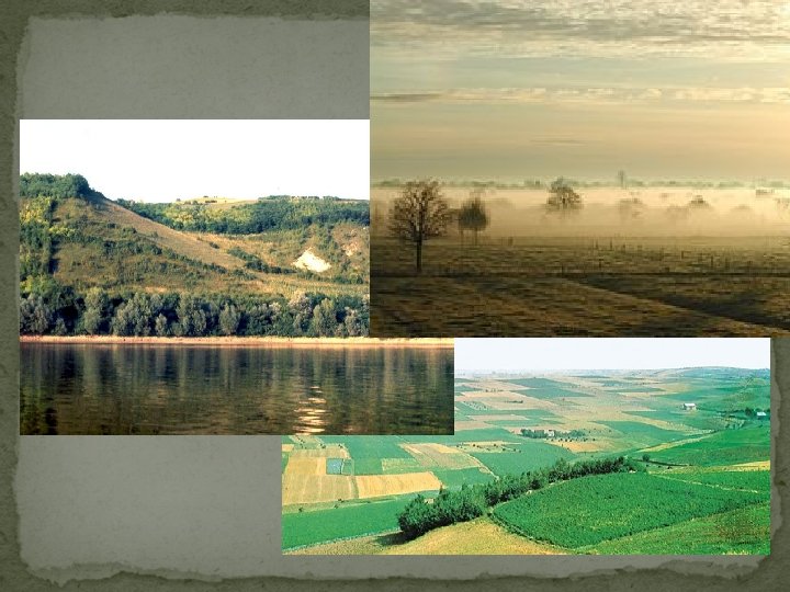
Northern European Plain Lies just south of the Northwestern Highlands Ranges from France to the Ural Mountains Averages less than 500 feet above sea level Low flat region with many rivers, fertile farmland, and large population Many large densely populated cities located in this region -(examples) Paris and Berlin Route for travel, trade, migration and wars
Nazi Blitzkrieg Napoleon's French Army
BERLIN, GERMANY PARIS, FRANCE
Central Uplands Just south of the Northern European Plain ranging from France through Germany to the Czech Republic This regions has many hills and small plateaus, with forested slopes and fertile valleys Examples: the Massif Central of France and the Jura Mountains on the French-Swiss border The Central Uplands are an old eroded region with the low rounded mountains and hills Coal is the major industry (Germany)
Bavarian Highlands in the Central Upland Region
Alpine Mountain System The Alps stretch from France’s Mediterranean coast to the Balkan Peninsula Peak elevations reach 14, 000 feet Similar to Rockies Glaciers and Avalanches are fairly common The Matterhorn
Alpine Mountain System Southern most region Includes: the Alps in north of Italy, the Carpathian Mountains in Eastern Europe, the Apennines in Italy, and the Pyrenees of France and Spain Carpathian Alps Pyre Ap nee s en n in es
Alpine Mountain System is the location of most of Europe's MICROSTATES Among Europe’s 48 countries are many Microstates (countries that are no larger than cities) Some are Enclaves Andorra Liechtenstein Malta Monaco San Marino Vatican City Sometime Luxembourg and Cyprus The Vatican City is where the Pope resides. It is also the smallest country in the world.
Alpine Mountain System The Alpine System was formed by the colliding of the European and African Techtonic plates Earth quake and volcanic activities are common in this region
Mount Vesuvius 1944 eruption Pompeii AD 79
Climates Europe has three major climate types: marine west coast, humid continental, and Mediterranean Humid Continental Marine West Coast Mediterranean
M ar in e W es t Co as t i um Mediterranean H d n Co t al t n ine
WHY IS EUROPE SO WARM? Equal latitude comparison with North America The southern most region of Europe passes through Washington D. C.