Photogrammetry Introduction Photogrammetry the science art and technology


 rb/R = f/(H-h)")

- Slides: 21
Photogrammetry
Introduction • • • Photogrammetry: the science, art, and technology of obtaining reliable information from photographs. Two major areas: metric, and interpretative. Terrestrial and aerial Photogrammetry. Uses of Photogrammetry: topographic mapping, determine precise point coordinates, cross sections, deflection monitoring, and many other applications. Why Photogrammetry?
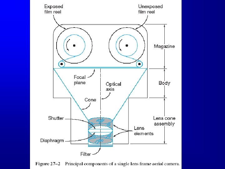
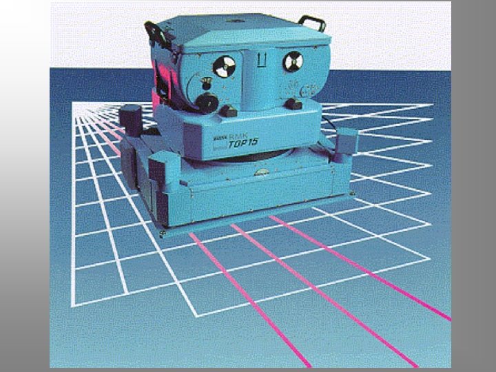
Aerial Cameras • • For precise results, cameras must be geometrically stable, fast, have efficient shutters, sharp lenses Single-lens frame cameras: figure 27 -2 – – – most used format size is 9”, focal length 6 in components: lens, shutter, diaphragm, filter, focal plane, fiducial marks. shutters can be operated manually or automatically. The camera could be leveled regardless of the plane orientation. Exposure station and principal point. Camera calibration.
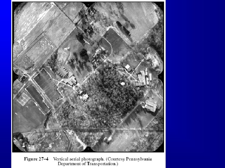
Aerial Photographs • • True Vertical: if the camera axis is exactly vertical, or near vertical. Tilted Photographs Oblique photographs: high and low Vertical Photos are the most used type for surveying applications
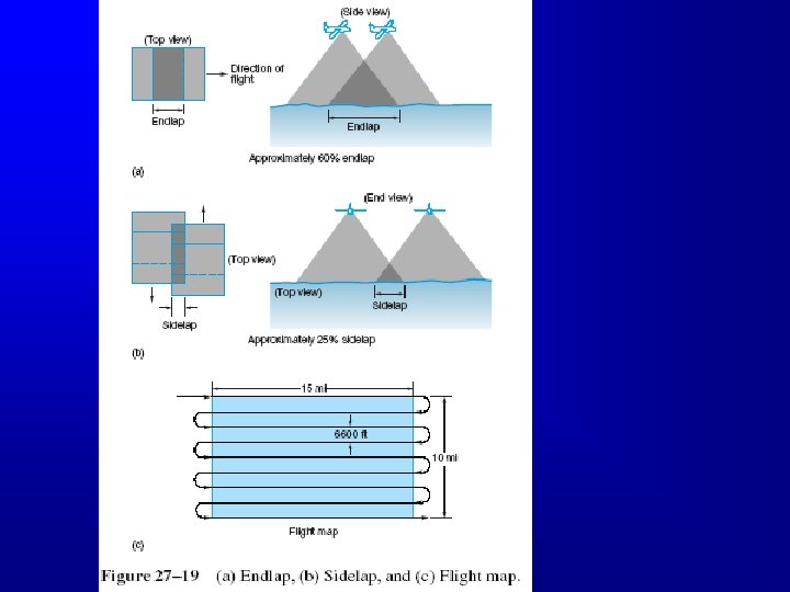
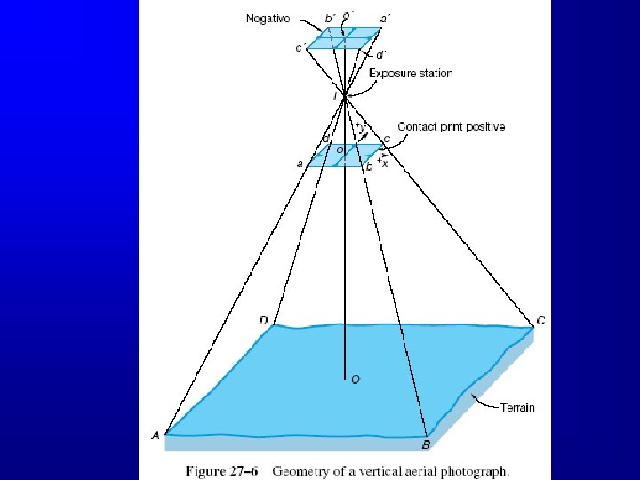
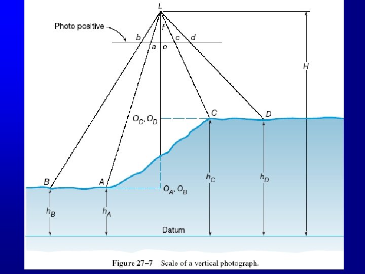
Geometry of Vertical Photographs • • • Figure 27 -6 Define: image coordinate system (right handed), principal point, exposure station. Measurements could be done using negatives or diapositives, same geometry. Strips and Blocks. Sidelap (about 30%), and Endlap (about 60%), why?
Scale of a Vertical Photograph Figure 28 -6 • Scale of a photograph is the ratio of a distance on a photo to the same distance on the ground. • Photographs are not maps, why? • Scale of a map and scale of a photograph. • Orthphotos f • Scale (s) at any point: S= H-h f • Average scale of a photograph: Savg = H - h avg • If the f, H, and h are not available, but a map is available then: photo distance X map scale Photo Scale = map distance
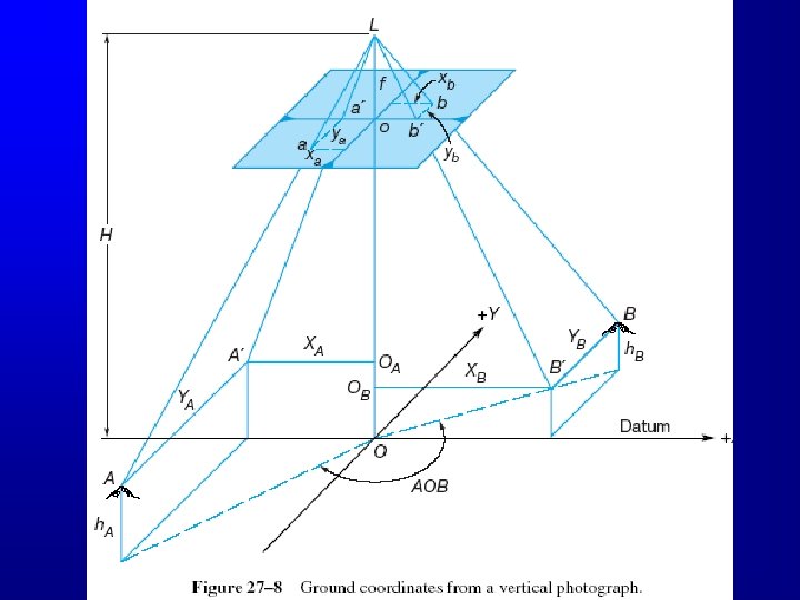
Ground Coordinates from a Single Vertical Photograph • • Figure 27 -8 With image coordinate system defined, we define an arbitrary ground coordinate system. That ground system could be used to compute distances and azimuths. Coordinates can also be transformed to any system In that ground system: Xa = xa * (photograph scale at a) Y = y * (photograph scale at a)
Relief Displacement on a Vertical Photograph • • Figure 27 -9 The shift of an image from its theoretical datum location caused by the object’s relief. Two points on a vertical line will appear as one line on a map, but two points, usually, on a photograph. In a vertical photo, the displacement is from the principal point. Relief displacement (d) of a point wrt a point on the datum : rh d= H where: r is the radial distance on the photo to the high point h : elevation of the high point, and H is flying height above datum • Assuming that the datum is at the bottom of vertical object, H is the flying height above ground, the value h will compute the object height.
ra/R = f/H Or: ra *H = R * f ----(1) rb/R = f/(H-h) Or: rb * (H-h) =R * f ---(2) Then from (1) and (2); Or ra *H = rb * (H-h) then; D = rb - ra = rb *hb /H
Flying Height of a Vertical Photograph • Flying height can be determined by: – Readings on the photos – Applying scale equation, if scale could be computed • Example: what is the flying height above datum if f=6”, average elevation of ground is 900 ft, scale is 1”: 100 ft? Is it 1500’? – Or, if two control points appear in the photograph, solve the equation: L 2 = (XB - XA)2 + (YB - YA)2 then solve the same equation again replacing the ground coordinates with the photo coordinates.