Panama Capital La Ciudad de Panam Nationality panameo


- Slides: 12

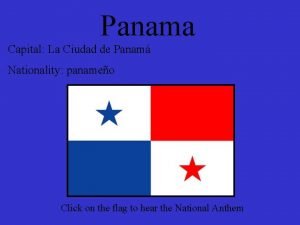
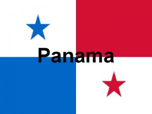
Panama Capital: La Ciudad de Panamá Nationality: panameño Click on the flag to hear the National Anthem

According to the CIA World Factbook, Panama has a population of 3, 309, 679. The majority of the population is mestizo (mixed European and Amerindian) and approximately 15% is. Amerindian. Five percent of the population is made up of indigenous tribes, including, the Nôbe-Buglé, Teribe, Kuna, Embera-Wounaan, Guaymi, Talamanca, and the Bokata tribes. Let’s learn about a few of these indigenous people. The People

Diverse Cultures Abound

Tapestry made by the Kuna Indians Click on the image to see a video of the Kuna People The Kuna are an indigenous group with a population estimated at 53, 000 located mainly in Panama. The majority of Kuna Indians live in the San Blas Archipelago (Kuna Yala) located along Panama’s northeast coast. The Kuna settled this area because they found refuge here from the subjugation of Spanish colonization. The relationship between the Kuna and the Spaniards catalyzed the beginning of the journey of struggle to maintain their traditional lifestyle and resist assimilation. Their success at maintaining isolated by moving from the mainland to the periphery has resulted in a strong cohesiveness in this group that continues to this day.

Click on the image to see a traditional Kuna dance

History of the Embera People Certain cultural and mythical characteristics suggest a possible Amazonian origin of Emberá culture. Before contact with the Spaniards in 1511, the Emberá were surrounded by other ethnic groups: Cuna, Burumiá, Chanco, Idabaez, Suruco, Waunana, and Orocomira, among others. Hostility and war characterized their relations with these peoples, and the Emberá expanded territorially at their cost, also taking them as slaves. Setting out from Santa Maria la Antigua del Darién, Santa Fé de Antioquia, and Anserma and entering by the San Juan and Atrato rivers, the Spaniards repeatedly traversed Emberá territory. Their aims were to enslave this large population and to open up the region for the exploitation of gold, using Black slaves as laborers. They intended to conquer these "warlike Indians" who attacked already-pacified groups and threatened Spanish settlements in Anserma, Cartago, Toro, and Nóvita; to settle them in new villages; to make them pay tribute; and to evangelize them. Because they cohered as a single ethnic group and because of the segmentary nature of their social organization, the Emberá were able to resist final colonization of their territory for more than three centuries. They either confederated under the authority of temporary war chiefs or dispersed, escaping into more inaccessible areas. Several expeditions, such as those of Gómez Fernández in 1539, Melchor de Velásquez in 1588, and Martín Bueno in 1638, were annihilated by the Emberá. The Spanish policy of burning the Indians' houses and fields and the loss of a considerable part of their population owing to war, slavery, and contagious diseases such as measles had a debilitating effect on the Emberá. Finally, they began to tolerate the establishment of European settlements, the exploitation of gold, and the relatively free transit on rivers and trails within their territory. There was an increase in the number of Emberá who submitted to paying tribute and who established commercial ties with Spanish centers in the interior. In the second half of the seventeenth century, a policy of missionization replaced open warfare; this was initially very successful and achieved the almost total pacification of the Emberá. Beginning in 1680, however, a crisis developed because of the abusive behavior of some missionaries. Almost all the Indian villages were burned or abandoned, and the Emberá left for the more isolated and desolate headwater regions of their habitat, where they formed autonomous nuclei in an effort to survive. This is one cause of their current dispersal over such a wide territory. The Spaniards responded with new armed incursions to put down the rebellion, but it took them twelve years of military campaigns to consolidate their control over the area and its inhabitants. There continued to be local uprisings throughout the eighteenth century. From the beginning of contact, the Emberá have resisted intermarrying with White or Black settlers, with the exceptions of the Emberá of some areas such as the interior slopes of the Colombian Cordillera Occidental and the Chocó, where there are large concentrations of people. As a result of Spanish occupation, the Emberá fought with the Cuna, whom they displaced toward the north, despite the fact that the two groups had many cultural and especially religious patterns in common. With the Waunana to the south, the Emberá share 50 percent of their linguistic roots and a large number of suffixes, as well as numerous important cultural elements such as shamanism and mythology. In the late twentieth century the Emberá coexist with Whites who have settled in the peripheral zones of Emberá territory, in the interior of Colombia. In some places, such as the department of Caldas, there is little difference between Indians and Whites, and even the Emberá language is losing ground. There exists a close relationship between the Emberá and the Black population on the Pacific Coast. The degree of cultural assimilation varies, however, and the ethnic situation is too complex to be described in terms of assimilation.

The Embera People. Click on the photos to see more about their culture Video

In Panama’s jungles, a native people cling to an ancient way of life. Click on the photo to see a video of Embera people of Panamá

Of course, there is the Panama Canal Click on the above photo to see a time lapse video of a ship passing through the canal.

The Panama Canal is a man-made canal in Panama which joins the Pacific and Atlantic oceans. One of the largest and most difficult engineering projects ever undertaken, it had an enormous impact on shipping between the two oceans, replacing the long and treacherous route via the Drake Passage and Cape Horn at the southernmost tip of South America. A ship sailing from New York to San Francisco via the canal travels 6, 000 miles, well under half the 14, 000 mile route around Cape Horn. Although the concept of a canal near Panama dates back to the early 16 th century, the first attempt to construct a canal began in 1880 under French leadership. After this attempt failed and saw 21, 900 workers die, the project of building a canal was attempted and completed by the United States in the early 1900 s, with the canal opening in 1914.

The Places The canal, Panama City, a city street, and the ruins of the first capital, Panama Viejo.

Panama City and the beaches
